Days 21-29

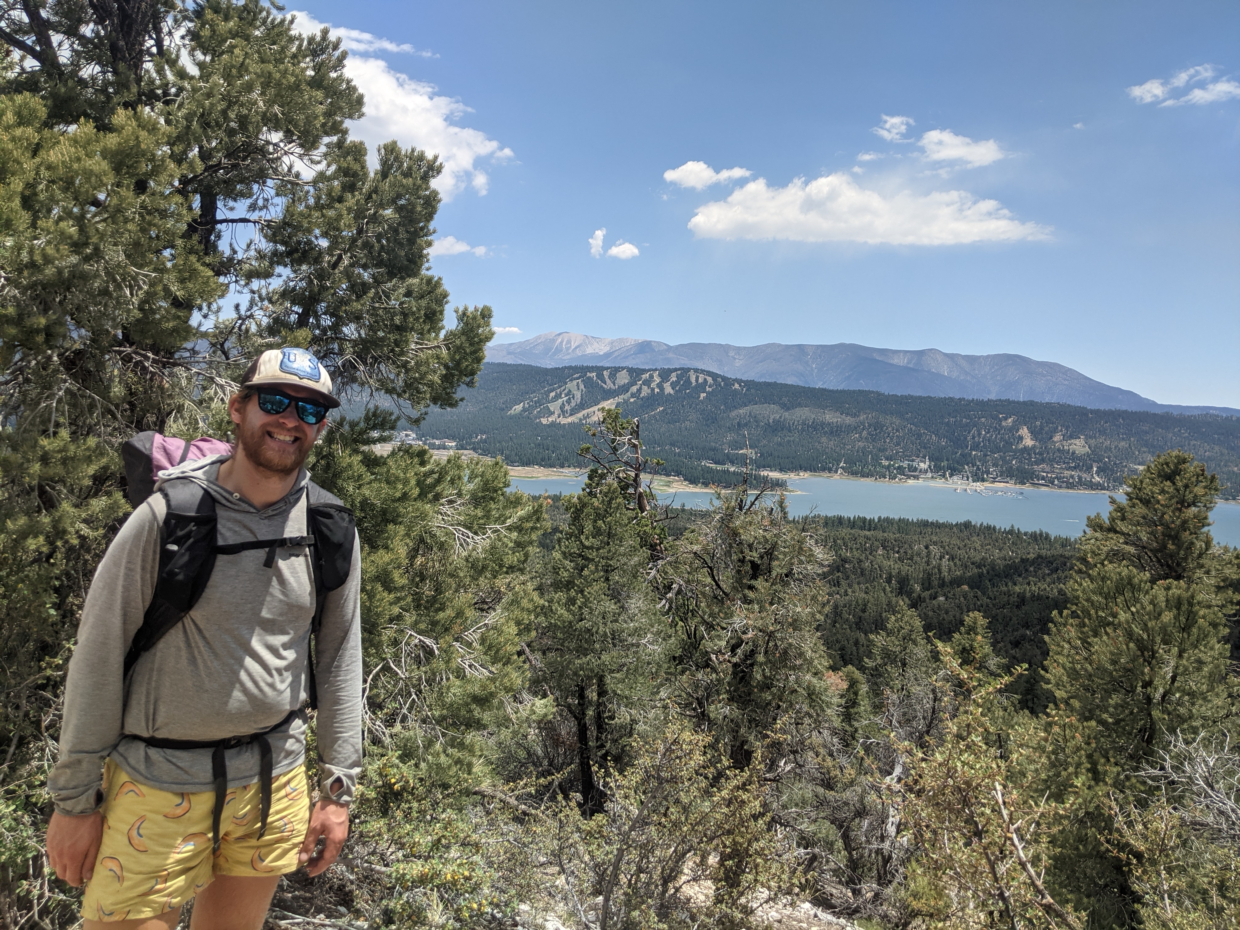
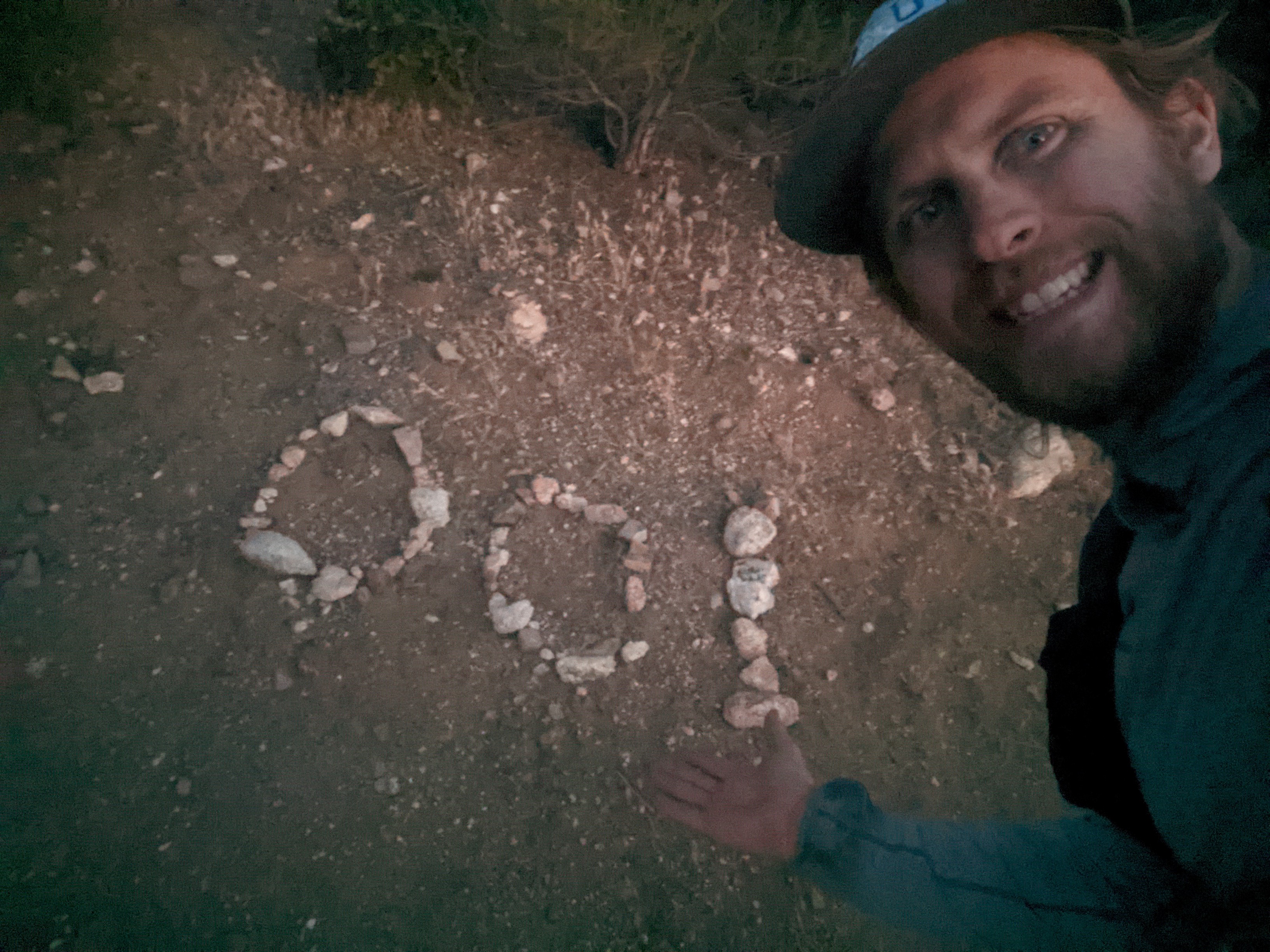
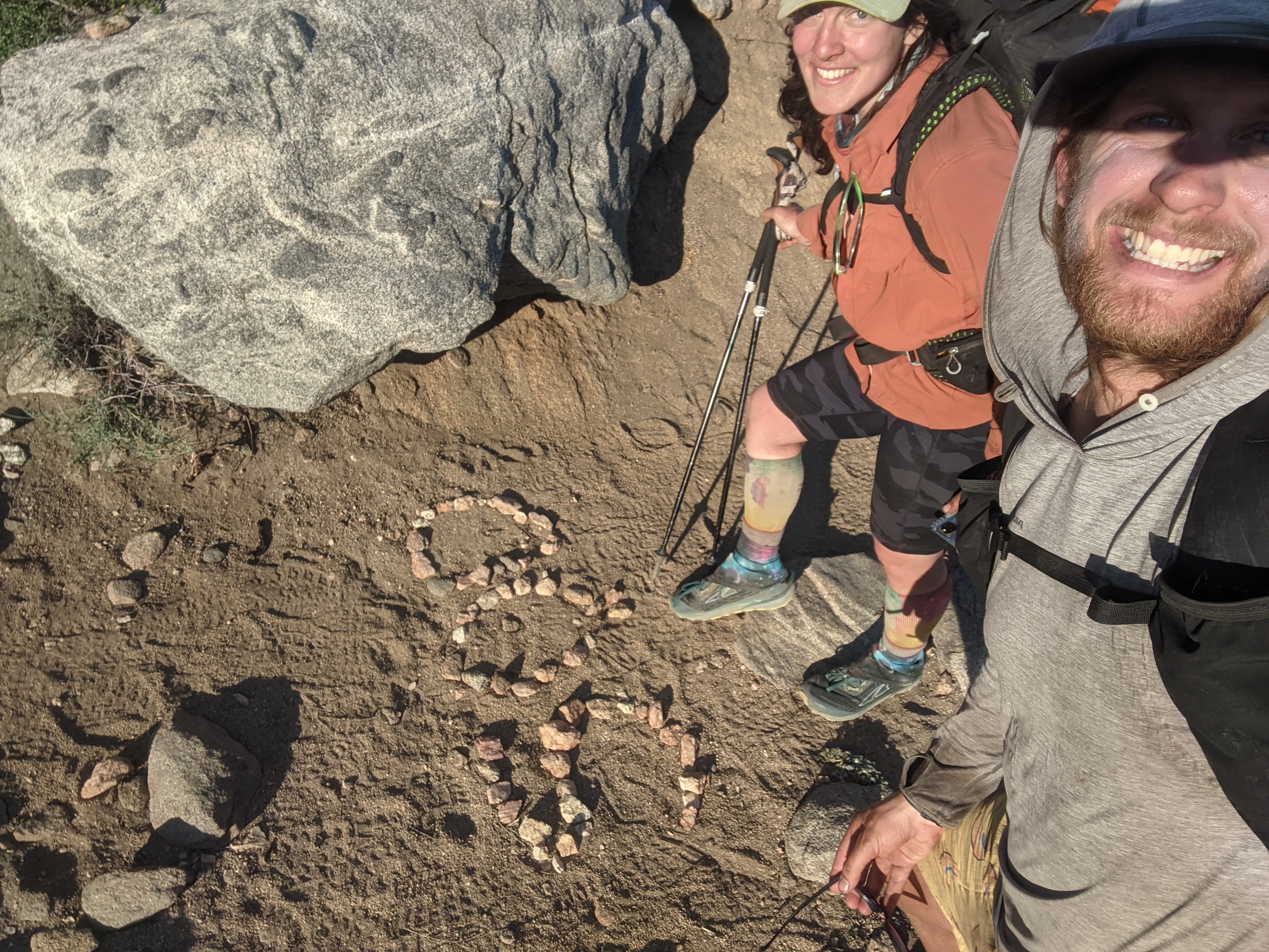
Day 29: June 20, mile 693.5- 702.2, 6.7 miles

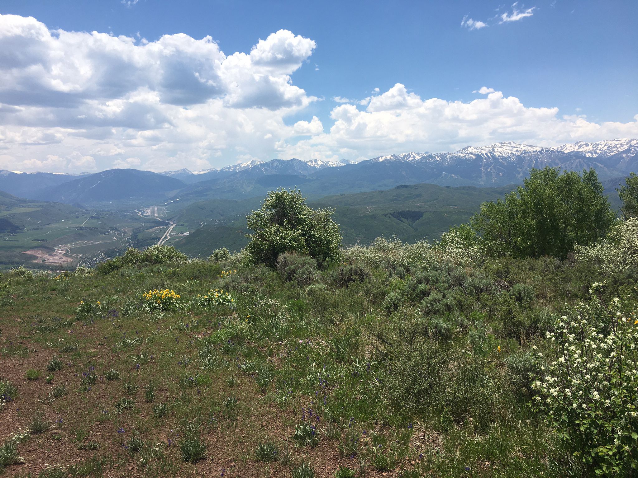
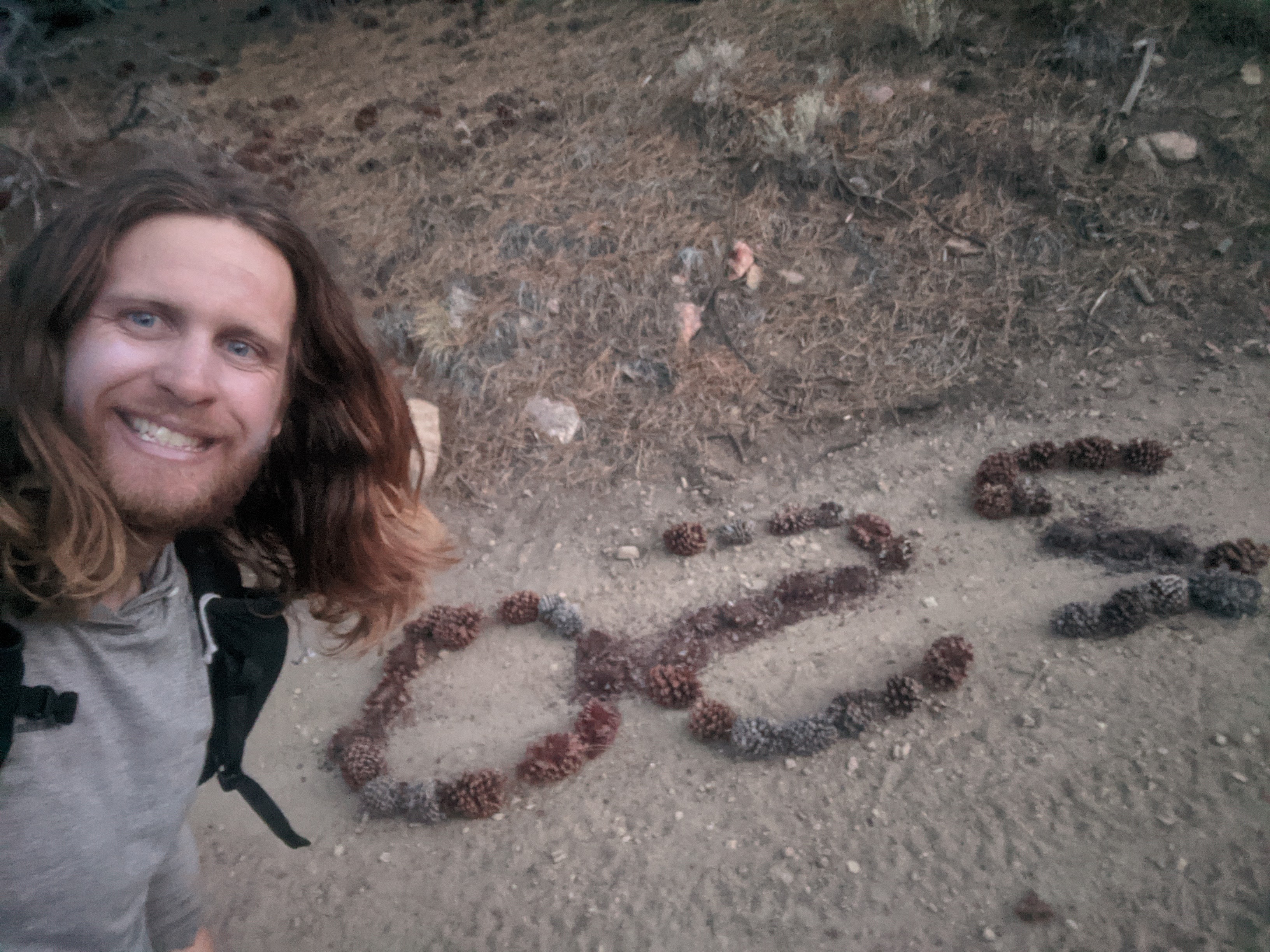
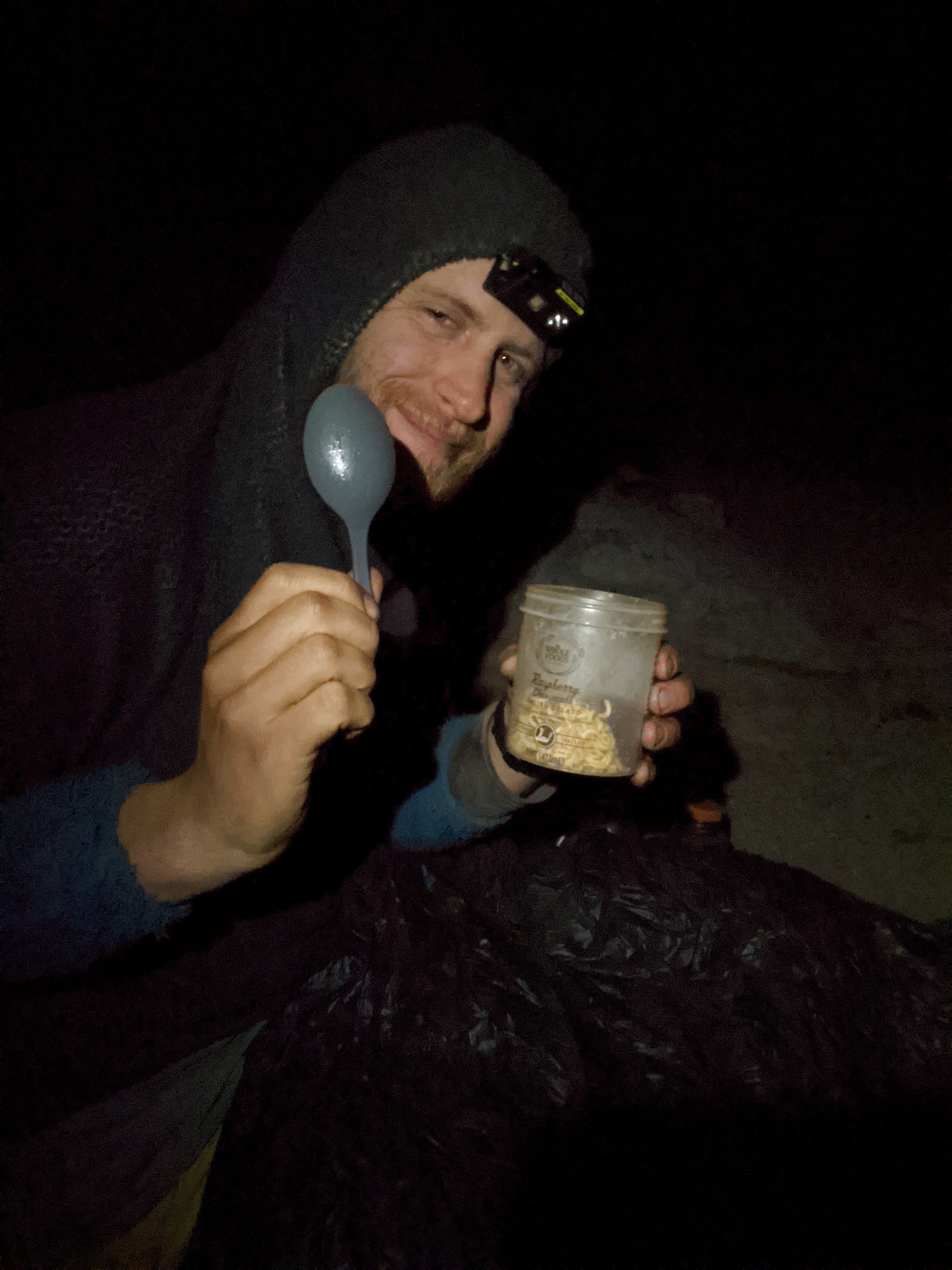
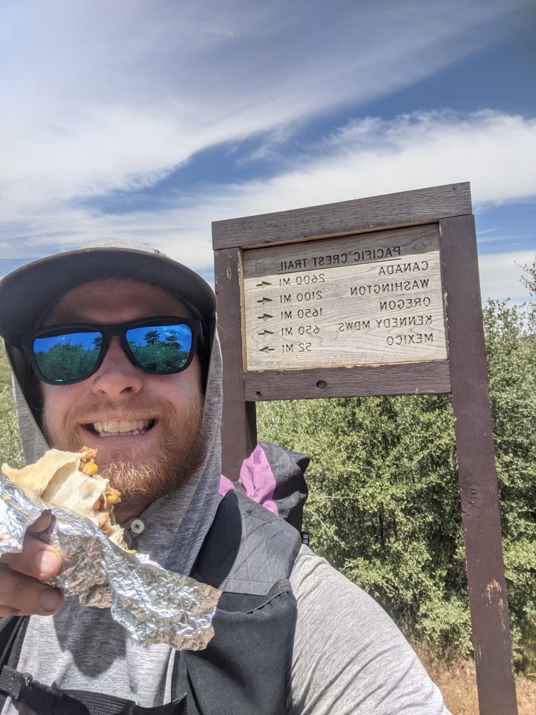
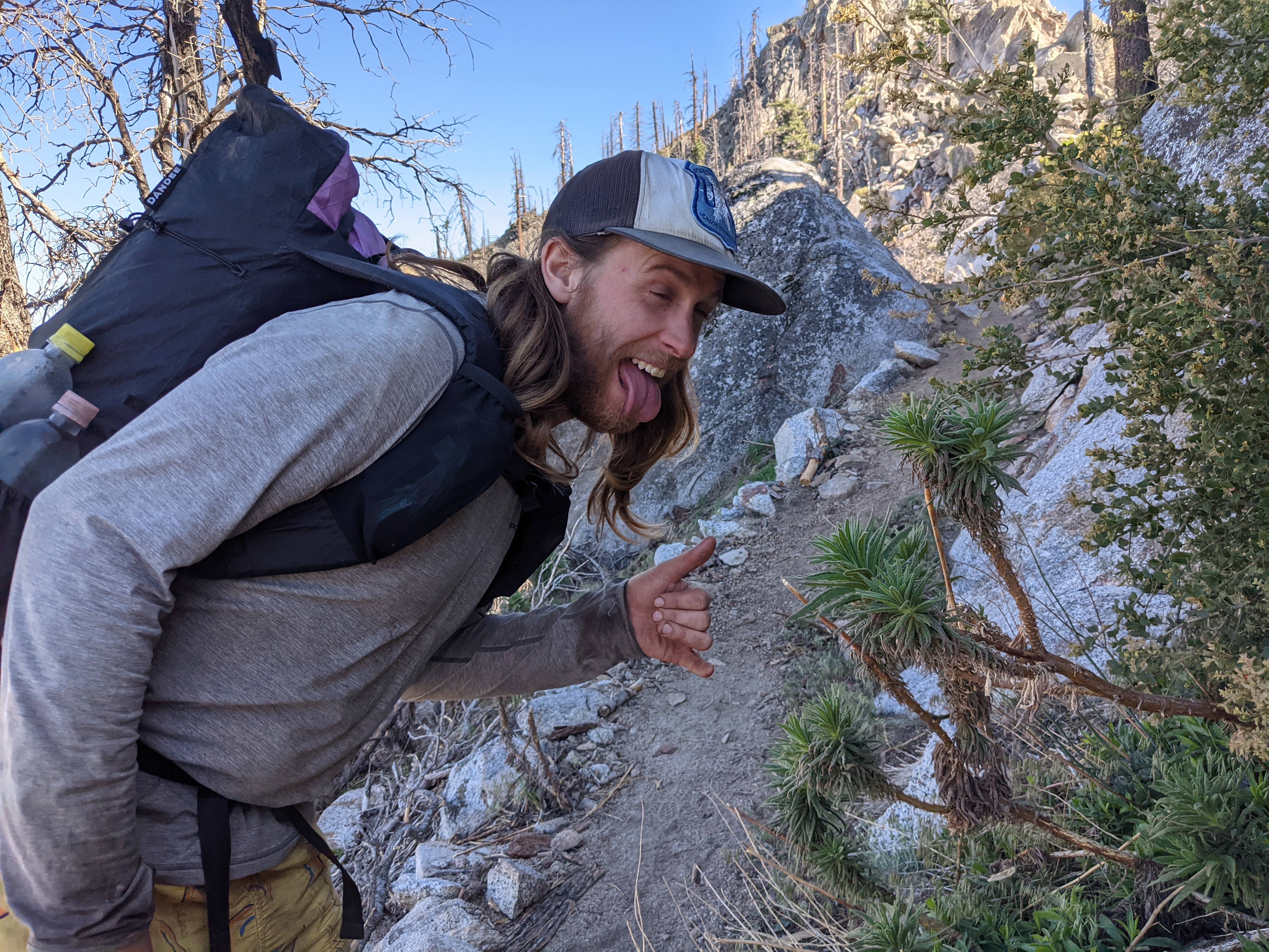
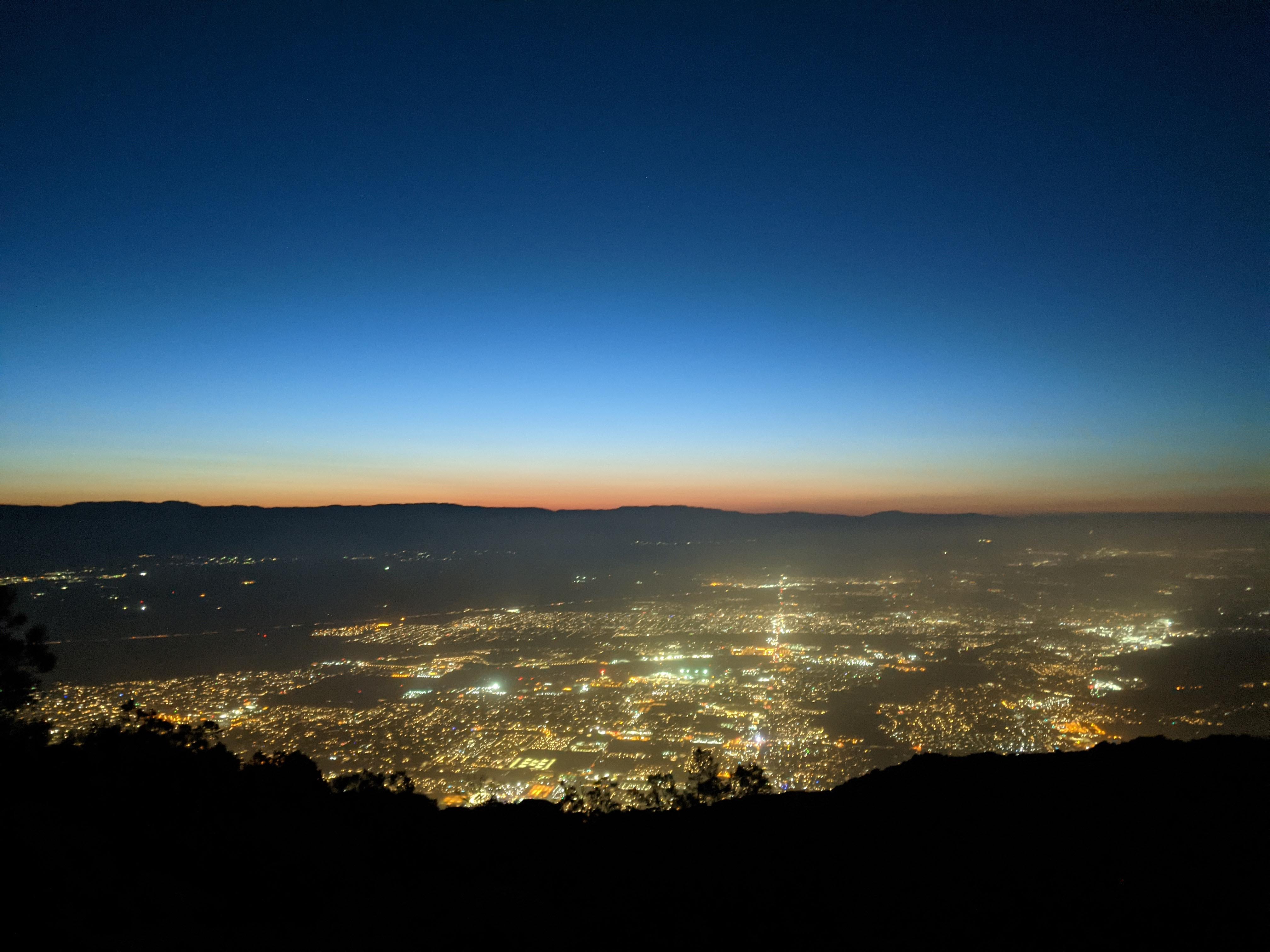
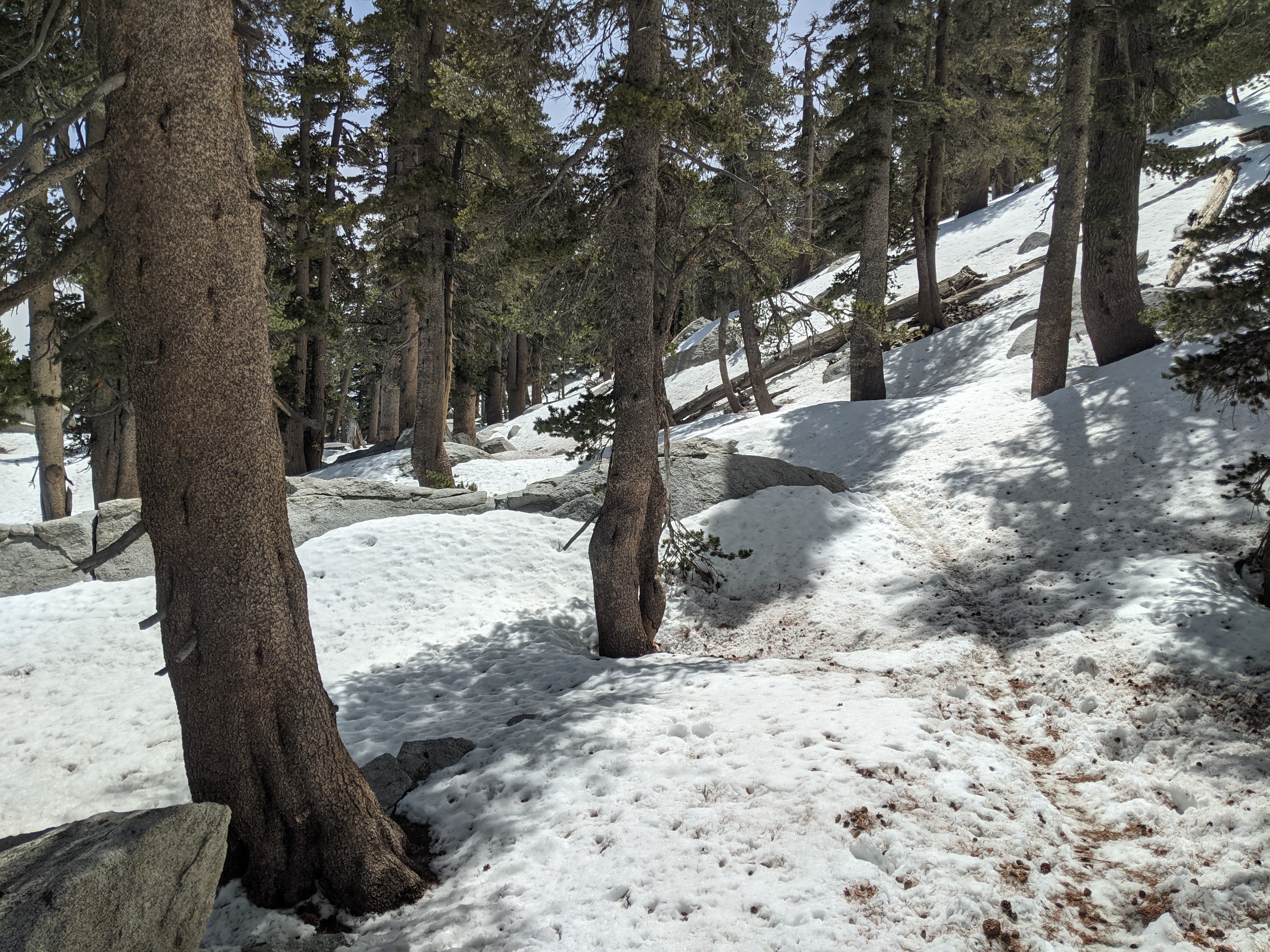
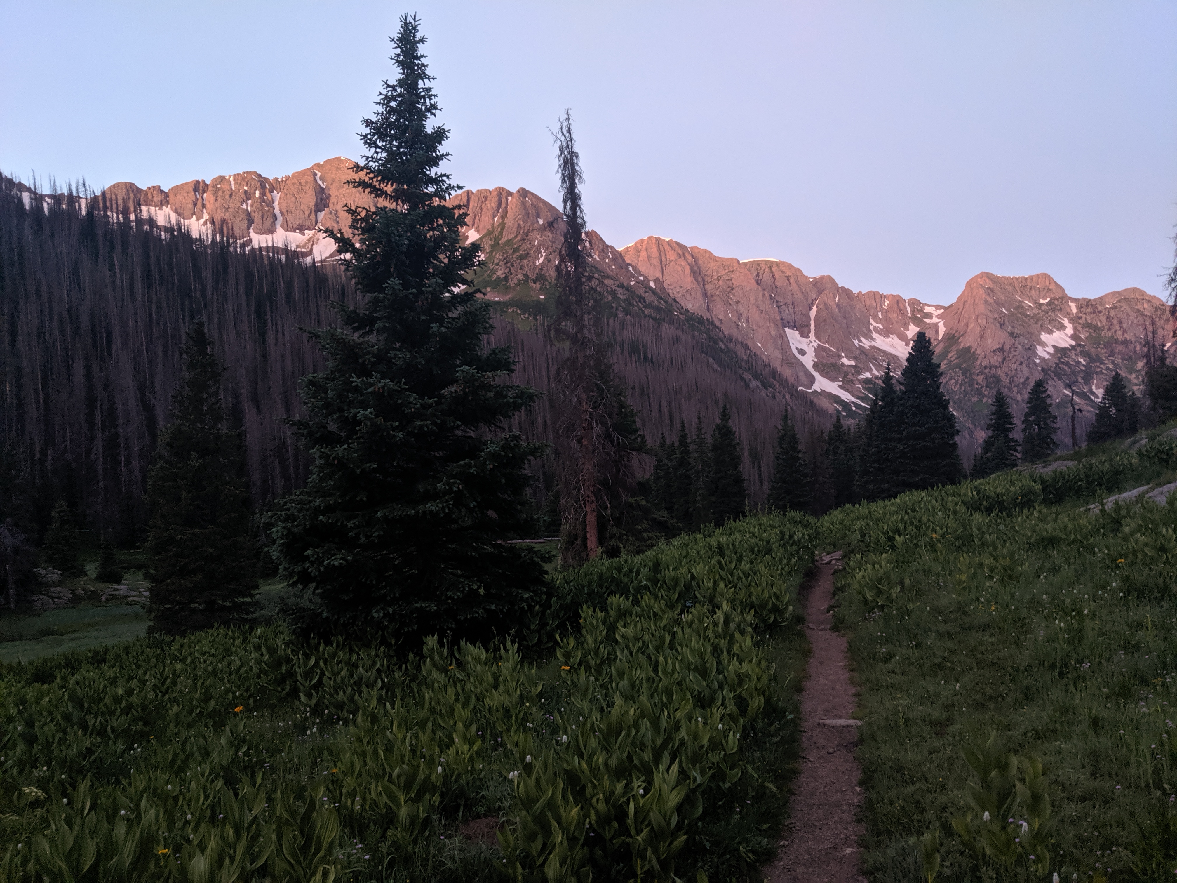
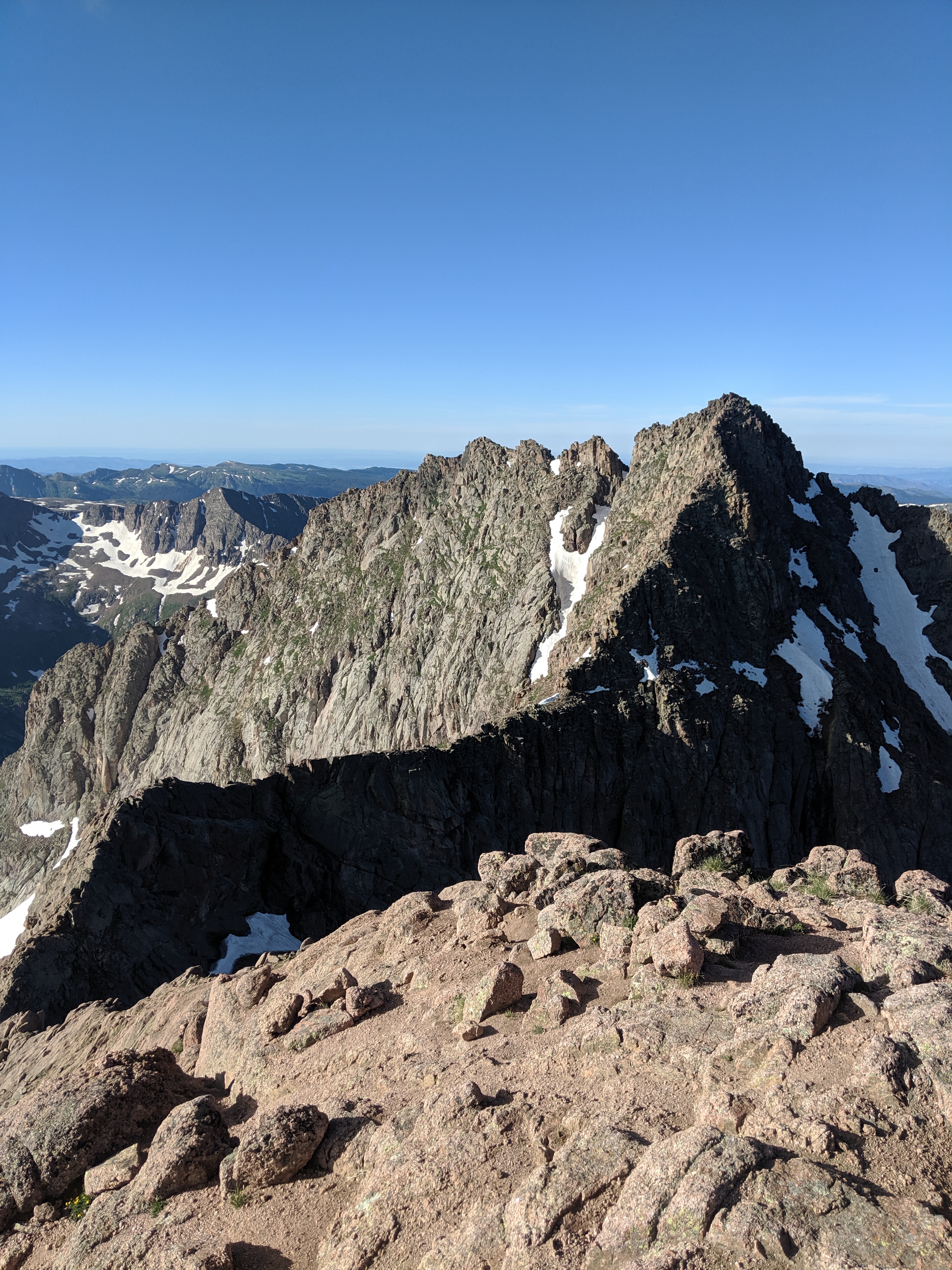
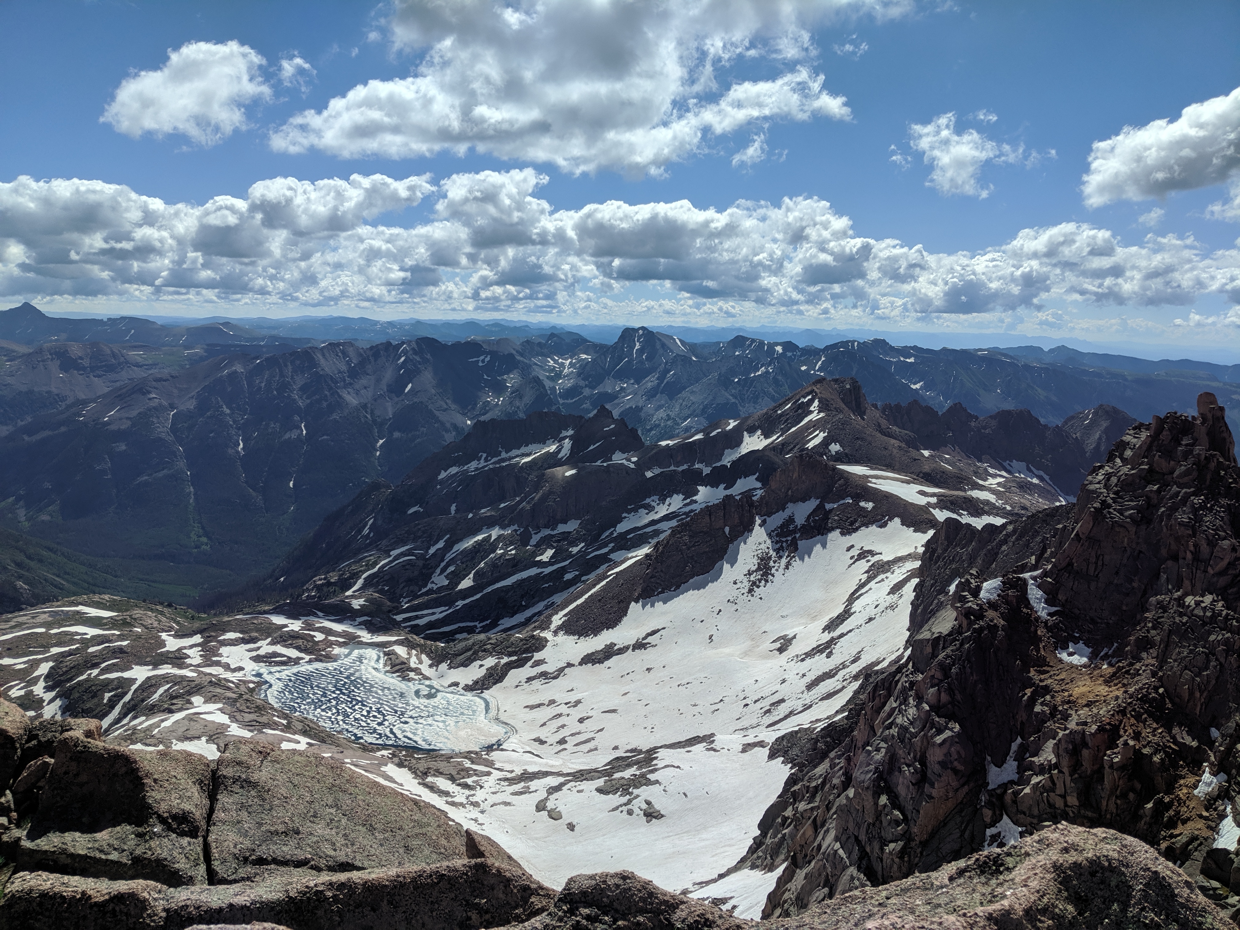
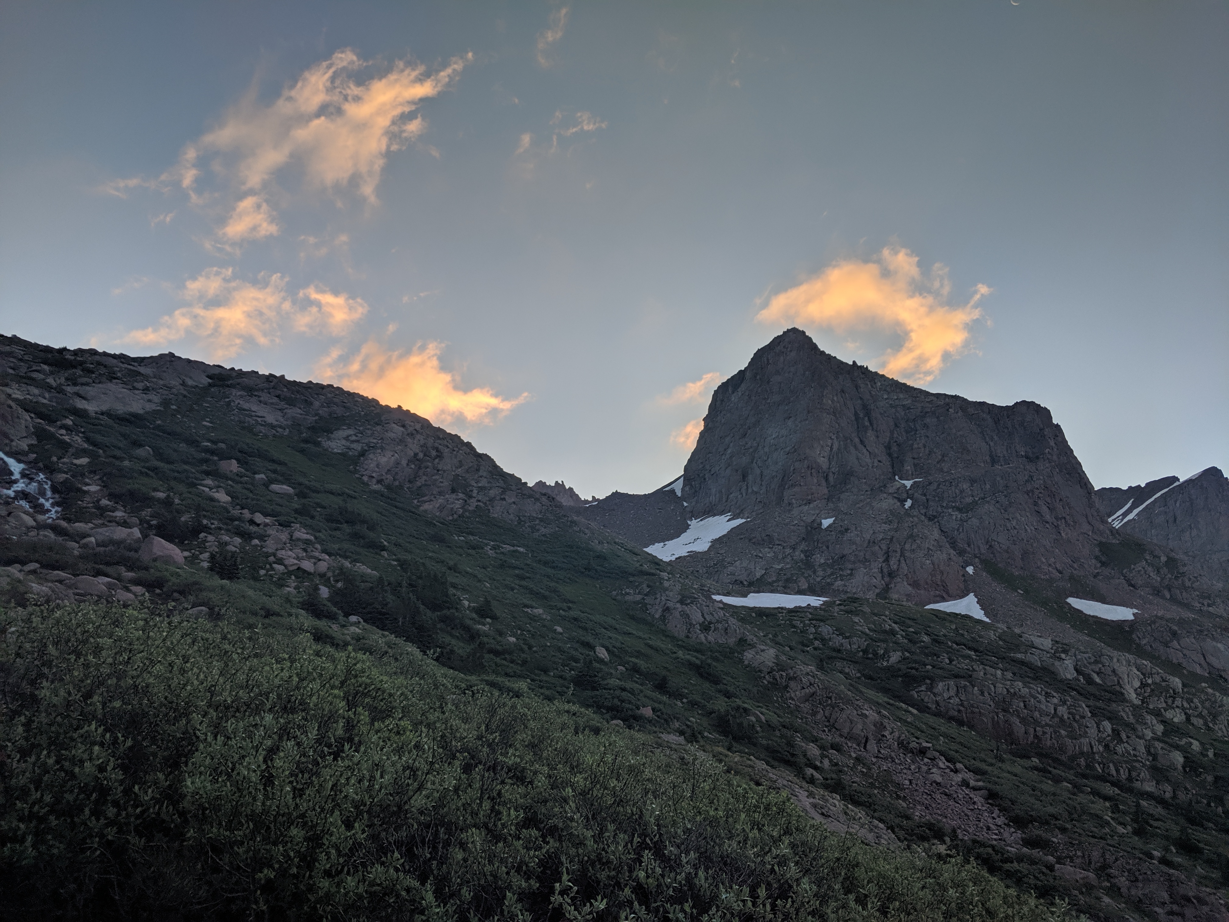
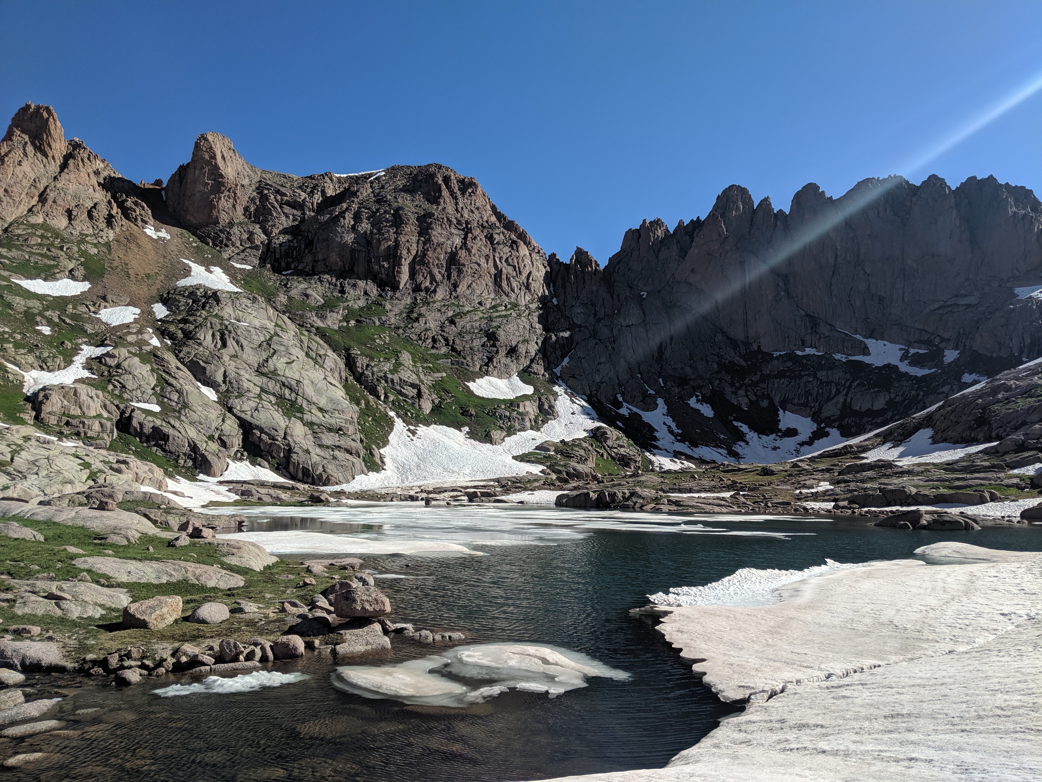
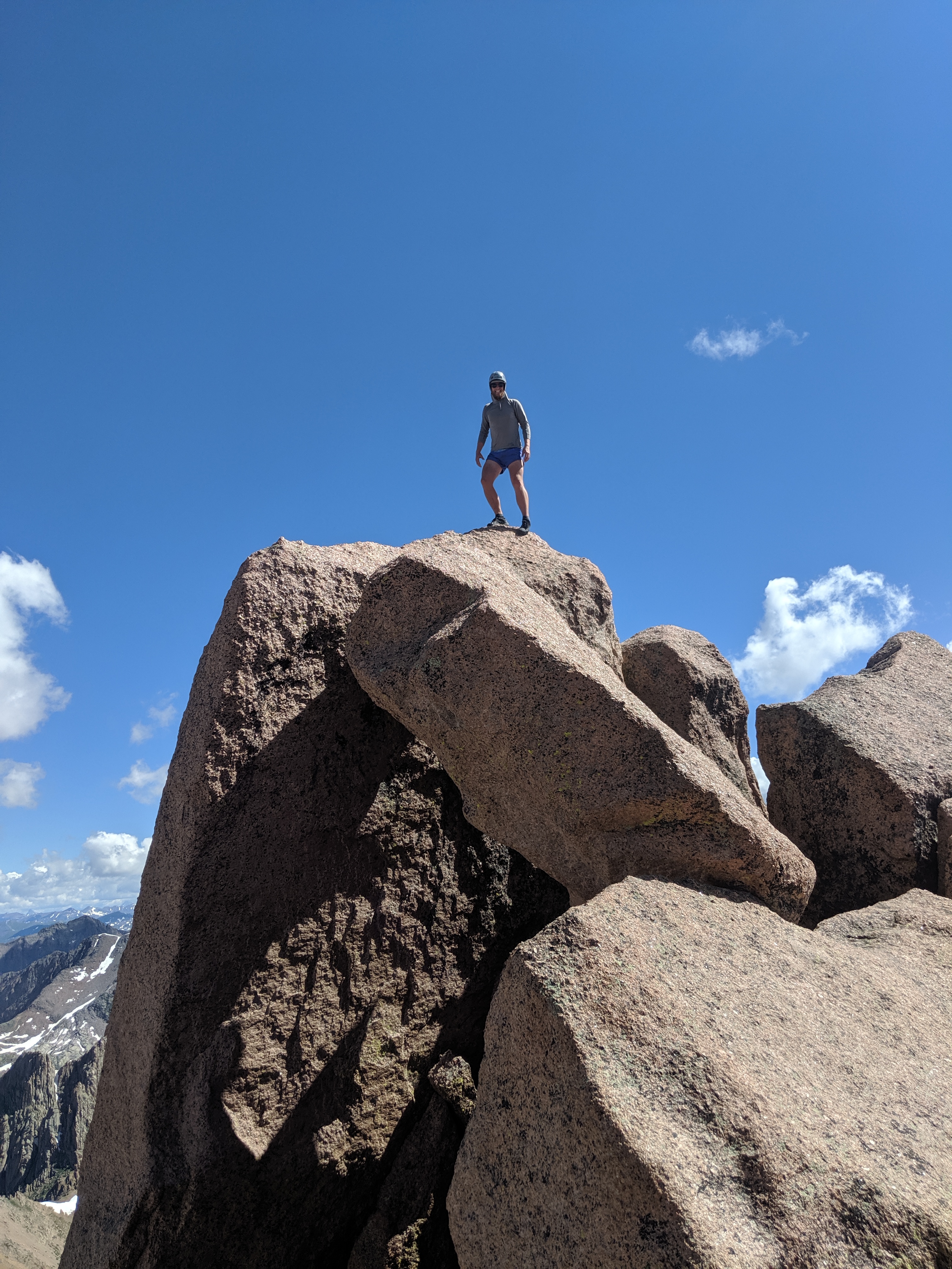
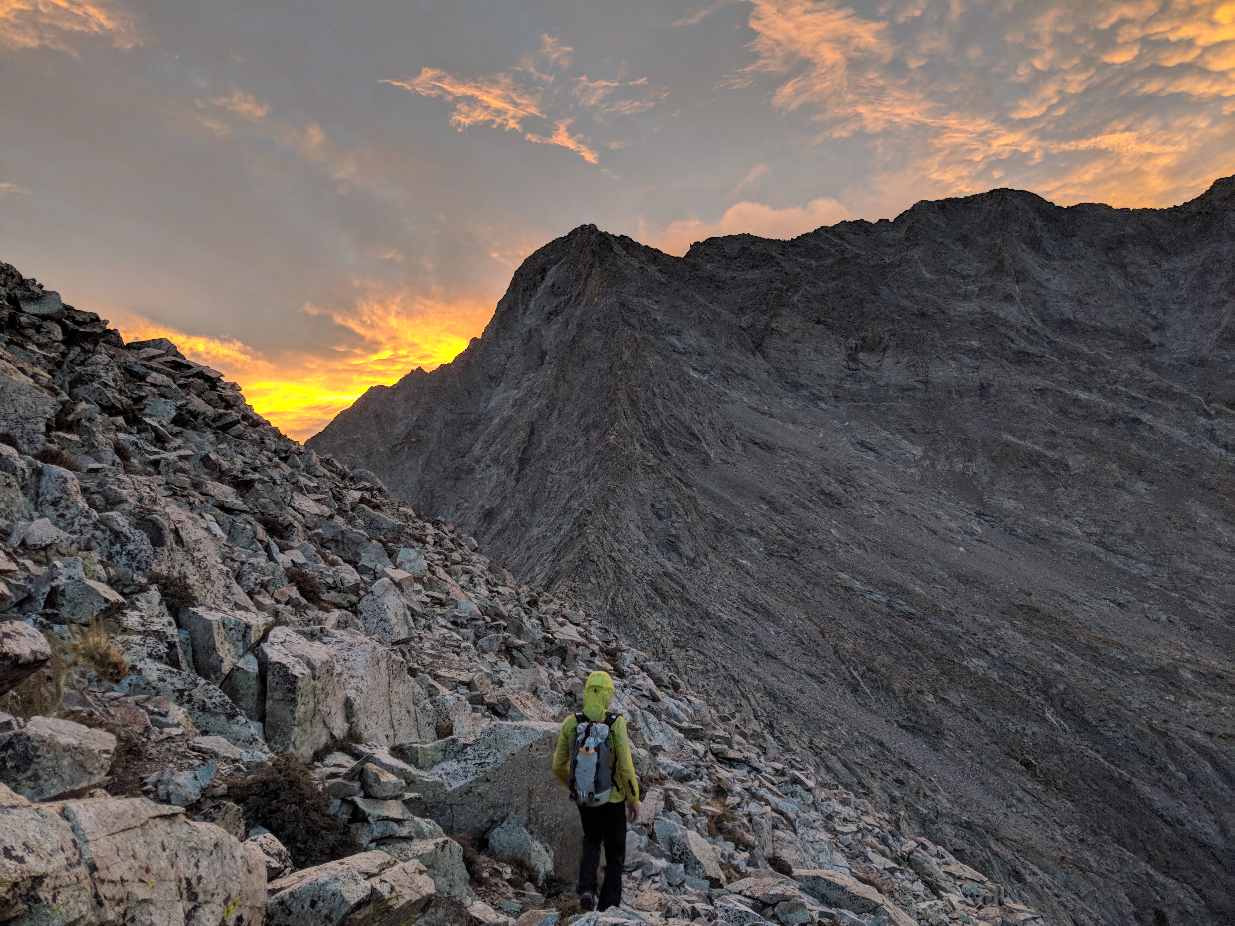
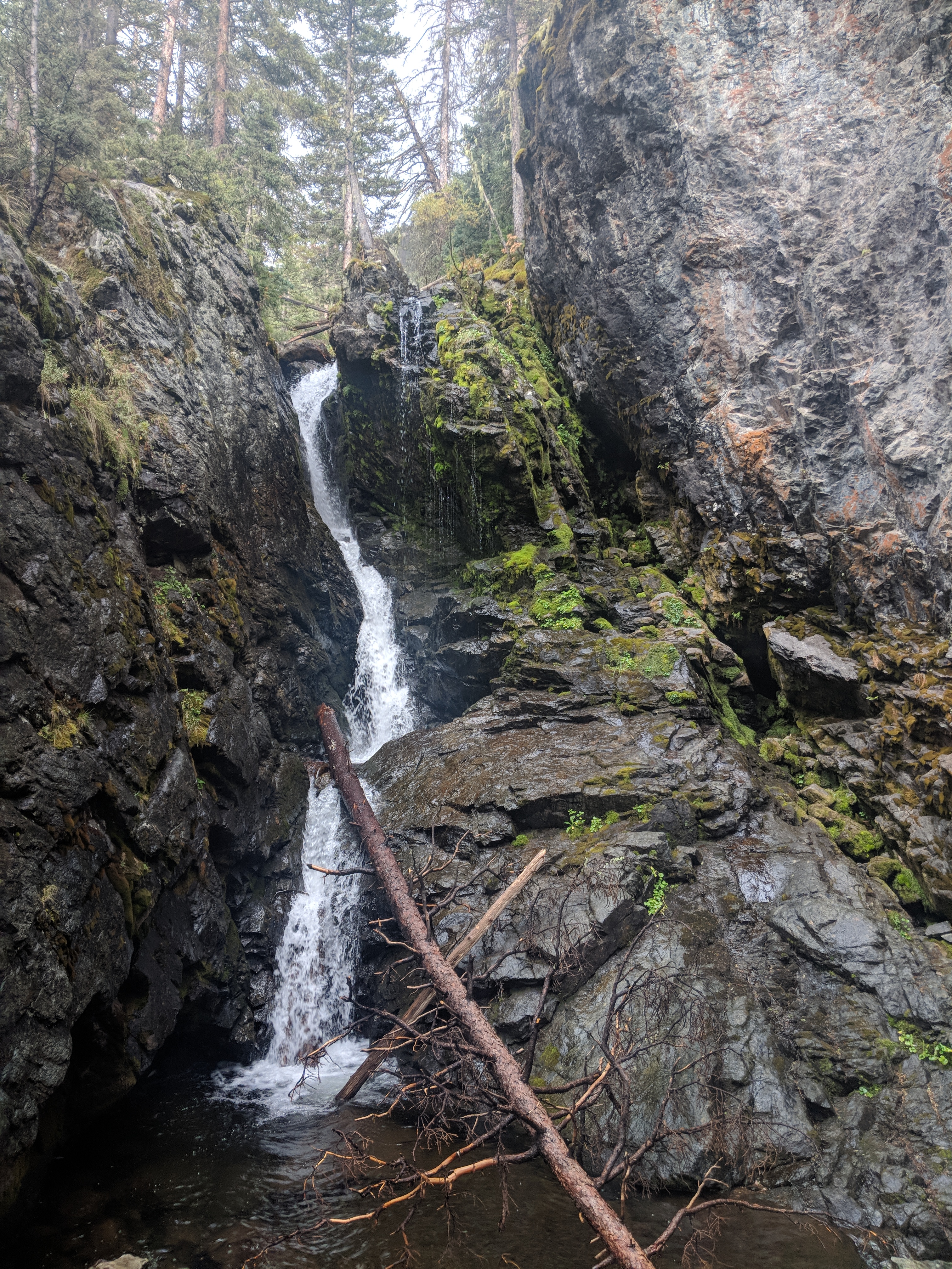
I was up early and ready to head into town! I started hiking in this beautiful basin with some granitic peaks around me. It was really starting to feel like the Sierra Nevadas, yeehaw!! I hiked to the road and headed into the general store. I saw another hiker/trail angel I knew who gave me a ride to Grumpy Bears. We spent the day hanging around the bar/restaurant for the day after eating a mega breakfast. My dad drove up from San Diego to hang for the day. What a great surprise! And it was father’s day. I am excited to enter the Sierra tomorrow. Somehow 8 days of food fit in my pack and I’m hoping to carry all the way to Tuolomne Meadows, 240 miles without crossing a road: how cool! I can’t wait to get started after camping with my Dad, Amanda, and Margot tonight.

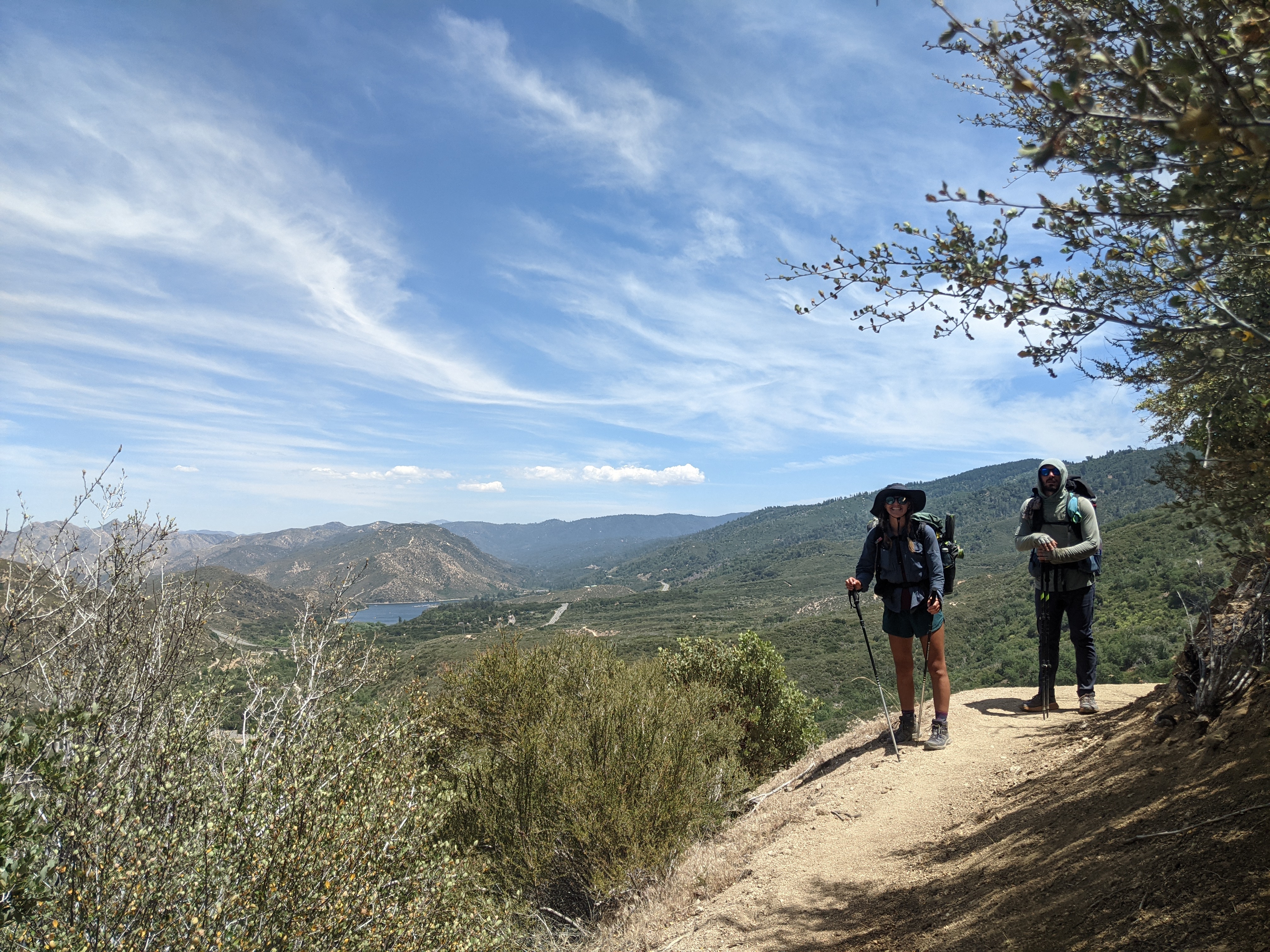
Day 28: June 19, mile 664.1 -693.5, 29.4mi

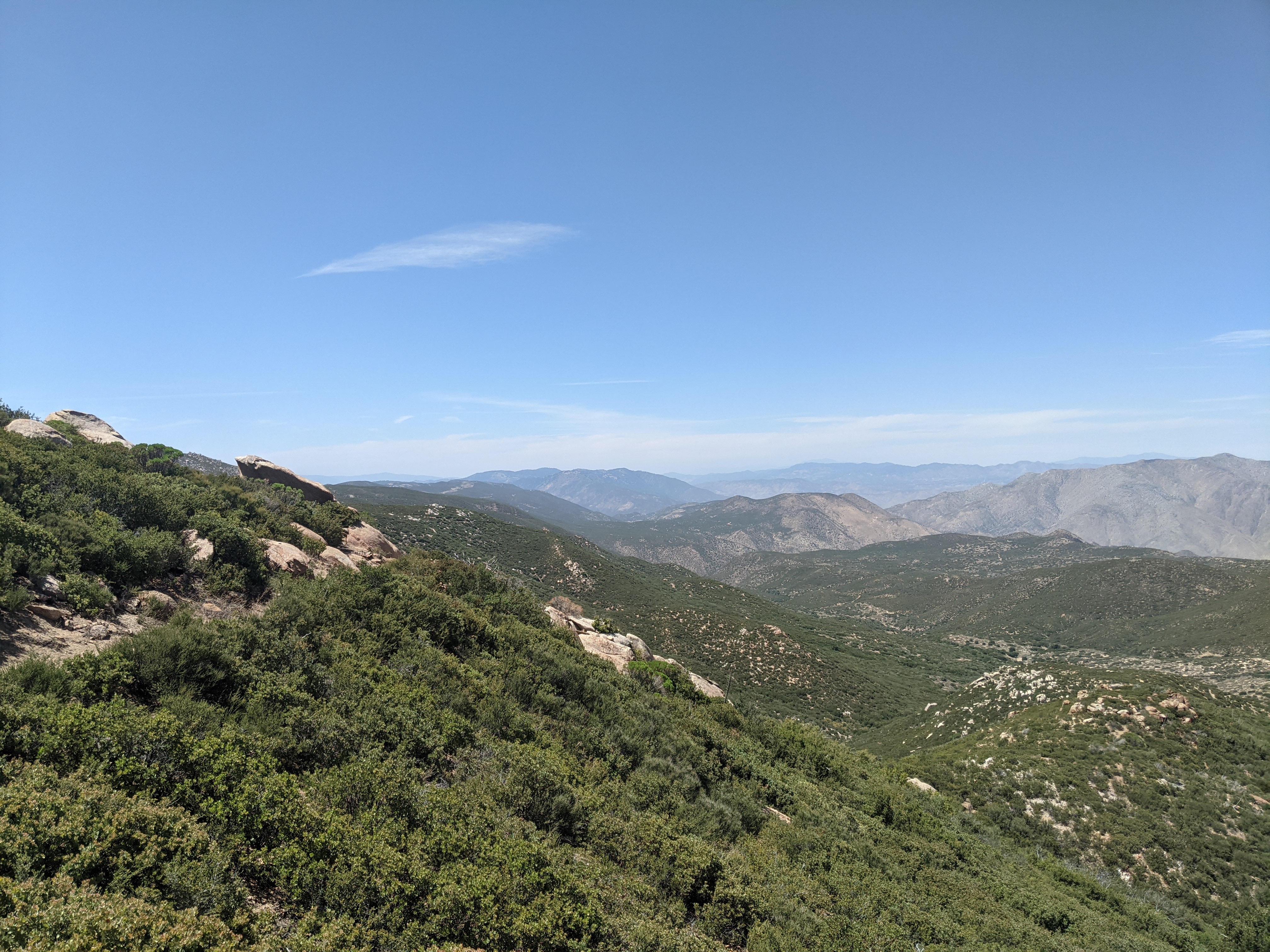
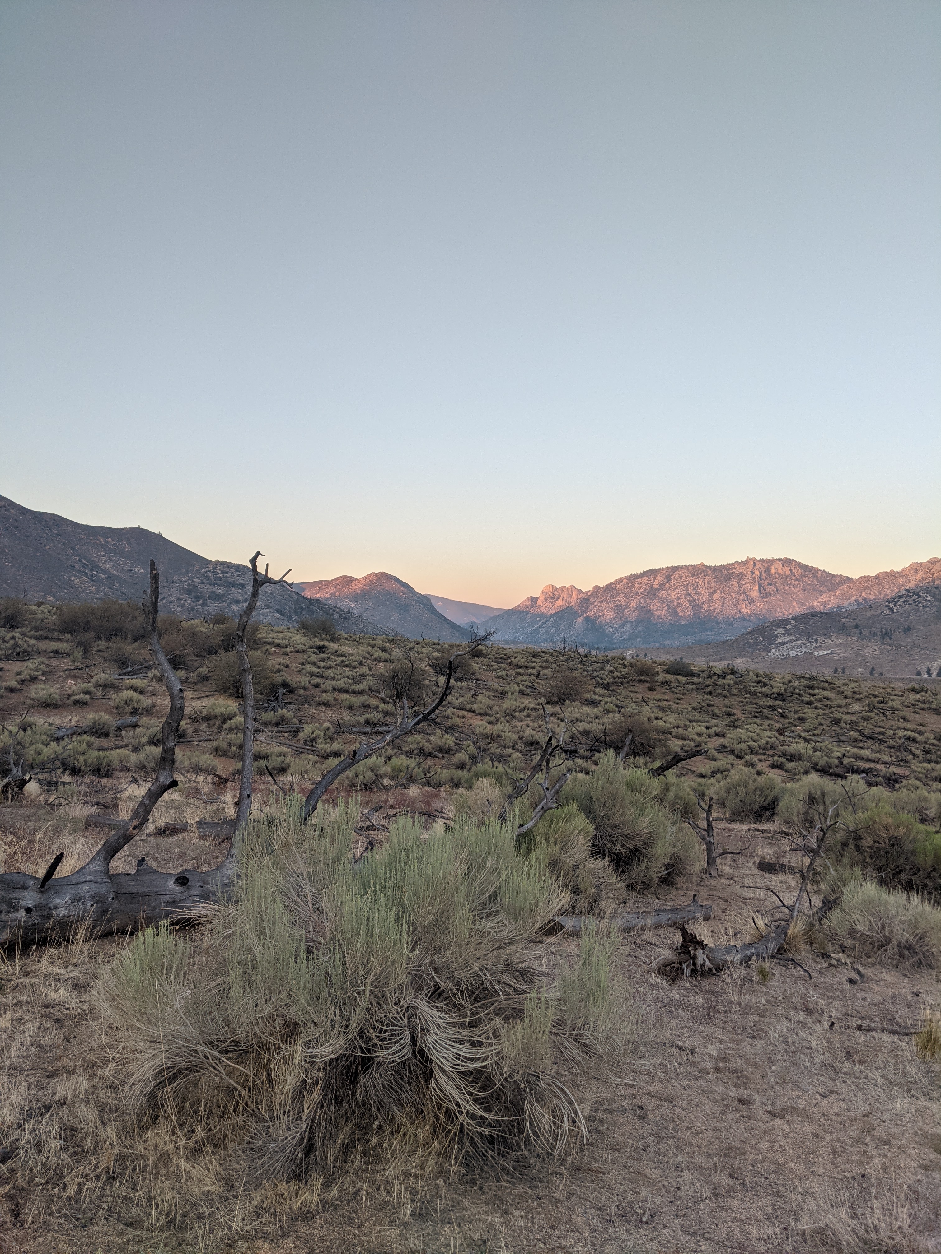
After sleeping hard last night I woke up super chipper and ready to hike!! I cruised the first 4.5mi to a spring then Margot and Amanda caught up. Along the way I saw bear tracks on 3 separate sections. The dry was recently cleansed of footprints from the wind and I was the first person on it for the morning. Very cool to see big animals using the same trails we do while we sleep. I may have also seen some mountain lion tracks but I am not sure.  At the spring we got water, I washed my socks and feet, and we headed out. We had a bit of a climb up but I love it. I wasn’t too weighed down by my pack, the uphill felt great, and I felt strong. I was smiling big time. This was one of those days I was stoked to be on trail!! At the top I checked my phone and I had a text from my dad. He was on his way to Kennedy Meadows to meet me!! How fun!! I called him briefly and told him I was stoked to see him and hustled back to trail. Not too many miles later we made it to a creek. We took a break there with the other hikers from nearby. It felt like a warm day but we had shade under a big tree and water nearby…..it almost seemed like we were out of the desert! After a bit of a break we hiked on. The scenery was great, it was starting to feel mountainous with granite peaks and many trees. The hike out of the creek we had awesome views looking back. We made it to the next creek around 8pm and met a few folks out for a weekend trip. We had planned on hiking a few more miles but ended up chatting with them and deciding to camp here. They even shared avocado with us, what a treat!

Day 27: June 18, mile 634.1-664.1, 30mi

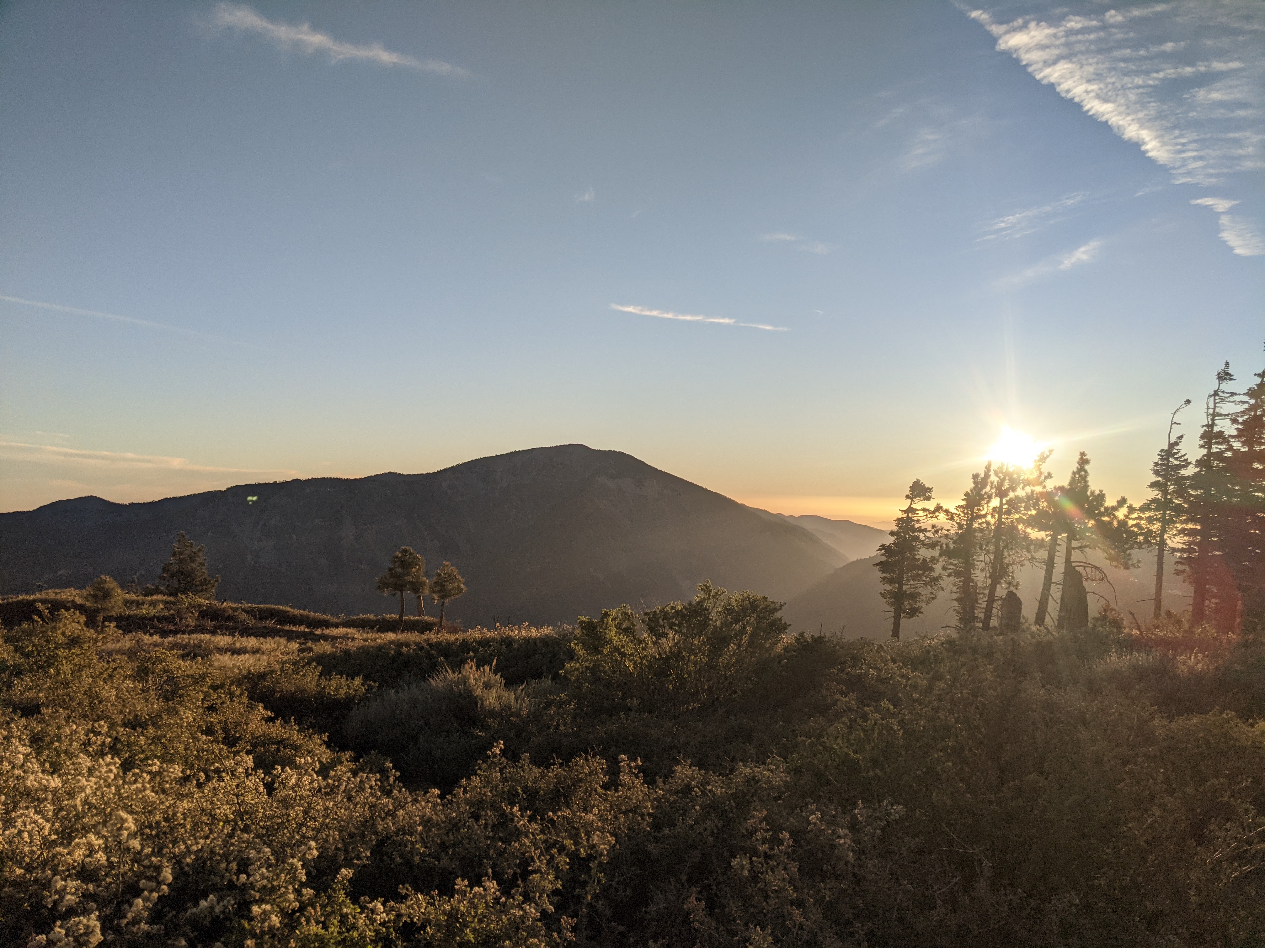
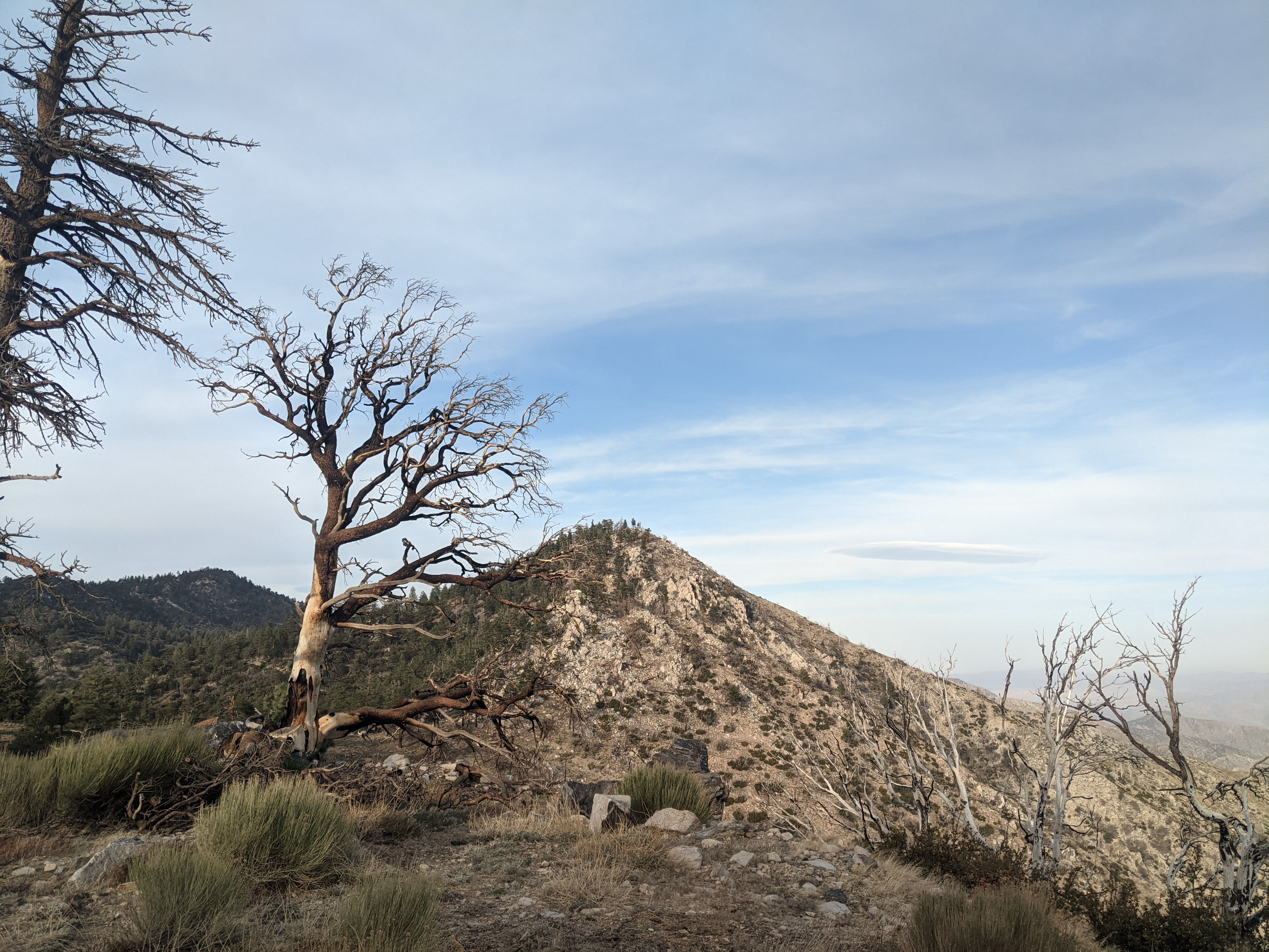
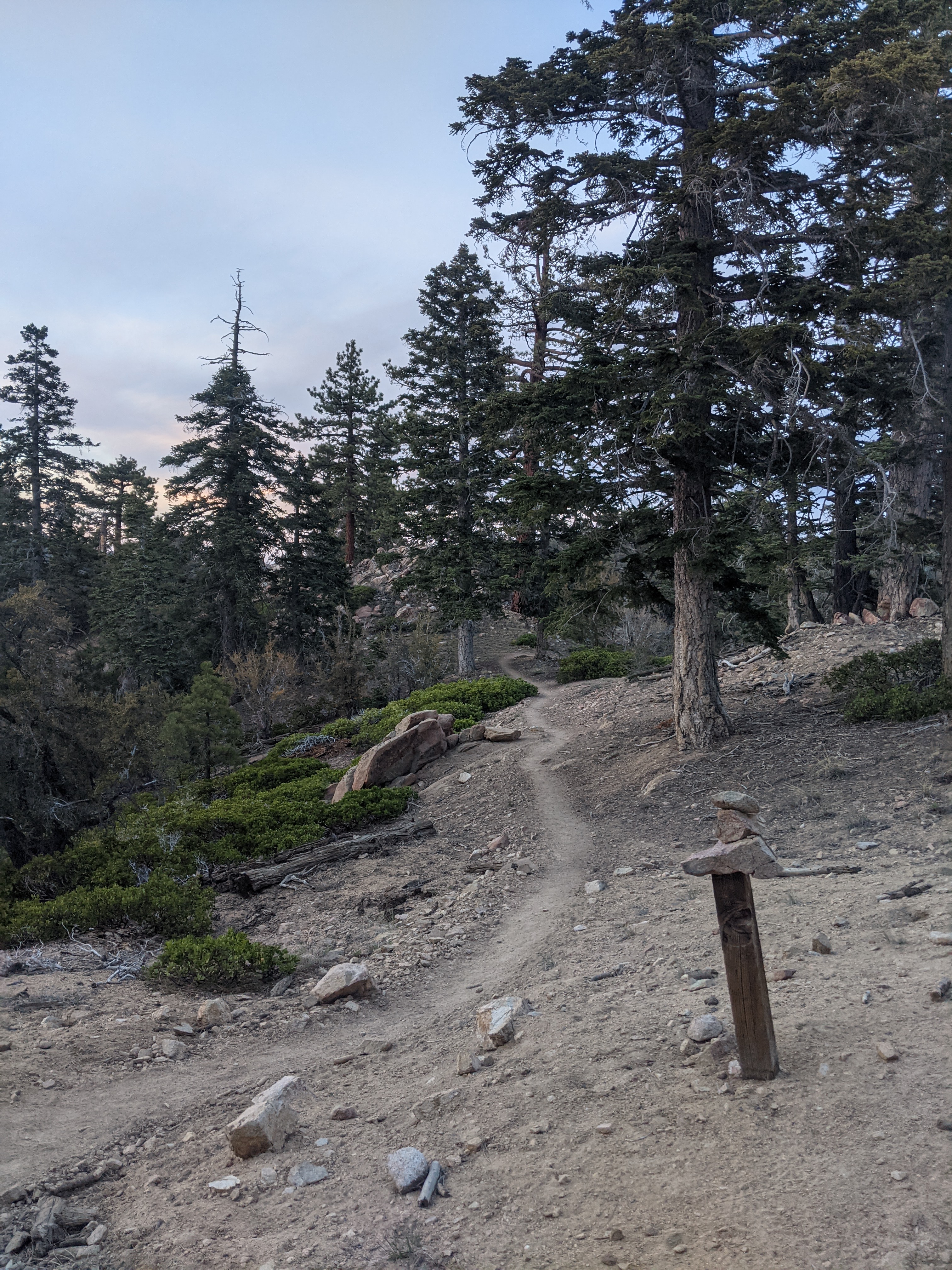
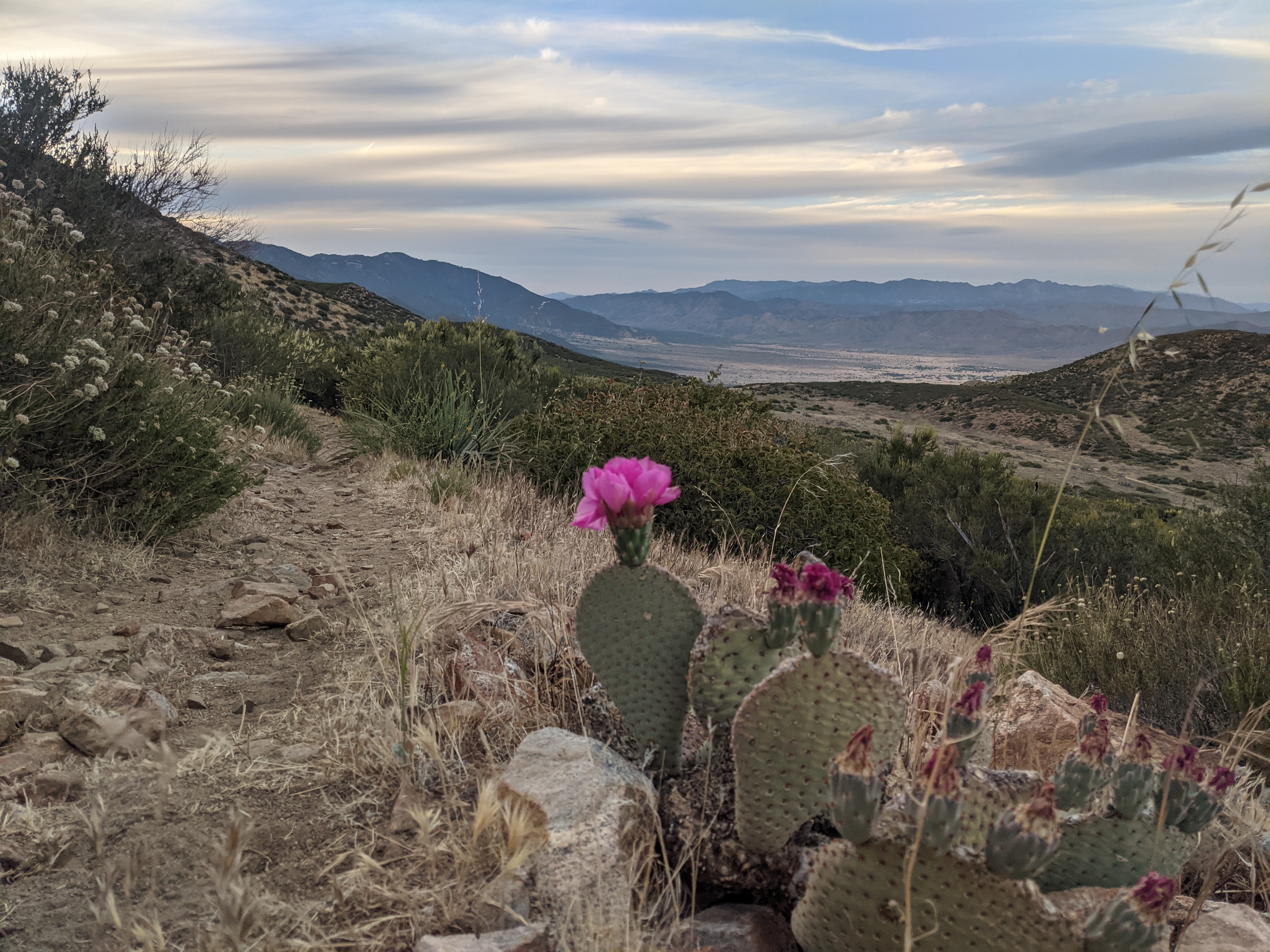
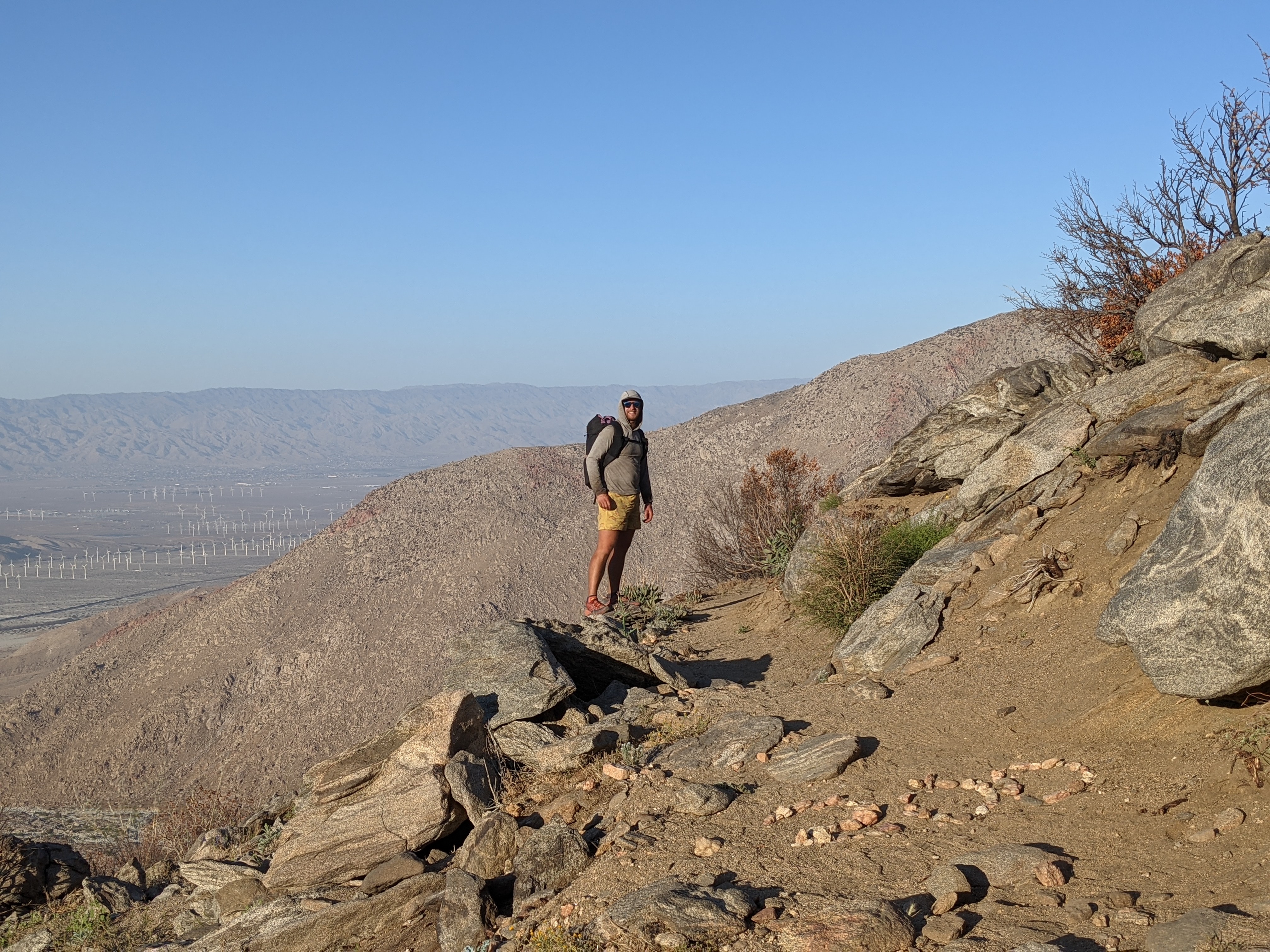
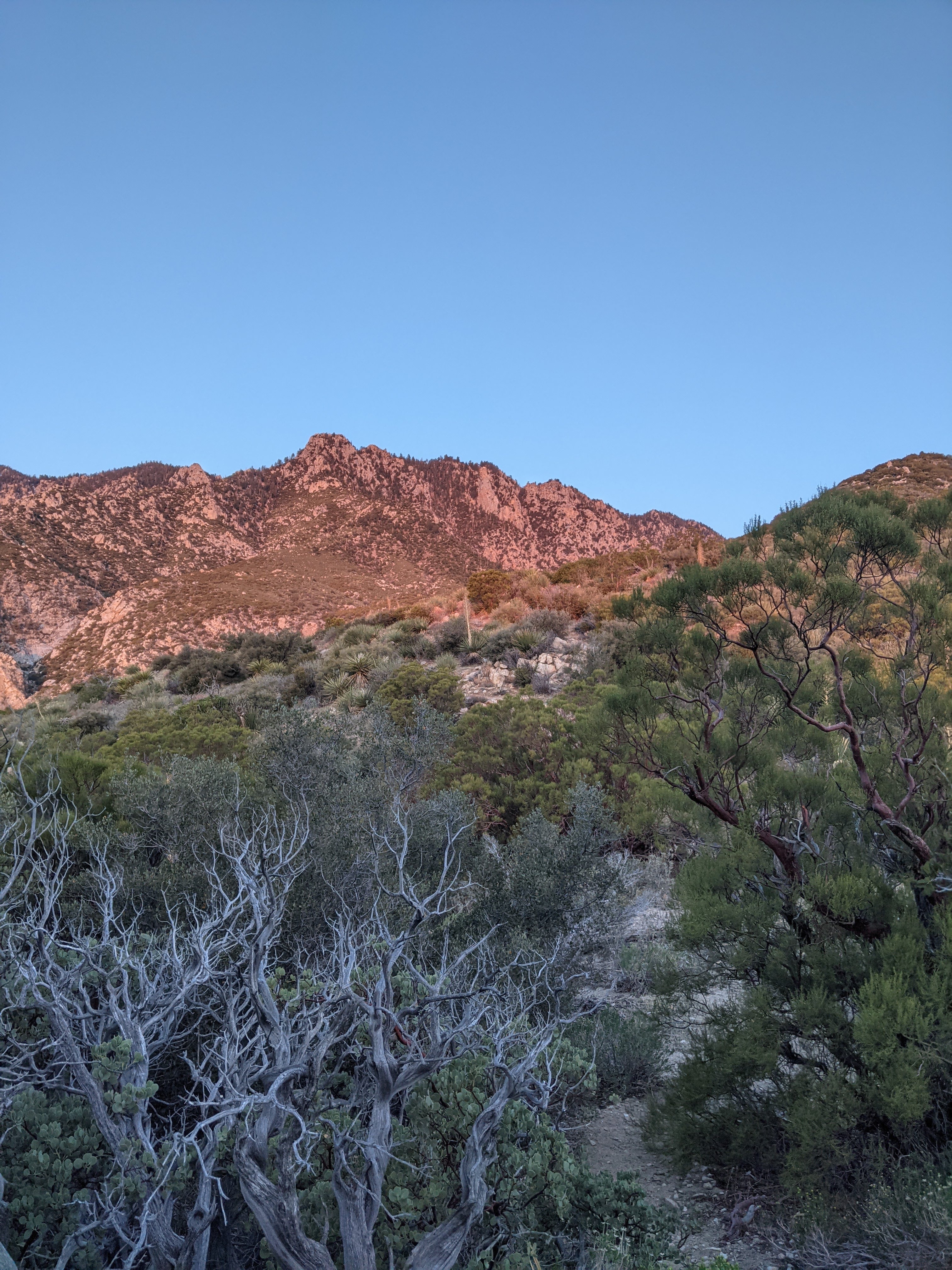
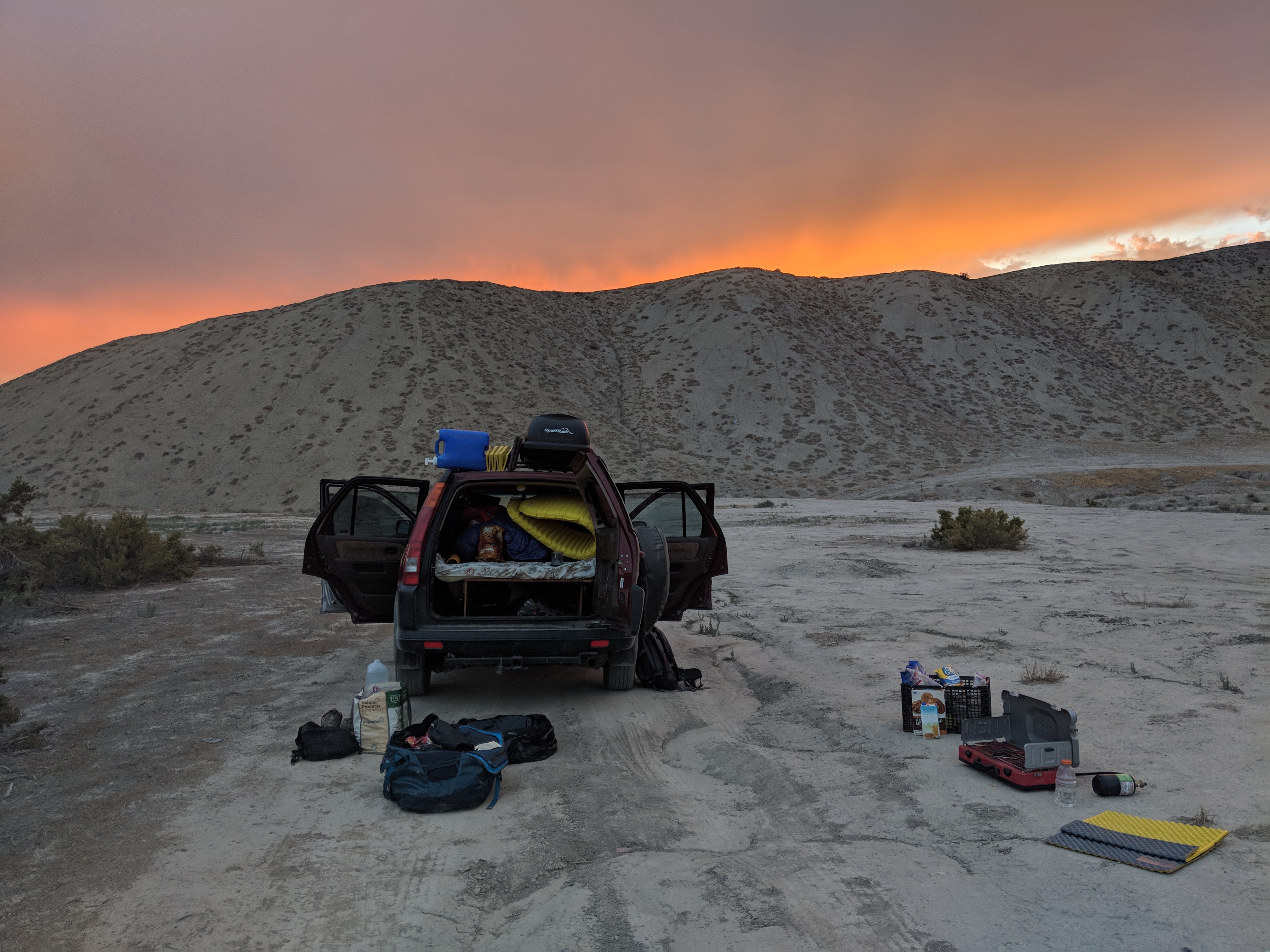
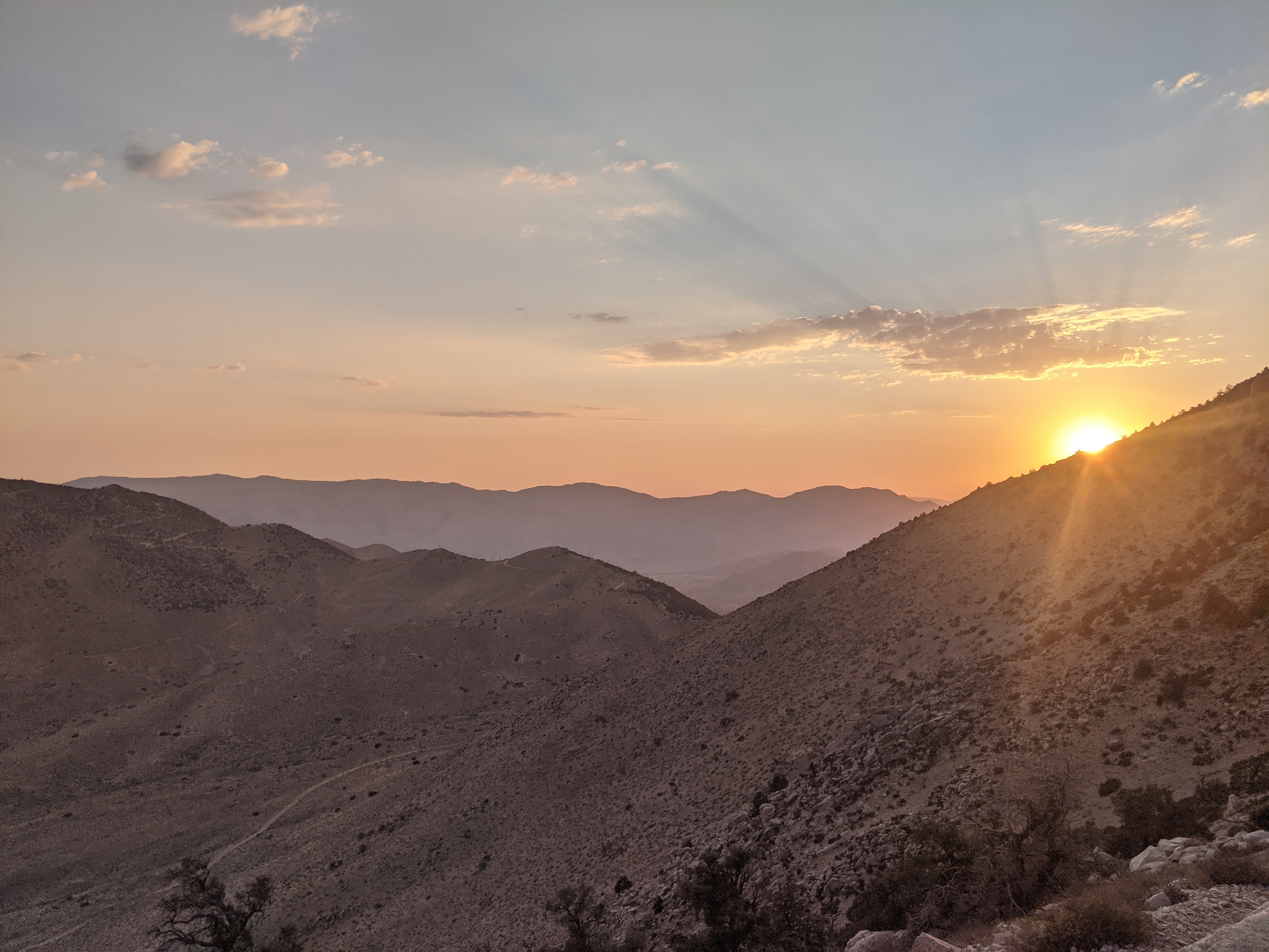
Shortly after falling asleep we had a big windstorm move through. I noticed some big puffy clouds forming in the afternoon, but didn’t pay them any attention. It can’t rain in the desert, right?? The wind moved in with some fat raindrops which we thought would pass quickly. A bit later it was not passing. I rushed to set up my tarp and we scrambled under. The wind got heavier and ended up affecting our sleep through the night. Bummer! The tarp collapsed at 4:11am, right when we usually wake up  I re-erected it and we slept in a bit. We were on trail just after 6am and right away meet a few hikers we had seen earlier. The also had rough nights. The trail meandered out of the pine ridge and down until there were minimal trees left and rocky and sandy substrate. We arrived at Walker Pass around 1pm and there was trail magic with fruit, water, and Gatorade! Yum!! We hung out a bit then left the campground to hike to camp. We had a tough climb out of the pass but luckily the sun was largely behind clouds. We found ourselves on a rocky granite ridge overlooking the desert below with awesome views. It feels like we are almost in the Sierra! We got to camp just before 8:30, tired from a poor night of sleep.

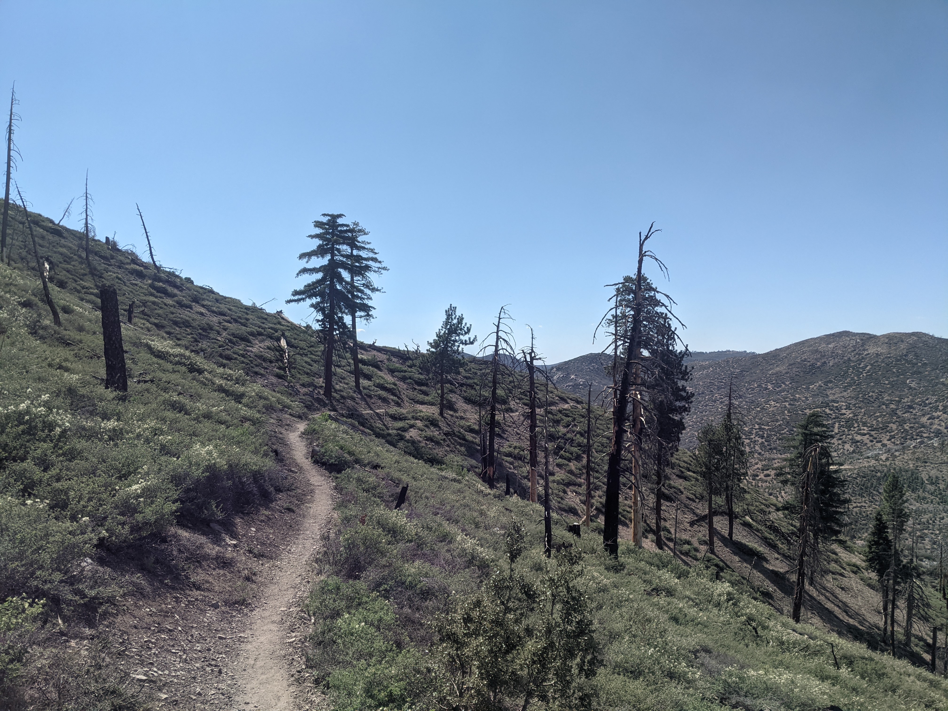
Day 26: June 17, mile 603.4 -634.1, 30.7mi

We got an even earlier start today. I was on trail just after 4:30am. A few miles in a head poked up above a log. It was Amanda! She hiked a bit further than we camped and me passing her was the impetus to get up. She packed fast and joined me on trail. We hiked for maybe an hour and a half until we reached a sweet spring. They had privies and we both used em then walked over to the water. The spring was gushing!! We took some time to fill up, eat a bit, and I finally got to wash my socks (down stream of course!). Margot showed up before too long. I rinsed my legs a bit. They were filthy. I took off, leaving Amanda and Margot to finish their chores. The trail promptly left the nice trees and began descending into the desert. Bummer. It was warning up too. 7mi in there was a sweet water cache. I chugged a liter and topped off my bottles. I met a few other hikers, chatted a bit, then took off. There was a decent climb out of the cache and I put in some grateful dead and jammed out. It was great. Awesome views, Joshua trees, and some good music. By 10, things were already getting warm out there. I hiked on, crossing dirt roads with good views all around. Around 1230 I was starting to feel the heat of the day and took a short break under a piñon pine (I think) and ate some ramen for lunch. I continued for just over an hour, passing some napping hikers until I couldn’t take the heat anymore. Another hiker was getting up to hike and I took his shade spot. His thermometer said it was 100⁰ out. Feeling drowsy, I laid down and napped in the small shade intermittently for about an hour and a half. I woke up when the shade had moved on me and I was in the sun. By then some big pooofy clouds were above and teasing the sun almost clouding out the sun. I figured it was as good of a time as any to start walking so I continued on in somewhat of a stupor. 10 minutes later I heard a familiar voice, it was Margot! She caught up to me! She was in a great mood, singing to the desert and “DJing* the “Mojave desert radio station.” I’m sure the Joshua trees appreciated the show. We hiked onto the next water cache enjoying the sudden cloud cover and a light consistent breeze, walking some ridges. We made it to the cache. It was great! Tons of water and they even had charging bricks. Wow! We hung out there, cooking dinner and drinking some water. A couple of other hikers rolled in when we were about to leave. Always hard to not chat but we had a few miles to bed. The last 4 miles were a bit of a climb to a ridge. Great sunset and nice breeze through camp which should help with sleeping in the heat. Today I drank about 3gallons of water. I was still pretty dehydrated.

Day 25: June 16, mile 572.9 -603.4, 30.5mi 

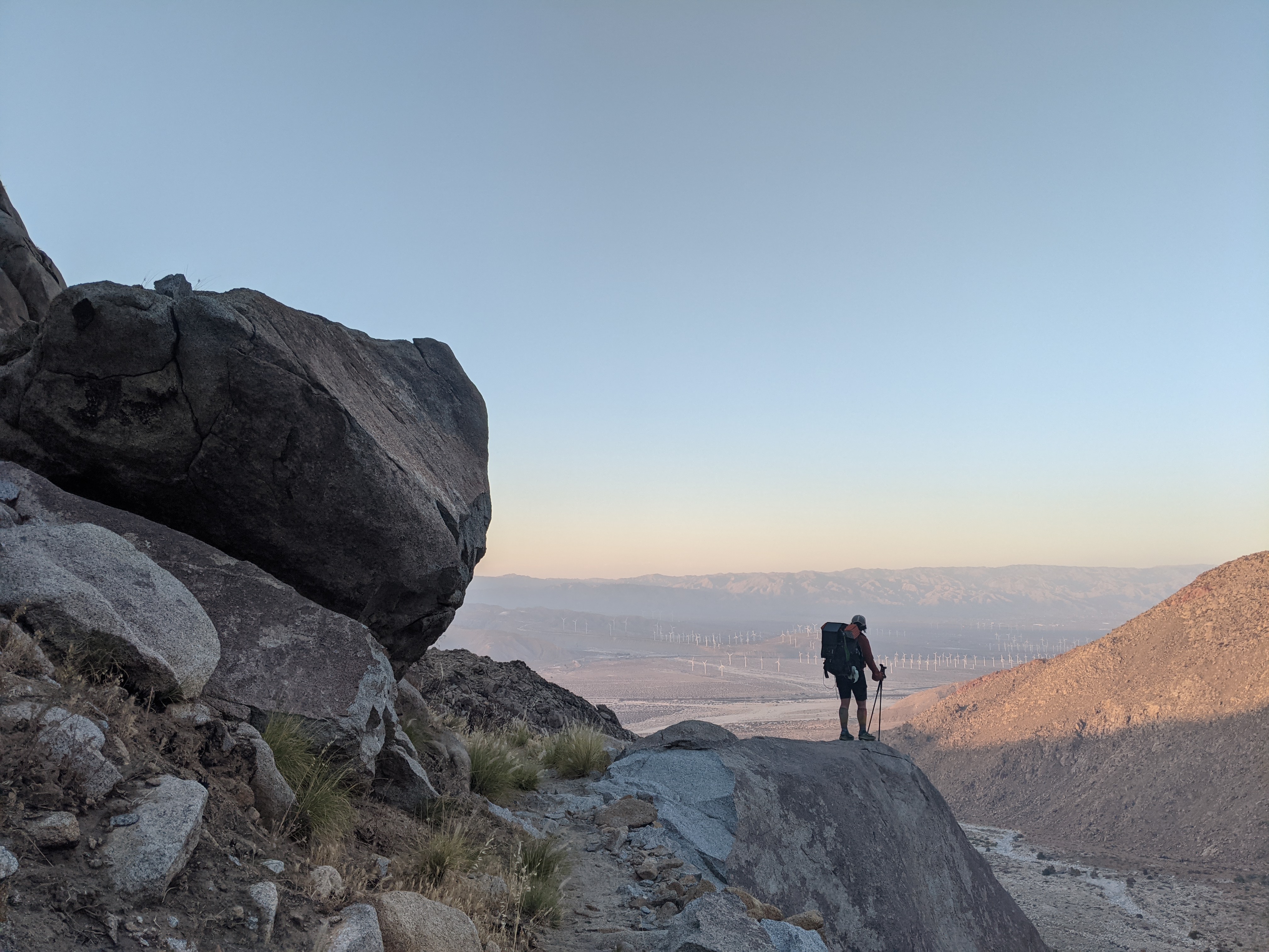
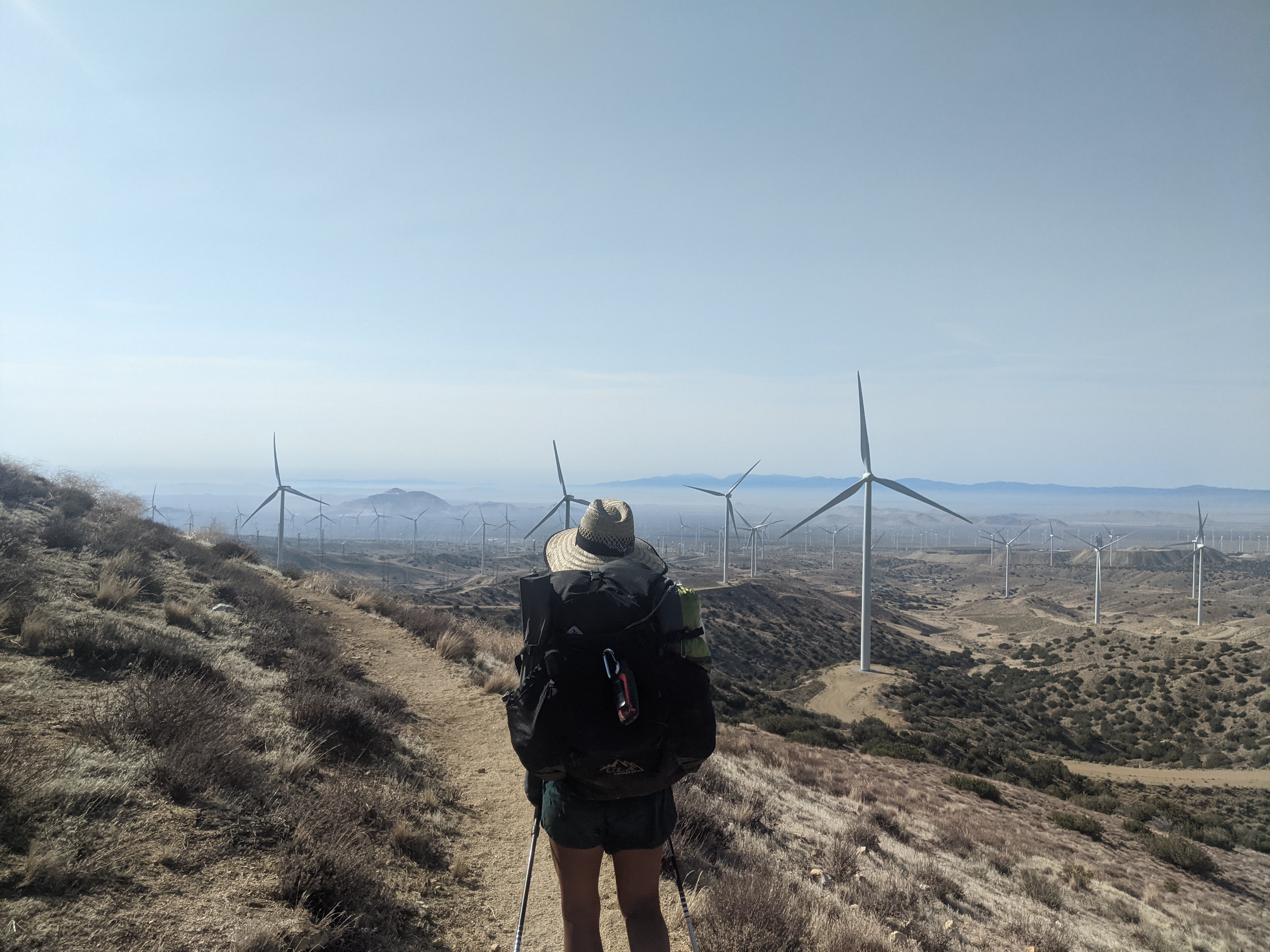
We woke up early. Margot and I got on trail before 5am. It was my birthday. I had an emotional start to the day and wondered why I was out here. Funny how the low points can be so close to the high points like last night. After awhile I started looking up and the reason why I was out here was apparent. I just needed to look around!! I caught up with Margot and we had some good conversation to a spring. There I saw a couple familiar faces, folks I had met earlier and a couple new people. On a mission, we didn’t dawdle too long and took off before too long. We were hustling and making good use of our early start. We passed through a construction area and a guy offered us some chilled water. Yes please!! They were working on a project to install large wind turbines on the ridge. It looked almost like mountaintop removal to make large enough flat areas for the turbines. We hiked on, it got hot. We took a break that ended up stretching a little longer than planned. When we got back on trail we were thirsty. We were still a bit of a ways from the spring and I started rationing my water. It wasnt great. I knew I’d make it, but an extra liter or two would have been nice. It was uncomfortable to say the least, hiking through the heat of the day and rationing water. Of course that’s all I could think about: water, cold water, mountain streams, gallons of Gatorade, cold soda, etc. We pushed hard. It was uncomfortable but an important lesson that is easy to be told but I will be more careful after that. Thankfully the next stream had good flow. We filled up in the evening and hung out and cooked there. We night hiked to a campsite half an hour beyond the spring. The scenery today was was excellent. I dont have memories of much of this section and I was pleasantly surprised. 

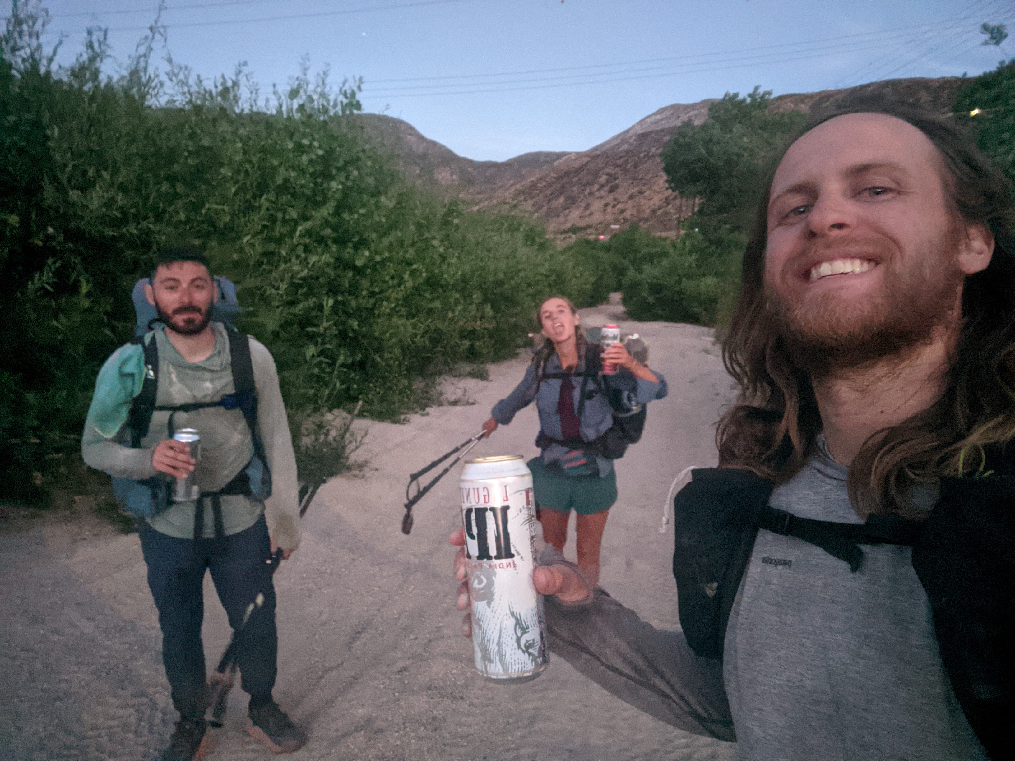
Day 24: June 15, mile 555.6-572.9, 17.3 miles

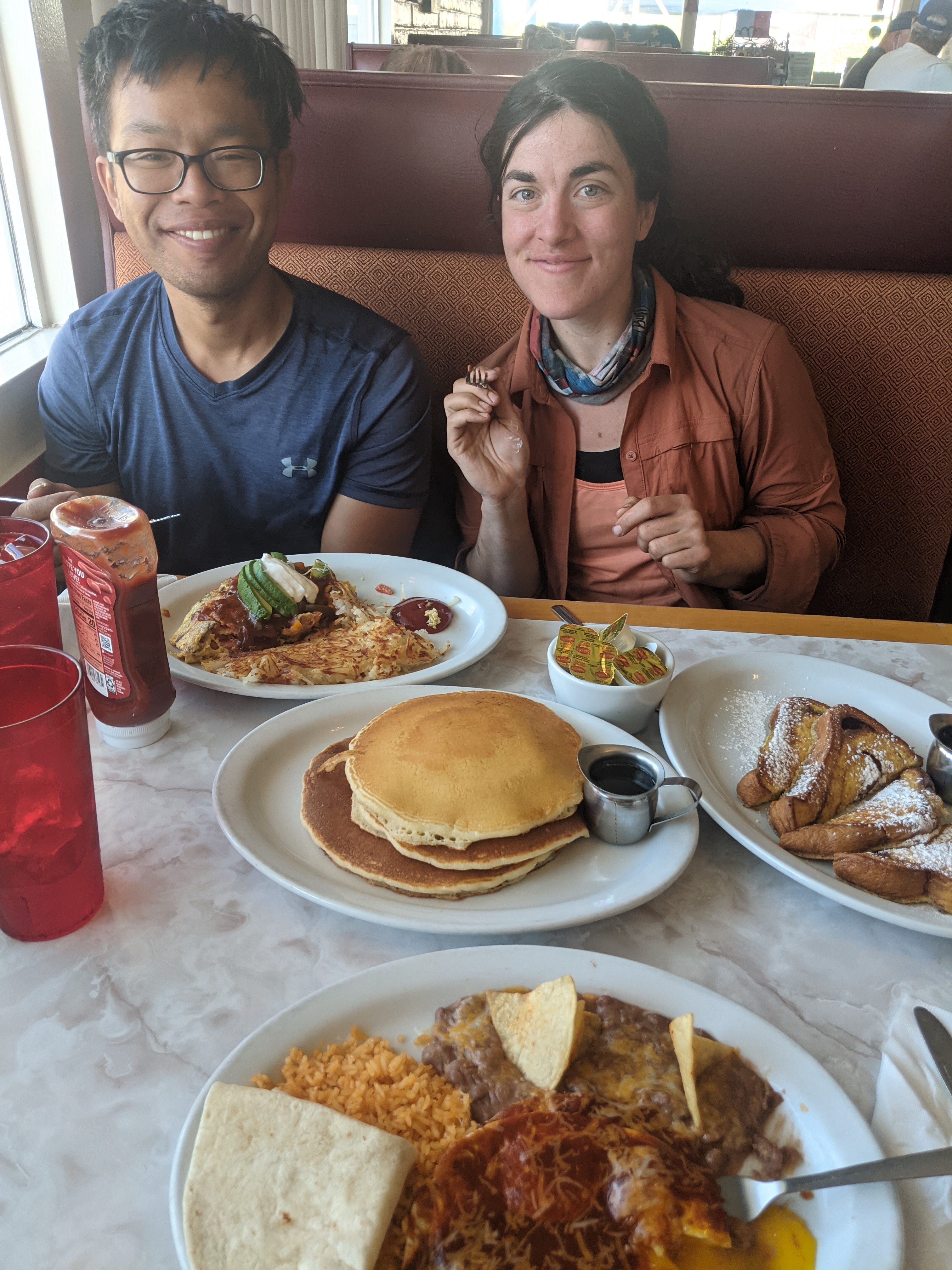
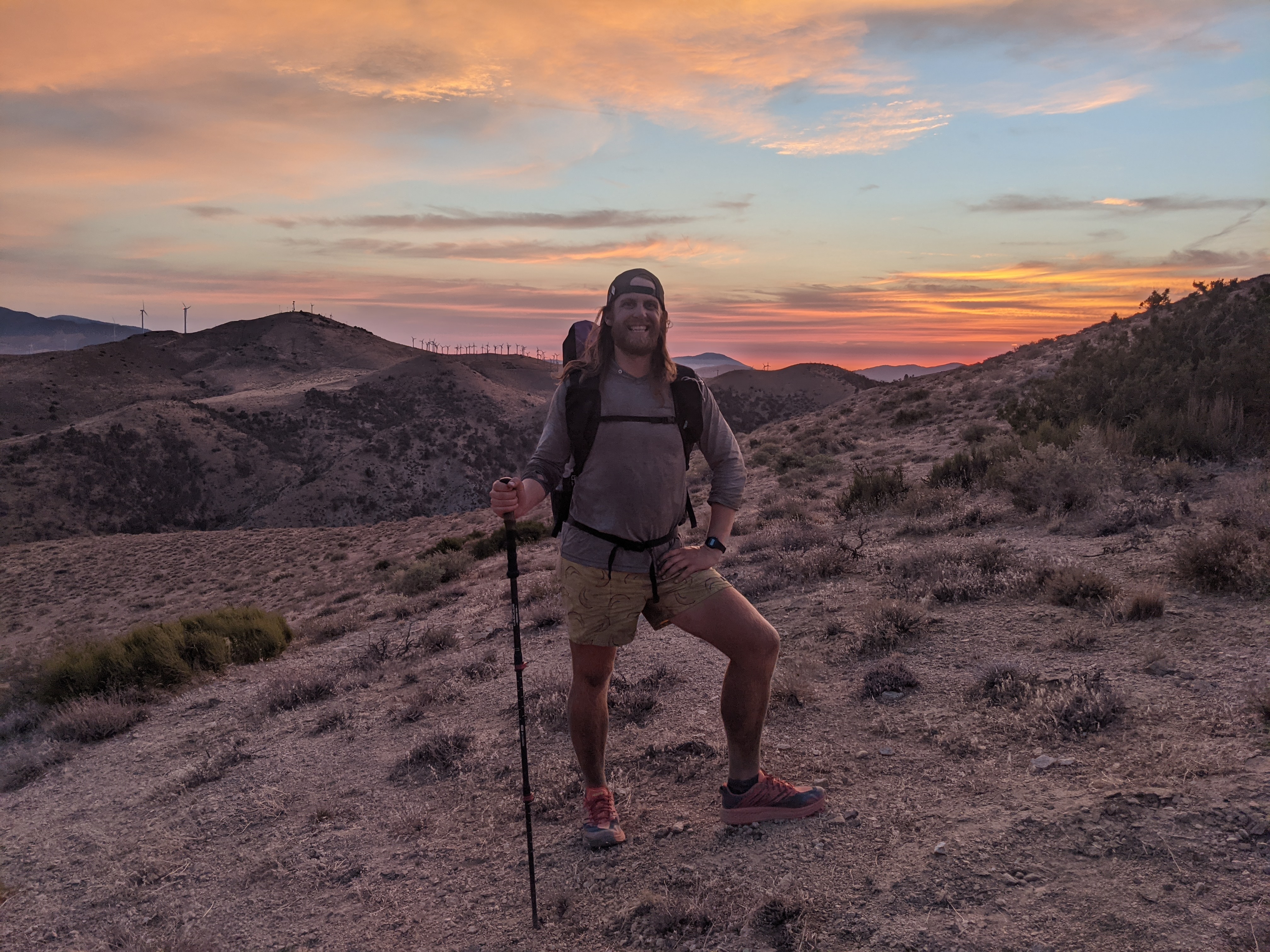
Margot and I woke up under the wind turbine and walked 3 miles to a road crossing. After the road crossing we walked through tons of turbines in the tehachapi wind farm. So many, and of all generations. It was cool to say and surprisingly beautiful. Ahhhh a walk in nature. Margot and I did 11 miles to a highway crossing to try and find a ride into town. As we got close to the overpass three other hikers were already there and dancing on the overpass to try and get trucks to honk!! I ran up and joined them and had a blast dancing and tons of trucks honked. Our timing was perfect because one of the hikers had called for a ride and 5 minutes after we arrived she was there. We all crammed in to her car and she drove us into town. We got groceries and hung out on the bench outside for a bit. Then we walked over and had delicious Thai food. After, we loitered on some excellent grass. Just like in 2017, tehachapi’s lawns are awesome!! We caught a ride out of town with another trail angel who dropped us off a bit after 6. We did about 6 more miles largely uphill and as the sun was setting the sky lit up. I was exhilarated. These are the moments that stand out to me thruhiking. Backpacking and hiking I’m not usually on trail as the sun sets, but thruhiking I am. I get to experience the trail in all it’s glory 12+ hours a day. No hiding out in a tent! I was stoked to be there. I took a number of photos and we continued hiking until finding a good tent spot. Margot Amanda and I lined up like sardines and went to bed. 

Day 23: June 14, mile 533.0-555.6, 22.6miles

We woke up kind of tired when the sun hit our eyes after a late night of aqueduct walking. We stumbled onto the trail and hiked 1.5 miles to a water spigot that we had aimed to get to last night but fell a bit short. Shortly after we left the aqueduct and started hiking through windmills. About 6 miles after the spigot was a trickle of water from a stream. We stopped there to get some water and saw a bunch of other hikers we had hiked with the night before. They had pushed hard, some arriving at 4am that morning, and were mostly relaxing in the shade of a huge beautiful oak tree. We don’t get many big trees out here so we hung out in the shade for awhile. We chatted with some folks, three of which were from NH! And I tried to nap a bit. We took off a bit after noon and hiked through the heat of the day. I had noticed some motorcycle tracks climbing hills and crossing the trail. At one descent location we decided to run down a steep and loose scree slope. What fun!! We caught up to Amanda and sat in the shade for a bit. We then started ambling asking, picked up another hiker taking a break and had some lively discussion. At mile 449 we visited the “449 cafe” where a trail angel maintains water and some treats! What fun! We took another break then the group of hikers caught up to us. We started to feel ancy to get going and took off. We walked another 2.5hrs then hit the hay. We camped below some turbines on a bit of a windy ridge. Very cool location though!

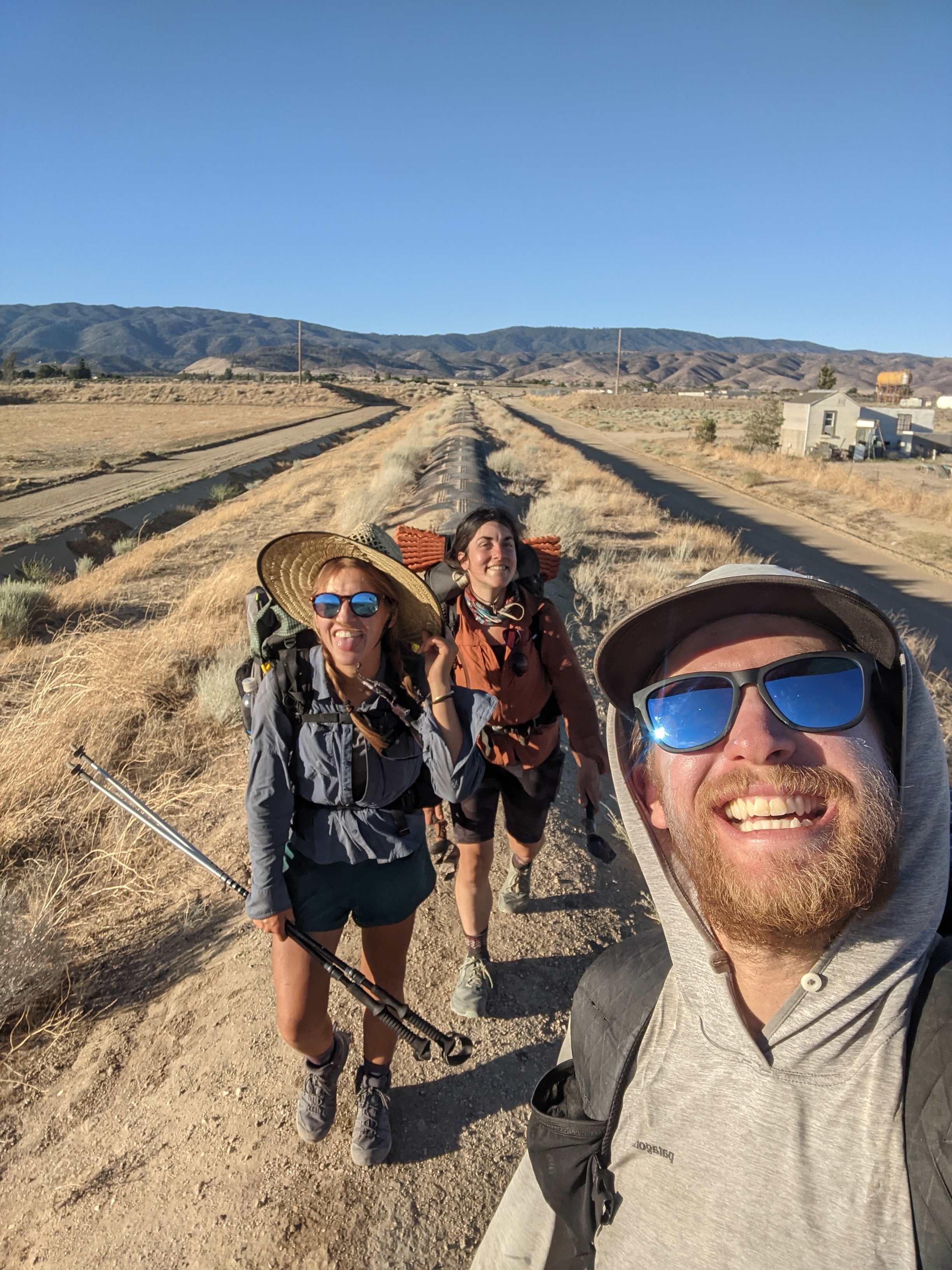
Day 22: June 13, mile 502.4- 533.0, 30.6miles

Margot and I woke up early and enjoyed a great sunrise. We filtered some not awesome water from a cistern then took off hiking. The morning was mostly in oak woodlands with some sweet grassy meadows and open areas. We passed through a burn area with all these small white flowers. The flowers looked like they were floating and their were hundreds of them in some areas. We caught up to another group eating breakfast. We chatted for a minute and they assured us it was all downhill to hikertown. It largely was and in no time we left the shade of the oaks and found ourselves among the desert scrub. The trail was largely downhill but did have a few climbs. By 9 or 930 things were starting to get hot. We met a cool botanist guy named Mike who gave me his number and told me to text him if I have any plant questions, and to send photos! We got to hikertown right around noon and met Amanda there. Not long later we headed to the Neenach Store and Cafe where we had lunch and were pleasantly surprised with their snack/resupply options. We ate lunch and our free ice cream (for hikers) then headed back to hikertown. I caught up on a couple emails, tried to nap, and then ended up hanging out with other hikers for the afternoon. I washed some socks then we started to pack up. The three of us left around 540 and began the aqueduct section. There was a light breeze and the sun got low pretty quickly. It was quite pleasant and we had a good time walking and chatting. We took a break a bit after sunset and another group of 6 hikers caught up with 4 more not far behind them. We chatted with them then split off into groups. We grouped/regrouped a couple more times. The aqueduct section was pretty fun. We didn’t make it to the spigot at “the end” but found a flat spot next to a juniper and laid down around midnight. It was fun to hike and chat with a bunch of other hikers who I only sort of knew from the past few days and this afternoon.

Days 17-21

Day 21: June 12, mile 471.4- 502.4, 31 miles
I was the first one out of camp in the morning and hiked about 7.5 miles by myself to the fire station above green valley. I hung out at a water cache for half an hour before a few other hikers arrived. We were getting ready to head out when some other folks arrived. Flavo, who I had met and been leapfrogging for a bit, and I started talking about our past trips to Patagonia. It turns out we had been there about the same time and done some similar hikes. Very small world. I headed out from the fire station and started what turned into a long climb up and over some mountains. It was hot, we were getting tired. We were closing into a road with a potential hitch to a town and found that there was trail magic for hikers! They had a full spread, soda, chips, veggies, watermelon, and even beer!! We hung out with some other hikers and after a couple hours we decided it was time to start getting going again. It was hot and the climb out was tough. 1.5mi out was a small spring I was counting on. It had a low flow rate which made me nervous about the upcoming desert stretch to Kennedy Meadows. Those three beers hit rather uncomfortably and the rest of the afternoon I was feeling it. We hiked up and up until we started following a ridge. We were in and out of burn areas and nice forest. We crossed mile 500 around 8pm and camped near a water cistern with a great view looking out over the Mojave Valley.


Day 20: June 11, mile 444.2- 471.4, 27.2 miles
Hiked out too much food and last night’s leftover pizza. Had good conversation with Margot in the morning climbing out of the KOA then through Vazquez Rocks. Some plants were labeled and we snacked on some juniper berries and Mormon tea. I also packed out a couple beers, not wanting em to go to waste and had a couple morning beers on the walk. Woohoo!! We had a great breakfast at homemade something in Agua Dulce. I ate huevos rancheros and had some good coffee. Our server was awesome too! We stopped at the hardware store and chatted with some cool folks there. We got back on trail but had a longer road walk in the heat. As we left the road things really started to heat up on the dusty trail. We met another hiker and found some shade on top of a ridge. Sweet spot. We then had a meandering descent to a water cache (thank goodness for that) then a longer climb up and over a ridge. We camped in a cool twisty oak forest. It reminded me of the enchanted forest of the Casa de Luna trail angels just a bit further than where we are camping, though their hosting days are over. Throughout the day I ate only two bars from my food bag but like 8 pieces of leftover pizza that was pretty heavy. It kinda hurt but I think a nice accomplishment to eat basically only pizza and huevos rancheros.


Day 19: June 10, mile 430.4- 444.2, 13.8 miles
The night was cold. I didn’t sleep well but when it was time to get out of bed I was slow. We were only going 14 miles to the Acton KOA. I had to get walking right away to stay warm so I hiked to a seasonal stream, pulled some water from a trickle (3minutes/liter!) And made some coffee in my cold soak container and had a sweet treat. Interesting notes of soy sauce in the coffee, I guess I didn’t rinse out my container well enough. Amanda caught up and we hiked to a fire station for a quick break. I used the pit toilet and when I came out John and Cricket had arrived. We chatted a bit then headed onto Acton. Good conversation with them while walking to the KOA. We arrived a bit after noon. I ate a pint of ice cream and some chips while hanging with other hikers. I met a few other hikers I hadn’t met before but had heard of, including some folks of “the blob” a 10 person trail family. I picked up my resupply box (new shoes, yay!) and sorted my food. In the afternoon we went swimming which was awesome. Then we ordered pizza, picked up some beer and had a grand ol’ time with other hikers. Pizza came way late and wasn’t all of our order, total mess! After dinner we headed to bed.


Day 18: June 9, mile ~397- 430.4, ~33 miles
Even though we hiked late last night, we got up early to hike. We did about a mile of roadwalking then joined the PCT at mile 398. The trail crossed the road a few times then we found ourselves at three points, where lots of hikers have been hitching around the fire closures, not us!! We found a hiker box and I picked up a glass jar of mushrooms…. Not the lightest add on, but I figured it would be good for dinner. We hiked a bit further to a spring and grabbed some water. We had planned on taking a break there but there wasn’t enough shade. We hiked about a mile further to a nice shady area and ate and napped for a couple hours. The nap was especially nice after a long night hike and a few hours of sleep. We took a bit to get going again and set our sights on the fire station with water. We arrived around 5 or so and chatted with Professor, another hiker. Margot and Amanda set their sights on a campground 13 miles away from where we were. We set off, passed mile 420, and walked on through the sunset. We pushed to the campground arriving around 10pm. Night hiking can be tough but it should pay off tomorrow when we head into town.


Day 17: June 8, mile 369.3- ~397, 17 PCT miles + ~5mi of roadwalk.
We slept in at Will and Krystal’s place in wrightwood then had a leisurely start to the day. We packed our packs and made pancakes and eggs in their kitchen. They were awesome hosts and I wish we had more time to talk. We left around 11 and headed to the hardware store in town. We were able to catch a ride to the trailhead from a guy I met yesterday. Super cool to chat with him and we were grateful to have the ride. At the drop-off, I saw JZ and Cricket who he’s hiking with. Amanda and Vicky were also there. We took off in a mega group and chatted. Super fun to be hiking with a group like that. We summited Baden Powell and hung out a bit on the top. Another group of 4 we knew and had seen in town last night caught up to us. It seems like our mega group of ~12 is going to be at the Acton KOA around the same time, so I’m starting the rumor of a pool party since their pool will be open! I had a great time chatting with JZ and Cricket as well as the others. At the little Jimmy Spring, the best spring in the desert section, we hung out and talked a bit. Amanda and Margot took off and Matt and I hiked out together. We caught up to them at a picnic area around 815 after hiking through a maybe closed burn area?? We never saw any signs about the closure though. After everyone ate, the 4 of us hiked another couple hours on Hwy 2 to avoid the signed fire and frog closure. We had excellent conversation and a good time hiking the road. Saw very few vehicles and they all were driving slow. We are sleeping at a day use area and in the morning I can use a pit toilet and picnic table! It’s great hiking with a group, especially 4 of us and a few more folks around.

PCT Days 12-16

Day 16: June 7th mile 367-369.3, 2.3mi
We slept in until the sun was too in our faces, crawled out of bed and lazily packed up. We hiked the 2 miles to the highway crossing and caught a hitch into town. We had a wonderful big breakfast after stopping at the hiker friendly hardware store. We will have dinner tonight and staying with an awesome host family I met in 2017. So far we are enjoying the mellow day off. At dinner we ended up seeing a bunch of hikers we had seen earlier, including Amanda who I hiked with for a few days to Palm Springs. Super fun to be in a group of hikers having a grand ol’ time.

Day 15: June 6th mile 342.9- 367.1 24.2mi
I didn’t sleep great as we were camped close to the railroad tracks. All night we heard trains and their horns as they ascended and descended the cajon pass grade. We got up sorta early and headed off. The day consisted of 6,000ft of vertical gain from the low desert into the ponderosa pines. The day warmed up quickly and the grade was consistent. Consistent slight incline felt great and I was moving efficiently and in my element. As the morning turned into afternoon things warmed up and the scarcity of shade started to wear on us. We met another couple hikers and chatted with them a bit. Finally we made it to the pines and had good shade. As the sun began setting we were at the Guffy CG where we yogi’d (finagled without asking) some snacks from the car campers. We pushed the last 3 miles, which were beautiful, to our campsite for the night.

Day 14: June 5th mile 318-342.9 24.9mi
Margot and I woke up early with McDonald’s on the mind. We got going and hiked over the mojave dam. We were at Silverwood lake not too late and chatted with some day users for the lake while we lounged in the shade. We got up and heading on to the next picnic area. There we ended up taking a break for over an hour. We swam and filled up water and chatted. We met up with Matt as we were about to leave and hiked on with him into the afternoon. We had a hot climb and it was mid-day. After some climbing and descending we were baking in the sun. By then we were pretty close to the McDonald’s that we really started moving. We hustled the last couple hours and ended up at the legendary McDonald’s of Cajon pass. We went in, ice cream machine broke of course, and I got a slushie and some fries. We were mad that we couldn’t sit inside so we sat outside in the wind. The joys of hiking….. then we went to a taco truck and I got a bomb bean burrito with some veg. We went to a gas station, bought some staples and hiked out and to our camp. We all drank our gas station beers on the way to camp. Bellies full and tired we laid down next to a cottonwood tree near the railroad tracks. I hope I can get some good sleep tonight.

Day 13: June 4th mile 291.9- 318, 26.1mi
I woke up a bit early and lay in bed. Since I was starting with Matt I spent a little time waiting for him to pack up. We hit the trail and I was hungry eating hella snacks for the first couple hours. Right away we passed a number of hikers and chatted with some of them. At a tall bridge we stopped for a morning break and I swam. It was chilly but boy howdy am I glad I did!! We hiked on and it got hot. Not too far down we stopped for another break and I dipped my feet in the water there. Matt needed some time to rest so Margot, who I met that morning, and I took off headed for deep creek hot springs. We got there pretty tired and hot from the day. We swam and talked with some other folks who had hiked in to enjoy the springs. One guy was very friendly and offering us wine, of course he was in the buff!! We hung out there for a bit chatting and I swam again before we took off. Matt arrived just as we were about to leave and unfortunately I said bye to him. We had a hot hike above deep creek and found a campsite a bit further. Tomorrow we are hoping to get to McDonald’s before too late in the evening. We have already started thinking about our orders. I don’t think I’ve been to a McDonald’s since 4 years ago when I visited the same one while on the PCT then.


Day 12: June 3rd Mile 266.1-291.9, 25.8mi
Woke up a bit earlier than I wanted, oh well. Had an awesome breakfast Kenny made for us. We had eggs, french toast, potatoes, fruit salad, juice, and coffee. It was killer. I woke up hungry even after all the food I ate last night. I tried to eat as much as I could during breakfast. I was dropped off at the trailhead with Matt, who I had met a couple days before. We hiked all day long and had great conversation. We took a few nice breaks in the shade but overall the trail was pretty enjoyable and easy walking. There was a light breeze throughout the day and we stayed high and in the trees. It was a nice break from the low hot desert. A bit after midday, Matt and I met up with a group of 3 hikers. One was from Boston area and had hiked in the Whites quite a bit and the other two guys were from Reno, NV and Atlanta area. We had good conversation and excellent views. We stopped at a spring next to a dry creek and they decided to setup camp for the night there. We hiked on until around 9pm, unknowingly passing the last flat spot a bit around 8 and having to hike further than we’d like. Matt considers himself a pizza connoseior and we discussed all the intricacies of ingredients, cooking types, crust thickness, etc. He appreciates the diversity of pizza and all it’s unique creations though he doesn’t eat Domino’s.

PCT DAYS 9-11

Day 11: June 2nd. Mile 250.5-266.1, 15.6miles
I missed my alarm again this morning and woke up an hour after. That’s fine, I was headed into town anyways. I was 15mi out from the road crossing and packed up and set off. I enjoyed the big cedars, tall ponderosa pines, and the cool mountain air. A large change from the desert of yesterday. A couple hours in I met another hiker who was heading into town. We talked for half an hour until discussion about vaccines and the pandemic came up. I took off shortly after. I got water from an excellent spring on the side of the trail. I walked another hour then put on my audio book to get me to the highway. I passed the 10% marker on trail this morning. Passing it was a much larger moral boost than I expected. At my current pace I am on track to finish in about 4 months but I expect to pick up the pace further north as days get longer, legs get stronger, and the overall terrain eases a bit. About 100yds from the road there is a “hiker text message” box. I wrote a quick note then noticed a box of PBR sitting nearby. I sat down to drink one before heading to the road to catch a hitch into town. Another hiker was trying to hitch at the highway so I went over and talked to him. He said a guy named Kenny was able to pick us up in a bit if we didn’t catch a ride in. After 20+ minutes, Kenny called and he was on his way. Kenny took me to a grocery store for my resupply and picked me up 30min later. By then his kindness and humor won me over and I decided to stay at his place for the night instead of trying to get some more miles in the afternoon. His house is a vortex, it sucks you in and you can’t leave! A couple other hikers had been here for a bit, unable to escape his hospitality. We all chatted and hung out. We got dominos for dinner of which I ate a whole medium pizza and a half gallon of ice cream (ice cream split across half the day). Tomorrow I’ll fight the Vortex and get back on trail after his legendary breakfast. After many days hiking alone, it’s nice being around other hikers.


Day 10:June 1st. mile 218.5-250.5, 32 miles
Last night I messed up setting my alarm. I woke up without it going off but only half an hour later than planned. I packed up quick and hiked to the Whitewater River. After 200+ miles of desert, this large creek comes as a surprise. It’s almost 10ft across and it’s got water!! I filled up, said hello to someone packing up and took off. A few miles later I noticed what looked like cat tracks. I followed them to Mission Creek. Not too long later I found a hiker with a dog. Phew! There I met another hiker who I hiked with for about an hour. The trail follows mission Creek crossing over it many times. Unfortunately due to a recent flooding the trail can be difficult to follow. While following it slowed me down a bit I was successful passing through. There is a 5-mile dry section where the creek and trail separate and somehow I missed collecting water before entering. Running out of water I found another hiker in a similar predicament. We checked our maps and saw a seasonal stream half a mile ahead and lucked out, it still had water. The morning was hot the afternoon as well. I was grateful to be following the stream up most of the trail however the temperatures still slowed me down. Eventually the trail started to climb out of mission Creek and there was a slight breathe near the high points. Towards the end of mission Creek I got water from a small spring that was like a cave with water dripping in the ceiling. I took my second siesta there though I couldn’t sleep then continue 10 more miles. Looking back I saw Mount San Jacinto and the temps were cooler as I was in the trees. I feel surprisingly good after 32mi. Tomorrow I will go into Big Bear for a resupply.


Day 9: mile 209.5-218.5, 9 miles
Last night we had talked about finding a hotel once we got to the I-10 overpass. Since we didn’t get in until 11pm and all the hotels were super expensive for memorial day weekend we decided to sleep just past the overpass in a wash. We were zonked from the day so we fell asleep unbothered by the whizzing cars. Amanda and I woke up sorta early and realized how close to a house we had slept-woops! James, Amanda’s friend had slept in his car nearby and we hung out for a bit before choosing a breakfast restaurant in palm springs, the reason we pushed so hard last night. I had an awesome breakfast, huevos rancheros and 3 large pancakes and finished it all after a quick 10 minute break in the middle. Amanda and James rented a hotel room and I snuck in the backdoor. I showered, charged everything, and we hung out in the A/C. A few hours later we went to get lunch- monster sub, and ice cream, mega shake!! Palm Springs was hot and we walked around a bit. We came back and Amanda and I swam before I packed up and they dropped me off on the trail. I hiked 9 miles then a bonus 0.5 to whitewater preserve where I didn’t have much luck finding an excellent spot. I had the other half of my sub for dinner. I said bye to Amanda and James when they dropped me off. I really enjoyed hiking with Amanda. We crushed some tough terrain and did it with some goofy and fun energy. Maybe she can catch me in the coming days!

PCT days 1-8

Day 1: mile 0- 21, 21mi
I got a late start today because I undertook a very last minute project, moving down from an old vest to the quilt I took on trail. I think I’ll be glad I did it though. My dad’s dropped me off at the Mexico border/southern terminus at 1230 and I started walking after peeing on Trump’s wall. 3 miles in I crossed some railroad tracks and my timing was perfect. I saw a small single-person cart prerunning the tracks before a train came through. The afternoon was hot for a couple hours. Because of my late start I didn’t want to hide out in the shade so I hiked through the heat. I passed three hikers, much less than I expected, then came upon a group of 4 around dinner time. I ate my cold soaked beans with them then hiked another two hours to camp just beyond Lake Morena. I am sleeping under a manzanita tree (my favorite!) Next to a big ol’ oak. It’s going to be a cool evening but I don’t think it’ll get too chilly. Tomorrow I would like to get up early and take a mid-day break to rest my feet and avoid the hottest part of the day.


Day 2: mile 21-42, 21mi
I slept kind of cold last night and the bright moon kept me up. Unfortunately I was also close to some houses and heard the inhabitants and their dogs throughout the night. Nevertheless, I woke up rested around 5:20, packed up real fast and started hiking to warm up. The dawn broke beautifully while I hiked the meandering trail up and around some hills. Before too long I was at the trailhead for Kitchen Creek Falls, a popular day hike for many. I followed the twisting trail while it steadily climbed up above Kitchen Creek. Around 10am, I scrambled down to the Creek, got some water, and waded in to wash my feet and socks. I took a small break there before scrambling back to the trail. A constant breeze kept the heat off my back until the breeze dried down and I was hiking uphill in the unrelenting sun. I took another break under a big oak, are some cold soaked noodles, and then pushed on. In the last couple miles before Mt. Laguna big pines rose up and formed a shady canopy over the trail. I took another long break at the turn off for burnt rancheria campground before I walked in and found my dad and Josie who were meeting me up there for the night!


Day 3 mi 42-68 26mi
I started the day with a hearty breakfast, thanks Josie!! I found myself dawdling a bit before getting on trail. I finally got onto trail around 830 and promptly saw a rattlesnake eating a mouse! The first 7 miles of trail are excellent, meandering out of the tall Jeffrey pines and along the desert edge with expansive views east to the desert floor. I had the rest of last night’s burrito for lunch- what a treat! Then picked up some water for a long dry stretch. This trail is beautiful through here, paralleling the highway and tracing contours around the hillsides. Eventually the trail turned off the highway and began a long descent. This section was pretty as you could see the green hills from where you came and the craggy barren hills climbing out of the desert. I ate an early dinner of pearled couscous which cold soaked exceptionally well though it had been soaking for over 4 hours. I hiked on an hour and a half to a water spigot. The sun was setting and I was debating hiking on. Another hiker showed up and invited me back to where a few folks were camping. I hadn’t spoken to any other hikers since 10am and was happy to have the company. Plus, 26mi was a good distance for the day. I enjoyed chatting until hiker midnight when we all went to bed, about 8:30pm.

Day 4 May 26, 2021. Miles 68-101, 32mi
The day started off with a long meandering descent to the desert floor. I covered 9 miles in just over 3 hours to scissors crossing. While I was relaxing in the shade under the overpass I met Professor who took it upon himself to maintain the water cache down there. Nice guy, thanks Professor! I headed out around 11 and begun a long gradual winding climb along a south/southeast slope. This set the mood for most of the day. I stopped a few times in some shade and tried to stretch my legs and feet. I finished my first audio book while walking. I watched a lizard rustle in the bushes as I approached. I paused then he scampered out, launched himself off the side off the narrow trail 3 feet off and 12 feet down. There was an audible thud when he landed before taking off. I hope he’s alright. I carried a few liters to the 3rd gate water cache, rested there for a bit then continued on. I ate some really good ramen while walking that I soaked in an empty plastic container. It hit the spot. I ended up doing 32mi, maybe a little more than I should have but I didn’t want to stop early. I didn’t see a single hiker all day today, am I late for the crowd? Where is everybody?? A few people signed the logbook at the 3rd gate water cache for today but I never caught up to them.


Day 5 May 27, 2021 miles. 101-131 miles, 30mi
The day started off kind of chilly. I was a bit cold last night and I struggled to sleep well through the night. I slept in a bit and got a later start than normal, around 7am. I hiked the 9mi into Warner Springs in the morning. I enjoyed the cool start to the day and the open meadows. I mooned some cows that were grazing. The last couple miles into WS had a few streams and big oaks with lots of squirrels. This was the first flowing water I had seen in over 60 miles. I entered WS, got some water, washed my socks, then continued on. 6 or so miles in, after crossing a big meadow I met another hiker named Jerry. We hit it off and walked the 12mi together to Mike’s place. It was hot in the afternoon but good to be chatting with someone after a lonely last couple days. Mike wasn’t around at Mike’s place, a popular stop with hikers for water, shade, and sometimes shenanigans. Alive was in charge and she was running the show. Right away she’s offering beer to hikers, getting a headcount for dinner, and providing constant commentary on all sorts of things. She’s a hoot!! I sick around for about an hour before heading off in the cooler evening with Rodney. We did 4 miles to a decent campsite but pulled in late. Planning on town tomorrow so that’s exciting.


Day 6 May 28, 2021 mile 131-158.4, 27mi
Day started early walking before the sun was up. I cruised about 15mi. I met Amanda at Mary’s place and met Mary there too. Hot hiking out of there but hit the road just a bit after noon. Caught an easy hitch into Idylwild with Amanda and ate floor cookies from the car. Town was a blur but bought too much food. Ate delicious Mexican food and caught an easy hitch back to the trailhead. Amanda and I had great convo hiking out of town and probably hiking 30 tomorrow.

Day 7 May 29, 2021 mile 158.4-182.7 24.4 miles
Amanda and I got an early start and started hiking! I had a yogurt and salad for breakfast at a pretty view. Today the miles weren’t super high but the views were excellent and the terrain climbed and descended a bit! We also hung out a bit in shady spots. Overall it was pretty cool and a nice break from the desert. The trail climbed and meandered along the north to south ridge above Idylwild. Awesome views, some steep sections and lots of desert views! We are camping on an awesome outcropping looking south over Idylwild!

Day 8 May 30, 2021 mile 182.7-209.5, 27mi
Chilly night, some wind, but excellent views. Woke up and dozed for a bit longer. Started hiking and since we were in the San Jacinto wilderness saw a few other campers. We hiked along the ridge, enjoying the wind in the big trees. We saw a few day hikers and were able to drop some trash with them. We then started a long descent. We descended over 6000ft to the desert floor. A couple hours in we took a long siesta to avoid the heat of the day. We relaxed in some shade, snacked a bit, and then slept for a good 20-30min. Around 3pm we packed up and began descending to the desert floor. The descent was long and we saw two rattlesnakes within twenty minutes of each other. Both rattled and gave us a bit of a fright! We also saw a few other snakes on the descent. We finished the hike at a water spigot in the dark, hard headed not to turn on our headlights. We hung out with another hiker chatting then packed up and did the 4mi to the I-10 overpass. Along the way we saw a scorpion and some cool burrowing owls flying around us on the last push.

Starting the PCT and a gear list

For the past 9 months I have been planning a PCT hike. Originally, I was going to start in Washington and go southbound. 2 weeks ago I flipped my plans and I will be going northbound. This moved up my start date by about a month and a half and I have been busy the past couple weeks with logistics for my hike. Fortunately, I have some prior backpacking experience and I hiked the first 700 miles 4 years ago. I have been gathering my gear for this trip all winter and spring and I am using a kit that is similar to what I have used all over the world.

Resupply Plan

My overarching resupply plan is to keep it simple. I have packed up 3 resupply boxes for myself that will be shipped by my father while I am on trail. My first box will go to mile 442 for pickup at the Acton KOA. My second box is to Grumpy Bears Retreat/Kennedy Meadows (south) at mile 702. My second box has food and my necessary Sierra gear (bear can, additional layers, and microspikes). The final box that will be shipped from home will go to Sierra City at mile 1198. North of Sierra City I plan on purchasing, boxing, and shipping food for a few additional resupply locations where shopping is difficult. Overall, I expect to send about 8 boxes of food to myself but only 3 for the first half of the trail. I will be buying my food from small town supermarkets and grocery stores for all other resupply locations. A deeper dive into my food choices below.

Gear Systems

I am minimalist when it comes to what goes in my pack. In my experience, I find that I would rather add items to my pack if I want them then get rid of items. All items in my pack fill an important role and ideally fill multiple roles. Here is a brief overview of how some of these “systems” work.

Packing

I will be carrying a frameless pack. I will be using my sleeping bad, folded up, as a make-shift frame for the pack to help distribute heavier loads. Within my pack I am using a nylofume plastic bag as a pack liner to keep my stuff dry. Inside I only will be using two stuff sacks for organization. One will contain my food and the other will be holding my small, not oft needed items. Clothes will sit loosely on top of my pack unless it is raining in which I will put them into the packliner.

Sleep System and Clothes

I approach my sleep system and clothes as one system. I will be carrying a lightweight 30° quilt that I will be using in conjunction with a closed-cell foam pad cut to torso length and corners rounded. My backpack will go under my feet and will have extra items in it to double as insulation preventing heat-loss from the ground. I will be sleeping inside a bivy which adds a bit of warmth and doubles as a ground cloth. I will be carrying a tarp for when its raining. I do not expect to pitch my tarp often at all. Site selection will be crucial to prevent condensation and dew as well as maximizing heat retention. My clothes will either be worn on colder nights or used as ground insulation or a pillow, shoes included. In the desert I expect minimal rain but a bit of wind, and thus the windshirt and windpants. I find a fleece to be a more enjoyable hiking layer than a puffy as it breathes well but still insulates, especially under a shell. If it is extremely cold I will wear my windshirt directly on top of my sunshirt, then fleece, then rain jacket. The windshirt will double as a “Vapor-barrier liner,” keeping humidity, and thus heat close to my core. The rain jacket will trap warm and dry air inside. I can also use my extra pair of socks as gloves if necessary. In the Sierra I will be picking up a synthetic puffy jacket, fleece pants, beanie, and gloves for the coldest bit of trail I expect to encounter. I expect to sleep in all my clothes most nights in the Sierra, to push the lower limit of my sleeping bag.

Cooking/water

I will be adjusting my water capacity for dry sections of the trail by buying and recycling bottles as I walk. Gatorade/Powerade bottles are a favorite as it comes with a free tasty drink! Since I will be using bleach (controversial, ~1 drop/L) to purify my water, the mouth of the container isn’t as important. I prefer wide mouth bottles for scooping and filling water. I will have the capacity of about 5L starting and will be able to easily pick-up a few additional liters before the longest dry stretches. I will not be cooking in a traditional sense, instead I will be using a whole foods gelato jar to “Cold soak” my food. In reality, it means lukewarm food ready with minimal prep. When it is ready I can sit down and chow down with no messing with a stove, lighter, dishes, nor food I need to wait to eat because it is hot.

Food

The first 4 days of food I plan on starting with.

I approach my food with 3 goals: simple, food I want to eat, and calorically dense. I plan on consuming 3,000 calories of food per day for the first week+ of hiking and then I will ramp it up to 4,000 calories (or more) per day when the hiker hunger kicks in. My diet is heavy on fats utilizing nuts and oils. Dinner will be fortified with a generous portion of olive oil (260c/oz) and snacks will be heavy on nuts either in bars or trail mix. I will try to cut back on my overall sugar intake unlike in years past but the thru-hiker staples (poptarts, clif bars, trail mix, ramen, and chocolate) will still make an appearance. In the desert I will be mixing in gatorade powder to some of my water to replenish my electrolytes. Dinners will typically be ramen, dehydrated beans (not dry), Knorr sides, or couscous. Breakfast will be “breakfasty” bars such as fig bars and belvita bars. I will be skipping a traditional lunch in favor of food I can eat on the go: bars, dried fruit, trail mix, and sometimes chips.

C2C2C Trail: Mt. San Jacinto from Palm springs

First sight of the sun roughly 4 hours and 8 miles into the day

Cactus to Clouds route

  • Nearly 11,000 ft of vertical gain roundtrip across ~30 miles.
  • Hike from the desert of palm springs to the summit of the tallest mountain in the lower 48 (tallest, not highest)
  • Expect sand, cactus, snow, pine forests, and the humbling effects of altitude.

A map of the route:

A screen capture of the trail up San Jacinto. Where the red dot is and the line in the profile is the eastern side of Long Valley. Photo taken from a Caltopo.com created map. Click here to play around with it on Caltopo’s website.

Interested in your own hike of C2C? Here are some great resources I used while planning my own hike:

My Hike:

At midnight Wednesday morning my alarm went off. 30 minutes later I’m in the car hurtling down the highway towards Palm Springs, coffee in hand listening to the radio. 2 hours later I’m parking on an empty street next to the Palm Springs Art Museum. A few minutes later I’m on my feet starting the hike to the summit of Mt. San Jacinto.

Starting at my car, I climbed the eastern facing slopes of San Jacinto, overlooking the city of Palm Springs. Preceding sunrise I caught a faint easterly glow of light. When sunrise hit I was already a few thousand feet up and well into my day.

Look down onto Palm Springs with a faint pre-dawn glow out east

While climbing out of Palm Springs I noticed that the trail starts with the typical low elevation desert ecosystem: agaves, prickly pear, and the occasional spiky shrub. As I followed the trail higher, new species started to appear including taller shrubs such as manzanita and juniper. Around 7,000ft ponderosa pine made an appearance, solemnly standing on either side of the trail. I struggled with the next 1,000ft as the trail steepened before reaching Long Valley, a sort of hanging valley high above the desert. Upon cresting the trail into the valley, I felt transported to a new ecosystem. I was surrounded by monstrous ponderosa pines with forest meadows spreading out beyond the trail. The hot and sandy desert the trail began in felt a world away. Here I heard forest birds call out to each other. The prickly defense desert plants adapted to prevent herbivory had been dropped. I saw small brooks, rushing with crystal clear water, draining the seasonal wetlands. I felt forest duff under my shoes. So far I had not seen a single person since I got out of my car 5 hours prior, yet suddenly I was back in a world where humans frequented. I used the bathroom at the ranger station and refilled my water, yet still no actual human was to be seen. 

The alpen-glow during the sunrise
Some of the snowy trail
Summit!!

A mile or so later I crossed a pleasant brook and started climbing the north facing slope up to Wellman’s divide. Finally, snow. I made quick work of the climb to Wellman’s divide, my spirit having improved while being on snow. At Wellman’s divide I saw the trail continue north up to the summit. A pleasant hour or so later I found myself in the upper snowfields below the bouldery peak. At this point I was really starting to feel the 10,000ft of vertical gain and the humbling effects of altitude. Being so close I was happy to push on. Having been kicked to the curb with altitude sickness before, I knew that my symptoms were mild. No HAPE or HACE yet, just a mild headache and a bit out of breath, though I did keep checking in with myself. Upon summiting I was nearly blown away, both figuratively and literally! The wind was fierce up there but the views were incredible spreading down into the LA basin and across the 10,000ft chasm of the Cabazon/I-10 corridor, to San Gorgonio and on to Mt. Baldy. I bundled up in most of the clothes I carried from the desert to sit down for a few minutes. 

Looking north off the summit. San Gorgonio is the snow capped peak. The LA/Riverside valley is covered in clouds that dissipated as they moved east. At the bottom of the valley is the small strip of I-10 near Cabazon and Morongo.

15 minutes later I was back on my feet heading down, knowing that I was only at the half-way point. I finally saw the first people of the day just below the summit and a PCT thruhiker not far after. When I was back in Long Valley, where the aerial tram lets passengers off, I found no one. I stopped into the office and found that they aren’t running Tuesday and Wednesday for now while working on some remodelling of the summit station. I only saw one additional hiker between the aerial tram and the last mile-or-so of the trailhead where I saw numerous folks. 

The descent was long. I ran sections when I could and had to take sitting breaks at times as well.

This hike challenged me. The massive amount of gain, the early start, and the bit of snow I experienced near the top, sufficiently wore me out by the time I got back to my car 16 hours after setting out. Upon reaching home I ate some pizza and fell asleep.

Gear and food

Some folks may be interested in what I chose to take so below are photos of what I had on my back. I wore Patagonia Baggies and a Patagonia Tropic Comfort 2 sun hoody. My shoes were Hoka Speedgoats and regular ol’ sunnies and a trucker hat. I packed everything in a UD running vest roughly ~15L in size. I carried a 500mL and 600mL soft body bottles and a ~750mL foldable platypus-style bottle for the hike to Long Valley. It wasn’t used beyond the first 10mi.

I made the gametime decision to not take any snow specific gear beyond folding z-style hiking poles and I did not wish I had microspikes or an axe for any section. A few weeks prior I may have needed them.

For warmth I brought and wore a Patagonia Houdini and liner gloves. I also had a beanie and wind pants, neither were worn. Of course I carried a mask though I rarely used it until the last mile when I saw a dozen people.

For small items I brought a variant of my typical first aid/safety kit: ibuprofen, superglue,  gear tape, small knife, bleach for water purification, headlamp, space blanket, benadryl, epipens (for bee allergy), nitrile glove with TP for emergency bathroom usage, and some hand sanitizer.

Food carried plus 2 homemade burritos
Clothing and others. Not pictured: 2 body-bottle soft flasks, phone, printed map, backpack, hat, sunnies nor z-folding trekking poles.

I brought a ton of food and didn’t eat it all. Not pictured are two homemade burritos (sweet potato and black bean). I tried to prioritize food I will eat, items easy to eat, and a diversity of sugary goods and savory/salty items in that order.

Chicago Basin 4-pack

Note: This was written in April of 2021 but I hiked it in late July of 2019.

Click here for route description and an overview map from 14ers.com

Dawn illuminating the San Juans in the Chicago Basin Valley.
Eolus’ class 3 NE ridge as seen from North Eolus
Looking out over the jagged peaks and snowy slopes of the San Juans

I was feeling fit from a busy summer trying to climb the remaining 14ers before moving to New Hampshire for school. I had been eyeing an ambitious do-it-in-a-day route that was on the edge of what I thought I could do. Paying close attention to the weather the weeks prior, I was waiting for a window of stability on a day off from work. Then, in the last few days of July, things started to line up- stable weather, workable snow levels, confidence in route choice, and a strong fitness base. After work I booked it down to the trailhead just north of Durango, pulled the curtains in my car, and tried to fall asleep around 8pm. Just after midnight my alarm went off and it was go-time! I drank some water, chugged as much coffee as possible, grabbed my pack, and crawled out of my car. The hike started cool, with the initial trail descended 1000 ft down to the Animas River, I knew that was going to be a bummer hiking out of. I spent the next 5 hours hiking with only a headlamp on until I started to reach the beginning of the Chicago Basin. I awoke a deer, spooking me, as it took off running through the bushes. Around 4am or so I thought I was hearing voices just off trail, so I looked around. I think it was just a gurgling stream but I hustled outta there quick!

Dawn began to break as I climbed towards the Chicago Basin. The clouds above were pink like cotton candy and I was feeling good, ready to start the climbing part of the day!

First up was Mt. Eolus, named after the god of wind. Shortly upon entering the upper cirque, I encountered snow and ice. I donned my trusty microspikes, pulled my axe off my pack and started the traverse west to the gully up to Mt. Eolus’ NE ridge. The travel was going smoothly with an enjoyable Class 3 scramble to the summit. I met a small group with a guide, briefly explained what I was up to, then hurried off to North Eolus. Eolus must have been wreaking havoc elsewhere because the morning was pleasant with only a light breeze. I descended back to the upper cirque, crossed the largely-still-frozen lakes and passed under Peak Eleven and the Needle Ridge en-route to Sunlight Peak. The snow was supportive yet soft enough to yield traction. I climbed up the south face of Sunlight, switchbacking east then back west until I was on solid rock. I found the last couple hundred yards to the summit a fun puzzle to the summit. Upon the summit there were two guys from Texas. We talked about what may be the most interesting summit of the entire 58 fourteeners- a large boulder balanced up high with plenty of airy exposure needed to stand atop it. They took a photo after I scampered up.

Then it was time to descend back down to the upper-upper basin, cross it, and climb Windom’s more gradual west ridge. I had saved the least technical ascent for last. Exhaustion began to creep in. I focused on putting one foot in front of the other. Summit! Eat. Drink. Take a photo. Okay time to go, I have a long way back. 

Descending was easier, I retraced my steps and was able to get in some glissading. Shortly, I was exiting the upper basin, hiking through the lower valley of the Chicago Basin. I had hiked in and stashed a mountain dew kickstart in a stream, thinking that a cold, bubbly caffeine boost may help me get back to the car. Delicious! Next I was passing the turn off for the train, and then walking the trail parallelling the river and train tracks. Somewhere I began to start feeling the weight of the day. I tried distracting myself, put in some tunes, sang, and looked around. Oh well, now is when it is time to keep going, what else could I do? After (finally) crossing the Animas River on a good bridge I sat down on the water’s edge. I took my shoes off, dipped my feet in the river, ate a snack. I tried to mentally hype myself up for the last ~1000ft of gain back to my car. I put in some more tunes and started walking.

Wildly foraged in a mountain stream
One tired guy with the shortest shorts in the basin!

I reached my car around 7pm, 18 hours after setting off. I called my girlfriend and started eating two burritos I had pre-made the day before. Halfway through the second one, tiredness slammed into me. I hung up the phone, put the burrito down and slept for 12+ hours. Overall my effort was about 40 miles of walkin’ and ~12,000ft of vertical gain. Enough to wear me out. I took the next day off, eating in Durango and driving to Crestone in the Sangre de Cristos for my final CO 14ers: The Crestone Traverse.

The Four Great Traverses of the Colorado 14ers: Part 3, Little Bear- Blanca Traverse and the Crestones

This is part of a series of blog posts from attempting the 4 great Traverses of the Colorado 14ers. Our trip occurred in August of 2018 but I wrote them in April 2021, so some details are fuzzy.

Looking at Little Bear (right) and Blanca (left) with the mile long ridge connecting them. Photo from Ellingwood Point.

Little Bear to Blanca Traverse

Click here for a map and route description on 14ers.com

We slept in the next day and drove through Durango then across the San Luis Valley to the Lake Como Trailhead. We arrived around sunset, shouldered our packs amidst cactus and piñon pine and started hiking up the Lake Como Approach. I have always liked the Sangre De Cristo mountains for a number of reasons. One of them is that you literally walk from below trees, i.e. the desert, into the forest, and then climb out above the trees. We pitched our tents in the dark somewhere before Lake Como, just off the road a bit, ate a snack, and then crashed. We got up early (surprise, huh?) and started with the rest of the road walk to Lake Como. We then found the trail up a gully on the north side of LB’s NW ridge. We had a fiery sunrise while climbing up, up, and up. We located the hourglass gully and climbed it with bated breath, hoping that there was no one above us. Looking back, it was one of the most nerve-wracking bits of any 14er I have been on. It was wet, rockfall hazard was high, and the fixed ropes looked sketchy at best. However we picked our way carefully and summited Little Bear still early in the morning.

From the summit of Little Bear Peak we could see the mile-long mohawkian ridge to Blanca Peak….then set off on it. This being the “most dangerous” of the 4 great traverses, we were nervous. However, a clear day with decent rock, awesome views, exciting exposure, but nothing above our abilities put us in a good mood. After some exciting bits of exposure and good overall scrambling, we summited Blanca with a bit of relief knowing the hard part was over! Whistler and I had a snack then hiked over to Ellingwood Point via the fun ridge connected to Blanca. From Ellingwood we had an excellent view looking across the basin to the ridge connecting LB and Blanca. We then hiked down to our tent, packed up, then headed back to the car. We spent the next night on a friend’s property in the San Luis Valley looking up at Little Bear’s bold, blunted shape. 

Photos clockwise: Whistler beginning the ridge to Blanca under awesome clouds in the sunrise; scrambling near the end of the ridge; one of the more exposed parts of the traverse; climbing up the hourglass gully; what the frayed, fixed rope is afixed to gave much to fret about.

An Attempt on the Crestones


Click here for a route description and map from 14ers.com

Reading through our guidebook and some info obtained online, it looked like the Cottonwood Trail from the west side of the Sangres would be our best option because of its relative proximity to us and rather short approach to Cottonwood lake without any unnecessary gains/losses. Plus it meant that I could hike the 14ers without ever doing the whole South Colony road walk! I had done Humboldt’s West Ridge in the winter a year or more prior.

We slept in that morning, waking up to a cloudy, cooler day in the San Luis Valley. We drove to the trailhead, packed our stuff, then began the amble down the trail. We were feeling the past week of hiking beginning to wear on us. The day was mostly clear, drizzling here and there while we hiked up the trail. The approach trail was great with a little bit of bushwhacking and route finding here and there but some gorgeous cascades and cool exposed rocks. We got to camp, pitched the tarp, cooked inside it (mac & cheese!), and started to get ready for bed.


We slept in that morning, waking up to a cloudy, cooler day in the San Luis Valley. We drove to the trailhead, packed our stuff, then began the amble down the trail. We were feeling the past week of hiking beginning to wear on us. The day was mostly clear, drizzling here and there while we hiked up the trail. The approach trail was great with a little bit of bushwhacking and route finding here and there but some gorgeous cascades and cool exposed rocks. We got to camp, pitched the tarp, cooked inside it (mac & cheese!), and started to get ready for bed. 

The next morning we woke up pre-dawn knowing it was the last early morning of the trip. It was still cloudy as we made our way up the trail. Following a route description we were reading, we turned north shortly after leaving the trails, trying to follow cairns in the dark. It was dark, the trail was tough to follow, and the highest peaks were in the clouds. We started climbing a large grassy slope using Google Maps for navigation. Looking back, we had lost the trail completely and were blindly gaining elevation far west and north of the trail. Navigating in clouds with a flashlight we could not tell where we were or needed to go. After an hour or so, we descended and found the trail we were supposed to be on. A small error in navigation cost us a couple hours and started to wear on us. We found the red gully on the south face of Crestone Peak and began to climb it. The foggy weather never let up and After an hours of this, we were tired with minimal hope of the weather improving. We threw in the towel. We hiked back to the tarp, packed up and headed out.

Overall, we had done 3 of the 4 classic traverses, all first time climbs for both of us. We were disappointed to bail on the last route but content with what we had gotten done in a short period of time. We experienced some excellent corners of Colorado and had lots of fun times. 

Note: a year later I finished the 58 of the CO 14ers with the Crestone traverse with another buddy. We used the same approach and didn’t have as hard of a time finding the trail. Now I travel with caltopo maps in my pocket in addition to a number of other mapping tools.

The Four Great Traverses of the Colorado 14ers: Part 2, the Wilsons and El Diente

This is part of a series of blog posts from attempting the 4 great Traverses of the Colorado 14ers. Our trip occurred in August of 2018 but I wrote them in April 2021, so some details are fuzzy.

INTERMISSION from the traverses: Climb of Mt. Sneffels

Whistler and I headed South to the San Juans after a quick dip in the Penny Hot Springs. We decided on climbing Mt. Sneffels via the SW ridge as I had excellent memories of the last couple hundred feet of exposed easy scramblin’ on good rock. Plus the peak is just stellar to look at. We had a great climb, awesome views on the way up, and good scree skiing running down the standard route. Once again I felt myself entering the flow state scrambling the last bit of the SW ridge to the summit. 

The glory of the San Juans
Whistler ascending the last bit of the SW ridge on Sneffels

(INTERMISSION: Part 2)

My car had been having on and off trouble starting in the past few months. It hadn’t crapped out on me completely until the last few days. After a number of conscientious parking choices, Whistler would give me a push start (the benefits of manual!) Coming down from Sneffels it was clear I needed to take care of this. We got the car rollin’ and headed to the closest autoshop in Montrose where they could take care of me ASAP. Dwayne at Black Canyon Auto was awesome, he was able to replace my starter motor the next day, allowing us to get back on the road and back onto some high peaks! 

A fiery sunset after dinner in the hills outside of Montrose

The Wilsons and El Diente


Click here for a route description and map from 14ers.com

If you have looked at a map for these peaks, you will realize that there is no easy way to do these guys, especially if you want to tag all 3 summits. We settled on accessing the basins (yes plural!) from the south with the Kilpacker TH approach. We packed up and started hiking after eating a big late-lunch/early dinner. The nice thing about hiking with another thruhiker is that you know how long a mile will take and while hiking in the dark isn’t preferred, it sometimes needs to be done. We crashed in the basin somewhere still in the trees, a bit beyond a trail that connects Kilpacker to Navajo Lake trail. The next morning came early, as they always seem to, and we packed up quickly, leaving our tent and sleeping bags behind. We headed up El Diente with gorgeous early morning light. We started the traverse over to Mt Wilson with a few other folks nearby. While this traverse certainly had some sketchy, loose rock, we found good rock when we needed it most. Somehow I managed to slip while standing still on a rock with a thin sheet of ice on it. I gashed my leg pretty bad, a few inches across and deep enough to possibly warrant stitches…though we were on the move so no time to dawdle. We summited Mt Wilson and began a bummer of a descent down into the Navajo Basin. Weather was holding so we scampered up Wilson Peak (why such similar names, and right next to each other?). The hike up Wilson Peak wore us out, and we still had a long descent back to the car. We hiked out, took the connector trail back to the Kilpacker Basin, picked up our camping equipment, and hoofed it outta there. That night we stayed awake long enough to cook some dinner (I am sure it was Mac ‘n Cheese as that’s what we mostly ate!) and crashed in the car at the trailhead.