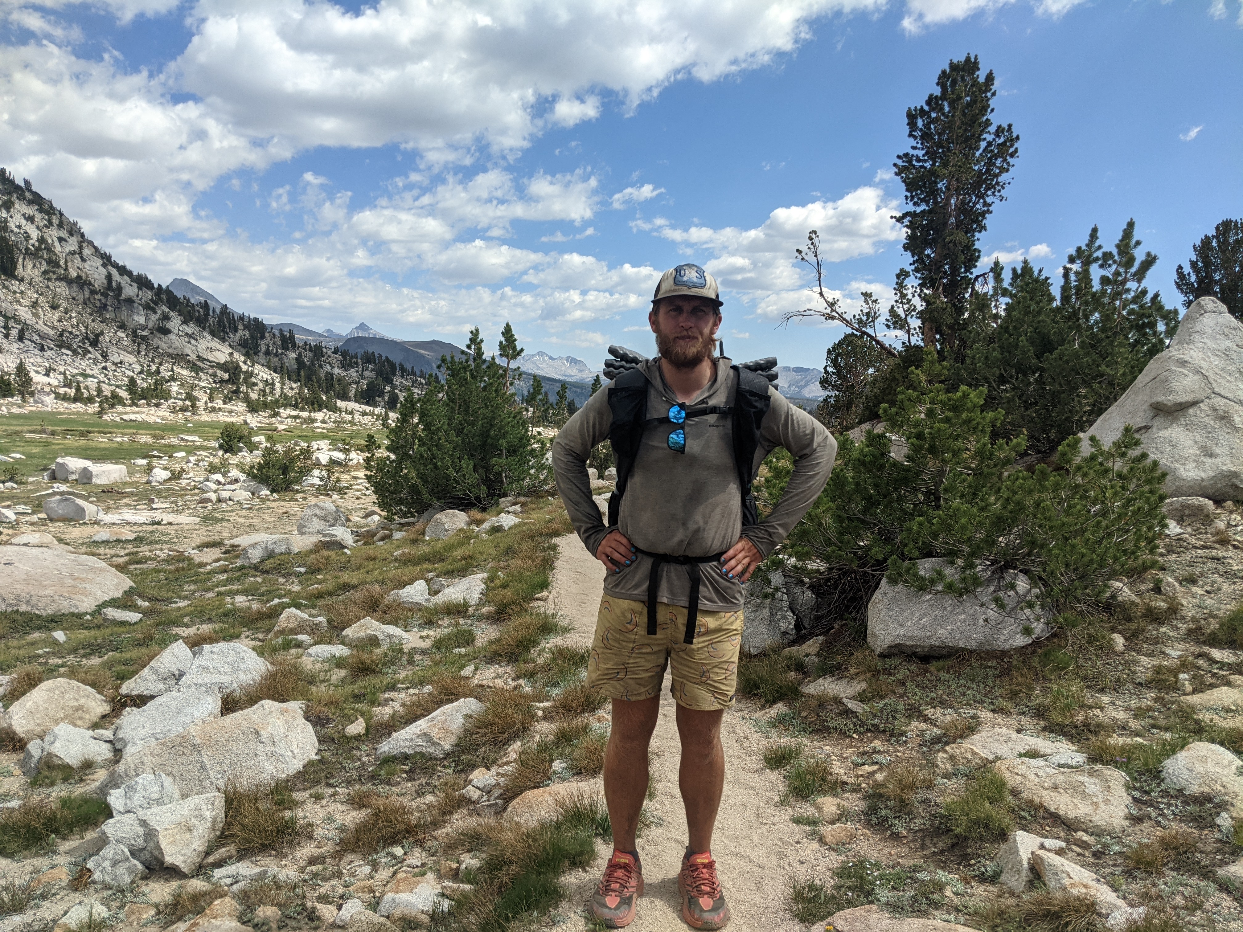
Day 38: June 29, mile 924.6- 942.5, 17.9mi
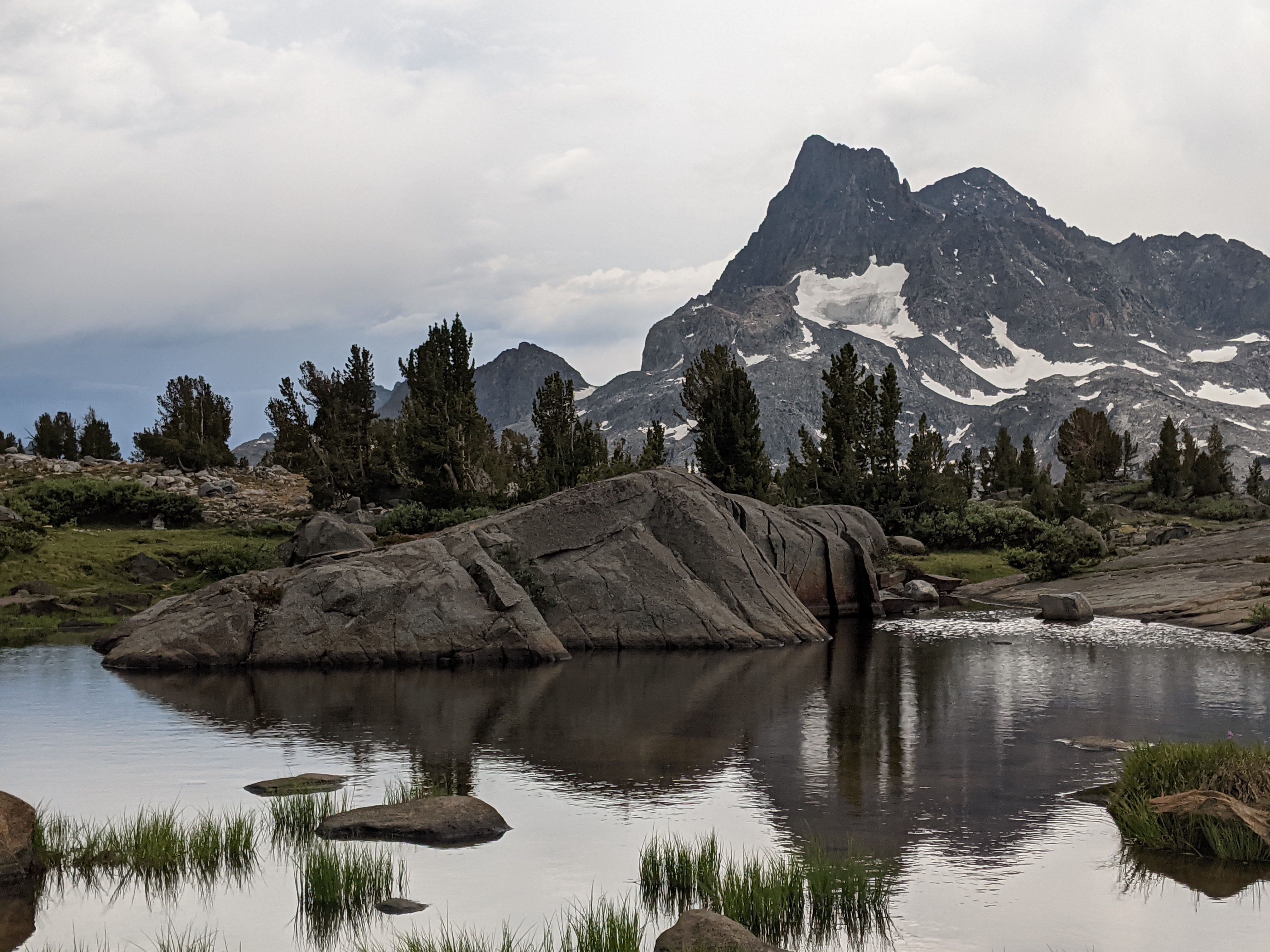
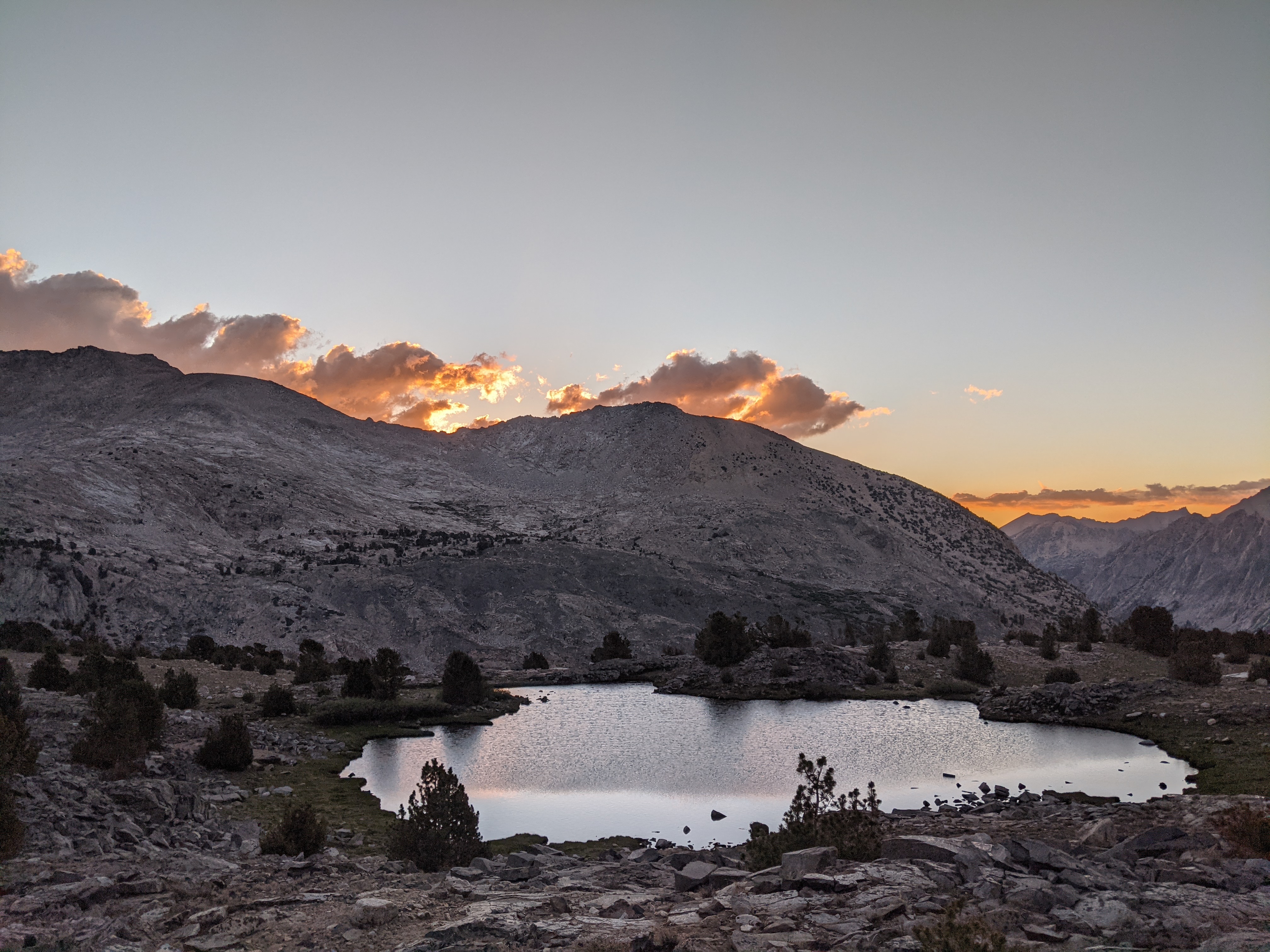
We did it. For years I had been dreaming of carrying food for the longest roadless stretch of trail in the lower 48. Around 2pm today we crossed Tioga Pass Rd, concluding 8 24hr periods of not crossing a road. We ran low on food, worked our bodies harder than ever, and I experienced real emotional lows. The highs were high and included walking through beautiful scenery as the sun sets, snowball fights atop passes, skinny-dipping in alpine lakes, and a feeling of fulfillment and presence while out there. After reaching Tioga Pass, we got rained then hailed on and spent the next 4 hours under some eaves before catching an evening bus to Mammoth for a bed and a shower. Other hikers entertained us and employees of the general store kept our spirits up with goofy commentary over the intercom. Tuolomne Meadows General Store, Post Office, and Grill are a unique corner of the universe.
Day 37: June 28, mile 891.9- 924.6, 32.7mi
Long exhausting day. Today was tough, emotionally and physically. Nice walking and chatting in the morning with two other PCTers. Tough middle and ending. Really been feeling the hunger and the last 7+ hard days. Sleeping on top of Island Pass. Beautiful flowers, gorgeous lake, and awesome sunset. The walking ended with a rain and thunderstorm. I am looking forward to Tuolomne Meadows tomorrow. Real food and a bit of a break. Almost done with our long haul food carry through the Sierra.
Day 36: June 27, mile 866.0- 891.9, 25.9mi
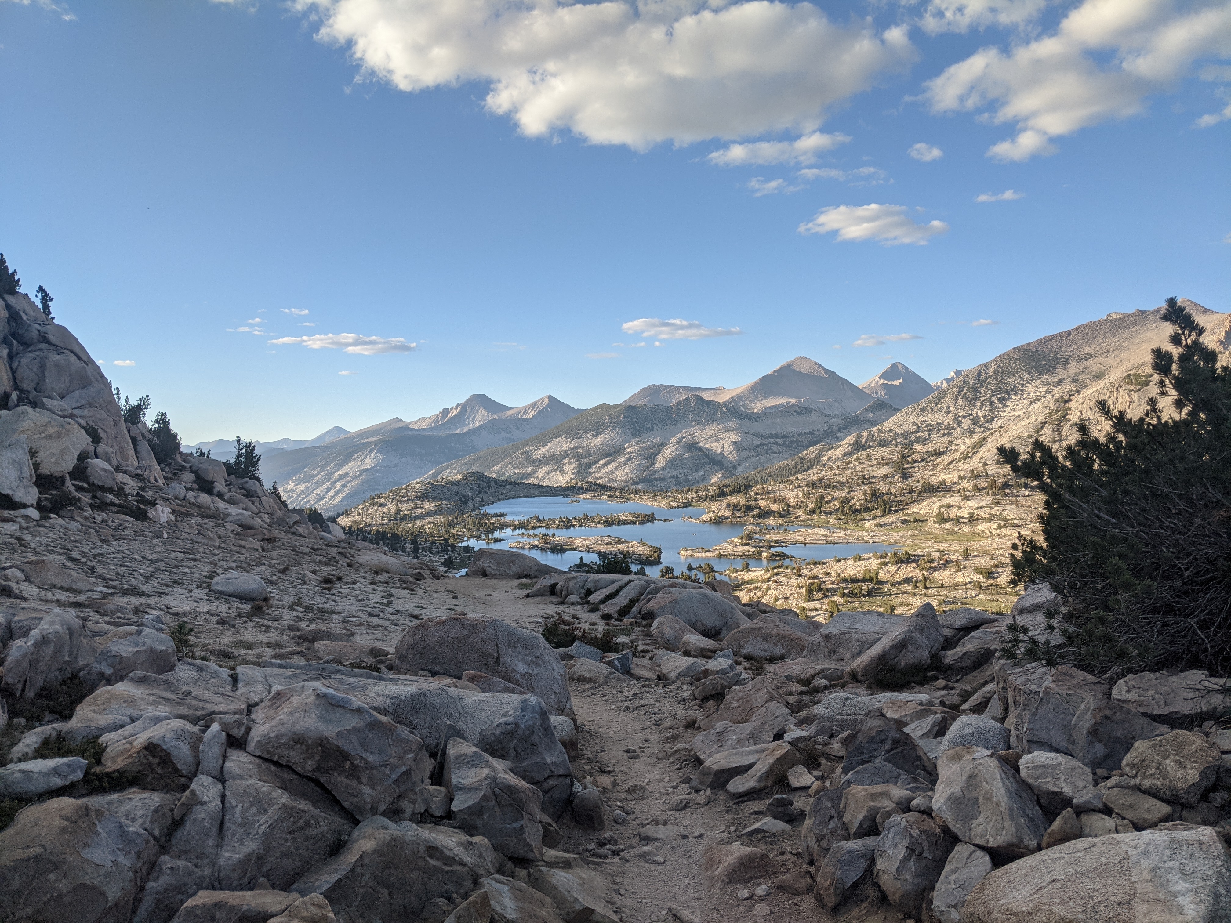
Slept in again which felt nice. We had a long descent and it got very buggy. We passed by the two exits to VVR and at the junction for the last one we met some field techs working on an experimental forest. They were so kind they took our trash out for us. 6+ days of trash out of our packs, woohoo! We got to the top of Silver Pass, great view looking north to some beautiful ladies. We swam at the lake just under the pass which was an awesome break. Cool clear water helped rinse off some dirt. We descended along a stream and walked with another PCTer. We then had a beautiful climb up a south shore in the evening shade. The mountains were granite grays and pinks and the shadows of the setting sun made for a dramatic setting. We saw lots of beautiful wildflowers today and the evening we spent walking around Lake Virginia, a beautiful hanging lake with cotton candy clouds floating above the lake. What a spectacular way to end the evening.
Day 35: June 26, mile 836.5-866.0, 29.5
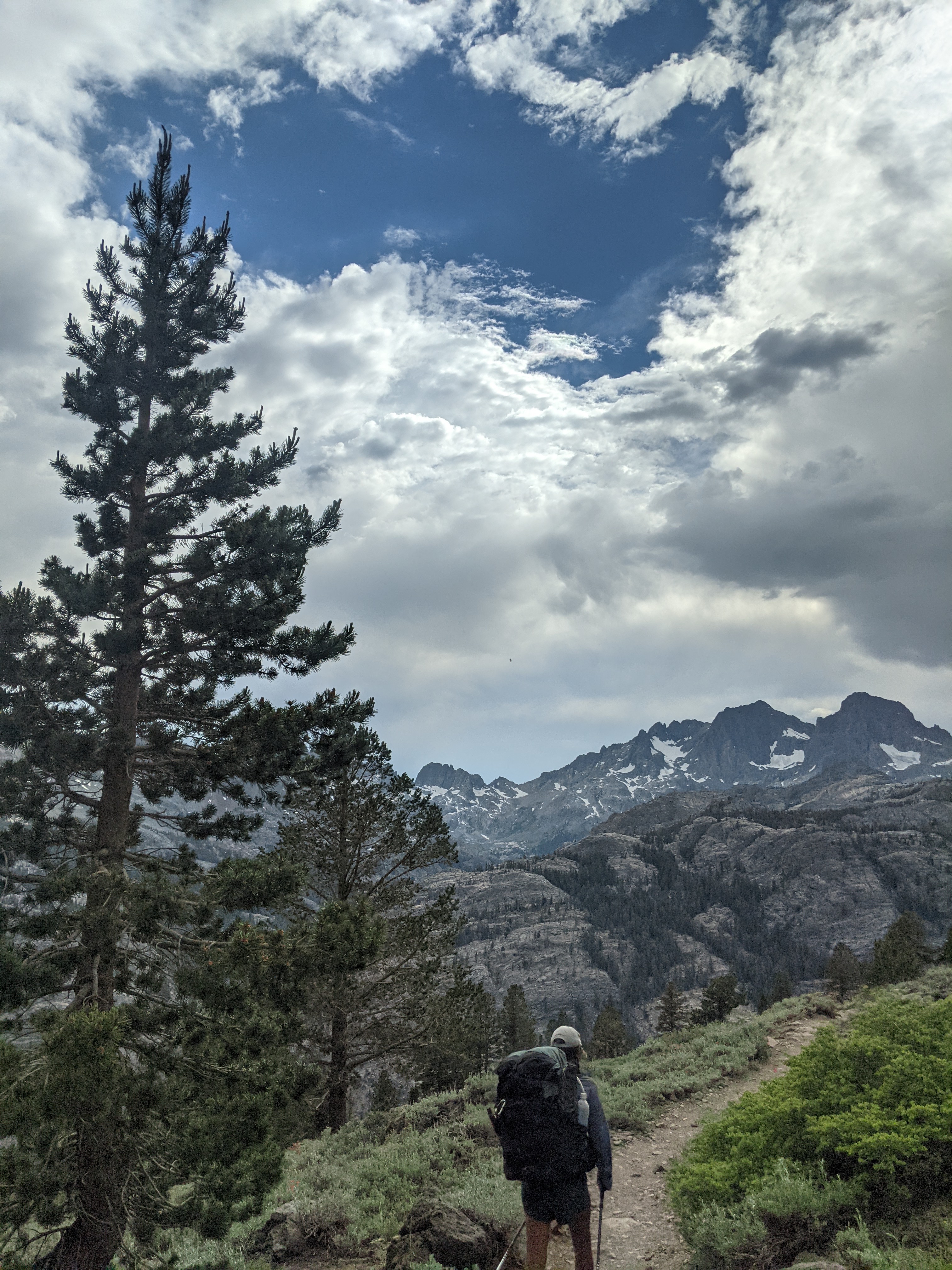
We slept in this morning and were on trail about 6am. We had a less than 1000ft climb to Muir Pass and it was beautiful. What a way to start the day! The trail meandered uphill around lakes and across streams, very pretty! At the top I checked out the shelter and ate some breakfast. We descended into a beautiful Evolution valley (I believe) walking along lakes while descending altitude. We met a number of weekenders and JMTers. The trail descended for awhile, with the creek we were paralleling getting deeper. Eventually we crossed Evolution Creek as a ford, only shin deep. In big snow years PCT hikers sometimes need to swim it. I swam at the crossing and we had some food. We then split from the valley and descended to the San Joaquin River. It was beautiful but low. I noticed familiar plants from the desert section and it was warming up. We opted not to go to Muir Trail Ranch and didn’t check guthooks. We both ran out of water a few miles from the next source, because we were so used to the constant Sierra streams. We went up Seldon pass, topping out at 715 with gorgeous views to both sides. We decided to camp early above a lake. Mosquitos are horrendous tonight, hopefully a one off thing but I doubt it
Day 34: June 25, mile 808.8- 836.5, 27.7
I had a chilly night last night and Margot had frost on her sleeping bag. We slept in until about 530 then packed up and hit the trail. We stumbled our way down the trail. After a few miles we ended up seeing some new friends, Sheedy and Moonshine. Moonshine was waiting for Sheedy at the top of Pinchot Pass last night when we got there. They offered us coffee which we gladly accepted! What a treat. They were still in bed, cowboy camping and making coffee….what are we doing out here waking up early and hiking all day!? We crossed one of the forks of the Kern River and began the climb up to Mathers. The trail meanders through a beautiful green alpine meadow then loops around under the pass then begins switchbacking up. We had an excellent view of the pass then started climbing. I was hyped! The coffee was kicking in and it was time to climb, let’s go!! I hiked and hiked feeling very strong. On the route up I spied a hiker also going quick and I wanted to catch him. I pushed hard but he summited before I could pass him. At the top he said he saw me hiking up and put it on to not get passed! I hung out there for awile waiting for Margot and chatting with the other folks up there. One guy I’m pretty sure I met in 2017. Two older guys rolled up and one said I was the strongest hiker he had seen, wow! The other guy was in his late 70s and had just had a heart surgery 7mo ago when he was on the AT. We walked down the pass and near the bottom stopped at a lake. We all swam there and had a good time chatting and eating. Most folks were from CO or CA, ha! After lunch Margot and I descended low, to around 8000ft and into some deep forest. We then began the climb back out towards Muir Pass and passed some beautiful meadows and awesome waterfalls. We also saw some HUGE spruce and pine trees, I hugged a few. We are camping just a couple miles short of Muir Pass in a very cool spot. I named it the nest. We are between granite boulders and pine trees high up but protected. Hopefully I sleep warmer tonight!
Day 33: June 24, mile 782.5- 808.8, 26.3mi
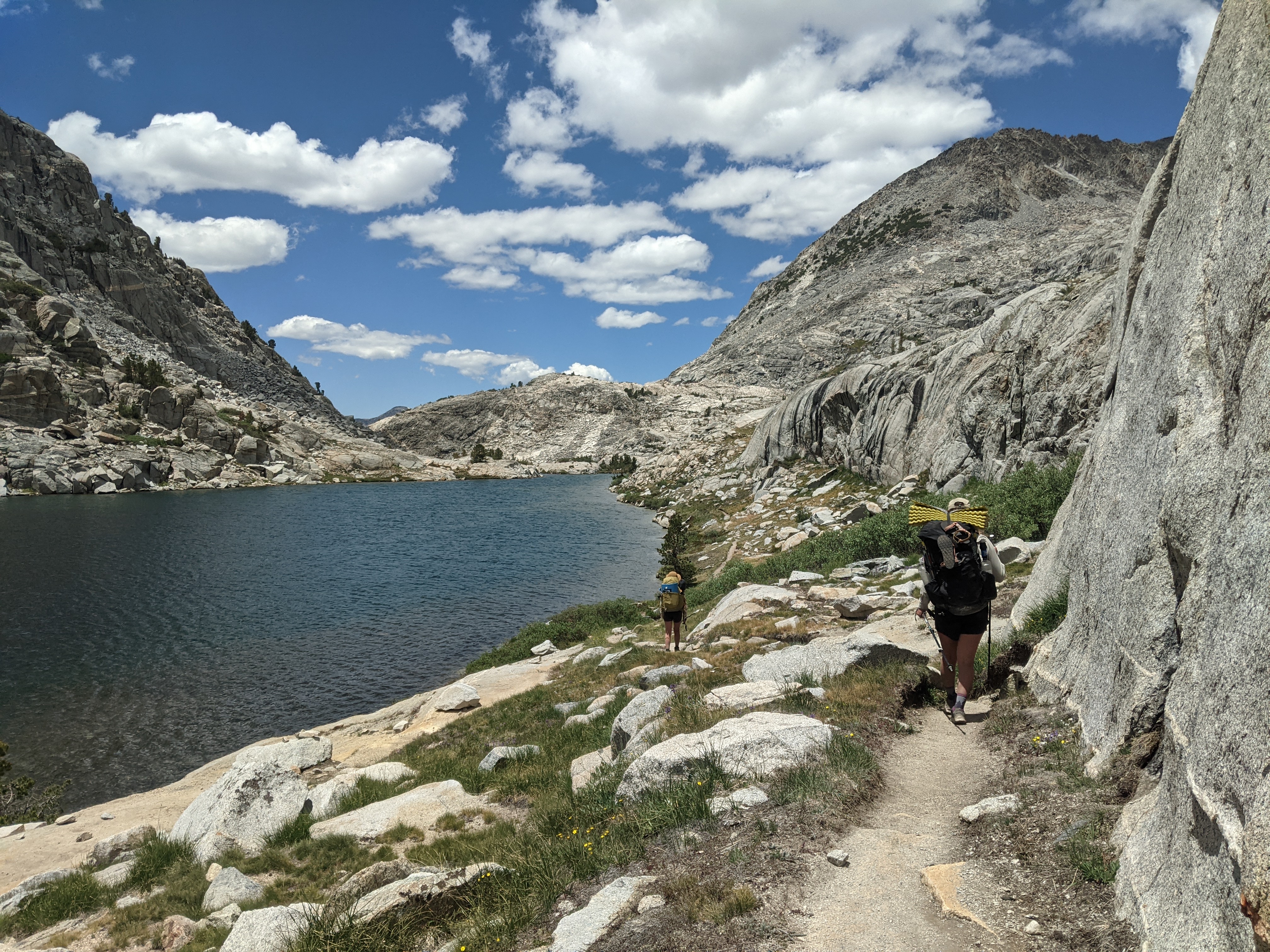
We slept in an extra 30min this morning cause we were so tired from yesterday. We packed up and hit the trail around 6am. We spent the morning walking with a JMT hiker who was pretty cool to talk with. It was a chilly morning! We started the climb to kearsarge/Glen Pass and at the top of the turn off to Kearsarge he gave us some extra food he had. Score! Maybe we will make it to Tuolomne after all! We took a break before heading up Glen and talked to a small group of PCT hikers. We knew one descently well and he caught up to us on the way to Glen. Cool guy fun to chat with. We summited Glen with awesome views behind and a great view down to the Rae Lakes. We took an hour plus break at one of the first Rae Lakes and I went for a chilly swim. We also ate a bit of food especially the new stuff!! We got going and had a long descent down to Paradise Valley. Along the way a number of folks recognized bus as PCT hikers, not sure why we stood out compared to the other backpackers. We crossed a very cool suspension bridge at Paradise Valley and then had a long but beautiful climb up to Pinchot Pass. We saw a bear en route and enjoyed the multitude of waterfalls along the way. Just below the pass there is a large beautiful grassy meadow. So cool! We are cowboy camping a mile or two below the pass kind of near a lake. We are watching the clouds and hoping they don’t build into a storm. Today was another long, hard day and we didn’t hit our mileage goal of 30miles. Bummer.
Day 32: June 23, mile 752.4- 782.5, 30.1mi
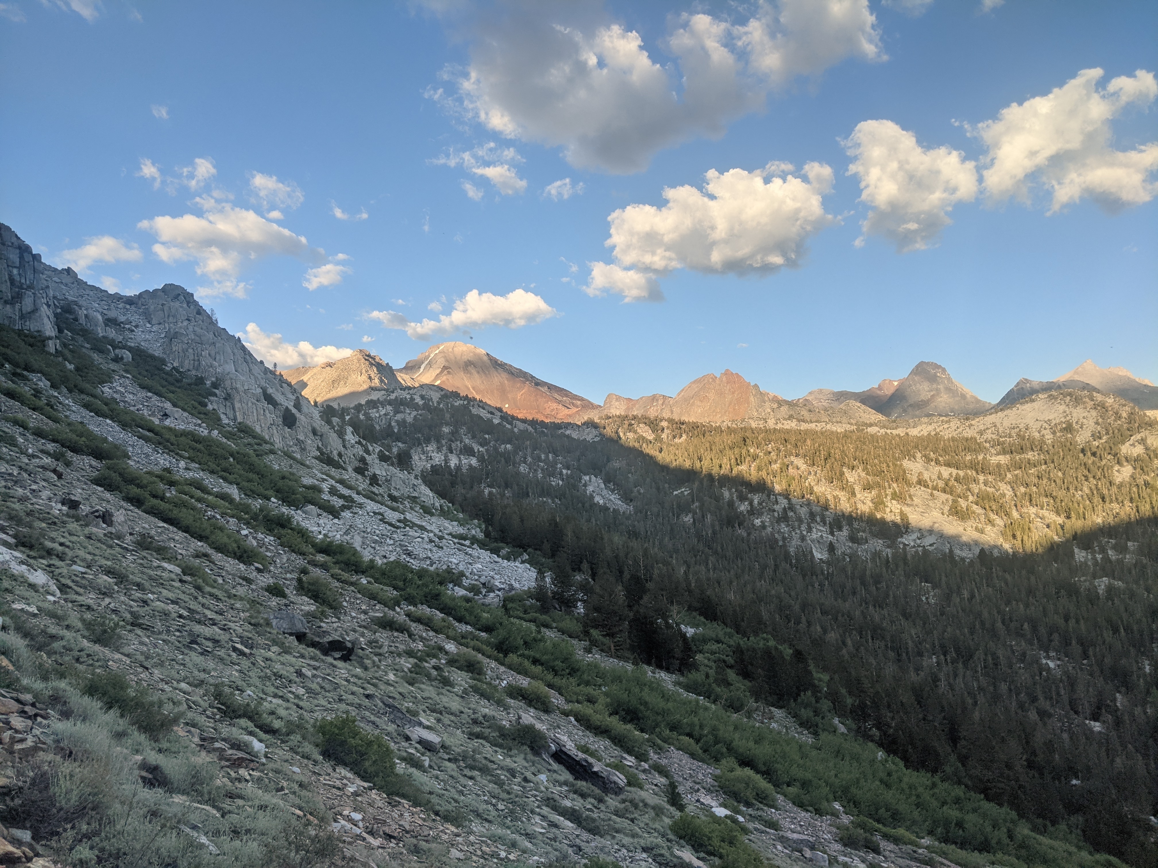
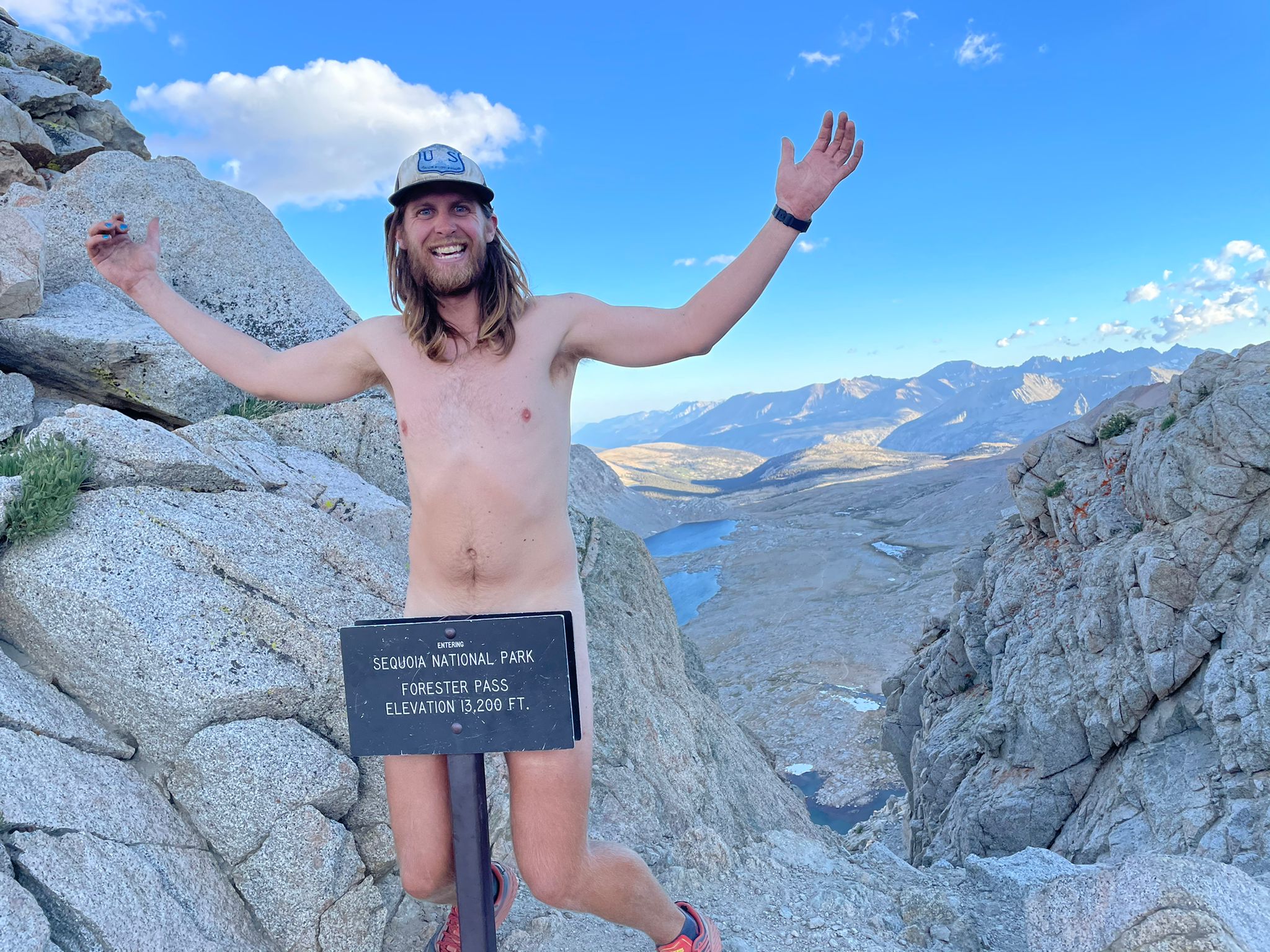
My one month anniversary on trail and what a day! We had a chilly morning with excellent views looking west. We walked through some very cool trees, maybe bristlecones? They were warped and twisted and close to dead but still had a branch or so alive, crazy! We had planned on summiting Whitney today, but when we got to the base some clouds had begun to form. We made the hard decision to continue on hiking. We met a few other PCt Hikers and some convinced us that Forester Pass was still doable for the day. We set our eyes on that and made it over, summiting at 7pm. Climbing over Forester that late in the evening is why I love thruhiking. Beautiful day, beautiful evening, self sufficient, and in a remote location. We are camping on a cool hillside with spots dug into the hill. It’s like a little favela! We had delicious dinner that we yogi’d from some other hikers exiting with left over food. What a score! Hard long day but good dinner and not as hungry as yesterday due to the yogiing. The climbing has just begun!
Day 31: June 22, mile 721.7- 752.4, 30.7mi
After last night’s disco party we woke up at 5am and we were on the trail about 5:30. Quick morning get ups reward us with easy miles in the morning. We hiked 9 miles to a spring. Our water carries are a lot easier than in the desert but with such a low snowpack this year, many streams are dry and we found ourselves regularly getting for 10mi stretches. We saw quite a number of other hikers in the morning and chatted with some of them. It seems many folks skipped some of the desert to get here and we are seeing them. We carried water from the first stream to another stream up and over a bit of climbing that seemed never ending, though it stayed pretty gradual. There were some cool twisting old junipers alongside the trail. there was also excellent views to the west and one viewpoint off to the east of the Owens Valley. Since we are at altitude, and slept at 10,000ft last night, it’s been cool most of the day. I’ve been hungry too. I planned on about 2,500calories per day because that’s about what I could eat in the desert, but already I’m second guessing if I’ve got enough food, and it’s only the first full day! The afternoon was tough. The trail kept climbing and climbing and meandering around very cool trees but I was just not content to be walking. We finally made it to Chicken Spring Lake around 6pm, the first alpine lake of the trail for NOBOs. We had dinner there and once the sun dipped behind the ridge it got cold fast. We met some JMT hikers who were finishing their trip. They said absolutely no snow on the passes and for them it was even in the 60s some nights. It’s a very bad drought year in California. We walked another couple miles to a flat piece of ground and cowboy camped there.
Day 30: June 21, mile 702.2- 721.7, 19.5 miles
Today was the first day of summer! I slept like a rock and woke up at 5am excited and ready to hike! I felt fresh, stronger than I did on day 1! I still went back to sleep for a couple hours. Since we were camping with my dad at a campground, he drove us down to the trailhead we got off on. Margot and I hiked the 2 miles back to the campground without our packs and then we hung out at the campground making mochas and breakfast. Car camping rocks! We had said bye to Amanda as she has some work to do at the general store and maybe will catch up to us later. We had a delicious breakfast of egg burritos then had an interesting encounter with a couple who locked themselves out of their van while looking for their thruhiking daughter. My dad saved the day and got them back into their car. Around 1, Margot and I said bye and hiked on the PCT into the Sierra. This was a moment I had been thinking about for years. We both had enough food in our packs to try and carry from the road in Kennedy Meadows to the road at Tuolomne Meadows, never crossing a road or resupplying for 240 miles plus Mt. Whitney. What a cool concept. We walked on the PCT chatting and having a good time. When we crossed the bridge over the Kern River it felt like the gateway into the Sierra. We stopped and talked to another hiker there and grabbed some water while watching the swallows. We climbed out of the beautiful meadow and are sleeping at 10,000ft. It’s getting real! Our campsite neighbors are listening to some electronic dance music and are a couple older guys. Very funny folks and I don’t mind the music tonight.
- Comment
- Reblog
-
Subscribe
Subscribed
Already have a WordPress.com account? Log in now.

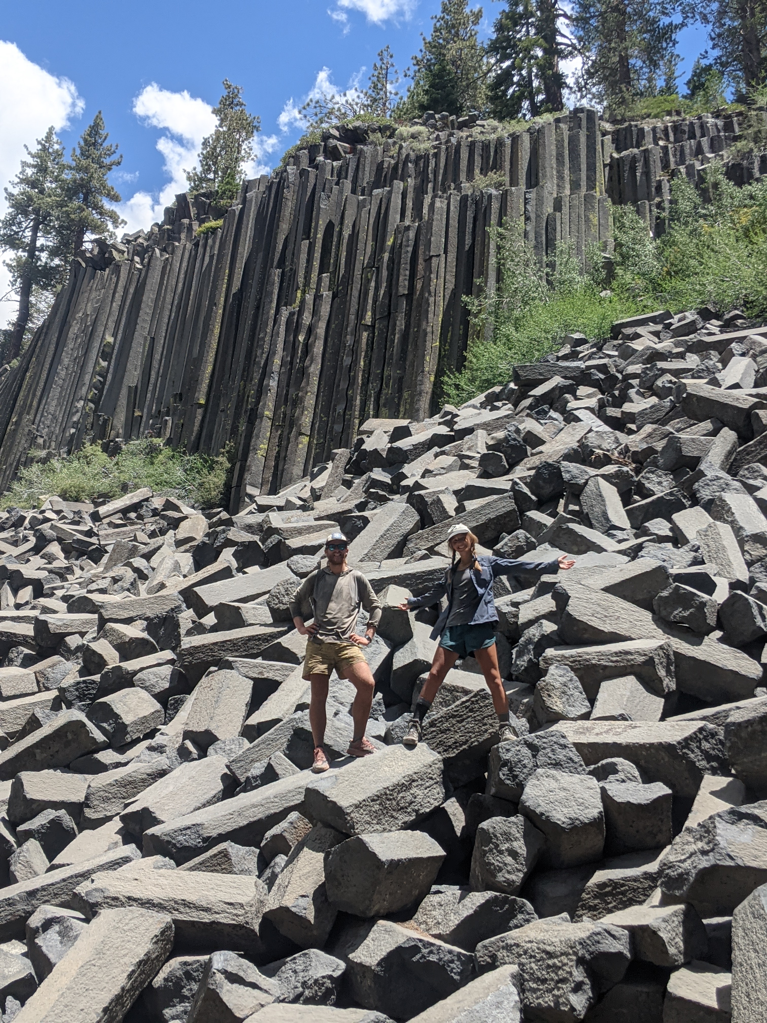
Way to kill it! Your descriptions of the Sierras remind me of my medicine trips up there. Looks like you passed through devil’s post pile as well?
LikeLike
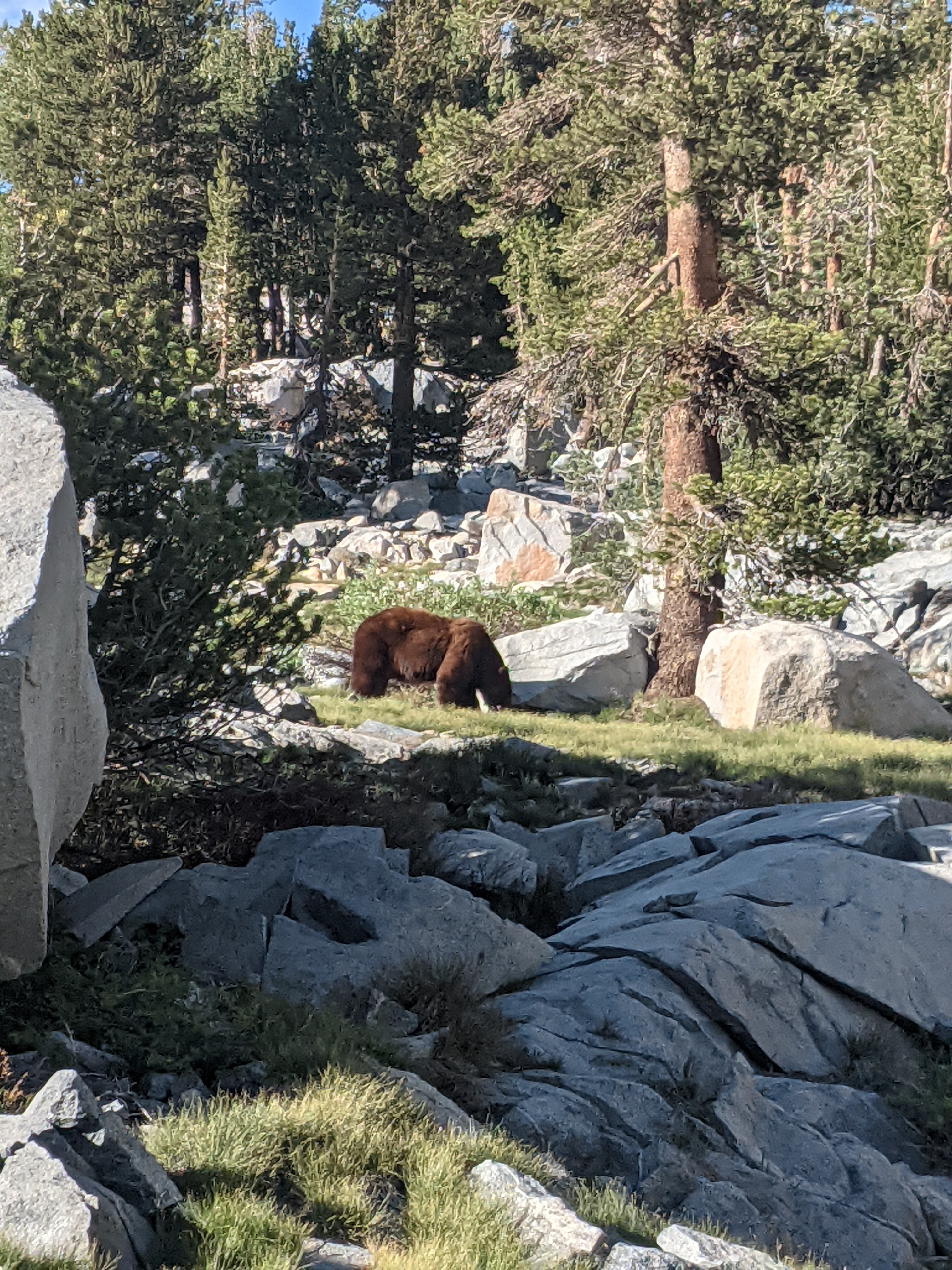
Running a bit behind here (after New Hampshire vacation: highlight was backpacking with Mary and finally summiting Hancock!). Now I’m following Sam’s blog using the PCT maplink he sent as well as googlemaps. Takes twice as long. What a long haul–over 200 miles without a road. Wow! Beautiful. Was that a brown bear? What do you do when you see a grizzly? HAVE you seen a grizzly?
Good hiking!
Julian Onderdonk
LikeLike