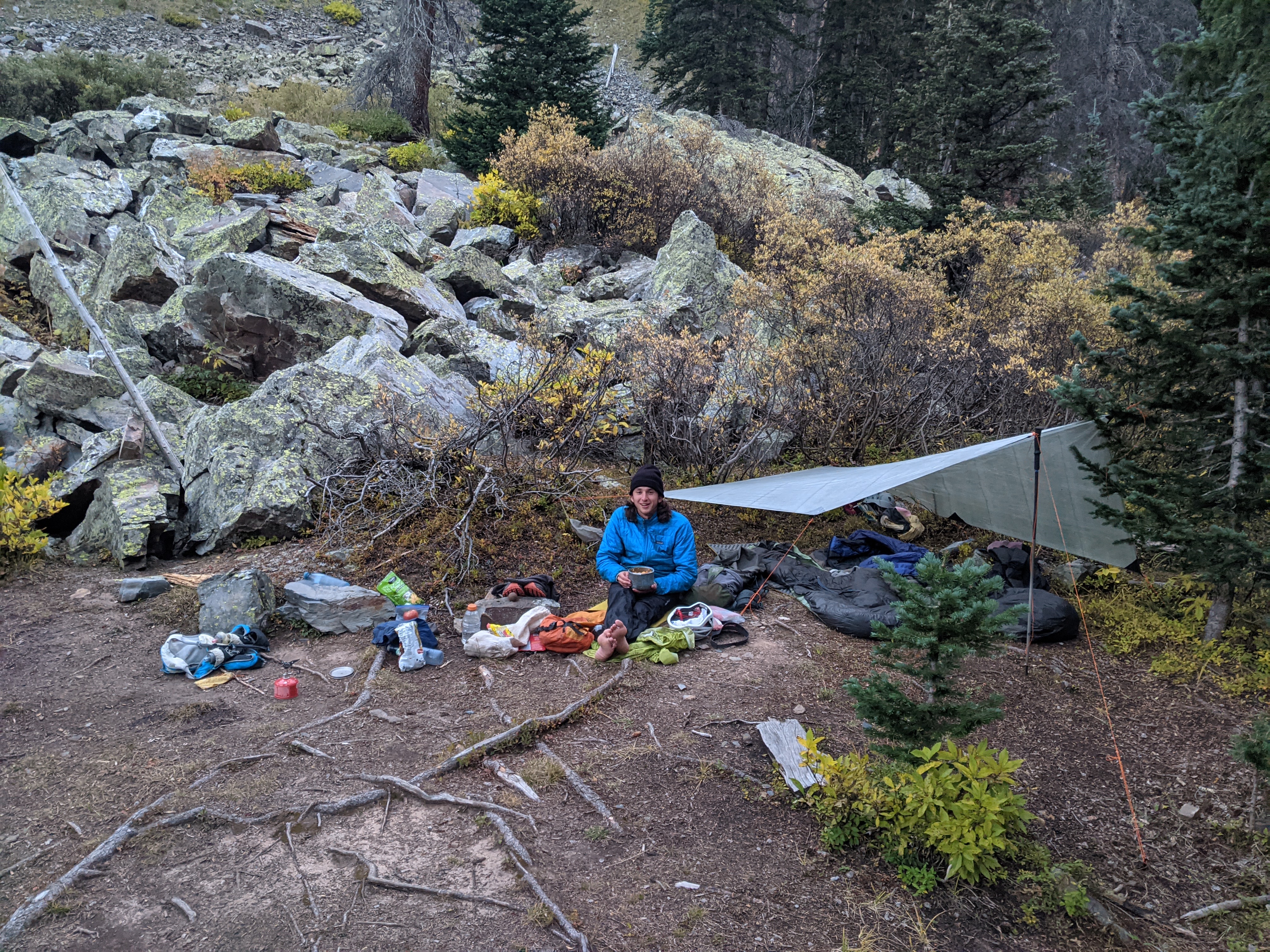
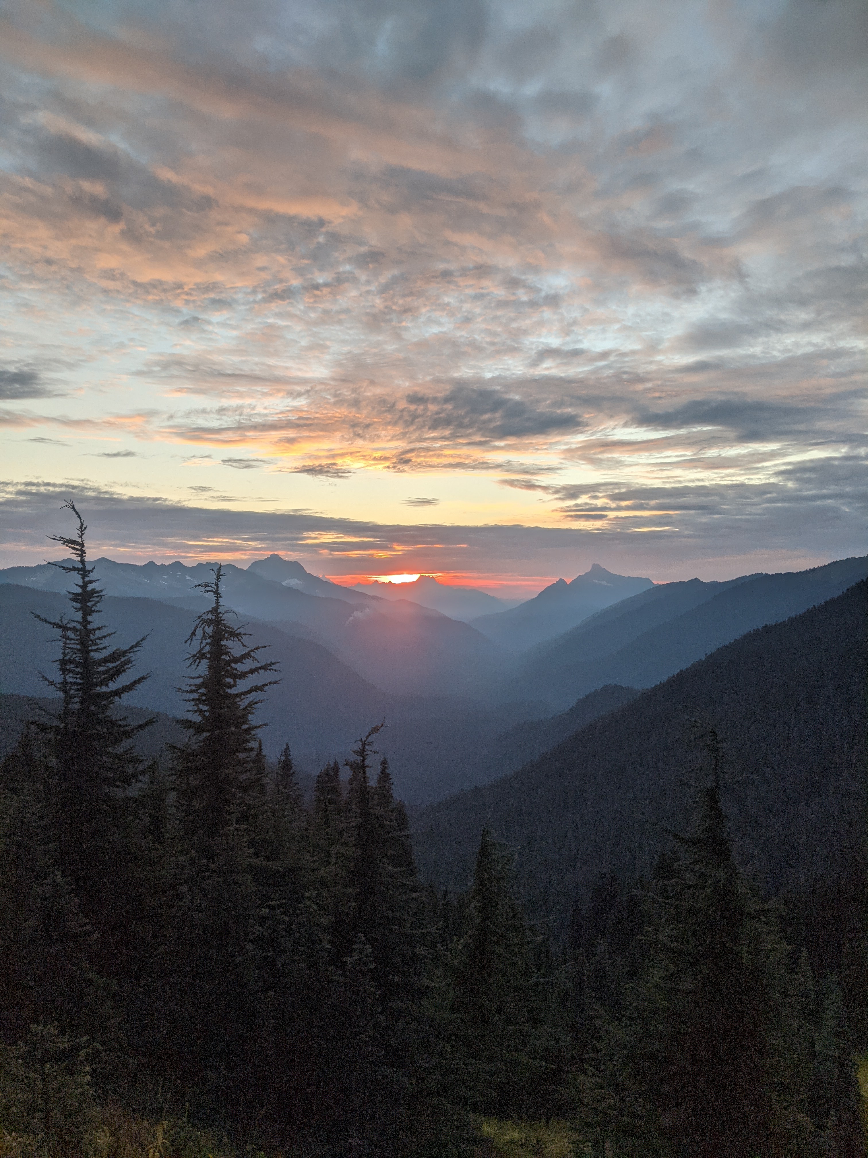
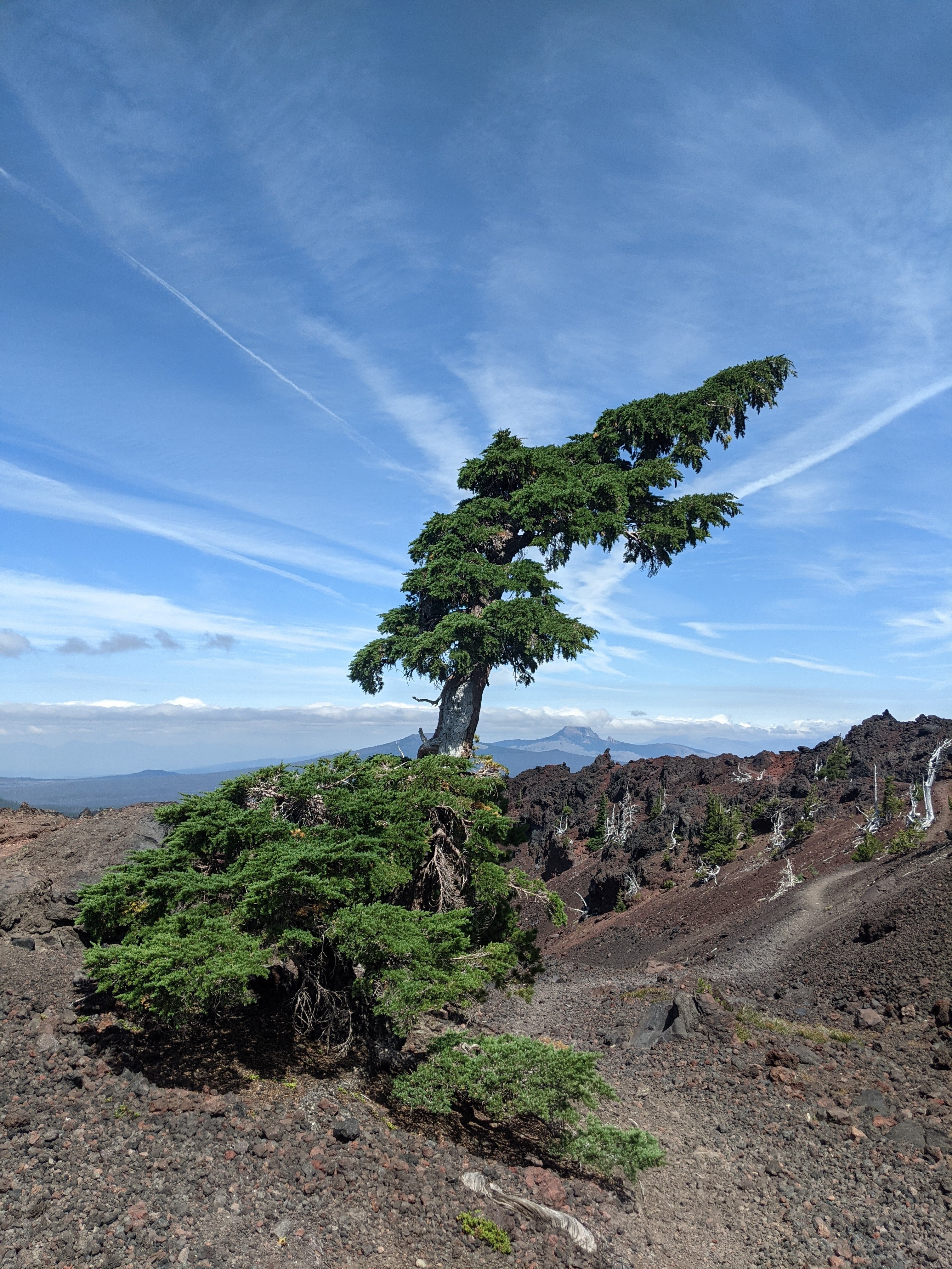
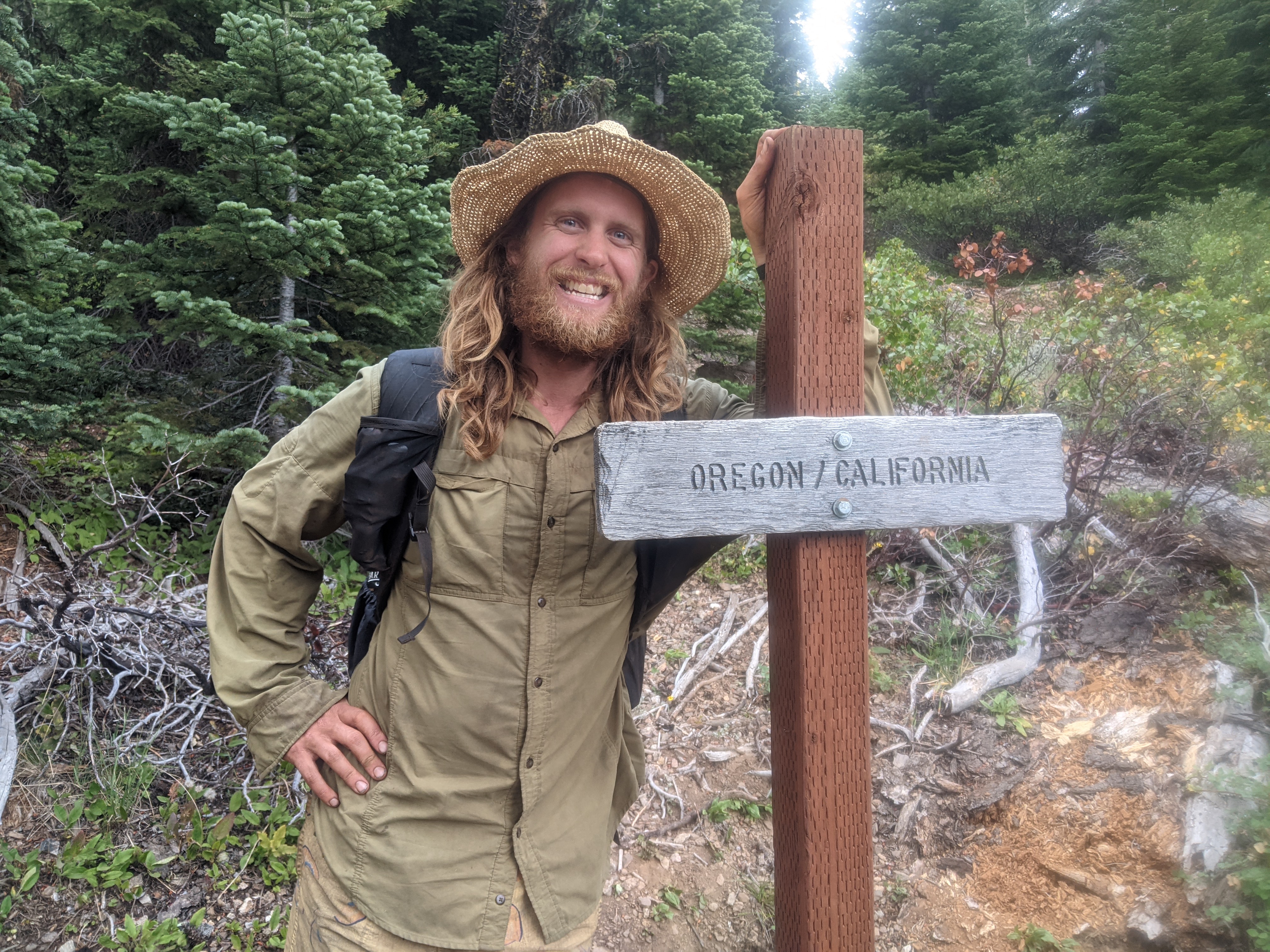
Chasing corn in the Eastern Sierra

Days 0 & 0
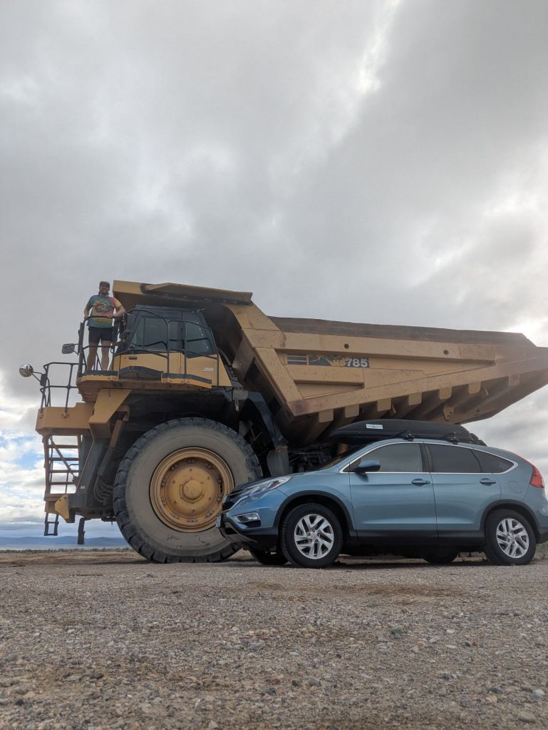
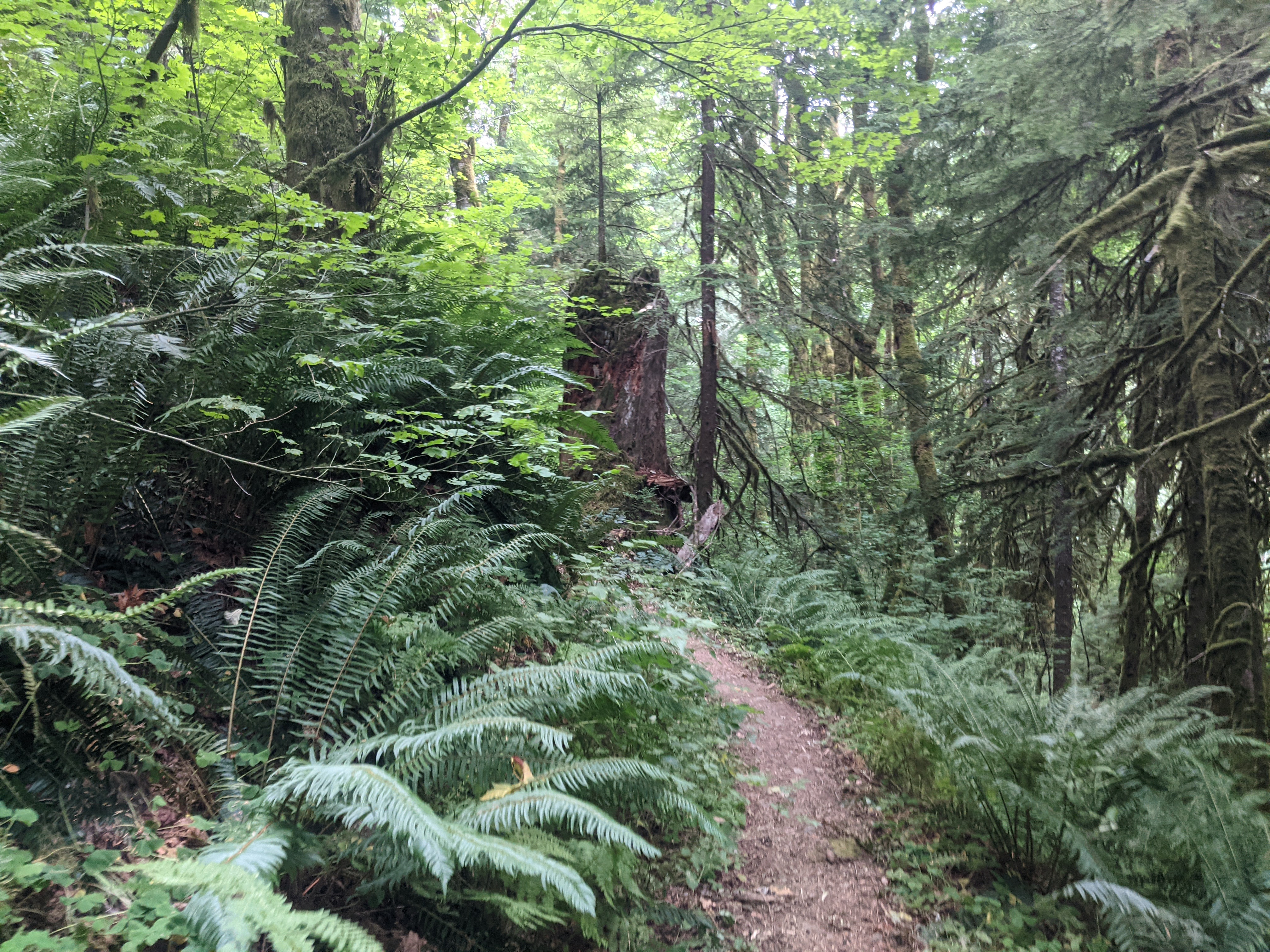
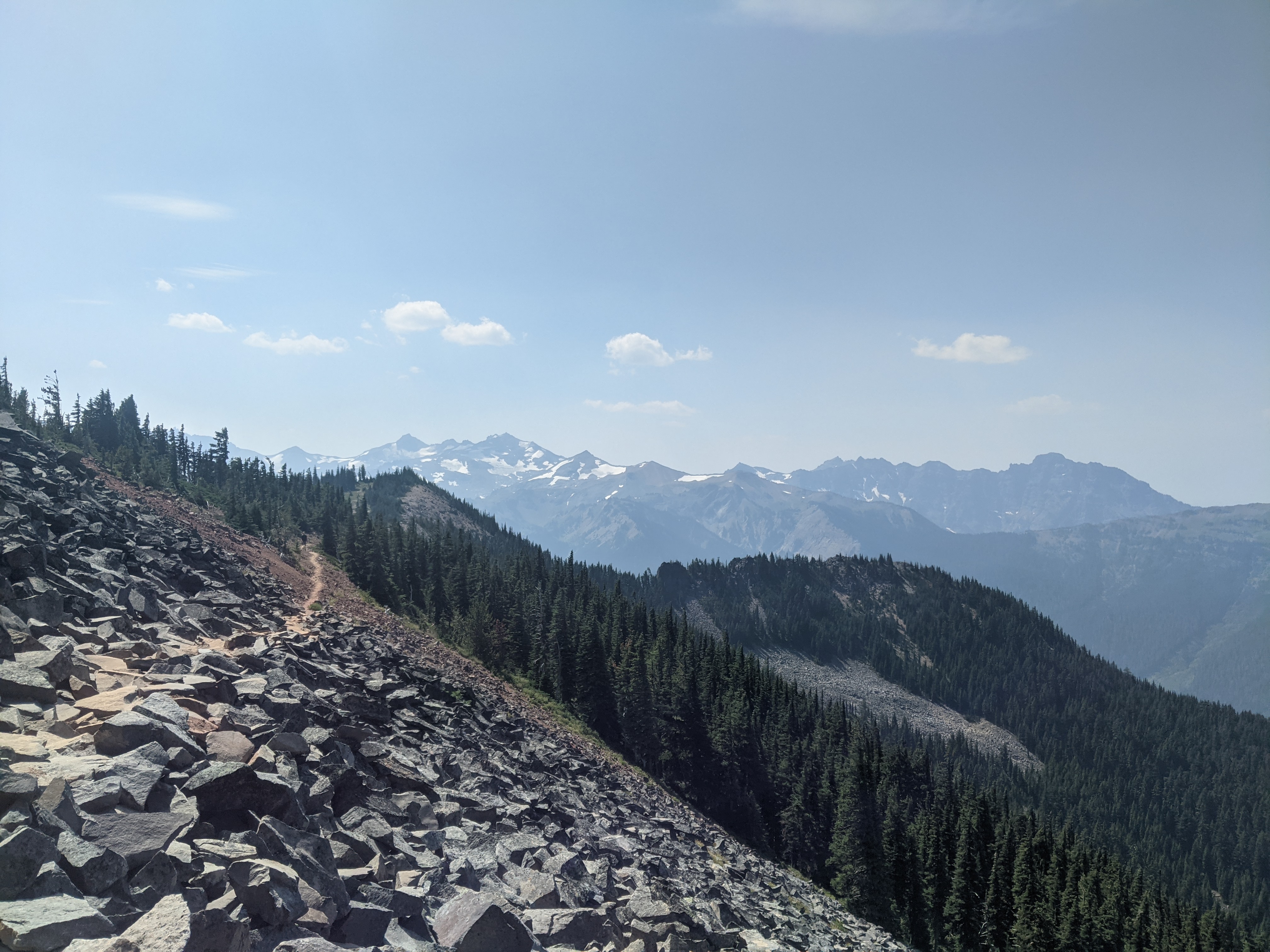
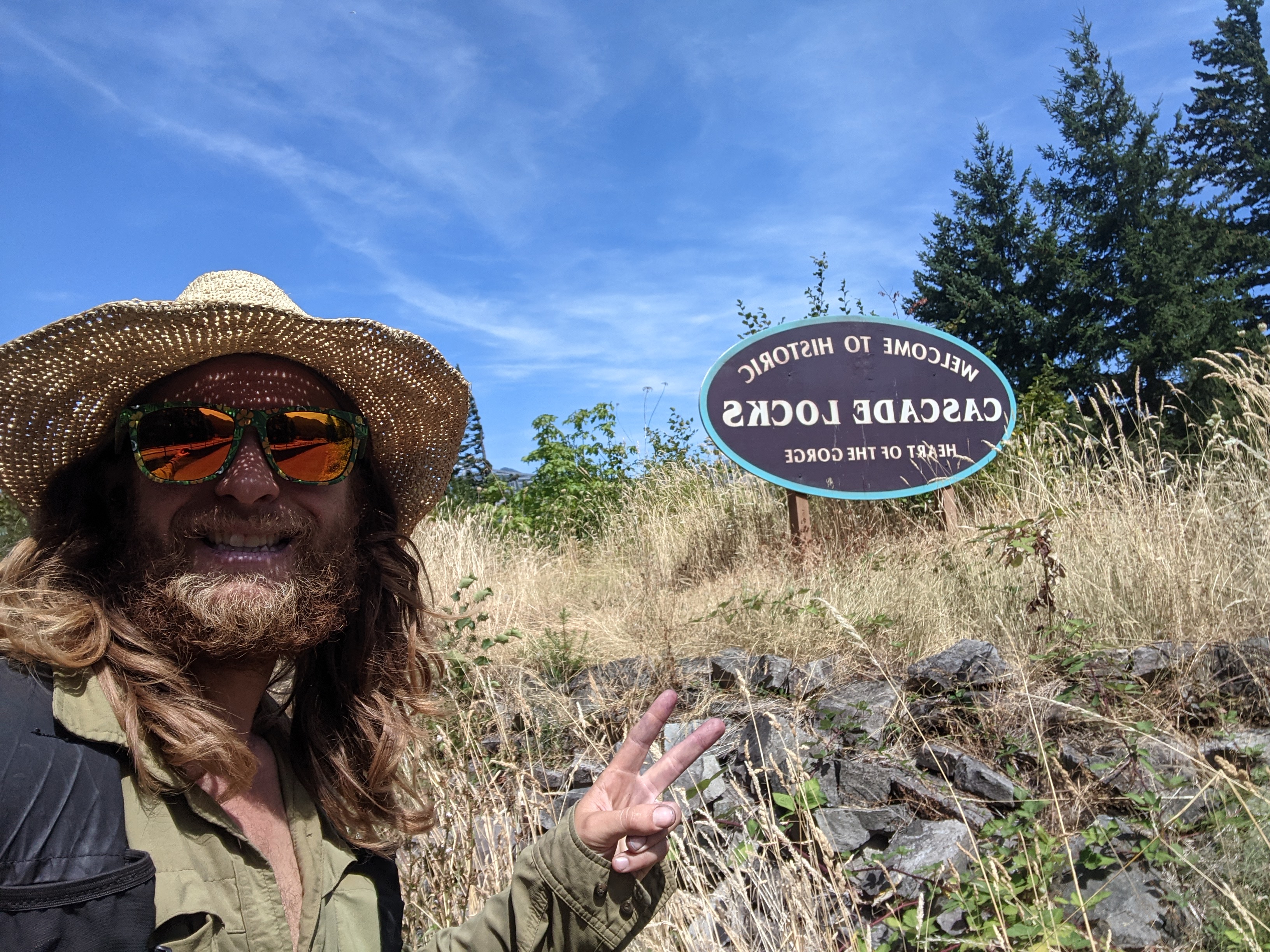
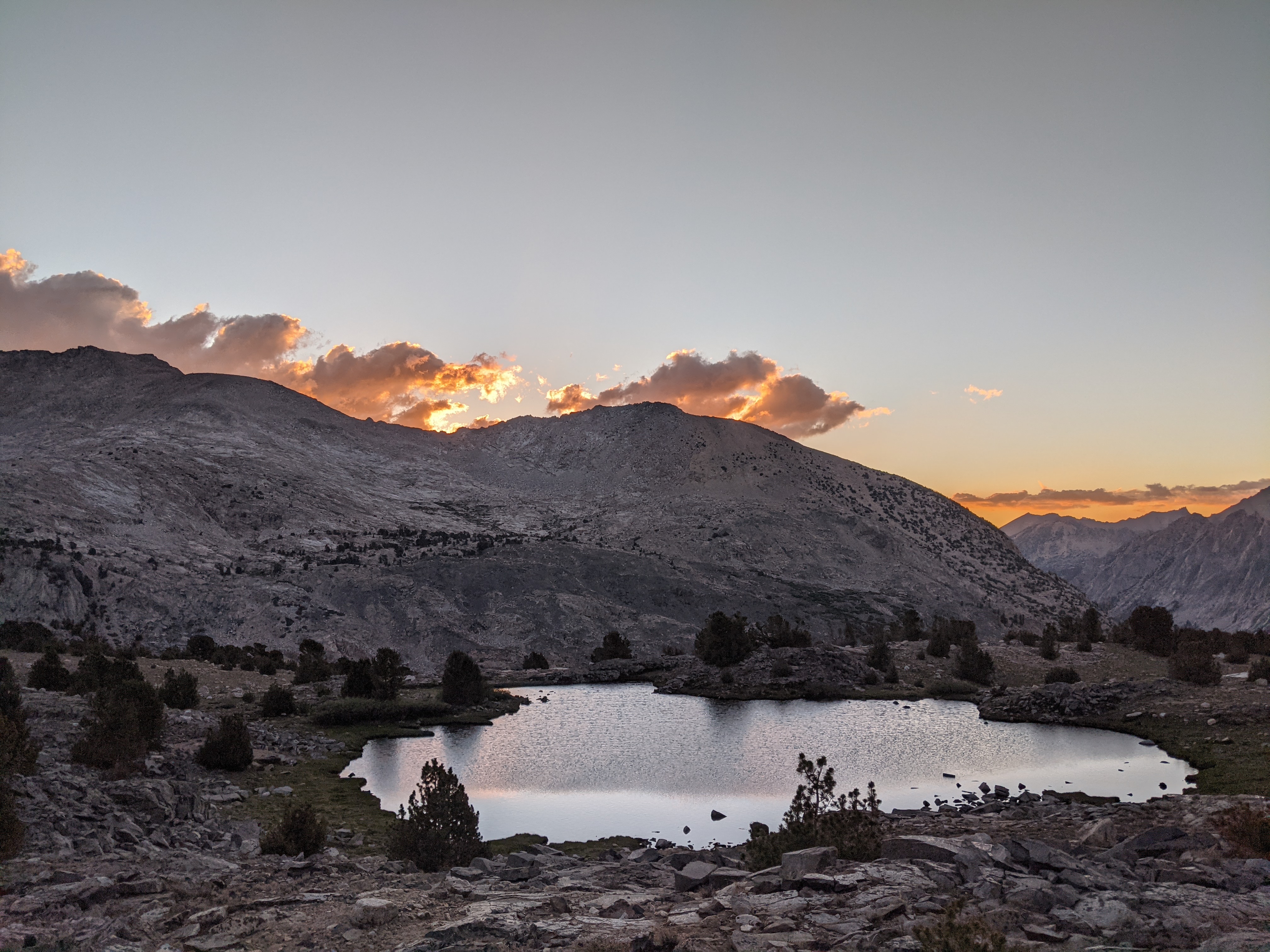
After the ski season ended and our employee party wrapped up I woke up, finished some packing and hopped in my car heading west to Shasta where I would meet up with my buddy Dan to ski Shasta and spend the next ~2 weeks climbing and skiing volcanoes, working north weather permitting. After driving for 9 or so hours through Colorado and into Utah, I barely crossed into Nevada and slept just outside of Great Basin NP at a cool little free campsite where I woke up to the N face of Wheeler Peak. I hopped back in my car  and continued driving. In Ely I got to stay on Highway 50. Out of the many times I have driven between California and Colorado, I had not driven this section of Highway 50, instead taking highway 6 to Tonopah. Driving this highway made me think of my Grandma who had spent years of her life crossing the nation by vehicle, and we had specifically talked about this section of highway. This section of highway has the shoe tree, a big cottonwood littered with hundreds of pairs of shoes from all sorts of travelers driving ‘The Loneliest Highway.’ Not found in travel books, I found a MASSIVE mining dump track with no one around. I got to play around on it for a few minutes and take some photos. Wheels taller than me, it absolutely dwarfed my tiny car when I parked next to it. I eventually pulled into Reno where I had the opportunity to pick up a headlamp as I had left both mine back at home- DOH! Driving across Western Colorado, all of Utah, and all of Nevada Reno was the largest city I would be in for the next 2 weeks. After picking up some groceries I raced up to the Shasta parking lot to meet up with Dan and plan for the next day on Shasta.
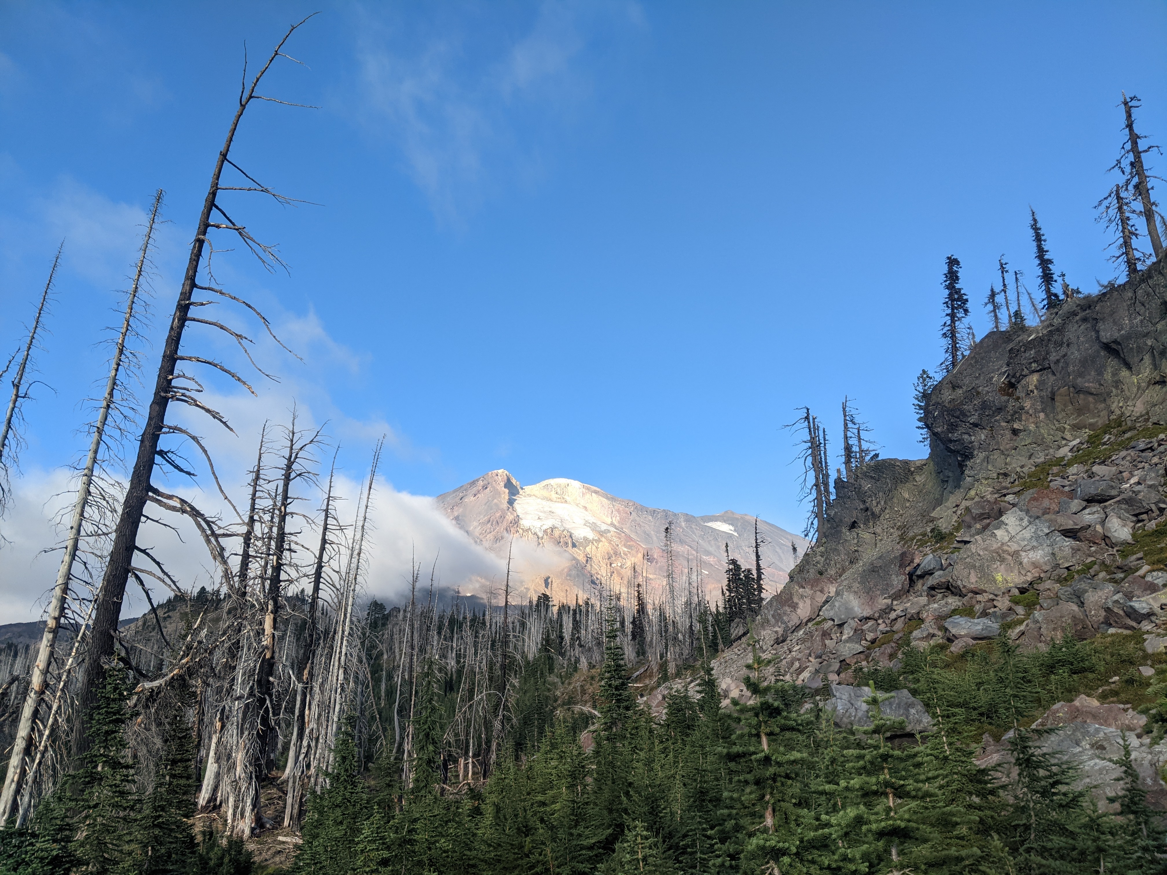
Day 1- Mt Shasta
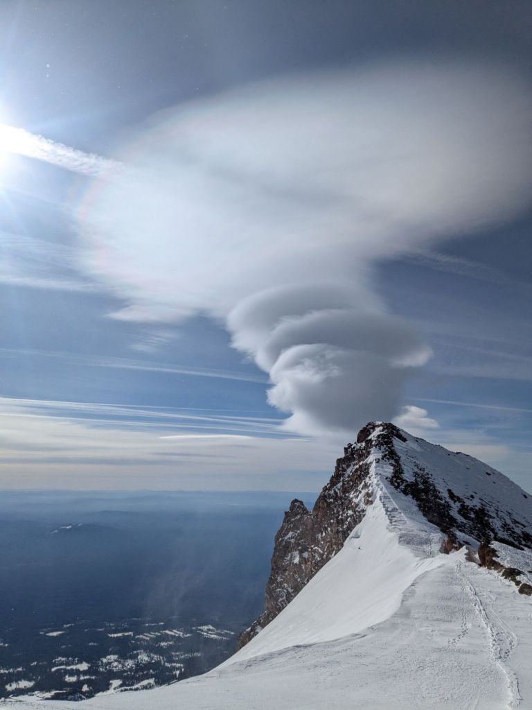
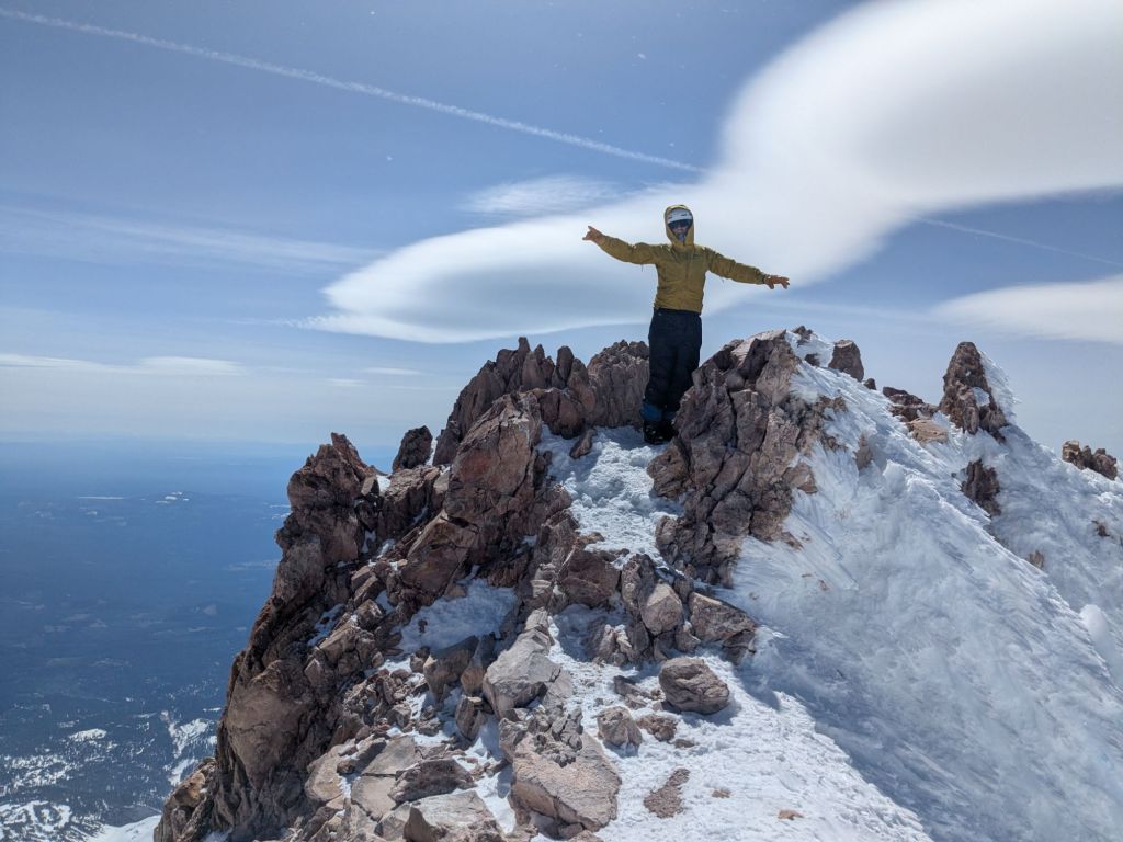
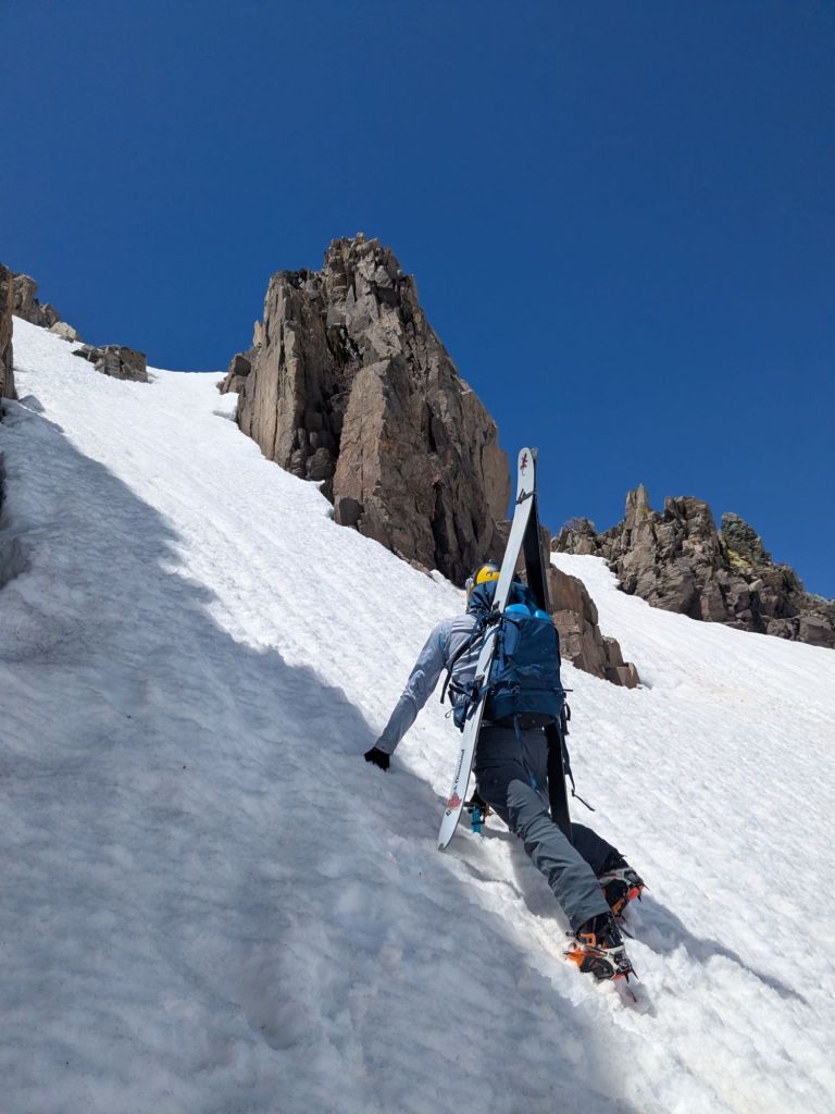
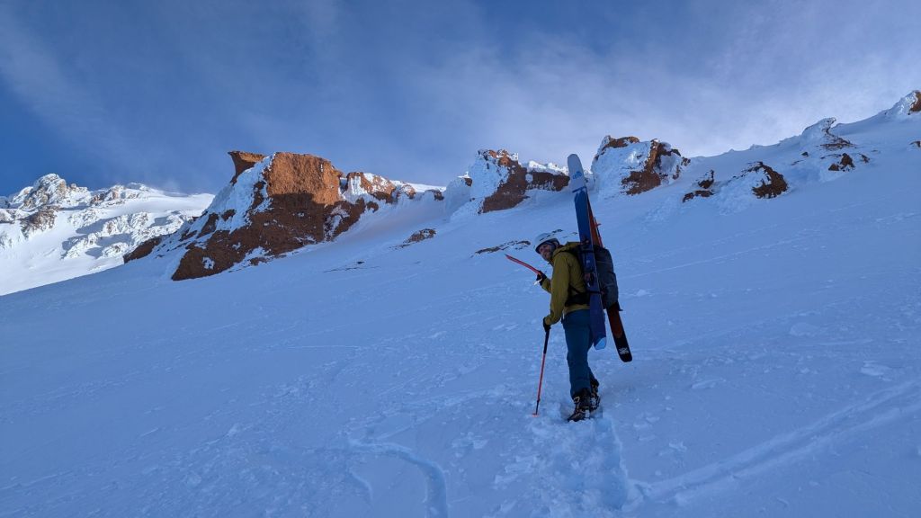
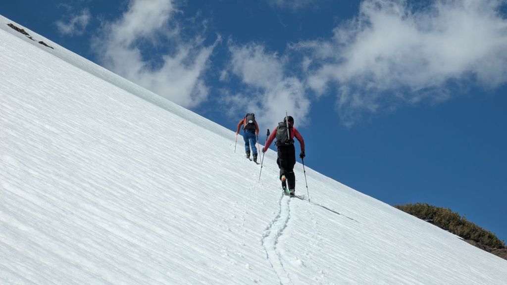
We woke up around 3am to blast off via the standard route, avalanche gully, up Shasta. We skinned in the dark for what felt like only an hour or two before enough pre-dawn light let us turn our headlamps off as we approached the consistent treeline. We meandered around different gullies but as my friend told me who had just done it “Yeah you kinda just leave the parking lot, get in the main gully and just go up…..it doesn’t require much navigation at all.” And he was right, all day it was pretty obvious how to continue going up. We took a small break around Lake Helen and listened to some more novice mountaineers freeze while waiting for the slow packer-uppers to get moving. Vibes were good, Dan is a goofy guy and it made the vert light work. We switched to boot crampons and tossed skis on our back maybe 1/3rd of the way up the actual avalanche gulch. We booted through the red rock band and found some wind up higher. We transitioned back to skins through misery hill where the wind really picked up. On top of misery hill (“I don’t know why they call it misery hill, i’m kind of having fun” -Dan would say for the rest of the trip) we should of left our skis but we booted on, almost getting blown off a few times with the skis in an A-frame on our backs. We sumitted the final head wall amongst rime and ice blocks, took some photos, and then scampered off- a respite from the wind was downhill! I put my skis on and side stepped down a stupid little chute and found terrible skiing until about misery hill where it wasn’t good but at least better. Unfortunately the avalanche gulch was pretty hooky/grabby punchy wind crust so lots of our vert was poor skiing. At Helen Lake we stopped for a snack and to hang out in the sun and found great skiing below all the way to our car. I feel like Shasta is known for its great corn, but unfortunately not for us.

Back at the car we started discussing weather and future plans. The forecast was calling for 2-3ft for the Cascade Volcanoes so we made the tough decision to head south, skiing Lassen enroute to the Sierra.
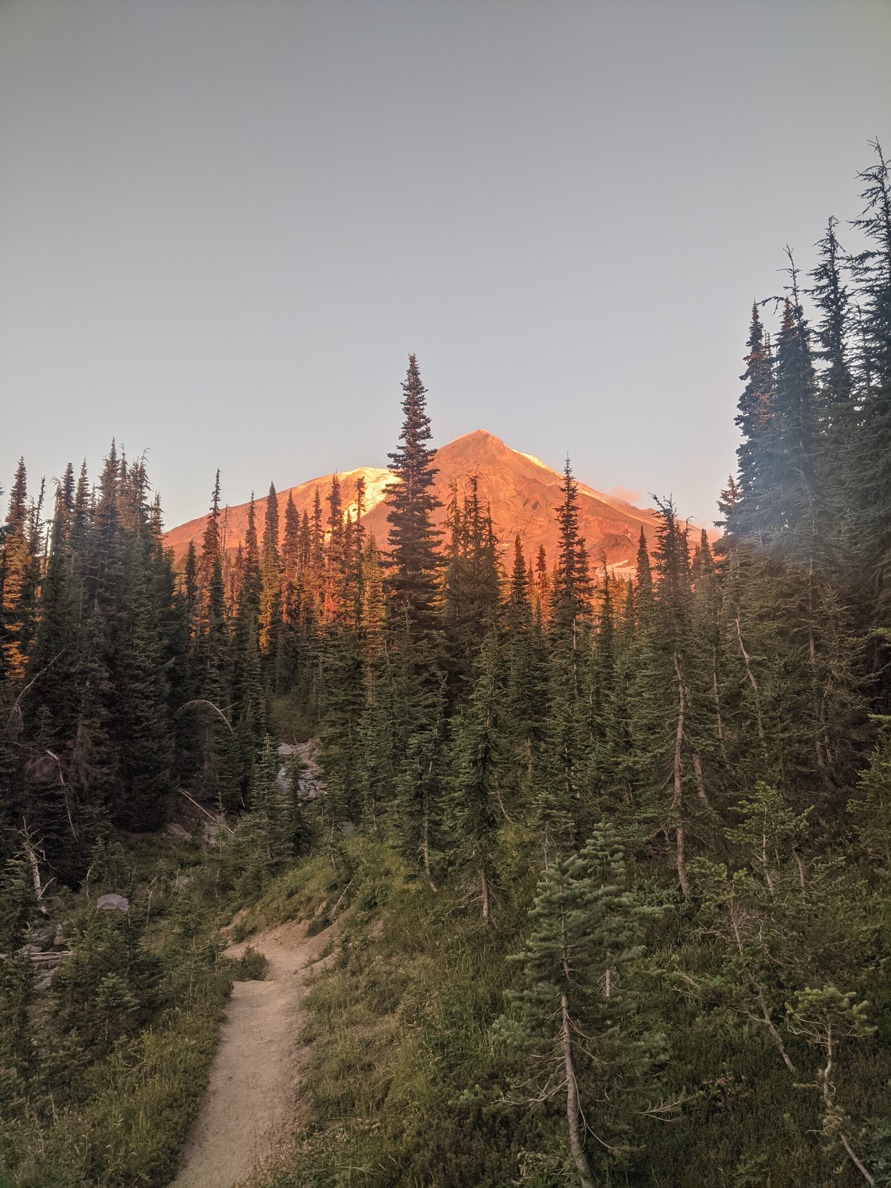
Day 2- Lassen Peak
Rolling into the Devastated Area parking lot we found some other skiers hyped on conditions, they had apparently been bouncing between Lassen and Shasta skiing good conditions and let us know that Lassen is “The place to be!” We looked up at Lassen’s NE face and set a time to wake up.The snow started immediately after the closure gate and we were able to skin about 1/3rd of the way up the face proper. Way better conditions than 2 years ago when I had skied it for the first time. We booted the top 2/3rd of the face and dropped in pretty quickly to harvest that good corn. I had done something wrong clicking in and immediately ate it on the 50 degree headwall, I came out of both skis right as a cloud rolled in and one ski went rocketing down into the ether. Bummer…I started descending on my other ski and eventually saw that my lost ski had stopped only a couple hundred feet below me. I was able to get it on and ski most of the vert out. The snow was a little past-ripe and heavier than preferred but still good skiing. We were able to ski to the closure gate 100ft from our cars and the last little bit was a fun pump track. After a quick climb and ski we had some time to try and bathe (I couldn’t get in the cold water) and stop by the subway caves just outside of Old Station. We took the next day off, having done 11k feet of vert in 2 days.

Day 3- Kirkwood
Still a bit tired from a good effort already we decided to go to Kirkwood and ski some inbounds terrain after they had closed for the season while enroute to the Eastern Sierra. Originally we were looking at skiing Roundtop right off the top of Carson Pass but it seemed to melted out. We found good skiing at Kirkwood and a fun time exploring a new-to-us resort, albeit closed. After we got down we met some friendly folks in the parking lot who also did some touring and we hung out for a few hours chatting and drinking beer.
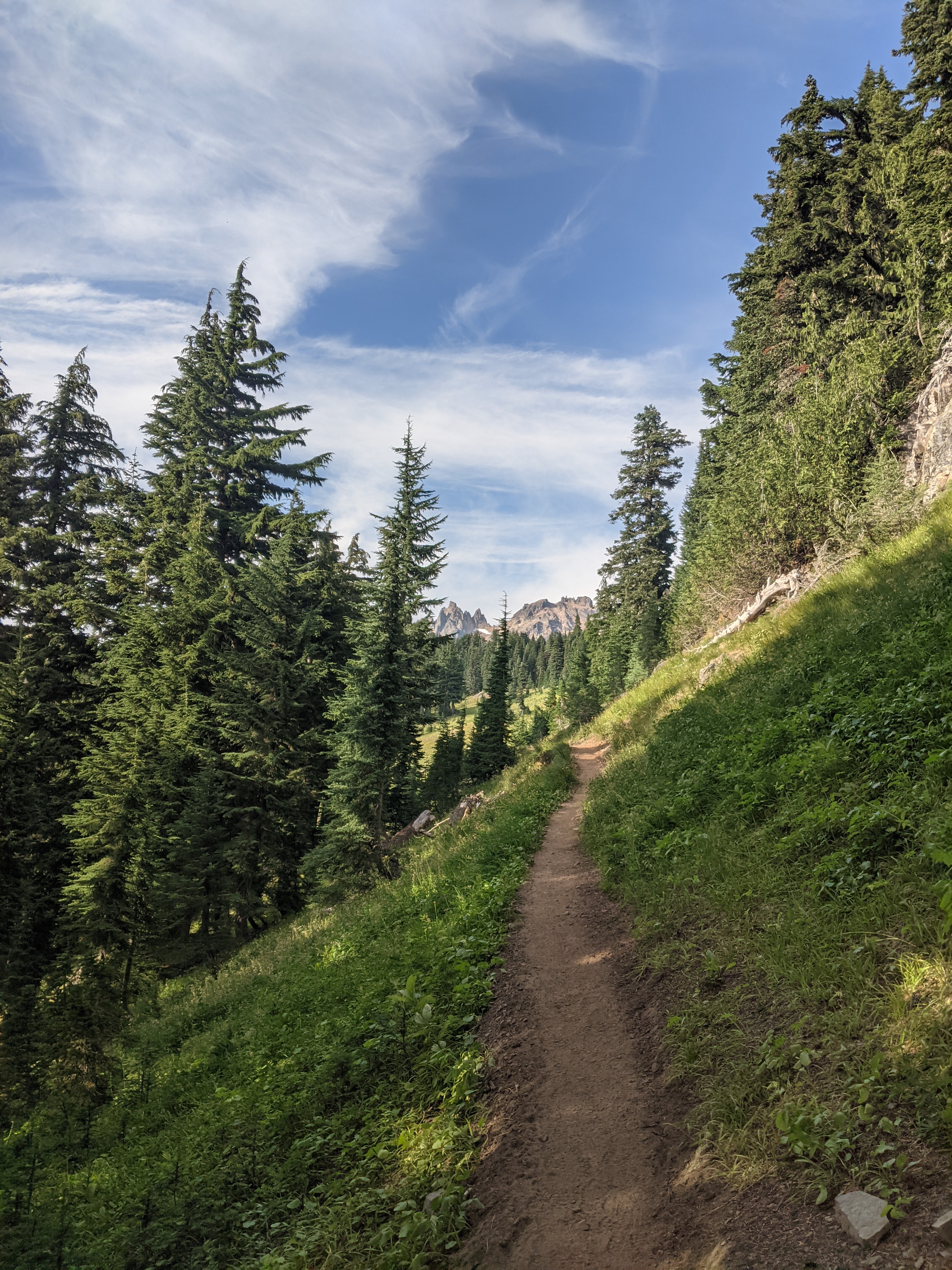
Day 4- Sonora Pass
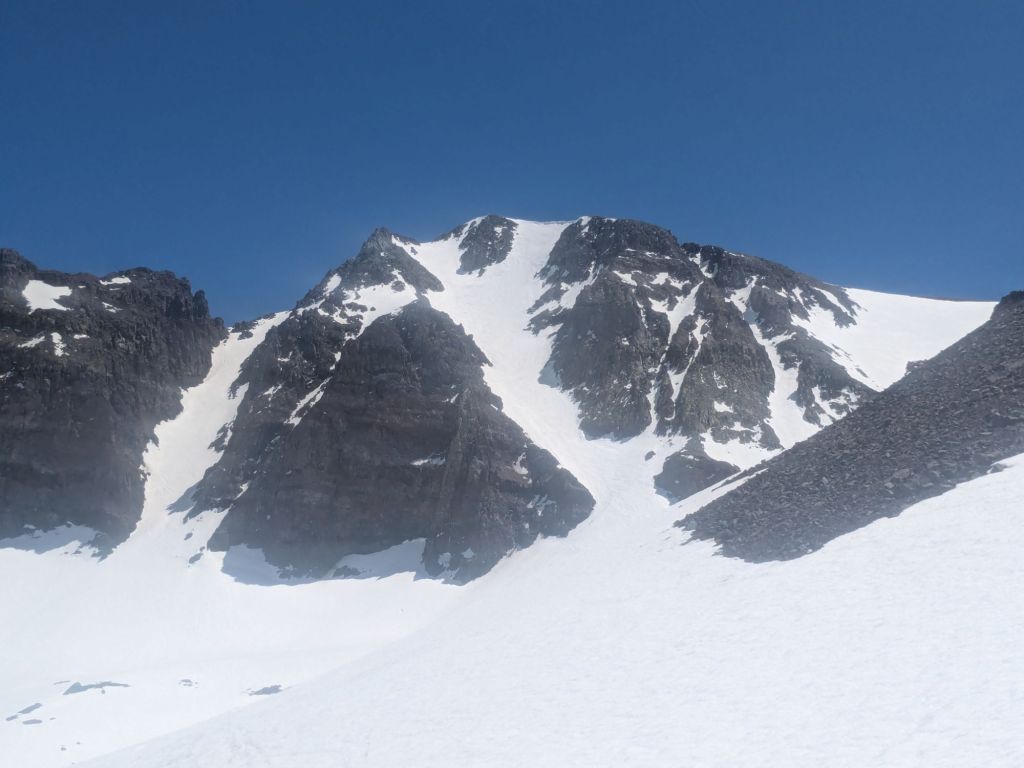
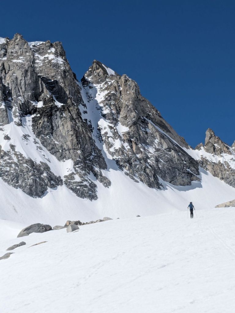
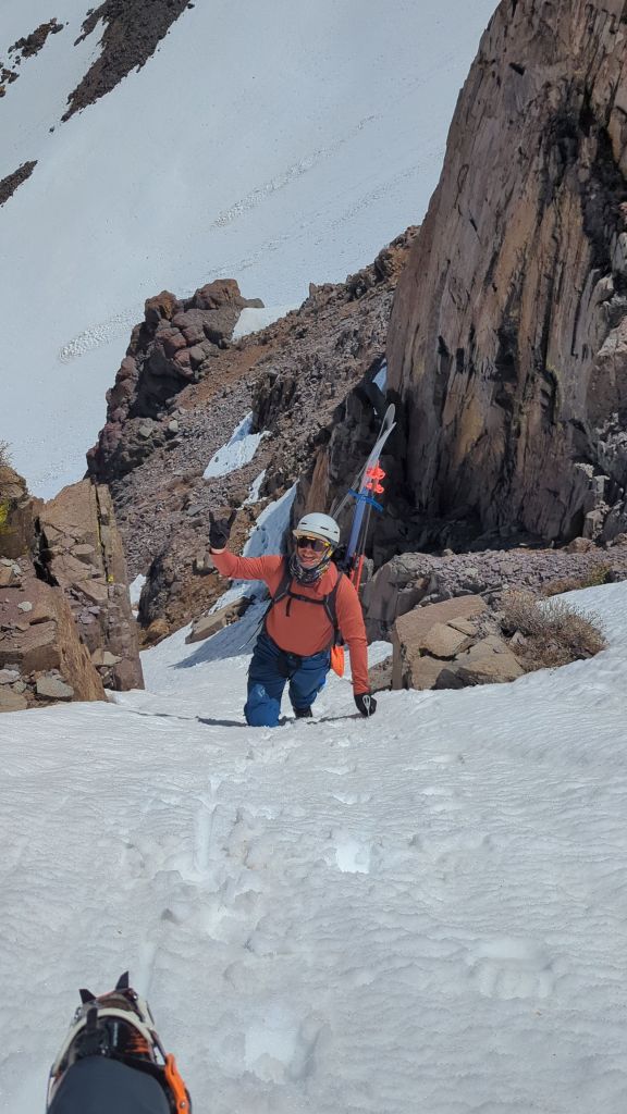
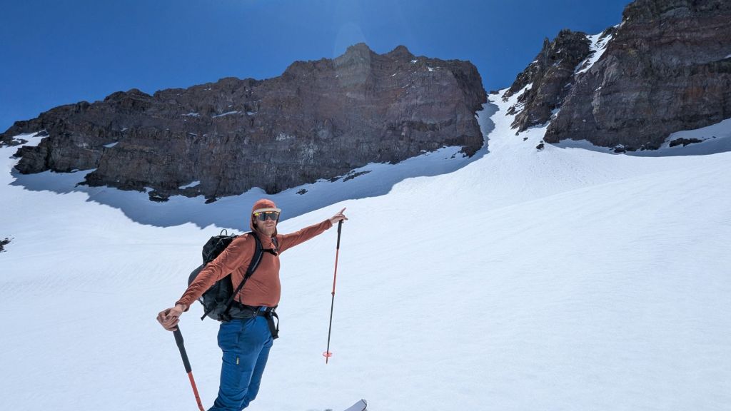
We had heard that Sonora Pass just opened so we figured it was worth a stop as we heading south. The only info online we could find was about Leavitt Peak’s Y-couloir. We figured, sure let’s ski that first and see what else is there. We were able to meet up with a friend, David, who was in the Mammoth Area and willing to drive up to ski with us. Using a car shuttle we started along the PCT heading south, skinning and walking along a ridge before getting a few turns in approaching the base of Y-couloir. On the final approach we saw a ton of other skiers, the place to be! At the top of Leavitt we met a friendly local who shared some additional beta. While waiting for the Y to soften we dropped into a West facing bowl for some soft corn snow. We then climbed out and found the Y still pretty frozen but it was time to drop in. On the way out we were able to ski some great chutes per our new beta with one more climb up to get ~1700ft of skiing in. In all we got 4 ski lines, 3 of which were in great condition!

Day 5- Sonora (again!)
David had to leave so it was just Dan and I again and with the great coverage we decided to spend another day on Sonora Pass. We dropped a car at the exit again and hiked in the now familiar approach. We summitted Leavitt again but decided to ski a narrower ‘hallway’ just west of the main Y-couloir. Once again, not soft snow but that was alright we had a couple more chutes to ski. We hiked back up and dropped towards Deadman’s Lake off Leavitt West Peak then traversed around and climbed a cool hanging snowfield. It was Dan’s first real snow climb and had a spicy ~150ft cliff at the bottom -can’t fall there! We were able to drop off the backside into a real cool chute and from there skated, poled, and skied out way back to the car. Another full day of skiing connecting multiple chutes together.

Day 6- Virginia Lakes
It turns out David was able to join us again and we were heading south to the Eastern Sierra. We decided on the Southeast Gully of Dunderberg Peak. It was a pretty straightforward climb and ski. Boots on at the car, 0.5mi of hiking through sagebrush before arriving at the car. A 2,200ft ski line lay above us so we booted on up and skied on down. The snow was soft and the skiing great. It was a leg burner skiing top to bottom without stopping.

Day 7- Kidney Chute
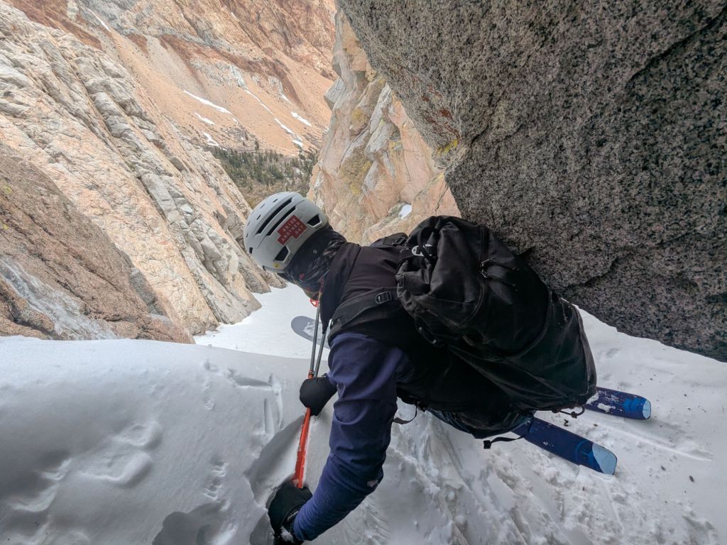
We had been eyeing Kidney Chute which reaches to the Dana Plateau above Gibbs and Kidney Lake for a few days and decided to go for it. It was a bit of a haul in, packs are much heavier with skis and ski boots on our backs. We traversed around the lake (it might be time for me to get ski crampons) and found a ton of wind at Gibbs Lake. Crossing boulder fields with ski boots on my feet and skis on my back was an exciting balance challenge. We climbed it, found even more wind at the top, and skied down in good conditions. A long hike out but Mammoth Lakes was the plan and a hot tub was on our horizon.

Day 8- Mammoth Mountain
We skied at Mammoth mountain, a much appreciated day out of touring boots. Chairlifts are amazing, you don’t need to hike! We had fun skiing around in the soft spring snow. We skied some of the wiggles around the mountain and enjoyed a few laps off the summit via gondola and chair 23.
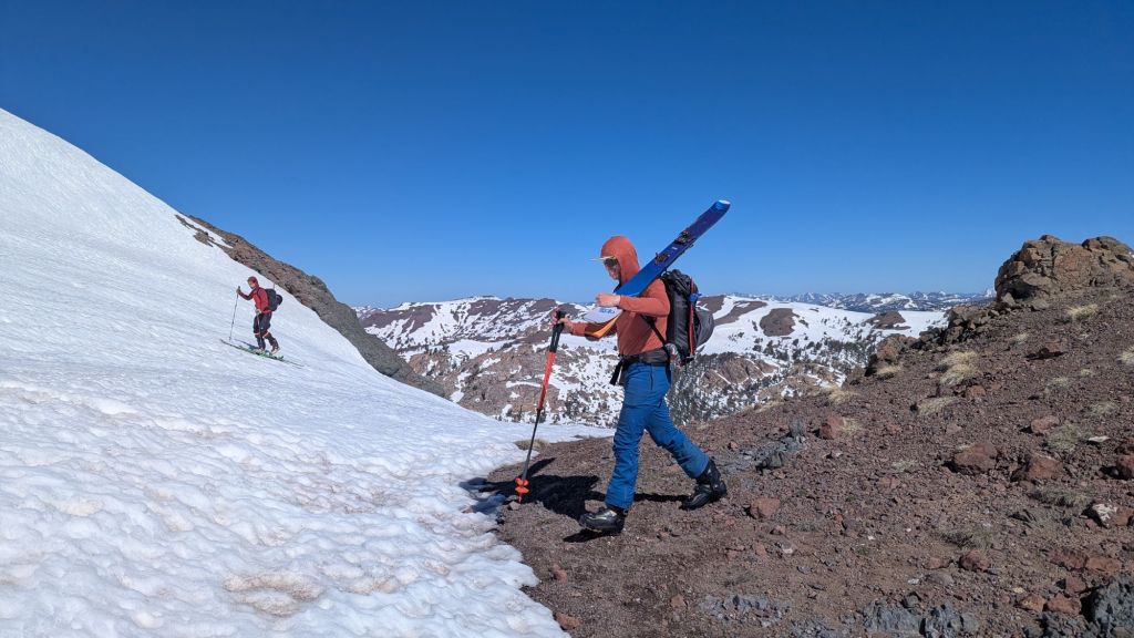
Day 9- Piute Ridge
At this point I was getting pretty tired and the idea of long approaches was not so appealing. David and I chose to check out the north facing chutes off Piute Ridge near North Lake up near Sabrina Lake. We camped down low in Bishop and met up in the morning. The line we chose to ski was a bit of a punchy post-holing climb and terminated in a huge chockstone mid-chute. Underneath the chockstone was a large cave we climbed into and hung out in. Skiing was alright but I was getting pretty tired.

Day 10- Gilbert N. Couloir
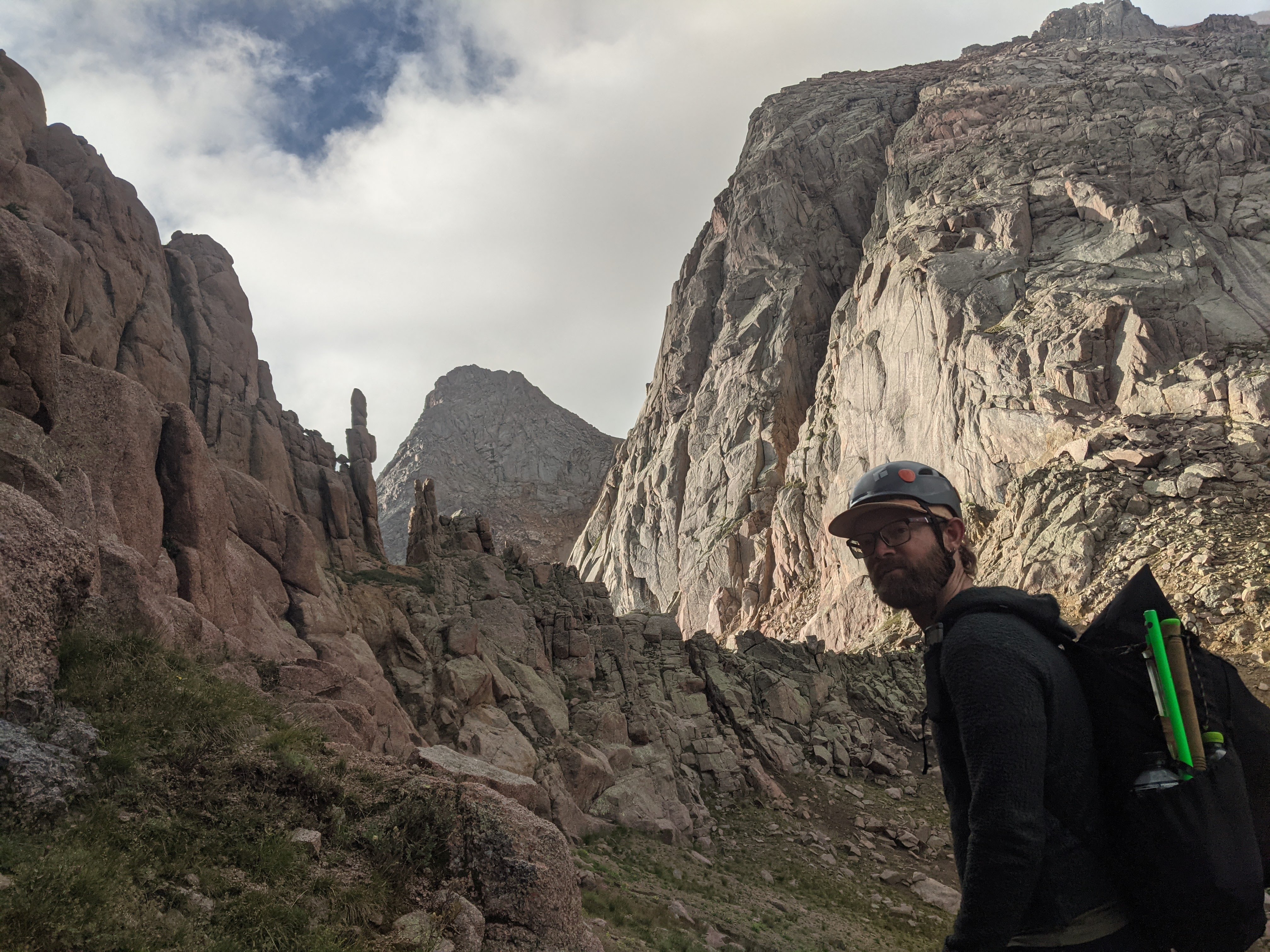
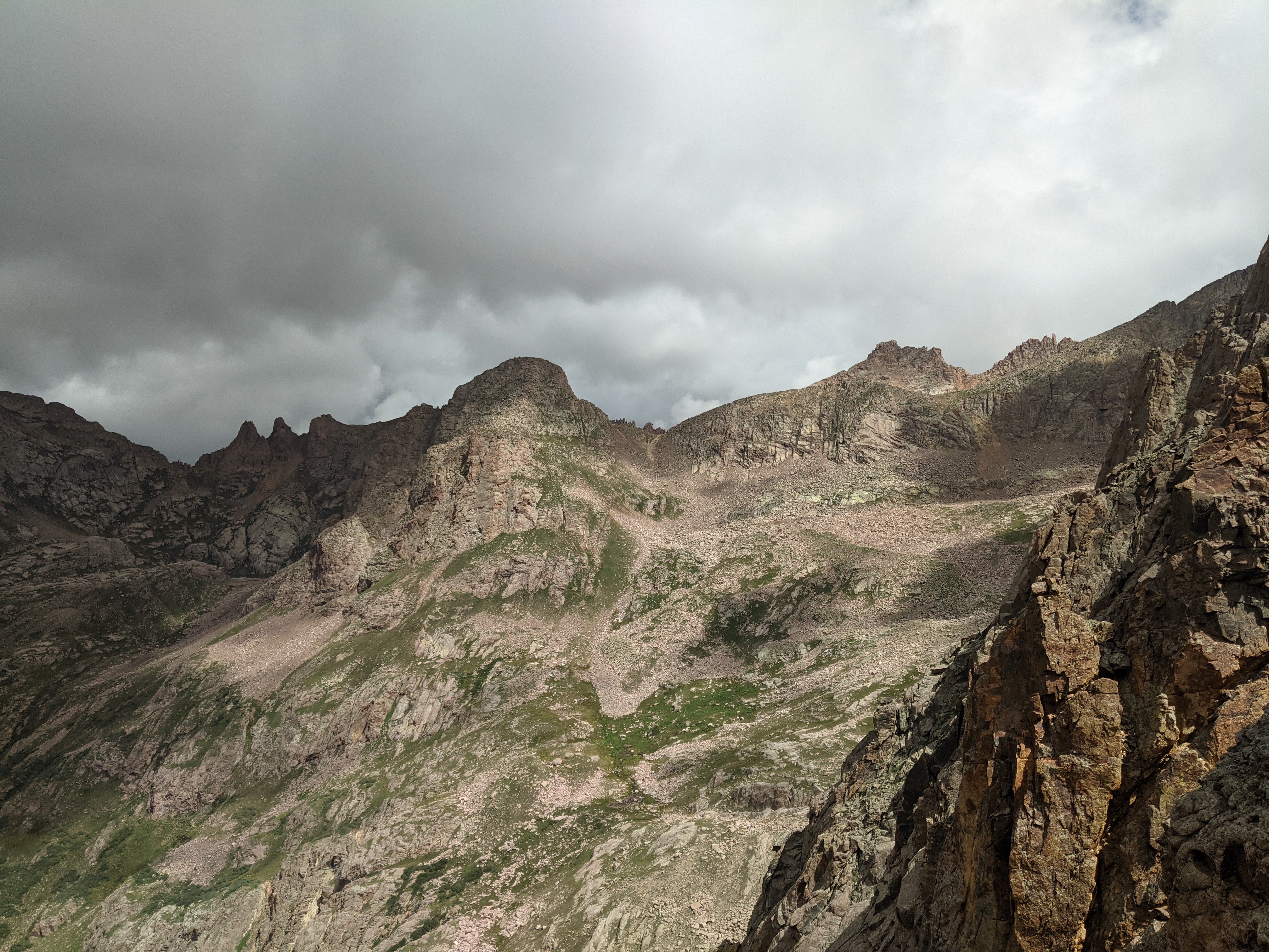
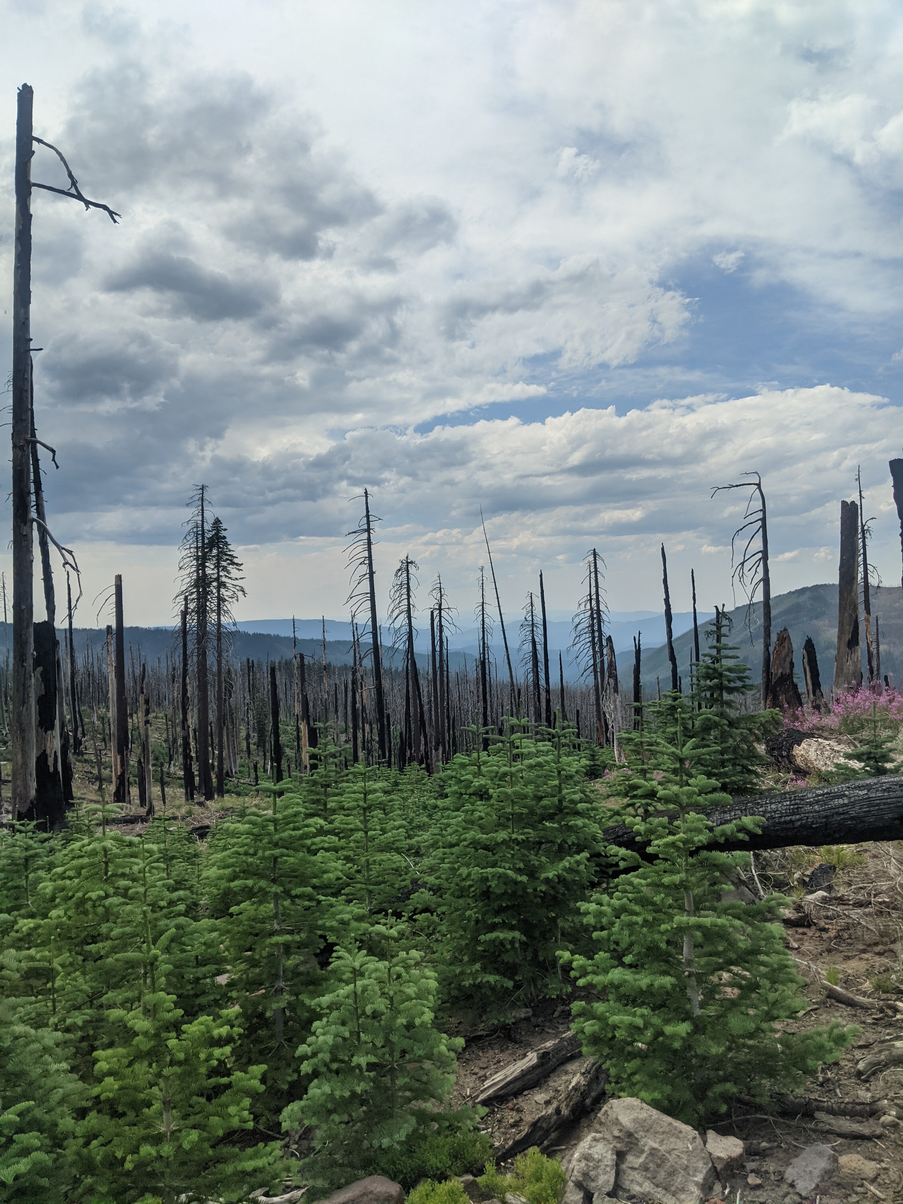
Gilbert’s N. Couloir near Bishop Pass was on the agenda. As we got closer to see it, we could see a large choke point with exposed rocks. Additionally we were finding some punchy snow conditions, so Dan and I decided we did not want to ski it. David was eager to so we watched him ascend most of it before we heading over to check out a different line. Dan and I skied what I believe is ‘Huntington Couloir’ on Mt Thompson. By the time we made it back David had finished climbing and was done skiing down. The approach was a bear but luckily we found a better descent route that let us ski a bit more than we could on the way up. The bootpack up the short couloir wore me out and I decided I was pretty burned out on skiing. I figured it was a good day to call it so I headed home with a quick detour through Death Valley.
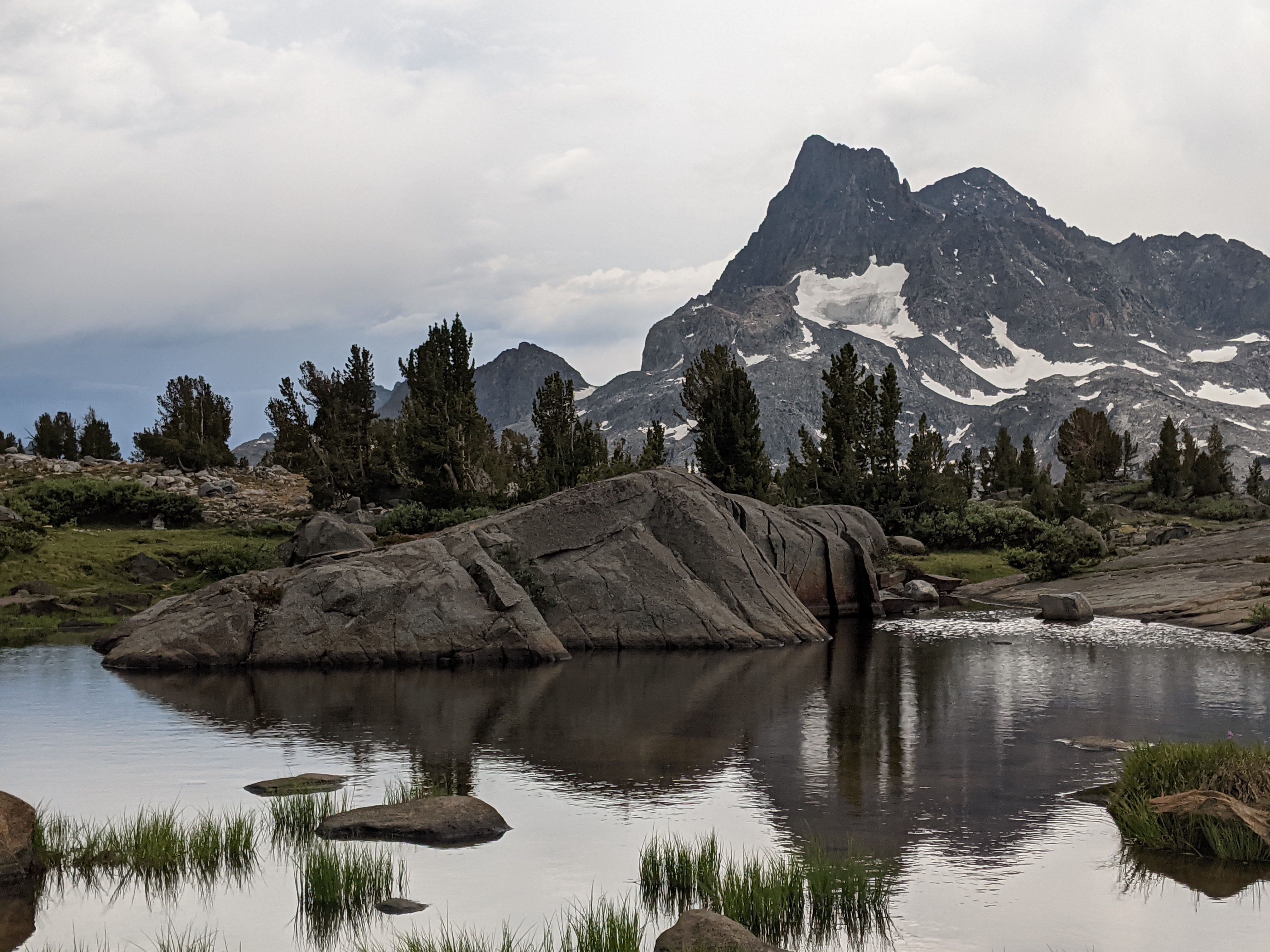
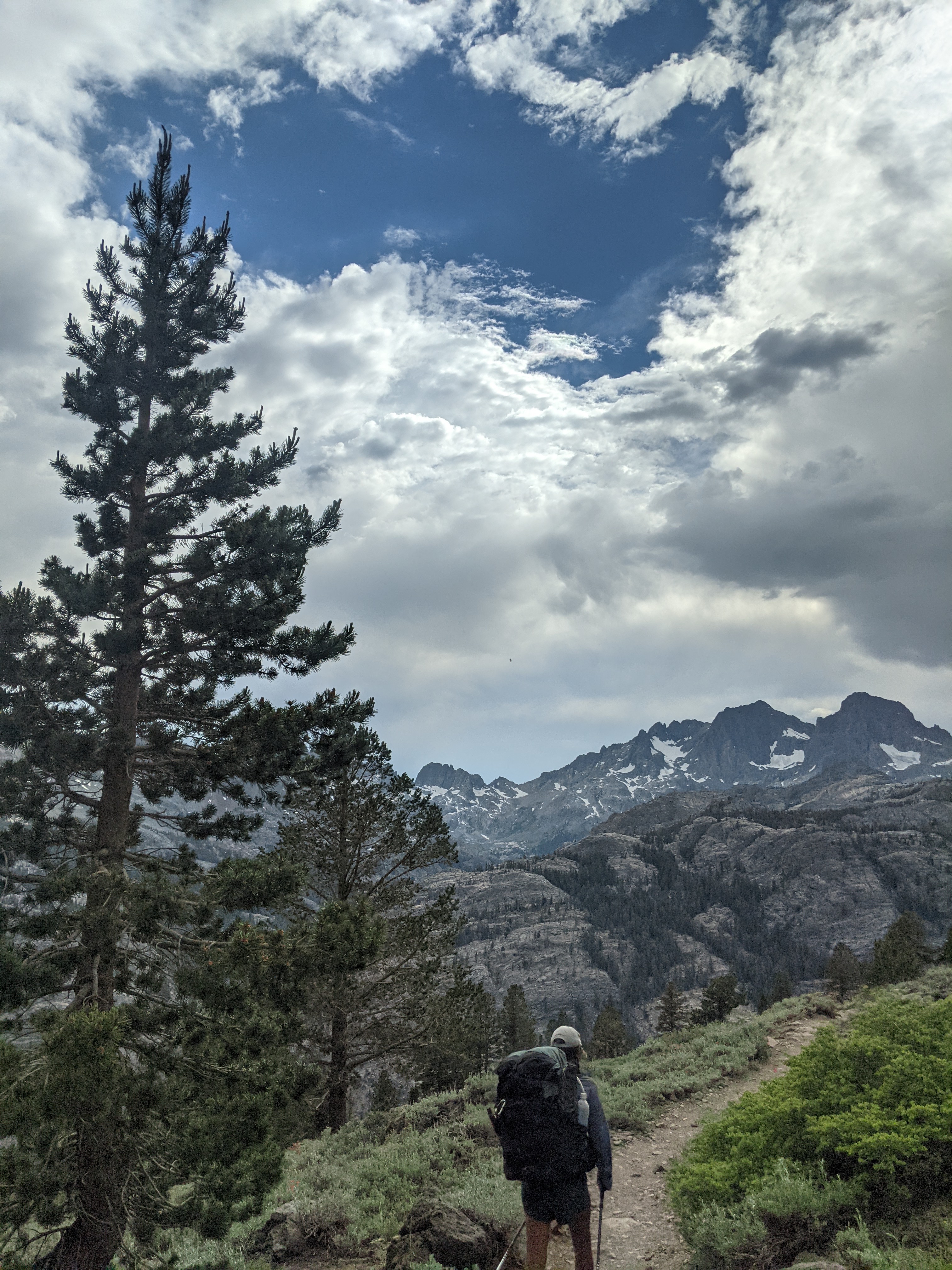
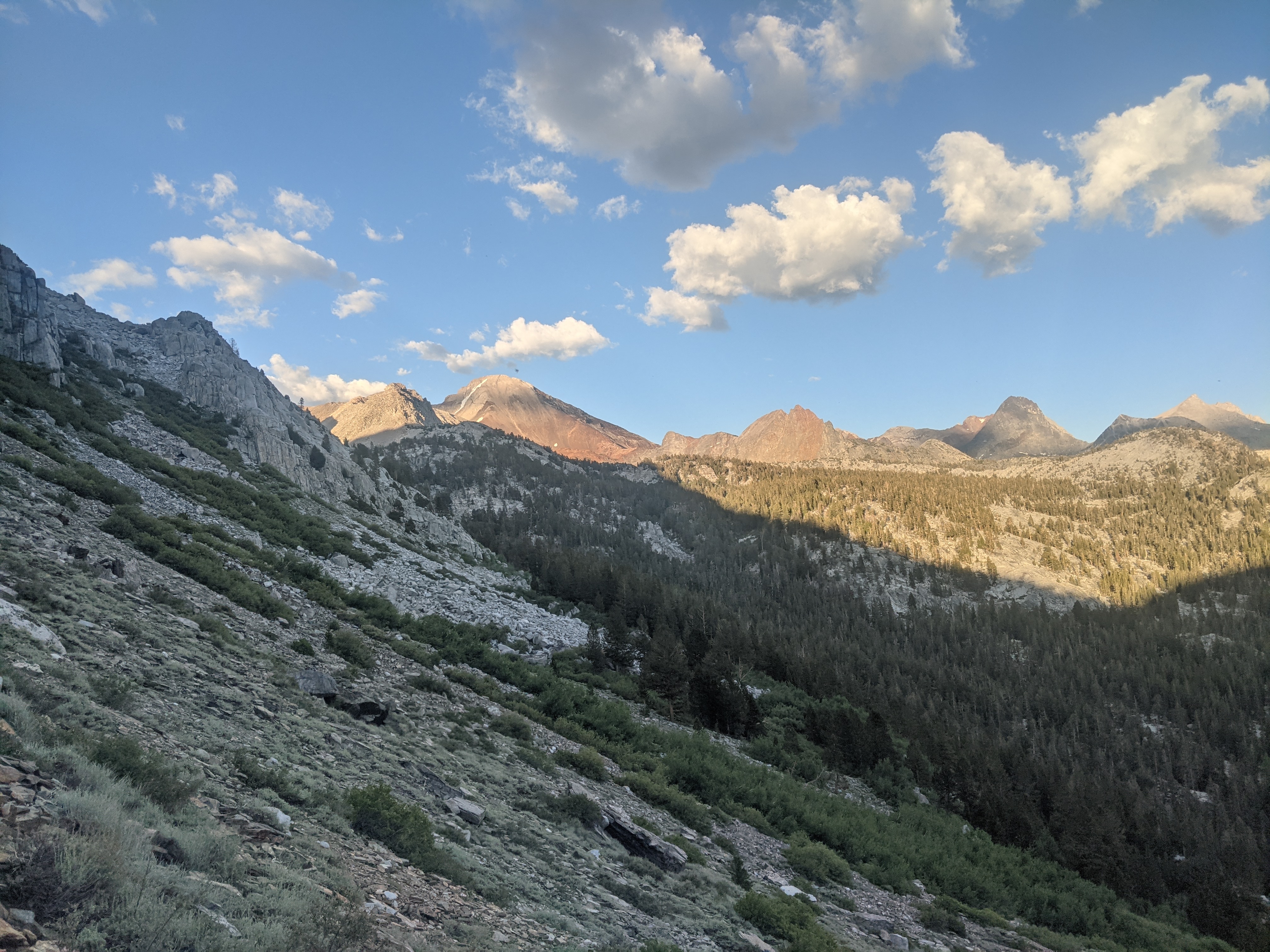

Summary
All in all we had a great trip. Tons of skiing, mostly good snow. A very pleasant ‘Plan-B’ to our original plans. We found the guide book on Eastern Sierra skiing to be amazing for planning and stoking us up. In addition to the skiing we had a great time being goofy and we all got a long very well. I also enjoyed exploring, mapping, and future trip planning as I will certainly need to come back to the Sierra for more skiing in future springs.

Weminuche High Route, or an attempt

Topo Map of Weminuche section of our high route. Not pictured: approach from Purgatory TH.

Day 0, Saturday Aug 13, 2022.

SamSam picked me up in Denver and we rolled out on 70 westbound. A couple stops were had, at the City Market in Grand Junction to get some last minute goodies, and an impromptu pre-dinner stop at McDs for the advertised chocolate pretzel Mcflurrys. We rolled into a campsite south of Montrose around 10pm. We ate some beans, sausage, rice, and cheese from a container Sam brought while kicking around a relatively round rock in the dark. Also drank a beer. Went to bed around midnight and was treated to some great lightning but no rain.

Day 1, Sunday August 14, 2022

A slow morning. We drank some coffee at camp and ate some scones and fruit. We rolled out mid-morning and stopped in Ouray to hit the bathroom and refill water. We weren’t on trail until nearly 1pm. The first few miles flowed by with a descent down to the Animas and a slight uphill paralleling the Animas and the Durango-Silverton railroad. We saw the train and a lot of cool mushrooms! By the time we got to the Needleton TH it was a bit after 4 and time to start the climbing and the off-trail bushwhack section. Initially we were able to follow a good trail up to a meadow. What a pleasant surprise! We lost the trail in the meadow then regained it. At some point on Pigeon Peak’s long west ridge we stayed high when the trail seemed to drop down low. We had a bit of vert gained then had to lose it on a mossy slabby down climb. Bummer. We picked up the trail again. We had heard this approach is an awful bushwhack which it sorta is but we were able to make use of a trail for most of it. We took the trail to Lower Ruby Lake and hiked into camp with headlamps. We decided that was far enough and called it good. The dehydrated beans I packed for the trip are too salty and my ankles feel a bit weak. Rain rolled in and SamSam and I rushed to pitch our tarps. It’s been awhile since I used mine so I’m a bit rusty at the setup.

Day 2, Monday August 15, 2022.

SamSam and I woke up naturally around 7. We ate some breakfast, packed up, and started what should have been an easy trail to follow up Ruby Creek. At the lake we spoke with one person and saw two more tents. We then had an arduous and wet bushwhack up to the upper reach of the creek where we turned off for Pigeon and Turret’s saddle after a quick break at the creek. It had taken us about 2 hours to go the 2 miles to the turn off. We then had a long slog up to the saddle that took another hour. The standard route wraps around from the steep east wall to the southwest gully. It loses 700 ft of elevation before climbing up the southwest gully. We saw some goats on the way around then slogged up the steep class 2 gully. We finally reached the class 3 ledges which brought quick passage to the summit. We had a bit of cell service at the top and I checked the weather to see storm potential in the afternoon. We started the descent and got rained on twice. With the slower than expected travel we had made, we decided to lose another 500ft and sleep in the upper basin of Tie Creek/N Pigeon Creek. We arrived at camp around 3, hung out and had surprisingly good weather until 5 or 6. We crawled into our tarps for the night with the intention of getting an early early start tomorrow morning.

Day 3 Tuesday August 16, 2022

It rained hard last night but cleared up before morning. My alarm went off early to try and beat the forecasted rain. Sam and I were walking a bit before 6:30, heading straight up the steep grassy hillside to the saddle between Pigeon Pk and Turret. We made it to the saddle and had some clouds, but they were not enough to warrant caution. We headed up Turret Peak, summiting before 9. We hung out on the summit for a bit and checked the weather forecast again. Rain was in the forecast for the afternoon. We saw hikers on the Eolus/ N Eolus saddle across the valley and watched a helicopter fly into the Chicago Basin. We watched clouds twist around Jagged Pk, many valleys away. As it was about time to descend a hiker topped out and greeted us on Turret Peak’s summit. We spoke to him for a bit before heading down. We got a little confused on the down climb but it sorted itself out. We took a steep gully full of loose scree- my favorite kind of terrain, scree skiing! We got lucky and saved some time and avoided regaining vertical because the gully did not cliff out. We aimed for some trees high in the Ruby Creek Basin to camp so we could get an early start tomorrow. We spent over an hour looking for a good campsite and eventually settled on one near a creek with some protection. Tarps were up before noon, with rain in the forecast. We got lucky though and no rain fell until 630pm so we spent the time hanging out, kicking my cork ball, doing basic camp chores, and whittling away the hours. It was certainly frustrating that we made an early camp then rain didn’t materialize, however we camped early based on the information we had and we kept telling ourselves that. Plus it was nice to just hang out all day and watch the clouds dance and obscure the surrounding ridges. 

Day 4 Wednesday August 17, 2022

Another early morning. I was packed and ready at 6am. We started the day with a good vertical climb around some big cliffy slabs and up to a pass all off trail. There was excellent lighting and clouds on the way up. What big, cool mountains. We ended up higher than expected at a pass that led to a drainage north of ours and we wanted to go east. We took the opportunity to tag a bonus peak, Peak 12, which sits lower than many surrounding peaks (only a tad above 13,000ft!) but offers an eagle’s nest perch looking into many drainages. The clouds danced around the peaks off in the distance and above us. We followed goat tracks up. Peak 12’s north ridge connected to our pass and we descended some gullies and scurried around cliffs to get to our pass. We saw goats in the valley below. From the pass on we did a descending traverse below some high cliffs of Glacier Point’s north faces before reaching the base of Twin Thumbs Pass to get into the Chicago Basin. We arrived at the base, scurried through a talus field, and found ourselves on loose scree losing one foot of progress for every two gained. Eventually the scree ended and we had 30ft of easy cliffy ledges to the top of Twin Thumbs Pass. Upon topping out,l we ate some food, took some photos, then descended to the popular Chicago Basin. We didn’t see anyone until we were down below Twin Lakes. Weather was cloudy up high, okay down low. We turned left and headed for Jupiter Mountain, a centennial peak (one of 100 highest in the state). We took the trail up, passing two mining shafts and one old cabin then took our exit to the top. We ascended very steep grassy slopes to a rocky ridge. That took us into the clouds and eventually a false summit. The true summit was another 200 feet away and we scrambled up to it. It was a cool blocky, airy summit with no view at all. We rapidly descended, eventually getting out of the clouds (and rain!) and found ourselves back on trail. From there on it was just a simple walk out on good trail! We stopped for a long lunch and coffee. While eating, rain moved in and  then passed. We continued hiking what seemed like a long forested trail. My feet got pretty banged up in my shoes and I found a big ol’ blister when I got to camp. We camped at the Animas River which has picnic tables! What a treat to cook and eat dinner sitting down. We have an easy hike out tomorrow. 

Day 5 Thursday August 18, 2022

Samsam and I slept in and had a casual morning. We only had a handful of miles to hike out so we took our time getting ready in the morning and used it to dry and organize gear, pack our stuff up, drink hot coffee, and eat the remainder of our food. Once we were ready to go around 11 we tossed our packs on and started trudging up and out. My heel blister HURT! We arrived at the cars a bit after 1pm. We drove into Durango and ate a ton of food at the Durango Diner then spent time at the library before swimming in the Animas River. What a cool place to have spent a handful of days.

Grand Canyon Rim2Rim2Rim: 45mi and 10,600ft

At 7am I found the first rays of sunlight hitting me. “Ahhh, my companion for the day” I thought to myself knowing it was going to be a long day and while I would see some people, the sun would travel from east to west while I ran from the Grand Canyon South Rim, to the North Rim, then back to the South Rim.

My alarm went off just before 5am. I woke up in my car, not well rested. The night before I drove in and while I was able to fall asleep before it was too late, I heard a knocking on my car around 11pm. A couple had locked themselves out of their car and was wondering if I had any tools to help them unlock the car. I couldn’t help them and said so. They asked to borrow my phone which I happily obliged. They then asked if I could run them into town, “Sure no problem.” While I was happy to help, I was perturbed to be losing an hour of sleep before a big day. 

At 6am I found myself boarding the Hiker Express shuttle to take me to the South Kaibab Trailhead where I would descend to the Colorado River, climb up and out to the North Rim on the North Kaibab Trail, then turn around and return to the Colorado River. I would finish the day by hiking out along the Bright Angel Trail to the main Grand Canyon Village area where I would walk a few minutes to my car waiting for me at Lot D/Backcountry office. 

The descent down the S. Kaibab trail was beautiful, descending through hundreds of millions of years of geologic time. I began with my headlamp stashed and found myself stripped down to my shorts and sunshirt within the first half hour, never needing to put another layer on until I returned to my car. I reached the Colorado River around 8am, having passed two mule trains en route, one descending with cargo and one party climbing out of the canyon with tourists on their back. I leapfrogged with another runner who was doing a loop down to the river and back to the South Rim and he gave me some beta for what was coming up. I stopped briefly at Phantom Ranch, an outpost just off the river that has a small store/cafe with limited hours (8am-4pm, 7pm-8pm when I was there), meal service for those with reservations, and a few cabins and some tentsites. I bought a postcard and a stamp, wrote out a quick note, and dropped it in the box to be carried out by mule train. It is kind of funny that blank postcards are carried down by mules, filled out and stamped at the bottom, then carried out with some ink on them. 

From Phantom Ranch, I had about 7mi of relatively flat terrain with only a moderate incline following a stream up, before the climb to the North Rim started. I put in some music and was able to run this in about another hour and a half. I reached Cottonwood Campground around 10am, filled up on some water and walked/jogged to Manzanita resthouse, another 1.5mi further. I ate and drank my water through here knowing that Manzanita was the last water source until the N Rim IF I chose to walk a bit to get some water from a faucet. From Manzanita the climbing really started. I slowed down to a walk, occasionally jogging some flat sections. There was beautiful terrain through here and I enjoyed as the view changed while the trail climbed, switchbacked, and meandered up. I saw a gully with bright yellow cottonwoods and passed through some tall orange cathedral spaces. While climbing up and out my head coined the phrase “excellence on a magnificent scale” to describe the grand proportion of the landscape I was travelling through.

I topped out on the North Rim about 2.5hrs after leaving Manzanita at 12:30pm, 6hrs after I stepped off the bus on the South Rim. At the top I spoke with some other hikers, two of whom were also doing the Rim to Rim to Rim. The other two hikers had been out for a morning jaunt. They asked if I needed anything and I said “yes actually, if you have any extra water it can save me some effort.” I was carrying way too much food too so I passed some off to them. “Go far, go light” they said to me. Yessir, absolutely. I sat for a few minutes and analyzed my body. This was my best “out” if I needed to bail. I felt sore and tired already, but felt that I had enough in my tank to get me down and out. I pounded some sour patch kids, drank some water, and set off back down the trail. Pretty quickly I realized I was going to be walking much of the descent-bummer. I had used my legs up pretty quickly running downhill at the beginning. Truth be told, I wasn’t in excellent running shape. I had taken most of the last month and a half off, hoping that my PCT-built muscles were still around. I did know I had the mental capacity to push on a long day out. 

While descended I saw some familiar faces I had passed on the way up. A few people asked what I was doing and I told them. One couple was blown away and said “We are doing half of what you are doing across 3-days.” Lucky them, they get to spend nights in the Grand Canyon. 

I reached Manzanita then Cottonwood pretty exhausted already. I tried to gather the strength to run the flattish trail between Cottonwood and Phantom Ranch but I couldn’t muster the energy. I opted to walk knowing that would slow me down. Forward movement is still forward movement. I finished “Let My People Go Surfing” by Yvon Chouinard, a book about Patagonia (the company), their ethics, and the guiding philosophy on how to do good for the people and the planet as a business. It made me think about how to lead a life examined, how while the responsibility doesn’t fall on the consumer, we can still demand better alternatives from corporations.

I cruised through Phantom Ranch. Unfortunately the cafe was closed as the staff was serving dinner to guests. I could have used a hot coffee pick-me-up as the day was wearing on me. I stopped at the water fountain at Bright Angel Campground, drank some (bad) instant coffee cold, hydrated up, then took off at a walk. As I crossed the Colorado River on a bridge, I watched the sunset on the rocks. I said goodbye to my companion for the day. I began the climb out to the South Rim, at this point more of a trudge than a walk. The trail wasn’t too technical nor steep but I was feeling the nearly 40 miles I had already done that day. By the time I reached Indian Garden, around 8pm, I had seen one other hiker descending the trail that evening and I felt very solo walking through the night. I took my last break, drank some water and refilled. I set-off leaving the glow of campers behind me. I saw one ranger halfway between Indian Garden and the South Rim who was descending in the dark. He asked if I was alright and I said “Yeah I think I will make it.” I gave him my info nonetheless in case my contact person didn’t hear from me by midnight. I topped out on the South Rim at 10:30pm. The last few miles were a bear. I struggled to put one foot in front of the other. I could keep climbing up but my muscles stiffened up considerably for any steps down. I struggled mightily when I stepped off the curb to get to my car. I checked in with my contact person, drove to where I had camped the night before, and passed out. 

San Juan Splendor- Late summer in Colorado’s Southwest Mountains

Friday, September 24, 2021
Post-PCT I was in communication with my buddy Whistler who I had met in 2017 when I first tried to hike the PCT. He finished the PCT that year choosing to flip to the Canada border and hike south while I opted to do some other mountain stuff that summer after we got pushed out of the Sierra by record setting snowpack. He’s a solid partner in the mountains and we both have fun when we are around each other. Come Friday afternoon, we found ourselves packing up our backpacks for a weekend trip into the Weminuche Wilderness of Colorado’s San Juan mountains. Bags packed and a couple errands ran, we shouldered our packs and left the car at Molas pass to begin the 10mi hike into Vestal Basin around 7pm. The first part of the hike descends to the Animas River on the Colorado Trail then climbs up a tributary. At a beaver pond ~7mi in we left the Colorado Trail and followed a less maintained but distinct trail up into Vestal Basin. By this point we were navigating by headlamp and the trail got rougher and steeper. Around 10:30pm we found a suitable enough campsite about 0.5mi before the popular meadow most climbing parties camp at. We pitched our tarp and ate the burritos we packed out. We chatted and giggled like school boys and hit the hay around midnight.

Saturday September 25, 2021
Because of our late night we didn’t leave camp until 9am. First on the list for the day was Wham Ridge on Vestal’s north face, a route I had been interested in for 5+ years. We hiked up to the high talus field below Vestal and Arrow and cross-country traveled to the lower base of Wham. We started direct on it’s low point and began climbing up. Initially the “ridge,” which was really more like a north facing slope, started off low angle. With approach shoes I was able to walk the first couple hundred feet without using much hands. The rock is quartzite with amazing texture. As the slope steepened we stopped under a ledge and changed to rock climbing shoes. Around there we ran into another party who was roped up and climbing “center shift” a more direct, straight up the gut route rated at 5.6. We stayed climbers right of them and found a few technical bits but nothing out of our wheelhouse. While a fall would certainly be fatal on most of the route, the climbing never became too challenging to make us contemplate retreat. On the approach, the peak’s north face clearly gets steeper up high with the peak looking nearly overhanging from the base. By the time we got to the steepest section, the ridge was blocky and had a multitude of ledges making for easier travel than lower. We scrambled the last bit and topped out on the summit around noon. We hung out for half an hour before starting the descent off the south face. The initial gully wasn’t too steep or loose. We exited it to traverse west to the Vestal/Arrow saddle. From the saddle we made quick work descending the loose slope dubbed “the dues collector” back to the talus plateau. From there we backtracked to Arrow’s NE rib. We began climbing it, a feature similar to Vestal’s Wham ridge with easy walking we called “a Class 3 trudge” until the slope steepened and we used hands. The final push followed cairns to the summit through some large blocks. We topped out around 3pm, savored the sunlight, then descended the same route we took up. We joked that Wham ridge was “the world’s largest waterslide in the rain” and we were glad we had favorable weathet for both peaks. We made it back to camp in early evening without needing to break out the headlamps. We spent the evening eating mac and cheese, hanging out, and reading a bit about the Trinity Traverse tomorrow. We hit the sack early.

Sunday September 26, 2021
The alarm went off at 6am and in the dark I fumbled for my headlamp to get the coffee going. We ate poptarts in our sleeping bags sharing a pot of coffee. Around 7am we headed out for the Trinities. On the way up we talked to three other groups camping. The first group gave beta on the traverse and the North Face of West Trinity, a route similar to Vestal’s Wham Ridge. I stopped at the second group’s camp and spoke with an acquaintance who I met years ago on Humboldt Peak in the winter. He had a big day yesterday, summiting Vestal, Arrow, and the three Trinities in a day. I spoke with him earlier in the week when he posted on Instagram that he had the same climbing objectives for the weekend that I did. We spoke briefly with the third party who was camping a bit higher. It was a chilly frosted morning and they looked cold sitting outside of their tents. We followed a trail that became more and more faint until it dissipated in some willows. We bushwhacked to the base of West Trinity and started left of center. The route up the north face required meandering around a series of ledges at the bottom then relatively easy 5th class climbing to the summit. I don’t think there is any one particular route up the north face, but the lower ledges seem to require some decent route finding to not necessitate ropes. Consensus among guide books, our group, and other groups is that the difficulty stays at or below Wham Ridge. While it’s not as fully aesthetic of a climb it’s a worthy route that in my view should become the standard route for a Trinity Traverse. At the summit we ate some snacks then began the decent to Middle Trinity. We stayed right (south) of the ridge proper and found 3 or 4 successive chimneys that gained access to the “Fourth Trinity” an unofficial subpeak of Middle Trinity at 13,670ft. From there it was an exciting scramble over to Middle Trinity. We sat on the summit for a short period of time before descending the east gully. The rock was a little loose but not too bad. From there, the west gully of East Trinity was obvious. We started up it and roughly 1/3rd of the way up cut left to the ridge proper. We had eyed it while descending Middle Trinity and it looked like it went. We climbed it and found surprisingly good rock to the summit. We considered it class 3 or 4 with some decent exposure in spots to the dropping north face. I nicknamed it “the ridge that whistles” and do recommend it to future parties. At the summit we hung out for half an hour. We looked back west and saw the 5 successive peaks we had climbed in the past day and a half. Clouds began building and we knew the forecast was calling for some rain in the evening. We descended to the Vestal Basin/Trinity Creek Basin saddle then headed down to camp. We packed up camp and were on our way to the car by 2:30pm. We got some light sprinkles but never needed the rain jacket. The final climb from the Animas River to the car was tough but we were at the car by 6pm. We drank a beer stashed at the car then drove back to Durango. Vegetarian Poutine was on the menu at Whistler’s house as well as a shower and some laundry.

Overall we had an excellent 2.5 day trip in the Weminuche scrambling some exhilarating routes that had been on my tick list for years. The weather cooperated and the vibes were casual all weekend. It was a ton of fun hanging and climbing with Whistler.

Days 90-100, the end!

Day 100, September 8, 2628.9-2653.6, and back to 2647.2 ~30mi

Today is the day I finished the PCT. Last night I walked into a campsite around 7:45pm, met a hiker named compass, and we decided to hike the last day together. About 21 hours later we were sitting at the border together celebrating our successful thruhikes from Mexico to Canada. He shared his “field baklava” made with a tortilla, honey, and walnuts, and shared his 0.5l of boxed wine with me. I couldn’t add anything unique. Some other highlights of the day: woke up to big rain drops at 510am while cowboy camping. I raced to pitch my tarp (only pitched 12 times in 100 days on the PCT) and went back to sleep for less than an hour. I saw many other hikers returning from their Canada trip, a few I knew somewhat well. Great views from awesome passes that are cloaked in reds, purples, oranges, and yellows as leaves on shrubs begin losing some color. I am camping at Hopkins Lake, just south of the border. 

Day 99, September 7, 2594.1-2628.9, 34.8mi

Beautiful night with lots of stars in the sky. I said adios to Lobo in the morning and was on trail by 7:15. I grabbed some water and started climbing uphill. I summited Cutthroat Pass and had awesome views of the rocky craggy peaks of the North Cascades. Folks talk about how the trail is awesome north of Rainy pass and that sure was the case. I spent the morning thinking about a few things. When I started the trail I had the idea that a 2700 mile thruhike consists of about 900 hours of walking at a 3mph pace which is what I’m pretty comfortable at. Whether you hike 15mi a day or 30mi a day, you split the time differently but are walking the same amount of time in 90 days or 180 days. For me, thruhiking this trail has required day after day of working towards a specific goal. I can’t walk much faster than 3mph so a mile passes every 20 minutes if I’m walking. 20 minute chunks add up until I’ve hike 10 miles in the morning, 15 in the early afternoon, and 25 or 30 by evening. 27 miles in a day is about 1% of the trail and that’s a whole days worth of effort. I repeat that effort day after day, 1% plus 1% over all these days and I find myself 99% of the way to Canada on day 99. It’s such a small increment of progress, painfully slow, but no shortcuts available, no other options but putting one foot in front of the other for hours and hours a day. It’s such a big goal but progressively I’ve been able to chip away at it. It makes me wonder what I could do if I could see incremental, albeit small, progress on other goals. What would I direct that energy to? Would I be able to dream bigger in ways I cannot fathom right now? The thought of finishing the trail and facing the other world feels directionless without a clear cut objective that I can slowly chip away at. Anyways beautiful hiking today with circuitous meandering on ridges. I only saw a few other folks all day and had a great conversation with a USFS employee at Harts pass. I dumped some food at the hiker box and hiked on to a campsite. I’m camping with Compass and he wants to finish together so we can take a photo of each other. I can’t believe tomorrow is my last day of the PCT though I’ll have to hike out Thursday back to Harts Pass.

Day 98, September 6, 2572.9- 2594.1, 21.2mi

Last night we slept in the concrete pad. It was pretty warm since we were at around 1000ft above sea level. I caught the 8am shuttle out of town, stopped at the bakery then to the trailhead. I saw Tide at the bakery, said a few goodbyes to some hikers I knew bought a sticky bun and got on the bus then hiked out on the trailhead. I watched a common merganser bob through some class 2 rapids, not even fishing. It was just like a kayaker bobbing through rapids on a river. How fun it must be to be a waterproof duck enjoying the surf.  Yesterday a hiker was reflecting about how profound the PCT experience was and someone was asking them what lessons they learned from this big ol’ experience. They asked me and I didn’t have any good answer. I’m happy to be here and I remind myself that every day this is the best thing I could be doing and there is no where else I’d rather be. However, I’m not sure if I have any life lessons or big grandiose thoughts about the experience as a whole. Maybe I’m just tired. I caught up to another hiker who had done the AT and asked him about it and he said some folks have profound life changing experiences while others don’t and that’s okay. Maybe I’m just happy where I am in life even if I have no idea where that is. I mulled on that for awhile climbing out of the Stehekin valley. At rainy pass there was some trail magic hosted by Suzy and Eric who are grandparents to Sam, a hiker I’ve heard of but haven’t met. I met Suzy and Eric at trail days with Rugrat who knew them. We had a good time and I talked with them and lobo. We had Gallo pinto for dinner with chips, delicious. I camped with Lobo tonight and talked about life and such. A frog jumped in my bivy while I was cowboy camping. Beautiful night. I also finished The Hour of Land book today. Terry Tempest Williams calls for direct immediate action to protect our nations Parks. It struck a chord with me.

Day 97, September 5, 2550.1-2572.9, 22.8mi

I slept alright last night in a sort of busy camping area near a creek. One guthook comment said they saw a mountain lion there so I was a little uneasy. Luckily another camper had a dog with them so I figured the dog would be more alert than me to a mountain lion. I woke up around six and packed up fast, hitting the trail by 6:15. I was on a mission knowing that the bus to town would come at 3pm and I didn’t want to miss it. There was a bit of a climb from camp to the top of a pass. On the way up I had excellent views of Glacier Peak glowing pink with the sunrise and large cotton candy clouds billowing above the peak also awash in pink. At the top of the pass I saw craggy ridges and a deep glacial valley in a big U shape. Very cool! Around here I also crossed the 100mi to Canada mark. From there it was mostly downhill with only a few small climbs to the road to Stehekin where I waited for the bus. While descending I listened to Terry Tempest Williams’s book The Hour of Land. I enjoyed listening to a book about nature, wildness, and the US National Parks while hiking through a wilderness area. While waiting for the bus another hiker gave me some unfinished Cheetos that a mouse had gotten into. I was famished so ate them. I also found a tortilla in the trash and some dirty but not holy socks in the trash. I’ll throw them in the laundry. Hope I don’t get sick. The bus arrived and brought some unfortunate news: the restaurant is closed due to lack of staff so the only food in town is the bakery. We stopped there, I spent too much money but loaded up on some pastries and lasagna and salad for dinner. Bummer. Then we headed into town. I hung out a bit with Ox and we split laundry. I tried to swim but the lake was cold. The group campground set aside for hikers was full so I’m sleeping on a concrete pad near the bathroom. This town is indeed very pretty but with the restaurant closed, the general store having nothing except beer and chips (not even candy or ice cream!) and not much to do in town I’m ready to get out. If I knew ahead of time I probably would have skipped this town.

Day 96, September 4, 2516.6-2550.1, 33.4mi (actually ~29mi)

Had a pleasant night last night no precip. Another slowish start to the day getting on trail at 7am. Right away there were some tough blowdowns to navigate and I got a little lost….frustrating. Then the trail was kind of overgrown and there was a big climb. At the top of the climb was the fire pass which had an awesome view N to some jagged peaks with glaciers, south to Glacier Peak, and across to some large granite walls. Super awesome. The descent was fast and I passed Mica lake. I considered swimming….and I would have liked to but it was a bit chilly at 930am and the water was not warm. There was an awesome rock to jump off into the lake though….dang. After there was a long descent with overgrown trail and some blowdowns to Milk Creek followed by a big climb up and out. Slow and kind of frustrating going. At the top I met a SOBO section hiker and I asked about Suiattle River. The trail there does a big 6mi roundabout to a big fancy bridge put in recently to replace an old washed out bridge. I had considered and talked with others about crossing the river on the old PCT trail and skipping ~6mi. He said the river was fast moving and deep but what irked me was his attitude of how I should hike the 6mi and enjoy it, after all isn’t that why I am out here?? Well sir, I’m not sure why I’m out here but I think I’ve done enough walking to consider some shortcuts as long as I don’t cheat by getting in a vehicle. It’s easy to look through rose colored glasses when you haven’t been on trail for literal months. I’m still enjoying my trip but I am ready to finish. Anyways….good views after talking to him then met some other NOBO section hikers, a couple cool guys. Chatted with them on a long descent and they were considering the crossing shortcut as well. At the junction we decided to go for it. Unfortunately from our direction the old trail is about 2mi to the river so it’s an investment just to get there and turn around, not something that can be observed from the PCT and then a decision made. We followed the trail, bushwhacked a bit, but honestly not as overgrown as the PCT sections we were just on. At the wide flood plain we b’whacked to the river side….it was moving fast and looked deep and silty. We saw a couple other NOBO PCT hikers that the section hikers recognized. We went over and take to them, Grandpa and Walmart two-socks. They had scouted the river N to S of where the trail comes out and didn’t see any downed log or good place to ford. First the two section hikers tried to ford together, one breaking the water with a staff and the other behind pushing him for support. That didn’t work well. Then we tried to make a bridge by getting logs and wedging them off a downed log that was halfway across. It kind of failed. Thankfully no one got hurt picking up heavy logs as a team and balancing on loose round river rock. Finally the two section hikers just went for it and swam across. They made it, the current was strong but they were on the other side. We started tossing stuff to them and setup a handline zipline to zip packs and gear across to them. It worked! Our stuff made it across and the three of us were next. We took turns jumping in and swimming like hell to the other side, a few short strokes were all that was needed but in that time we were 20-30ft downriver. Then five of us were standing on the other side with all of our stuff, yippee!! We were stoked. We packed up and started climbing up the hill. Thankfully the PCT wasn’t far and a few minutes of steep scrambling and we were on it. We had a mellow climb up. I chatted with Grandpa (a young dutch guy) and Walmart two socks and had dinner with them. We were all going to camp a couple miles further but the site was taken by an older two people who seemed reluctant to share…. frustrating as it was almost 8pm, getting dark, and the unstated rule out here is “there is always room for one more.” I pushed another 0.5mi and am camping at a stream where there are plenty of spots and nice folk. What a river crossing. We didn’t save any time but we did avoid about 6 trail miles and walked 2 bonus for a net gain of 4mi saved! At the time and looking back it was kind of a stupid thing to do. I’m sure I’ll reflect a bit on it in the coming days and years.

Day 95, September 3, 2483.6-2516.6, 33mi

I was warm last night!! I cowboy camped and had to unzip my sleeping bag in the middle of the night, how nice!! I got going about 645am and had a pleasant morning. Around 10am I came around a bend and Haiku and Coach were there. There was a bit of cell service which may be the last cell service on trail for the rest of trail. Thank goodness. Last night Tide rolled into camp and told us that since we were planning on arriving to Stehekin on Sunday afternoon and Monday was labor day we wouldn’t be able to pick up our boxes from the PO until Tuesday at 10am, ouch. I used the cell service to call the Stehekin PO and they answered. The guy was willing to set aside my box for me in the lobby to be picked up when I arrive regardless of the PO being closed, woohoo! He did it for Haiku and Coach too. So thankful that I had a bit of cell service there to make that happen. The rest of the day the trail followed ridges and was gorgeous. It was a little smokey in the morning but seemed to clear up after lunch. Haiku is also a bird watcher and we both saw two new birds for the trip, the fox sparrow and the white-winged crossbill. We had lunch at reflection pond which was kind of dark and murky. Then we were in for a treat, we walked along some ridges and had awesome views of craggy peaks off in the distance with glaciers coming off them. After that we went over a pass and saw Glacier Peaks west and north flanks. I ended the evening watching the sun set on Glacier Peak and Black Mountain, glowing pink with alpenglow. I’m cowboy camping in a cozy spot next to the trail protected with trees. Hopefully it doesn’t rain tonight! I stopped a couple miles short of what I was thinking I’d do. It’s been getting dark earlier and earlier. I have 5 more days of walking and 137 miles from here to Canada (plus 30mi back to a road). It is crazy to me that this trip is less than a week away from the end. Though, I do think I’m ready to be done. 

Day 94, September 2, 2465.2-2483.6, 18.4mi

Hung out in Leavenworth for most of the morning. Watched some Austin Powers and had a casual time. I ate some frozen burritos and a muffin and drank coffee. When it was finally time to go to the road to try and get a hitch it was around 11. After 10+ minutes, Haiku, Tide, and I were offered a ride from Carl who said he’d be happy to take us up but needs to stop at Starbucks first. We got in and he took us to Starbucks where he bought all of us drinks and croissants even though we tried to get him his coffee. Super nice of him. He had hiked the first 42mi of the trail last year trying to thruhike but got off because of COVID-19. Maybe next year he will hike. Upon leaving town we met a couple from Switzerland who we crammed into his car, 5 hikers plus the driver! Luckily I got front seat. We arrived at the trailhead and used some of the remaining cell service to call home. My dad got me a plane ticket out of Seattle. Really I should have dealt with it myself but I ended up panicking at the TH. The hike out was nice. Lots of water and finally some views!! I could see many jagged peaks of the cascades including Glacier Peak and I think Rainier way off in the distance. I passed by Valhalla lake with a cool jagged mountain towering above it. Nice hike. Camped a bit early with Haiku and I want to do 30+ miles tomorrow. Tide rolled in not too much later. Tide reminded us that we were on schedule to get to Stehekin on Sunday (PO closed) but Monday was labor day so probably PO closed again…..bummer. I’m going to sleep well tonight cowboy camping with all my sleeping pads and tricks in place. Yippee!!

Day 93, September 1, 2451.2-2465.2, 14mi

Well, decided last night to go into Leavenworth. It was cold this morning. I felt my heat leaving my body through the ground. I’m convinced that wet ground transfers heat better than dry ground. Oh well. I wasn’t on trail until 730am again and started in a puffy until the first climb. Just a few hundred feet above where we slept we found frost on the ground, brr! Thankfully the day was warm and clear. We finally had views and I enjoyed them. I ate a lot of berries, had a second cup of coffee, and before I knew it I was on top of a pass looking down to Stevens pass. I hustled downhill, picked up my box, then Haiku, Coach, and I all hitched into Leavenworth with a nice guy in a van build. In town we ate at a too expensive Mexican place (15$ for two tacos without rice and beans) and hung out. We checked into the Loge hotel which is kinda cool. Shared bathroom, outdoor hipster style, and had dinner at a Mexican place. Leavenworth’s theme is Bavarian village which seems kinda kitschy but kinda cute. Hoping I get an early start to trail tomorrow.

Day 92, August 31, 2420.8-2451.2, 30.4mi

Woke up to rain on my tarp. I was too cozy to get out of bed and wasn’t on trail until 730am. Last night I camped with Coach and Tide and was super cozy in the sleeping bag my dad sent me. Thanks Dad! Walked through mist and clouds all morning with only some views of the surrounding peaks. That was kind of the mood for the whole day. I also saw a grouse on trail, sooty I think.  I chatted with a section hiker named Eric for a couple hours. He taught me about a new to me edible berry. I’m camping a bit early at glacier lake so that I can go into town tomorrow with Haiku, Coach, and Tide. Two days of rain isn’t the end of the world but definitely a downer. Especially in a section that’s supposed to be beautiful but I can’t see anything. 

Day 91, August 30, 2394.2-2420.8, 26.6mi

Cleo left early from the hotel and the rest of us got breakfast at the pancake house (again, very good!) when they opened. We were joined by Long haul and Camino, two older guys who have experience hiking other long distance trails. Cool people, funny and fun to talk with. We hit the trail around 930am and I met Meatgrinder and chatted with him for a bit. Then I caught up to Tide and we walked most of the way around each other, chatting a bit. We saw a mama and kid mountain goat. The mom stared me down on the trail. Pretty cool. Awesome views today as we entered the Alpine Lakes Wilderness. We saw craggy peaks, cool catwalks, and some glaciers sorta peaking out below the clouds in the evening. Some beautiful lakes, alpine views, and a bit of mist/clouds kept it interesting. I had a good time in town but now it’s time to focus on the 8 more days to Canada!! I’m going to need to maintain a good pace of just over 30mpd which shouldn’t be too tough but is a little push which I like. 

Day 90, August 29, 0 miles

I dragged my feet getting out of town. Balloons and I had a not super early breakfast, chatted a bit, packed up, and checked out by 11am. I wanted to make a couple calls before getting on trail then found later we were hanging out at a picnic table and dragging my feet to get outta town. Coach, Haiku, Tide, and Cleopatra then arrived and the decision was almost sealed I was going to zero. I ended up zeroing. Some highlights: fried bean and cheese burritos from the Chevron, pizza from the pizza place, trolli gummy octopi, soda, watching Naked and Afraid, and hot tub and sauna with haiku and tide. Balloons ended up zeroing too with us. It was fun and I think much needed. In the future I should make my decision before packing up so I can just hang all day.

Days 82-89

Day 89, August 28, mile 2368.7-2394.2, 25.5mi
Woke up to sun and a clear day!! Not a cloud in the sky. I woke up just before the sun popped over the horizon and had a gorgeous view east with some tall jagged peaks sticking out. As I hiked along I also had some good views of Rainier, at last!! Last night I had noticed some orange flagging on the trail and today I discovered why, there was a 100mi race taking place today. I hit an aid station in the morning and they were setting up but gave me a banana and cookies, woohoo!! Maybe 15mi later I perfectly timed another aid station. The last runners were coming through and they were cleaning up so let me gorge on smoothies, candy, cookies, and PB&J’s! I hiked on, seeing lots of day hikers not too much further around a beautiful lake. I had a good day and enjoyed the sun being out. I took a shortcut down to Snoqualmie Pass on the ski slopes and I’m splitting a hotel room with Balloons, who I camped with last night.

Day 88, August 27, mile 2334.1-2368.7, 34.6mi
Woke up to rain, wind, and mist so I spent some of the morning in my tent eating breakfast and hanging out. I wasn’t on trail until 8am. The whole day was misty and cloudy though it didn’t rain too much overall but a constant drizzle of mist. Some highlights include: coming upon a cabin with a fire going inside, meeting littlefoot a 5 year old hiking the trail (she seemed happy, maybe a bit tired), and seeing a badger or weasel squeaking high in a tree but curious about me. I spoke to only a few other southbound hikers today and it was kinda lonely and cold. I think this stretch would have had excellent views if I could have seen them but it was all clouds. I had maybe 7min of sunshine. Camping where views would be great and had good dinner conversation with Balloons, another hiker I just met.

Day 87, August 26, mile 2298.1- 2334.1, 36mi
What a day! I woke up not too cold and had a pleasurable stroll through some placid lakes during a foggy morning. I chatted with another hiker and while we didn’t solve the world’s problems we did acknowledge a number of them! My foot has been bothering me a bit and today I thought I may need to take an ibuprofen for the first time on the whole trail. I pushed on a bit further and the pain eased up before I could pop an Ibuprofen, phew! If I were to need to take Ibu daily to finish the trail I think I would at this point. I’ll address any outstanding injuries when I get off. I casually hit 10mi by 10am without trying to make it happen. Around there I crossed a nice creek with an American Dipper bopping around. There were two great meadows as well! I then began a gradual and not too long climb up to enter Rainier NP. I had excellent views on the way up with clouds drifting in and out of the peaks. From the the trail seemed to zig and zag along a ridge going up and down. I saw the smoke plume from the Schneider Springs fire not too far from me but the cool humid air kept the smoke from bothering me. I finished Big Sur by Kerauoc. What a depressing book and a sad guy after he wrote On the Road and Dharma Bums. I crossed Chinook Pass and hiked up and on into the clouds. It started to sprinkle around 6pm and I kept going. It never fully rained but did cool down a bit. The last stretch I hiked through an old burn area with fog while along a ridge. Kind of eerie but I saw a few hikers the last couple hours before camp. I pitched my tarp for I think the 8th time all trip. 36miles today felt pretty casual. Woohoo!

Day 86, August 25, mile 2277.3- 2298.1, 21.8mi
Man, I was cold again last night though I had one of the best campsites of all trail. I could see Adams and Rainier and some basins in the goat rocks. I woke up and was on trail by 7am freezing my way uphill. I took a PCT alternate up towards Old Snowy Peak then across an awesome ridge. From there I could see the backside of the Goat Rocks and the glaciers on the North side. This is the view of the Goat Rocks everyone loves. Super cool ridge walking. Maybe the best mile of PCT so far. All morning I had excellent views in all directions though some smoke covered Rainier. The trail descended gradually back into the forest leaving the high alpine of the Goat Rocks. A couple more climbs with good views and some descending lead me to white pass where I went in to resupply at the general store. I saw a few hours I knew and was offered a shower. I was show to leave, doing 2 miles out to a camp by a lake.

Day 85, August 24, mile 2242.5-2277.3, 34.8mi
Cold night last night. Pulled all the stops and was still chilly. Good campsite location helped me though. In the morning there was frost on the ground and ice on some rocks near the river. Wore a lot of clothes for a couple hours in the morning. Walking around Mt Adams was awesome this morning, aglow in orange with big glaciers on the side. Some beautiful meadows and flowers around it too. About 8mi in, a thru hiker was taking a break from hiking and making pancakes from a van. Sweet trail magic!! There was also a very cute lovable puppy there named Olive. I love Olive. Met a couple hikers and one I recognized from earlier in the trail. He put it together and I met him way back at Kennedy Meadows resort, around mile 1000. We hiked a bit and chatted. I found myself slowing down in the afternoon and took a break to dry my sleeping bag. Tons of berry bushes today. I then climbed up to Cispus Pass and had great views of the goat rocks. Super cool section with views of Adams, the rocks, and later Rainer. Awesome sunset and lighting of the rocks. I Hiked about 4.5mi beyond the pass and I’m camping exposed. Calm night but I think it’s going to get cold again. Chatted with a weekend hiker named Josha for an hour and a half. Cool guy!

Day 84, August 23, mile 2209.9-2242.5, 32.6mi
I was cold last night and wearing all my clothes. I think it was a combination of factors. My sleeping bag was a little damp from dew the previous two nights and the wet ground seemed to pull more heat away from me than normal dry ground. I neglected to be use my backpack as a ground insulator for my legs so that probably didn’t help. Tonight I will. I got a late start again, not on trail until 8:15 but it was nice sleeping in a bit. I think I’m in a sleep deficit from the travel, Osterling party, and the trail days event. Hopefully I’m caught up by now. The sun was out today, thank goodness! But I found myself wearing a few layers for quite a while still, not quite able to warm myself up. I took an alternate 3mi in that added some miles and vert to try and get a view of Mt Adams. I got a couple glimpses but unfortunately as soon as I started climbing some clouds rolled in. The rest of the day passed relatively uneventful with some walking in the forest and some berry gathering. I met a SOBO section hiker who grew up in San Diego and went to Grossmont! I dried my stuff out 18mi in in a big meadow, which should help me sleep warm tonight. I opted out of Trout Lake today and I’m pushing on to White Pass. I climbed the western flanks of Mt Adams and found myself dragging and distracted by the berry bushes. I had excellent views of the alpenglow on Adams, cloaked in orange and now I’m falling asleep tucked away on a knoll. Off in the way distance I can hear some rockfall.

Day 83, August 22, mile 2177.6-2209.9, 32.3mi
I slept okay last night even though it was hard and gravelly. I guess the best mattress is exhaustion! Slow start for the day since we were so tired, leaving camp at 730. It was overcast all day with some light drizzle but I never got rained on. About 6mi into the day, we were able to ditch our trash and fill up water before a big climb out. We also met a couple other cool hikers and I was able to pass some trail magic onto one of them. The climb felt good. Rugrat and I were crushing it on the up until I somehow lost her. She never caught up even though I waited a couple times for a bit. It got cold in the afternoon and evening but it doesn’t seem as cold in camp. Camping alone tonight a little off trail at Indian Heaven Lake. I saw a chestnut-backed chickadee today and I believe I heard one when I woke up in the morning. I’ve seen a number of chickadees now! How fun!


Day 82, August 21, mile 2148.1-2177.6, 29.5mi
First day back on trail after my family reunion when I took 10 days off. I hung around the PCT days Thursday night to Saturday morning. This morning I headed out around 10am with Rugrat and Ebay after a good breakfast at the bridgeside in Cascade Locks. It was hard to get going from the comfort of the indoors. We crossed the bridge of the gods and got some trail magic from a car driving across. Welcome to the evergreen state!! After a few photos we started walking. We kept a decent pace but Rugrat and I ended up leaving ebay early on. Sorry! We chatted most of the day. We crossed a few open logged areas which was pretty cool with good views. It felt good to be back on trail and right away everything was so green, tons of ferns! The weather was overcast all day but it never rained on us. Cool temps kept us walking but towards the end it was getting me a bit down. We got benighted pushing the last few miles, finishing with headlamps around 9pm. We are sleeping on a flat spot next to a car where some nice folks are camping in a camper. They offered us hotdogs but we didn’t need em. They let us use their camp chairs which is a real luxury. It’s good to be back on trail but I certainly felt today’s miles more than I thought I would. I’m tired!!

Days 76-81, Mt Hood to Cascade Locks

Day 81, August 10. Mi 2025.3- 2148.0, ~18mi because of an alternate.
Woke up, started hiking around 6am. Beautiful sunrise with some alpenglow on Mt Hood. We had about 18miles into Cascade Locks which also finishes Oregon. Nice morning walking and took the Eagle Creek detour. Initially it was a steep descent through a burn area but then eases up. Ed and I had good conversation reminiscing to each other about other trips. Before long we saw two excellent falls, which in my mind may have been the best falls I have seen on trail! The first falls were Twister Falls, Eagle Creek flows through deep pools then plummets through a deep V canyon to a small pool then jumps 90⁰ and plummets into a deep pool all surrounded by high vertical basalt cliffs. Just after Twister Falls is Tunnel Falls. The trail runs through a tunnel behind a waterfall with moss and ferns growing all over. After these two falls we started to see more day hikers as we followed Eagle Creek to the parking lot. There we hiked a bit of the Gorge Trail then the bike path to Cascade Locks finishing the state of Oregon. Ed, Dreamcatcher, and I had lunch at a restaurant overlooking the Columbia River and I said bye to them. We had hiked something like 2 weeks together and they were pushing on while I headed into Portland for a week+ off for a family reunion in San Diego.

Day 80, August 9. Mi 2095.9- 2025.3, 29.4mi
This morning we woke up and hiked about 2mi to Timberline Lodge. The short hike in was beautiful. There were views of Mt Hood up above, fields of flowers up close, and a touch of morning dew in the air. Mt Hood is a lot more complex of a mountain than I thought with hanging glaciers and steep rocky faces. Some snow was still present on the lower flanks of the mountain and people were skiing. Ed, Dreamcatcher, and I headed into Timberline Lodge for our fancy schmancy breakfast reservations at the breakfast buffet. We ate a lot. Food was good. Oof it hurt to leave. Ed paid for my breakfast, thanks Ed!! Now I call him my sponsor. We hiked out with very full bellies, contouring around Hood. Most of the trail was a descent with one good climb after Ramona falls. Tons of day hikers and a number of southbound PCT hikers today. In the evening we hit a section with pretty bad blow down trees. For about a mile, the PCTA has an advisory for this area. Being the smart guy that I am, I lost the trail right away and started bushwhacking on the otherside of the ridge paralleling the trail. Being hardheaded I didn’t want to turn around so I pushed forward walking through blackberry and raspberry bushes and trying to dodge the stinging nettle. The upside of my offtrail detour is that I dealt with very few blowdowns. The downside is that I bushwhacked for an extra 30+ minutes scraped up and dejected. I should have learned by now that I can save a few minutes by backtracking instead of investing more time into pushing on. Oh well. I had to night hike an hour or so, catching a great sunset, to camp with Ed and Dreamcatcher. Oh well, I did find seclusion during that off-trail bushwhack!

Day 79, August 8. Mi 2087.5-2095.9, 8.4mi
Spent most of the day hanging and chilling. Fixed my shorts with a borrowed sewing machine from Nick’s roommate, woohoo! In the late afternoon, Nick and I picked up Ed and Dreamcatcher, had lunch at a brewery with food trucks. Then Nick drove us all the way to Government Camp to skip the closed trail. Very nice, thanks for the ride! He hiked the first mile and a half with us then turned back to head home. We collected some berries after and hiked on. We got to camp a little early, ate dinner, and are stoked to hit the Timberline Lodge breakfast buffet tomorrow, it’s less than an hour from us now.

Day 78, August 7 zero day in Bend
Spent the day with Nick. Pretty casual. We had fried eggs over fried rice for breakfast and some mint/honey tea he made. Very good. We spent the afternoon at the river park and swam a little. I tried to go down the rapids without a tube/floaty/wetsuit and got a bit scraped up. We then got lunch/dinner at 10 barrel brewing. We had nachos and burgers and a flight of beer. It kind of turned into dinner. We then heading back to his house and lounged.

Day 77, August 6 miles 1958.9-1983.7, 24.8mi
What a great day. The clouds cleared overnight and I had great views! In the morning I walked through a meadow and finally saw Mt. Bachelor and the Sisters. It was, after all, the Sisters Wilderness. Walking was a joy. Great views east to the peaks and saw some glaciers on Middle and North sister. One day I’d like to come back and try to traverse them. I walked through the Obsidian Falls area where shiny rocks were on the ground (obsidian) and there was a cool waterfall! I crossed a couple lava flows which wasn’t easy walking but pretty cool. Somehow trees were growing in the middle of the lava fields. Don’t they need soil?? The trail finished at McKenzie Pass and I checked out the observatory there before catching a ride into Sisters. Nick picked me up in Sisters and we had a fun afternoon and evening. We got tacos, boogey boarded the standing wave at the wave park in town, and hung out! It’s good to see him.

Day 76 August 5 Miles 1925.1-1958.9, 33.8mi
A tough day for me mentally. The smoke seemed to be a bit worse this morning than days earlier but did clear up by the afternoon. The trail was relatively flat and monotonous. I started and finished a whole audiobook today. I pondered all sorts of things. Like why do bumble bees bumble? I would think they’d be better fliers after millions of years of evolution. I contemplated getting off the trail for good in Bend, OR. I don’t think I will but the monotony got to me today. We passed by many lakes and for a week+ Ed has talked about how this section has so many places to swim. The irony is that it was a cool day with a high around 65. No interest in swimming today. Clouds rolled in in the later afternoon. I got separated from Ed and Dreamcatcher and didn’t see them after lunch. I’ll probably head into Bend alone tomorrow, I doubt they will catch up to me before then. I saw 15+ SOBOs today. The bubble! No views at all today, hopefully smoke/clouds clear for some views of the sisters tomorrow.

Days 65-75

Day 75, August 4, To mile 1925, ~25-30mi
Ed, Dreamcatcher, and I woke up at the Whitefish Horse Campground. I think we all slept poorly with horses being somewhat active sorta near us I kept waking up to animal noises which were the horses. We had coffee from the wonderful trail angels RV Keurig machine. What a treat. It was a chilly morning and I wore most of my clothes even when I started hiking. The 10mi trail to Shelter cove was easy walking. Largely flat. The last 3 or 4 mi paralleled a nice creek and it felt like the Oregon I expected, wet, green, mossy, and foresty. Previous Oregon was forested but still pretty dry. At shelter cove I had pancakes and a bagel then a couple hours later went back for a veggie burger. I only needed to pick up a couple bags of chips for resupply since I had lots of leftovers from Crater Lake. We chatted with a SOBO and got some beta on the upcoming trail then we went for a swim. We didn’t leave until around 2pm and we took a cool alternate out. The alternate consisted of a 0.7mi train tunnel with safety alcoves. Luckily no trains came. Then we bushwhacked for 10min to a dirt road and followed that to a trail to reconnect. Between these two alternates, we hadn’t hiked about 40mi of trail since we got off. Kinda funny. It was smokey and it’s burning my nostrils and I can feel it in the back of my throat. No views. Camping at Charlton Lake tonight hopefully some smoke clears up.

Day 74, August 3 miles 1849.9 (?) to unk, ~38mi
Today started out strong. On the trail by 6am. Spent the morning in my head. I had great views of Mt. Thielsen above me. A very cool rocky peak. Around 8am I washed some socks and my cold soak container in the very cold runoff of the crew below Thielsen. Very cold! An hour or so later I crossed the highest point of the PCT for OR and WA, 7,500ft. Not too significant compared to the Sierras! Not long after I passed a marker for 3,000km. Big landmarks! Smoke rolled in around midday and seemed to get worse as the day progressed. I took an alternate route off Windigo Pass that cuts off a few miles and stays low. I’m camping tonight at a horse campground where some awesome trail angels are campground hosts. They gave us some soda, let us charged our devices, and gave us beta on the upcoming section.

Day 73, August 2 miles 1820.9- 1849.9, 29.1mi
We woke up at the hiker CG in Mazama Village. We slept in a bit, much appreciated. I had to pick up my box of food from the store when they opened at 8am. Legend, the trail angel, was at the CG making pancakes, what a treat!! We had some pancakes and instant coffee. Yum. There were some other hikers, a couple of bikers doing a long trip, and two travelers with Legend that had a very cute dog. After pancakes I meandered to the store, picked up my box with WAY too much food, and stuffed most of it in my pack. Too much food plus some leftover food from the last stretch meant a heavy load of food. I’m opting to carry most of it to save some cash at the next resupply, a lake resort. Dwight, the genuinely nice guy from the restaurant last night, gave us a ride back to where the trail crosses the road. Very friendly, asked a lot of Qs, and was interested in our stories. We hiked up to the rim overlook and cafe and joined the hordes of tourists looking at Crater Lake. We stopped into the cafe and I bought a cheese and egg sandwich. We then hiked the rim alternate instead of the PCT to maintain views of the lake. What a cool view and pretty lake. Much larger than I had expected it to be and wizard island is awesome! The trail was steeper than expected and dry. After the last views of the lake we hiked what seemed relatively flat or downhill but somewhat monotonous. We saw more hikers, SOBOs and a few slack packers. At the water cache met a cool couple traveling in an RV for a year+. They, upon learning what we were up to, offered us grilled cheeses and beer- YES PLEASE! We hiked the rest of the afternoon listening to books/music and chatting a bit. Also ran into the slack packers at the next cache who were interesting to talk with. Although the PCT mileage is ~29mi, I think we did about 25 trail miles because the alternate was a tad shorter. Not bad after a 40 and a slow start but at least 30 would have been nicer.

Day 72, Aug 1. Miles 1781.4 -1820.9, 39.5miles (plus ~0.75mi of road walk into Mazama)
Good day. Woke up early and was on trail by 5:30. The goal was a 40 before the restaurant in Mazama closes. We made it. The day passed rather uneventfully even with all the miles we did. We had a 20mi water carry and before that carried for about 14mi. At two different but nearby stream crossings we saw more frogs than I have ever seen before. They were super little and all over. It was awesome. I did my best not to step on any. Good views of Union Peak through the day, cool granitic spire rising out of the green rolling hills. Also met my first SOBO PCT hiker, he said a few SOBOs were ahead of him. Walked through a long burn area maybe 6 or 7 years old. Kind of pretty with the trees and shrubs coming back. Also had a cool ridgewalk for a few miles high up, bouncing between east and west sides of the ridge. It was nice to get out of the trees for that bit then later in the burn area. Had a beyond burger for dinner and met Dwight, an employee who would bend over backwards to help PCT hikers. Just a genuinely nice man who wants to help. Tonight we are camping in Mazama Village, at Crater Lake NP. Cool they have a hiker CG for us tucked into the woods.

Day 71, July 31. Miles 1750.4 -1781.5, 31.1
Today felt monotonous but still had some highlights. Last night around midnight I moved from cowboy camping under the stars to sleeping under the bathroom awning at the car camping place we slept at when a light sprinkle woke me up. A couple other folks did the same. Sleeping on concrete was actually nice, level, flat, and cool on a warm night. In the morning we found some huckleberry bushes and gorged on them. Eating enough to make me feel a little ill. We walked around brown mountain traversing lava beds. Easy grade but not easy steps as lots of loose rock was present. From 230- 5ish we had a late lunch at fish lake resort. Delicious veggie burger (no pattie, just veg!), curly fries, a soda, and ice cream and I packed out a veg breakfast burrito. That was dinner, yum! The monotony peaked a bit before Fish Lake and I think we all felt it. After Fish Lake, Dreamcatcher and I chatted most of the way to camp. That helped pass the time. Bugs are back, and we are in a meadow. It’s not too bad but definitely present. Today felt a lot harder than 31 miles. We are trying to push a 40 AND get into Crater Lake/Mazama Village before the store/restaurant closes. I’m picking up a box there but will have too much food going in.

Day 70, July 30 miles 1718.7 to 1750.4, 31.7mi
Woke up early, had some food I bought at the market yesterday, packed up and ready to hitch around 7. We tried to hitch out on one road, no luck. Then took the bus to the on-ramp and waited there for maybe half an hour. Dreamcatcher doing the work to catch a ride. Caught an interesting ride out of town with a young farrier who raced horses very long distances. We hiked up the highway and joined the trail. Right away I spoke with a wildflower ID group. They showed me a small purple flower, very pretty. Saw a number of other hikers at the first water source. Things seem to be drying up and water is semi-scarce. Still not as tough as the desert. I listened to a new audiobook about water and the west interesting enough. We hiked near Pilot Rock and I was tempted to detour to climb it. We took a shortcut in the afternoon opting to walk on a dirt road over single track. It’s nice to chat with people alongside them, not speak to their butts. We are camping at Klum Landing which has bathrooms, outlets, picnic tables, and supposedly unlimited time showers. I was just on town so I skipped a shower.

Day 69, July 29. 0 miles
Spent the day in Ashland watching TV, enjoying the AC, eating food, and swimming at the hotel pool. Very nice day. We decided to zero around noon after breakfast while swimming. It was a good call that I think we all enjoyed.

Day 68, July 28. Miles 1698.3-1718.1, 19.8mi
Pretty mellow morning. Slept in a bit then started walking around 630am. The trail was largely downhill and about 10 miles outside of town there was sodas in a cooler. I cruised the 10 miles into town and overshot the turnoff to get to Callahan’s Lodge and where to hitch from. Had to do some bushwhacking and route finding to backtrack. I came down a steep hill right when Ed and Dreamcatcher were there, perfect timing! Easy hitch into town on the second car. Spent most of the afternoon eating in Ashland, at Ruby’s, then ice cream, then a salad, then pizza.

Day 67 July 27. Miles 1662.8-1698.3, 35.5
Did about 35 miles today. We got rained on this morning and really enjoyed the cool air! The first bit finished the climb from last night then the trail meandered along ridges high up. I’ve been really enjoying this high ridge walking. We stopped at a cabin and I had a wonderful poop with an open view. Then we crossed into Oregon in the evening 5 minutes after entering Oregon, there was trail magic. We took a number of breaks today and seemed to be pretty relaxed hikers but still got 35mi. I setup my tarp tonight for the 4th time this trip, more as practice than for need.

Day 66 July 26, miles 1632.4-1662.8, 30.4mi
Saw an owl last night over camp. In the morning the trail meandered along a ridge for awhile through forest and meadows before beginning to descend. As the descent began the trail was overgrown and had lots of downed trees. It got worse the further into the valley we got. Eventually the overgrown trail ended and I found myself at a campground with a 5mi road walk into Seiad Valley. The Road walk was long and hot and I chatted with Ed and Dreamcatcher enroute. There were blackberries on the side of the road most of the way in so it was tough to stay disciplined and keep hiking and not just pick berries. In Seiad Valley, we hung out in the shade eating ice cream and veg burgers from the cafe. There was another large group of hikers there that seemed to dominate the small space. Around 6pm it cooled off enough that we took off for the climb out of town. It was still hot and the steep climb began right away. There was more bushwhacking and blowdowns to navigate. We had an excellent sunset from a high ridge and camped in some protected trees.

Day 65 July 25 miles 1599.7- 1732.4, 32.8mi
Caught a 7am ride out of town with Sole saver. We fit 10 hikers into her car, it was packed but everyone fit! At the top I set off with Ed and dreamcatcher, a couple I hung with in town a little bit. We ended up going all day. The trail was nice, contouring along or just under the ridge and lots of great views. We swam around 1 which was a great cool off though it got hot once we started hiking again. Nice to chat with some other folks and great scenery today. Camping with them tonight. I am going into town, again, tomorrow. Fun! I didn’t buy enough food to make it to Ashland so it’s good I can resupply tomorrow.

Days 39 to 64

Sorry for the long overdue blog post…it’s a big one.

July 24, day 64 mi 1578.2-1599.7, 21.5mi
Smoke rolled in yesterday afternoon and it was pretty hazy today. Cruised some mellow and fun miles today waking a ridge to the Etna summit road crossing. Climbs weren’t too bad and neither were descents. Overall a very pretty day but I bet gorgeous when there are better views. I spent the afternoon in town eating and charging devices while hanging with others. Slept in the city park and took a shower. Hopefully the smoke clears soon!

July 23, day 63 Mi 1536.7-1578.2, 41.5mi
What a great day!! In addition to hitting my first 40 this trip, I also enjoyed walking all day! I drank a bit too much coffee this morning and was pretty amped. I hiked fast and barely made it to a vault toilet at a road crossing. As I was leaving a guy asked me if I wanted a nectarine, of course!! Fresh fruit rocks. We chatted and he gave me a small quartz crystal (very ultralight, it was small!) to ensure “I make it home safely.” Nice guy. I hiked fast for the next couple hours and jammed out to the grateful dead. Awesome views all around and just a good day of walkin’. I took a midday break after 25 miles and massaged my feet and dried my sleeping bag. I was cold last night because it had dew’d on me two nights prior. It’s dry now! Shortly after my break I entered the Trinity Alps Wilderness and it is a treat. Beautiful views and good walking. Water carries aren’t too challenging but I am paying attention to distance between water sources. Some haze from a fire rolled in in the afternoon and the sunset is pink and smoky. Tomorrow I get to do a half day into town and I’ll take the evening and tomorrow morning off.

July 22 day 62 35.6mi
I caught a 6am bus out of town, what seemed like the best part of the town. I was stoked to get out. Unfortunately I shared it with a very talkative guy and his adorable lovebug of a dog, buttercup. I got off at the trailhead and chatted with some other hikers waiting for the bus into town. I then got on trail and had wonderful conversation for the first 6mi with another hiker. The afternoon was hot and the climb was long. Food felt heavy in my bag. But the views were excellent!! I passed under the castle crags and had views of Shasta too. The backside was nice as well, lakes and ridge walking- the kind of stuff that inspired me to be out here!! Ended the evening walking with Sandals, another Sam. We camped at a lake where a third Sam played some fiddle before bed. Yes! There is a trifecta of Sams here!! As one Sam put it, Sam’s club!

July 21 days 61, 20 miles
Hiked 20 miles into town. Easy downhill miles flew by with good convo. Jumped in the Klamath river at a deep spot, got out and caught an easy ride into Mt Shasta. I resupplied fast then had lunch with Rugrat and Liam, her BF. I hung around town a bit more then tried to hitch out. After an hour and a half on the side of the on ramp, I gave up. I met up with Rugrat and Liam for dinner at a little bar then slept in a meadow near some houses.

July 20 day 60 Mi 1443.0-1481.9, 38.8mi
I did 38.8 miles today, my highest yet this year. Great beautiful morning with excellent views of the mountains around and Mt Shasta. Shasta had some lenticular clouds around the peak. I walked through a beautiful clearing from logging that was very birdy. There was also a buck with a big rack in the clearing. A couple hours later I saw a rattle snake. I know other folks had seen some up in NorCal but I wasn’t expecting it. The afternoon was hot. I dunked my shirt a couple times to try and stay cool.

July 19, day 59 Mi 1411-1443, 32 miles.
I dragged my feet a bit getting out of Burney this morning. I easily caught a hitch in just a few minutes with another hiker. We hiked together to Burney falls which was spectacular. So pretty, weeping out of the rocks and big falls. Very cool temps as well. After the falls I did about 24more miles enjoying the big trees around me. I camped with a different hiker on uneven surfaces but it was the best we could find. We talked a bit before bed while in our sleeping bags which was nice. Pillow talk, as Matt used to call it!

July 17, day 56 and 57 miles 1350.3-1385.5, 35.2mi
Woke up and hit the trail asap after grabbing my food from the bear box. It was a chilly morning, and I enjoyed the cool morning temps. I caught up to a few hikers I had seen earlier and hiked with Ping a long ways. We walked together through some tree farm with pines in straight lines and then made it to a gas station where I bought ice cream, frozen burritos, and a soda. What a treat to pick up some bonus real calories. After, ping and I hiked to the subway cave where we hung out in the shade. In the shade, we found Smokey napping! We hiked the rest of the way to a campsite with a long descent to some water. Camping with a big group of people tonight and town tomorrow.

Days 54 and 55. July 15 & 16, to mile 1350.3, 15 miles in and 19 miles out.
We did 15 miles into Quincy. The hike started with a climb then was a good ridgewalk to the first road crossing. Off in the distance smoke was visible from the Dixie fire. We arrived at the 2nd road crossing around noon and without much waiting a lady stuck her head out the window of her car and asked if we wanted a ride! Yes, yes we do! She was supporting her husband’s hike and waited around for more hikers to come before driving back down the road. How fortunate! She explained the upcoming fire situation, gave us a tour of town, and dropped us off. We dropped our packs and grabbed delicious lunch then I picked up some food from Safeway. At that point it was clear that the fire north of us was going to close the PCT. I had maintained a continuous footpath from Mexico to the trailhead above Quincy and it ended. The next morning I said bye to Margot and took a bus to Chester to hop north of the fire closure. The bus was full of 20 thruhikers and the driving was moving fast! In Chester the town was full of smoke. I caught an easy hitch to the trailhead and jumped back on trail. First time hiking alone since big bear….over a 1000 miles ago. The hiking was nice and not too hard. The trees through here are large and tall, very pretty. Lots of logging. I entered Lassen NP this evening and am spending the night at a car accessible campground with some other thruhikers I met. Supposedly it’s a bear rich region!

July 14, day 53. Miles 1220.6 -1253.0, 32.4miles
Today started off strong. A short climb then a lot of downhill meandering through the woods with springs present in the morning. As the day warmed up, we found ourselves going off trail a ways to get water. It was Margot’s last full day on trail, bittersweet. Around midday we took a road alternate choosing to walk pavement over single track for a change of pace. It started off nice but with little shade during the heat of the day it for hot. We also saw lots of logging trucks and chatted with one guy. By the time we were back on trail it was a relief. We cruised the afternoon until a long downhill that never seemed to end. At the bottom was the middle fork of the feather river and more importantly a great place to swim with deep pools and rocks scattered about. Thete was a cool bridge the PCT took over the river. We swam in the last light of the afternoon before the sun dipped below a ridge then hiked up and out of the canyon. En route we talked about how hiking is an excellent metaphor. Analogies abound but you can only hike about 3mph and you choose to keep going or stop. Peaceful evening campsite next to bear creek tonight.

July 13, day 52 Mile 1191.5-1220.6, 29mi
Good day. I didn’t go to Sierra City and missed the initial swimming holes during the morning. There was a steep climb out of the highway. At the top there were wonderful views all around. Then the trail passed the Sierra Buttes, I need to go back and hike around there. Very cool lookout tower from the top but the trail wasn’t near it. We took an alternate trail along a ridge instead of the PCT. Along the alternate we asked a guy if this was a popular trail as we suddenly saw lots of day hikers. He said “uhhh the PCT? Yeah it is.” Well we weren’t on the PCT, though it used to be the PCT before it was rerouted. I tried to tell him that but he insisted. I would have thought the image of two thruhikers would have convinced him otherwise but oh well. The rest of the ridge stayed high with great views of lakes below. At the end of the alternate we dropped down and swam in Deer Lake with crystal clear water. We hiked out and followed a ridge to camp around 830. The afternoon/evening hiking was beautiful. Tons of great lakes below, awesome views, and some granite walls to look at. What a treat. I feel like this section isn’t talked about much but I enjoyed the scenery today.

July 12, 2021: Day 51 Mile 1162.7- 1191.7, 29 miles
Mosquitoes were bad last night. Didn’t sleep well. Woke up a little grumpy and started hiking. The trail climbed up a couple beautiful ridges with great 360⁰ views. Atop the ridges, there were occasional trees and lots of herbaceous asters abloom. Very pretty meadows. Around 2, we arrived at a reservoir. I took a swim to cool off as it’s been pretty hot hiking. Ended loitering around the lake until about 5. Some campers gave us cookies and brownies, just the stuff needed to get to camp. We ran the last 0.5mi into camp, fun!

Days 48, 49, and 50 July 9-11, 1130.6 to 1162.7
After camping on the edge of a ridge, we did about 20 miles into Truckee. Most of the miles followed the ridge and we crossed under a few ski lifts. The last 8 or so miles were hot. Not far from the road we crossed a snow field and Margot and I had a snowball fight there. Caught an easy hitch into Truckee and were just exhausted. We stayed at the redlight hostel and zeroed the next day without planning too. It was hot in Truckee but swimming in the river was a blast. I scored a new hat when I saw it floating down. We did about 9 miles out of Truckee on Sunday seeing Amanda and some other hikers at the road crossing. We listened to some fun music and passed the Peter Grubb hut, opting to sleep a bit further.

Day 47, July 8 miles 1099.7-1130.6
Long day. I swam in a gorgeous lake with islands. I swam in another lake without islands and a murky bottom. That swim wasn’t as great. The morning hike followed the trail connecting lakes to another lakes. I felt like I was walking the string on a necklace and each lake was a unique pearl connected by the trail. It was warm in the evening. Tonight I’m sleeping on a 5 star ridge between a couple boulders with a bit of a breeze and a view to Lake Tahoe. Tomorrow is Truckee.

Day 46, July 7. Mile: ~1076.7- 1099.7
Beautiful hike. Great flowers. Trail magic at Carson pass at the NF visitor center from volunteers. Fun time hanging and chatting with them and soda is delicious. Climbed up and through a beautiful meadow with amazing flowers. Saw some irises and many indian paintbrushes. Swam at shower lake, fitting name. Then hit up the Echo Lake Chalet. I ate a pint of ice cream, some chips, a pound of macaroni salad, and drank two beers. Resupply was a little pricey but not too bad since I only grabbed about a day, day and a half of food. Walking along the lake was fast, with the confidence of the beers. Sleeping near Aloha Lake which is a large lake under beautiful alpine granite with lots of islands scattered around. Very cool spot! This section of the PCT shares trail with the TRT.

Days 42-45, July 3rd-6th, to mile 1076.7
Somehow my journal got messed up. The hike from Tuolomne Meadows to Kennedy Meadows Resort (North) was beautiful. Lots of mosquitoes and some gorgeous passes and granite rocks, also very cool trees! I crossed mile 1000 just after leaving Yosemite NP and then caught the shuttle to KM resort. I spent the 4th there with other hikers, chatting and doing chores. Food was alright and the atmosphere was interesting….lots of horses and cowfolk. I caught the morning shuttle out to Sonora pass and did about 25mi starting around 11am. Today, the 6th I hiked about 30 miles. Tomorrow I will resupply out of Echo Lake Chalet, skipping S. Lake Tahoe. I’ve been swimming when I can and it’s been pretty warm temps lately. The section from Sonora pass has cool geology. There is granite, conglomerate, rhyolite, and maybe pyroclastic flow among volcanic cones. Very cool!

Day 41, July 2nd: 962.5-983.3, 20.8mi
Slept in a bit, my body needed the sleep. It rained overnight so dried out some gear and had a lazy morning. Hiking today felt good, I didn’t check my phone often and just walked because I looked walking. I lost the trail at a stream crossing and ended up meeting another hiker named uncle possum. It seemed fitting to bushwhack with him. Not too much further, after a climb, I swam in a lake. Between the late start and the lake swim, I guess I see why I only did 21 miles today. Oh well mosquitoes were bad this evening. I also was able to pay it forward and pass on some food to hikers who were hungry.

Day 40: July 1, mi 942.5-962, 19.5mi
I took the bus out of Mammoth to Yosemite. Great breakfast of pastries, cinnamon rolls, left over pad thai, some wine, bananas, and Klondike bars. The bus dropped us off at the Tuolomne Meadows General store/grill and we hung out there for a bit. The folks who worked there are awesome, just cool fun people to be around. Eventually the trail called andnit was time to walk. The trail meandered through some meadows and then dropped down to the Tuolomne Falls, what a great waterfall! It passed Glen Aulin camp then meandered over some rocky ridges and outcroppings. A storm threatened all afternoon but it never rained. Right before camp there was hail on the ground but never fell on us. We must have dodged it!

Day 39: June 30: zero day (no miles)
We hung out in Mammoth doing our town chores. In the afternoon we were going to hitch back to the trailhead but it was raining hard. After sheltering in an abandoned mall for a couple hours, We decided to stay another night and catch the morning bus out. We had Thai for dinner.

The long haul through the Sierra: days 30- 38

Day 38: June 29, mile 924.6- 942.5, 17.9mi
We did it. For years I had been dreaming of carrying food for the longest roadless stretch of trail in the lower 48. Around 2pm today we crossed Tioga Pass Rd, concluding 8 24hr periods of not crossing a road. We ran low on food, worked our bodies harder than ever, and I experienced real emotional lows. The highs were high and included walking through beautiful scenery as the sun sets, snowball fights atop passes, skinny-dipping in alpine lakes, and a feeling of fulfillment and presence while out there. After reaching Tioga Pass, we got rained then hailed on and spent the next 4 hours under some eaves before catching an evening bus to Mammoth for a bed and a shower. Other hikers entertained us and employees of the general store kept our spirits up with goofy commentary over the intercom. Tuolomne Meadows General Store, Post Office, and Grill are a unique corner of the universe.

Day 37: June 28, mile 891.9- 924.6, 32.7mi
Long exhausting day. Today was tough, emotionally and physically. Nice walking and chatting in the morning with two other PCTers. Tough middle and ending. Really been feeling the hunger and the last 7+ hard days. Sleeping on top of Island Pass. Beautiful flowers, gorgeous lake, and awesome sunset. The walking ended with a rain and thunderstorm. I am looking forward to Tuolomne Meadows tomorrow. Real food and a bit of a break. Almost done with our long haul food carry through the Sierra.

Day 36: June 27, mile 866.0- 891.9, 25.9mi
Slept in again which felt nice. We had a long descent and it got very buggy. We passed by the two exits to VVR and at the junction for the last one we met some field techs working on an experimental forest. They were so kind they took our trash out for us. 6+ days of trash out of our packs, woohoo! We got to the top of Silver Pass, great view looking north to some beautiful ladies. We swam at the lake just under the pass which was an awesome break. Cool clear water helped rinse off some dirt. We descended along a stream and walked with another PCTer. We then had a beautiful climb up a south shore in the evening shade. The mountains were granite grays and pinks and the shadows of the setting sun made for a dramatic setting. We saw lots of beautiful wildflowers today and the evening we spent walking around Lake Virginia, a beautiful hanging lake with cotton candy clouds floating above the lake. What a spectacular way to end the evening.

Day 35: June 26, mile 836.5-866.0, 29.5
We slept in this morning and were on trail about 6am. We had a less than 1000ft climb to Muir Pass and it was beautiful. What a way to start the day! The trail meandered uphill around lakes and across streams, very pretty! At the top I checked out the shelter and ate some breakfast. We descended into a beautiful Evolution valley (I believe) walking along lakes while descending altitude. We met a number of weekenders and JMTers. The trail descended for awhile, with the creek we were paralleling getting deeper. Eventually we crossed Evolution Creek as a ford, only shin deep. In big snow years PCT hikers sometimes need to swim it. I swam at the crossing and we had some food. We then split from the valley and descended to the San Joaquin River. It was beautiful but low. I noticed familiar plants from the desert section and it was warming up. We opted not to go to Muir Trail Ranch and didn’t check guthooks. We both ran out of water a few miles from the next source, because we were so used to the constant Sierra streams. We went up Seldon pass, topping out at 715 with gorgeous views to both sides. We decided to camp early above a lake. Mosquitos are horrendous tonight, hopefully a one off thing but I doubt it

Day 34: June 25, mile 808.8- 836.5, 27.7
I had a chilly night last night and Margot had frost on her sleeping bag. We slept in until about 530 then packed up and hit the trail. We stumbled our way down the trail. After a few miles we ended up seeing some new friends, Sheedy and Moonshine. Moonshine was waiting for Sheedy at the top of Pinchot Pass last night when we got there. They offered us coffee which we gladly accepted! What a treat. They were still in bed, cowboy camping and making coffee….what are we doing out here waking up early and hiking all day!? We crossed one of the forks of the Kern River and began the climb up to Mathers. The trail meanders through a beautiful green alpine meadow then loops around under the pass then begins switchbacking up. We had an excellent view of the pass then started climbing. I was hyped! The coffee was kicking in and it was time to climb, let’s go!! I hiked and hiked feeling very strong. On the route up I spied a hiker also going quick and I wanted to catch him. I pushed hard but he summited before I could pass him. At the top he said he saw me hiking up and put it on to not get passed! I hung out there for awile waiting for Margot and chatting with the other folks up there. One guy I’m pretty sure I met in 2017. Two older guys rolled up and one said I was the strongest hiker he had seen, wow! The other guy was in his late 70s and had just had a heart surgery 7mo ago when he was on the AT. We walked down the pass and near the bottom stopped at a lake. We all swam there and had a good time chatting and eating. Most folks were from CO or CA, ha! After lunch Margot and I descended low, to around 8000ft and into some deep forest. We then began the climb back out towards Muir Pass and passed some beautiful meadows and awesome waterfalls. We also saw some HUGE spruce and pine trees, I hugged a few. We are camping just a couple miles short of Muir Pass in a very cool spot. I named it the nest. We are between granite boulders and pine trees high up but protected. Hopefully I sleep warmer tonight!

Day 33: June 24, mile 782.5- 808.8, 26.3mi
We slept in an extra 30min this morning cause we were so tired from yesterday. We packed up and hit the trail around 6am. We spent the morning walking with a JMT hiker who was pretty cool to talk with. It was a chilly morning! We started the climb to kearsarge/Glen Pass and at the top of the turn off to Kearsarge he gave us some extra food he had. Score! Maybe we will make it to Tuolomne after all! We took a break before heading up Glen and talked to a small group of PCT hikers. We knew one descently well and he caught up to us on the way to Glen. Cool guy fun to chat with. We summited Glen with awesome views behind and a great view down to the Rae Lakes. We took an hour plus break at one of the first Rae Lakes and I went for a chilly swim. We also ate a bit of food especially the new stuff!! We got going and had a long descent down to Paradise Valley. Along the way a number of folks recognized bus as PCT hikers, not sure why we stood out compared to the other backpackers. We crossed a very cool suspension bridge at Paradise Valley and then had a long but beautiful climb up to Pinchot Pass. We saw a bear en route and enjoyed the multitude of waterfalls along the way. Just below the pass there is a large beautiful grassy meadow. So cool! We are cowboy camping a mile or two below the pass kind of near a lake. We are watching the clouds and hoping they don’t build into a storm. Today was another long, hard day and we didn’t hit our mileage goal of 30miles. Bummer.

Day 32: June 23, mile 752.4- 782.5, 30.1mi
My one month anniversary on trail and what a day! We had a chilly morning with excellent views looking west. We walked through some very cool trees, maybe bristlecones? They were warped and twisted and close to dead but still had a branch or so alive, crazy! We had planned on summiting Whitney today, but when we got to the base some clouds had begun to form. We made the hard decision to continue on hiking. We met a few other PCt Hikers and some convinced us that Forester Pass was still doable for the day. We set our eyes on that and made it over, summiting at 7pm. Climbing over Forester that late in the evening is why I love thruhiking. Beautiful day, beautiful evening, self sufficient, and in a remote location. We are camping on a cool hillside with spots dug into the hill. It’s like a little favela! We had delicious dinner that we yogi’d from some other hikers exiting with left over food. What a score! Hard long day but good dinner and not as hungry as yesterday due to the yogiing. The climbing has just begun!

Day 31: June 22, mile 721.7- 752.4, 30.7mi
After last night’s disco party we woke up at 5am and we were on the trail about 5:30. Quick morning get ups reward us with easy miles in the morning. We hiked 9 miles to a spring. Our water carries are a lot easier than in the desert but with such a low snowpack this year, many streams are dry and we found ourselves regularly getting for 10mi stretches. We saw quite a number of other hikers in the morning and chatted with some of them. It seems many folks skipped some of the desert to get here and we are seeing them. We carried water from the first stream to another stream up and over a bit of climbing that seemed never ending, though it stayed pretty gradual. There were some cool twisting old junipers alongside the trail. there was also excellent views to the west and one viewpoint off to the east of the Owens Valley. Since we are at altitude, and slept at 10,000ft last night, it’s been cool most of the day. I’ve been hungry too. I planned on about 2,500calories per day because that’s about what I could eat in the desert, but already I’m second guessing if I’ve got enough food, and it’s only the first full day! The afternoon was tough. The trail kept climbing and climbing and meandering around very cool trees but I was just not content to be walking. We finally made it to Chicken Spring Lake around 6pm, the first alpine lake of the trail for NOBOs. We had dinner there and once the sun dipped behind the ridge it got cold fast. We met some JMT hikers who were finishing their trip. They said absolutely no snow on the passes and for them it was even in the 60s some nights. It’s a very bad drought year in California. We walked another couple miles to a flat piece of ground and cowboy camped there.

Day 30: June 21, mile 702.2- 721.7, 19.5 miles
Today was the first day of summer! I slept like a rock and woke up at 5am excited and ready to hike! I felt fresh, stronger than I did on day 1! I still went back to sleep for a couple hours. Since we were camping with my dad at a campground, he drove us down to the trailhead we got off on. Margot and I hiked the 2 miles back to the campground without our packs and then we hung out at the campground making mochas and breakfast. Car camping rocks! We had said bye to Amanda as she has some work to do at the general store and maybe will catch up to us later. We had a delicious breakfast of egg burritos then had an interesting encounter with a couple who locked themselves out of their van while looking for their thruhiking daughter. My dad saved the day and got them back into their car. Around 1, Margot and I said bye and hiked on the PCT into the Sierra. This was a moment I had been thinking about for years. We both had enough food in our packs to try and carry from the road in Kennedy Meadows to the road at Tuolomne Meadows, never crossing a road or resupplying for 240 miles plus Mt. Whitney. What a cool concept. We walked on the PCT chatting and having a good time. When we crossed the bridge over the Kern River it felt like the gateway into the Sierra. We stopped and talked to another hiker there and grabbed some water while watching the swallows. We climbed out of the beautiful meadow and are sleeping at 10,000ft. It’s getting real! Our campsite neighbors are listening to some electronic dance music and are a couple older guys. Very funny folks and I don’t mind the music tonight.