Day 0, Saturday Aug 13, 2022.
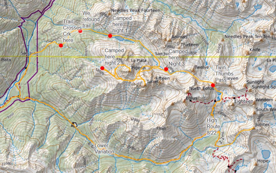
SamSam picked me up in Denver and we rolled out on 70 westbound. A couple stops were had, at the City Market in Grand Junction to get some last minute goodies, and an impromptu pre-dinner stop at McDs for the advertised chocolate pretzel Mcflurrys. We rolled into a campsite south of Montrose around 10pm. We ate some beans, sausage, rice, and cheese from a container Sam brought while kicking around a relatively round rock in the dark. Also drank a beer. Went to bed around midnight and was treated to some great lightning but no rain.
Day 1, Sunday August 14, 2022
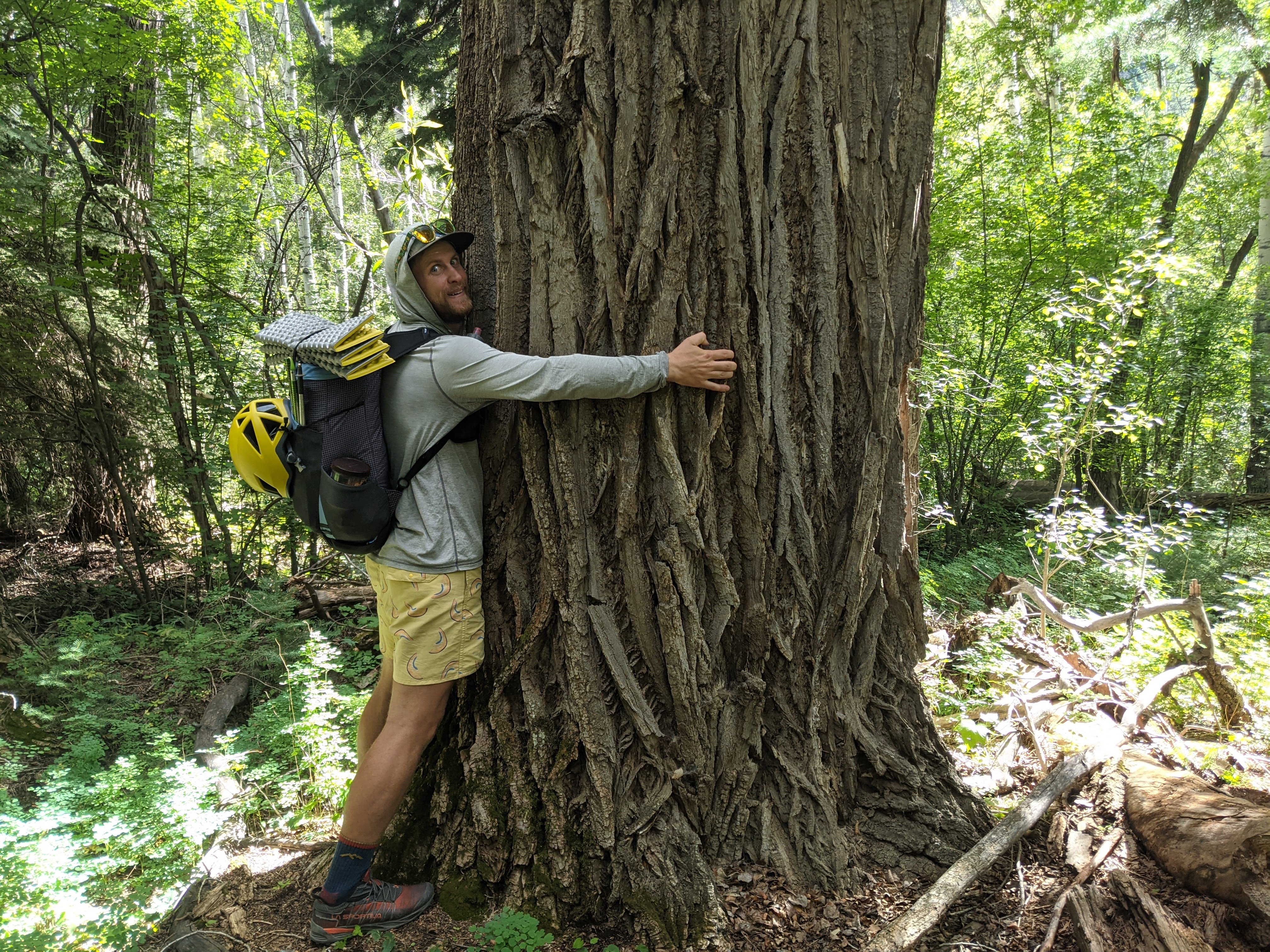
A slow morning. We drank some coffee at camp and ate some scones and fruit. We rolled out mid-morning and stopped in Ouray to hit the bathroom and refill water. We weren’t on trail until nearly 1pm. The first few miles flowed by with a descent down to the Animas and a slight uphill paralleling the Animas and the Durango-Silverton railroad. We saw the train and a lot of cool mushrooms! By the time we got to the Needleton TH it was a bit after 4 and time to start the climbing and the off-trail bushwhack section. Initially we were able to follow a good trail up to a meadow. What a pleasant surprise! We lost the trail in the meadow then regained it. At some point on Pigeon Peak’s long west ridge we stayed high when the trail seemed to drop down low. We had a bit of vert gained then had to lose it on a mossy slabby down climb. Bummer. We picked up the trail again. We had heard this approach is an awful bushwhack which it sorta is but we were able to make use of a trail for most of it. We took the trail to Lower Ruby Lake and hiked into camp with headlamps. We decided that was far enough and called it good. The dehydrated beans I packed for the trip are too salty and my ankles feel a bit weak. Rain rolled in and SamSam and I rushed to pitch our tarps. It’s been awhile since I used mine so I’m a bit rusty at the setup.
Day 2, Monday August 15, 2022.
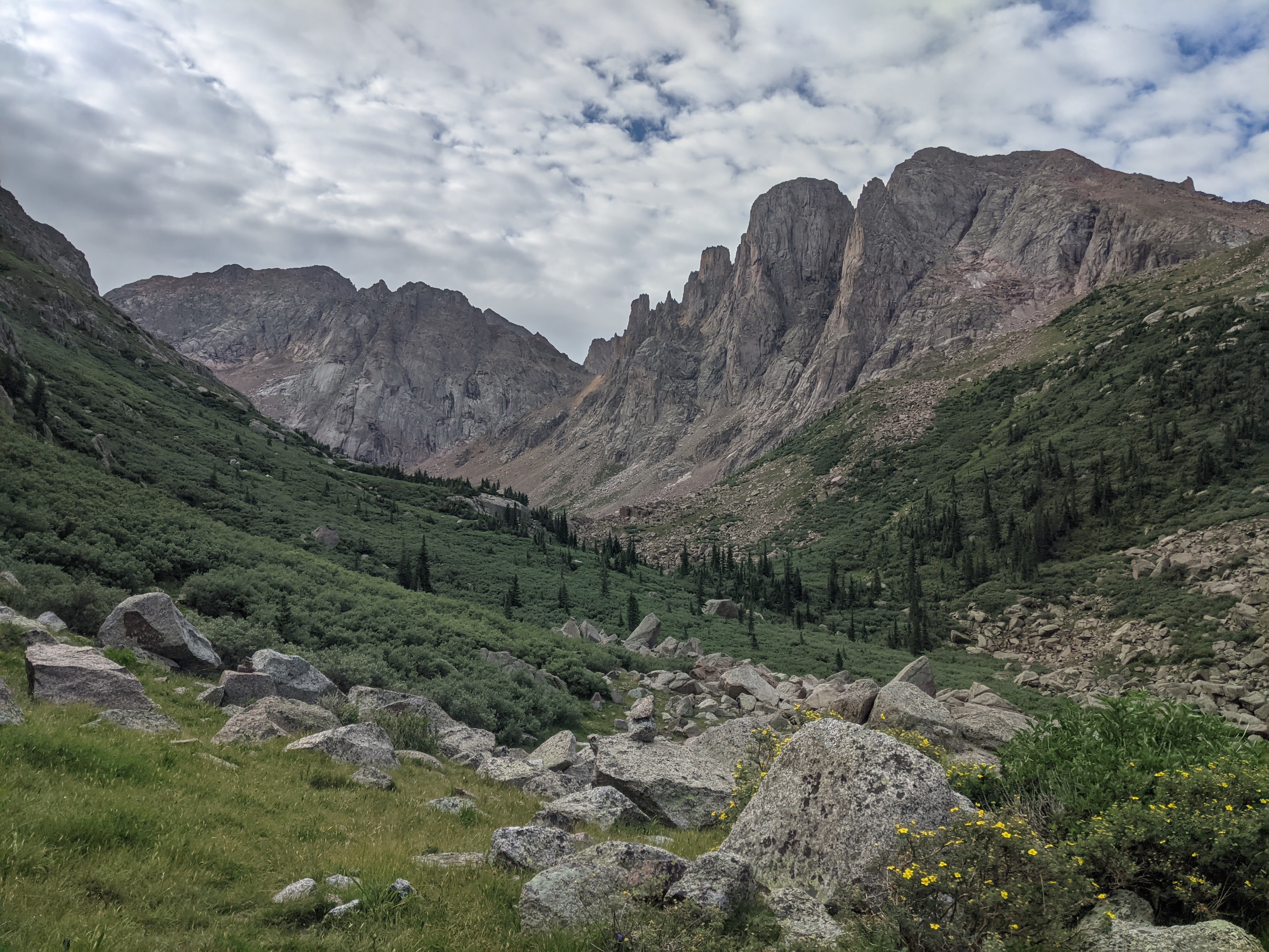
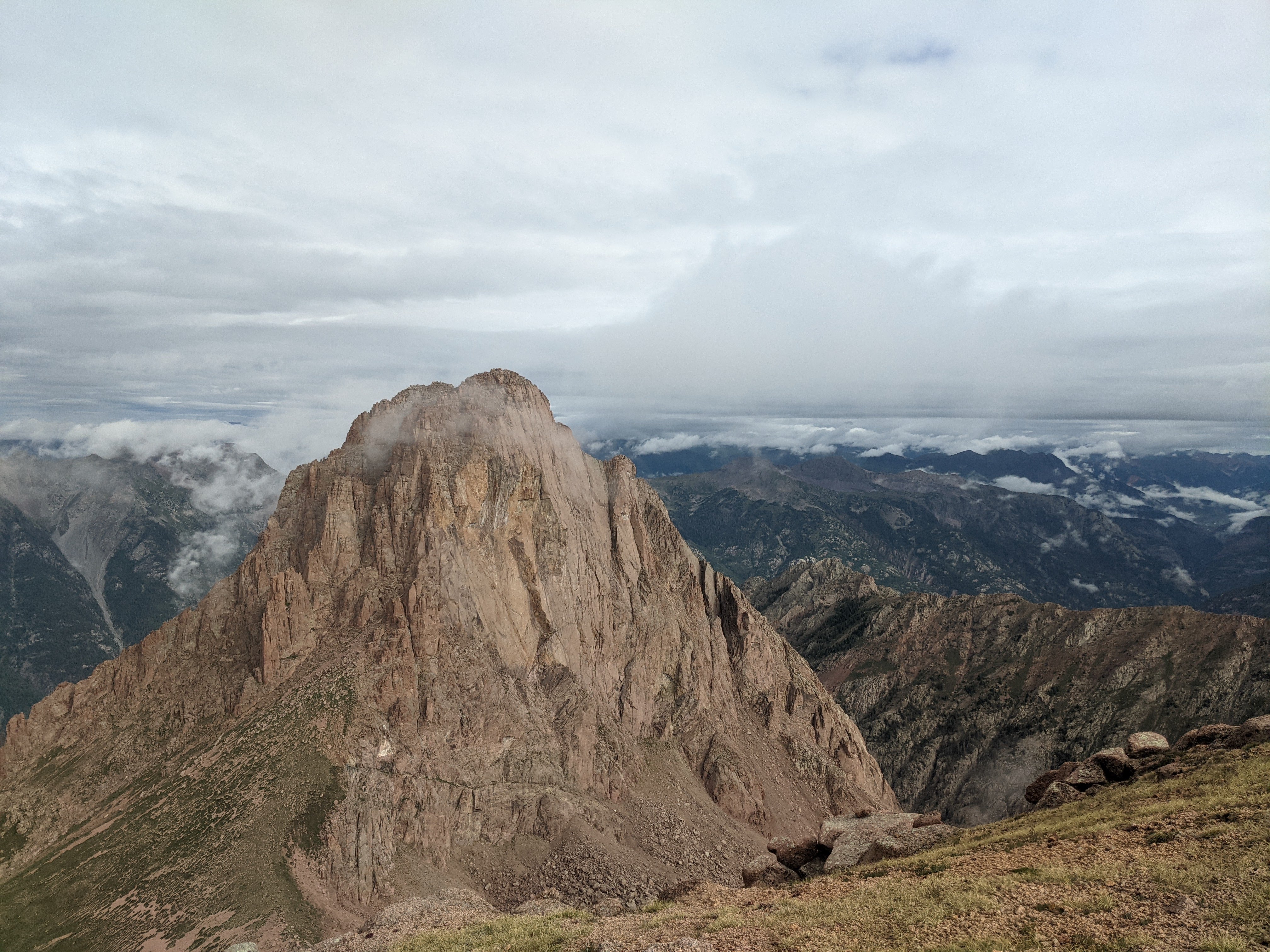
SamSam and I woke up naturally around 7. We ate some breakfast, packed up, and started what should have been an easy trail to follow up Ruby Creek. At the lake we spoke with one person and saw two more tents. We then had an arduous and wet bushwhack up to the upper reach of the creek where we turned off for Pigeon and Turret’s saddle after a quick break at the creek. It had taken us about 2 hours to go the 2 miles to the turn off. We then had a long slog up to the saddle that took another hour. The standard route wraps around from the steep east wall to the southwest gully. It loses 700 ft of elevation before climbing up the southwest gully. We saw some goats on the way around then slogged up the steep class 2 gully. We finally reached the class 3 ledges which brought quick passage to the summit. We had a bit of cell service at the top and I checked the weather to see storm potential in the afternoon. We started the descent and got rained on twice. With the slower than expected travel we had made, we decided to lose another 500ft and sleep in the upper basin of Tie Creek/N Pigeon Creek. We arrived at camp around 3, hung out and had surprisingly good weather until 5 or 6. We crawled into our tarps for the night with the intention of getting an early early start tomorrow morning.
Day 3 Tuesday August 16, 2022
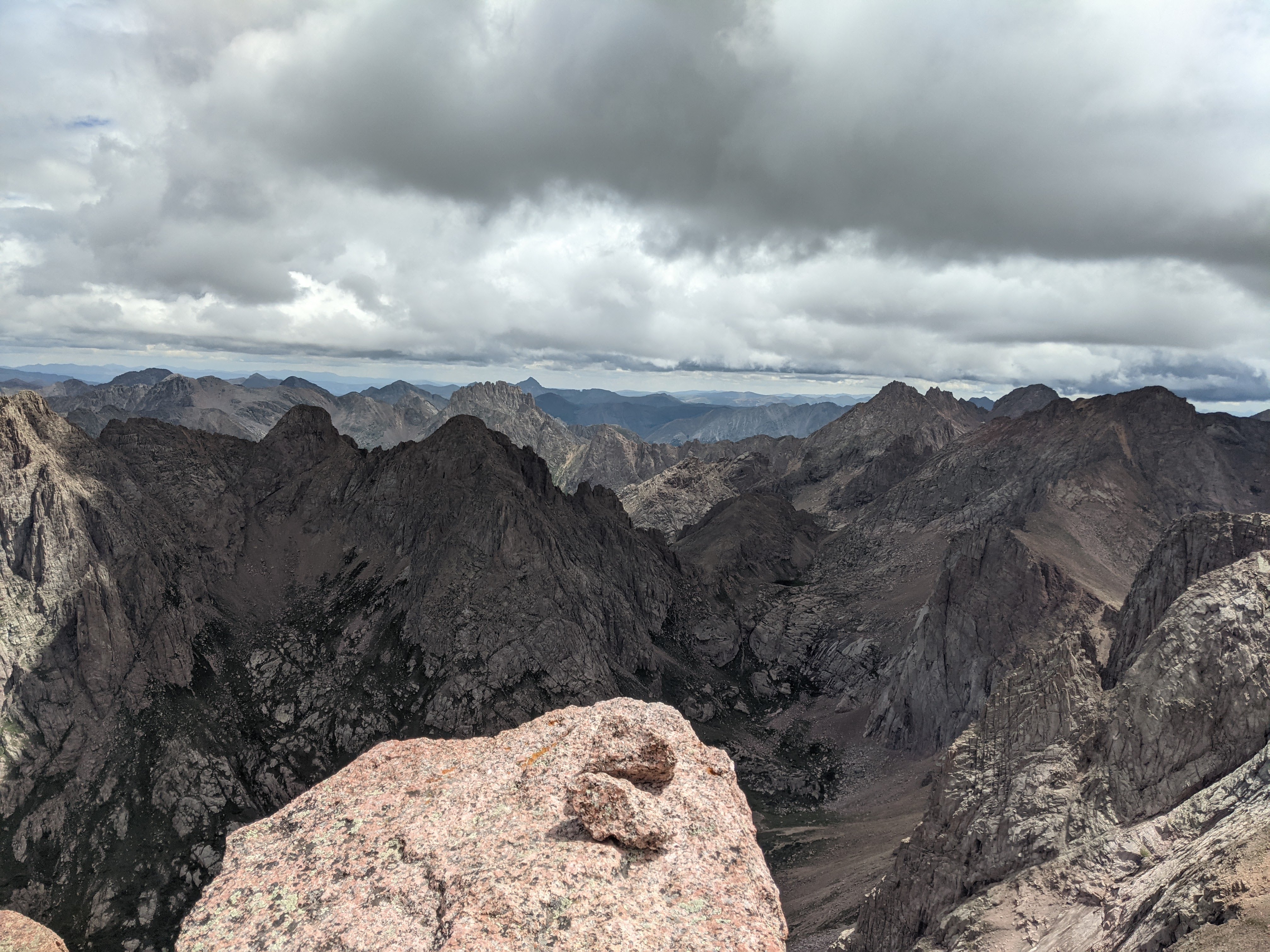
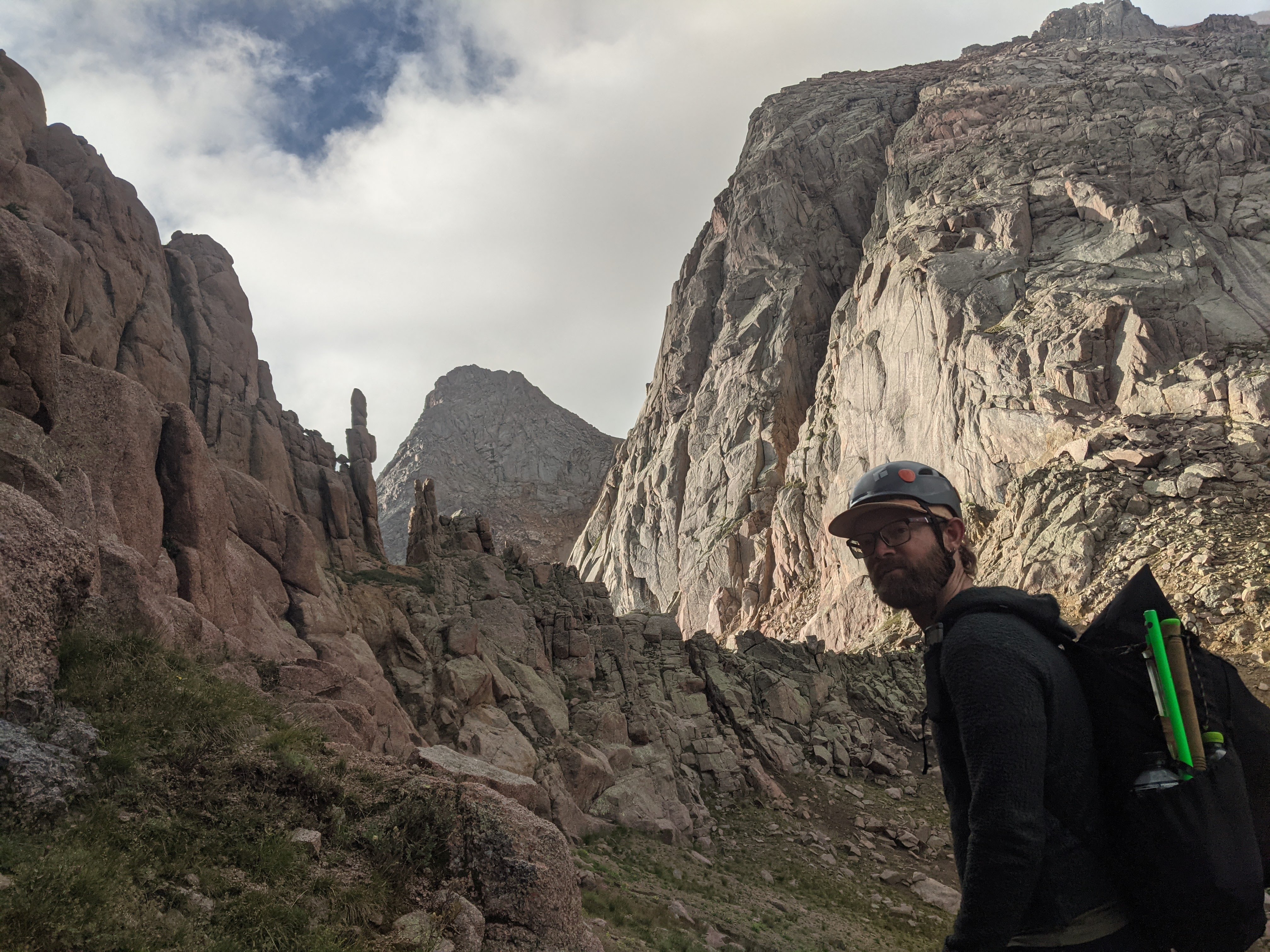
It rained hard last night but cleared up before morning. My alarm went off early to try and beat the forecasted rain. Sam and I were walking a bit before 6:30, heading straight up the steep grassy hillside to the saddle between Pigeon Pk and Turret. We made it to the saddle and had some clouds, but they were not enough to warrant caution. We headed up Turret Peak, summiting before 9. We hung out on the summit for a bit and checked the weather forecast again. Rain was in the forecast for the afternoon. We saw hikers on the Eolus/ N Eolus saddle across the valley and watched a helicopter fly into the Chicago Basin. We watched clouds twist around Jagged Pk, many valleys away. As it was about time to descend a hiker topped out and greeted us on Turret Peak’s summit. We spoke to him for a bit before heading down. We got a little confused on the down climb but it sorted itself out. We took a steep gully full of loose scree- my favorite kind of terrain, scree skiing! We got lucky and saved some time and avoided regaining vertical because the gully did not cliff out. We aimed for some trees high in the Ruby Creek Basin to camp so we could get an early start tomorrow. We spent over an hour looking for a good campsite and eventually settled on one near a creek with some protection. Tarps were up before noon, with rain in the forecast. We got lucky though and no rain fell until 630pm so we spent the time hanging out, kicking my cork ball, doing basic camp chores, and whittling away the hours. It was certainly frustrating that we made an early camp then rain didn’t materialize, however we camped early based on the information we had and we kept telling ourselves that. Plus it was nice to just hang out all day and watch the clouds dance and obscure the surrounding ridges.
Day 4 Wednesday August 17, 2022
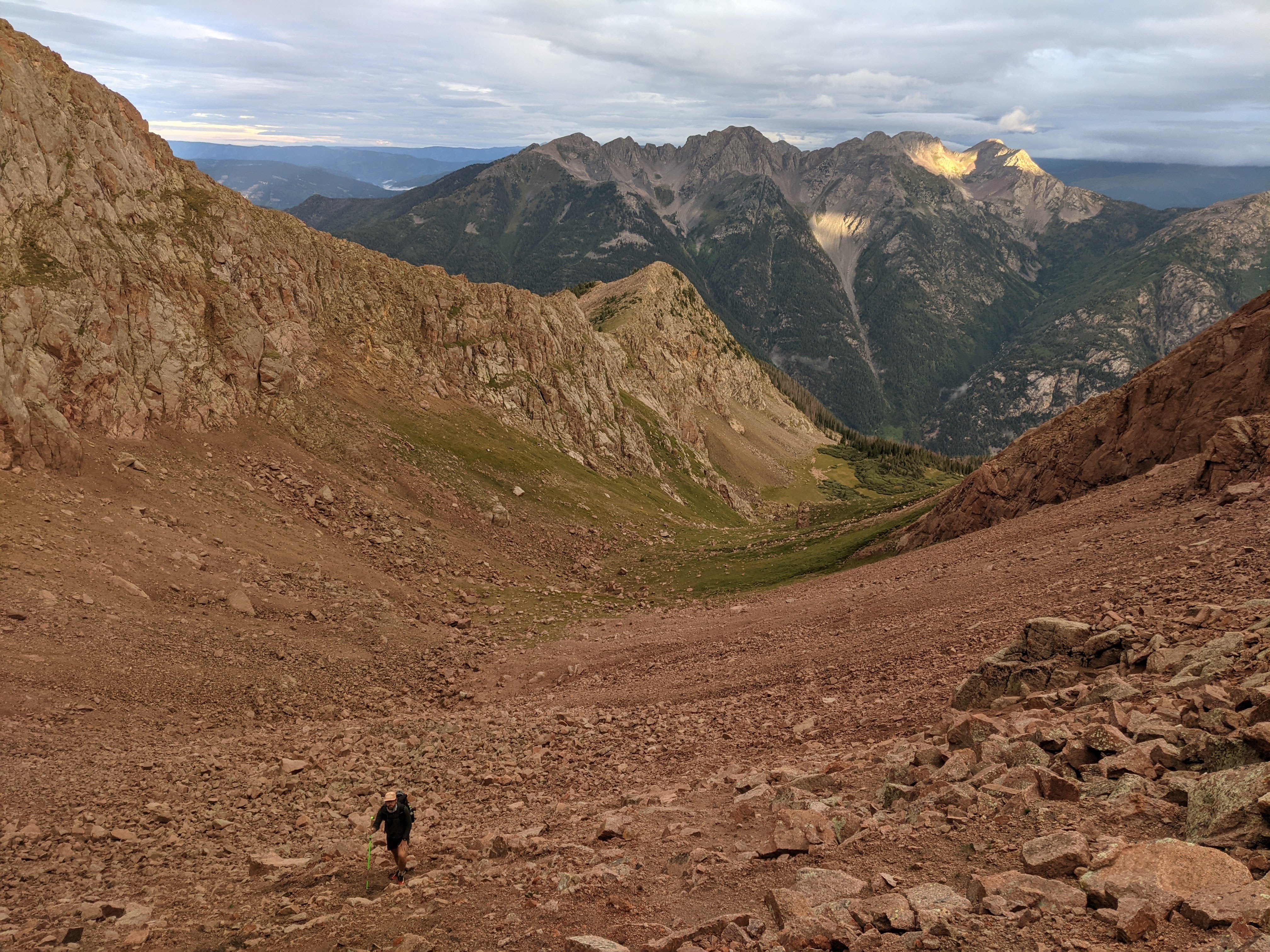
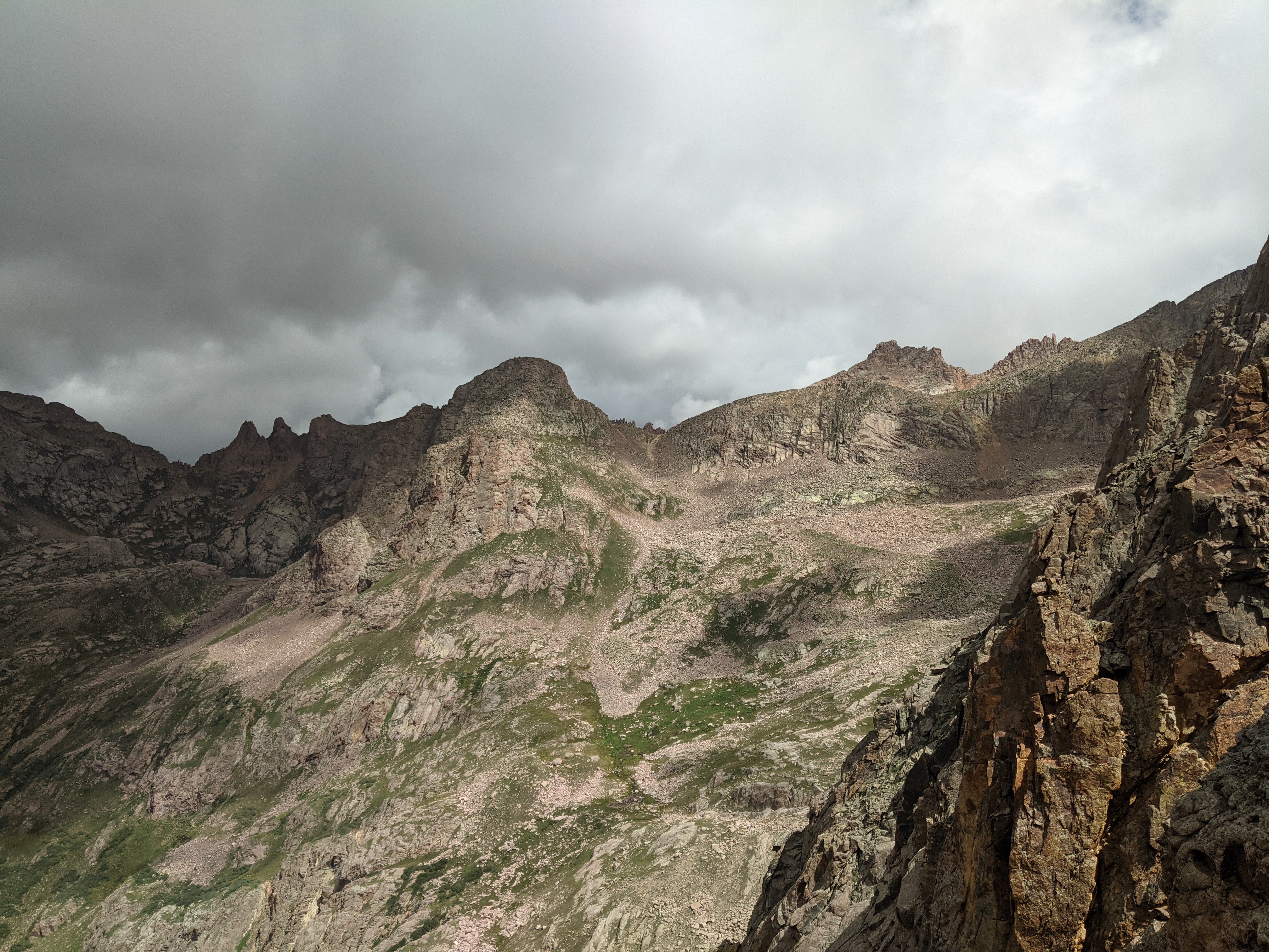
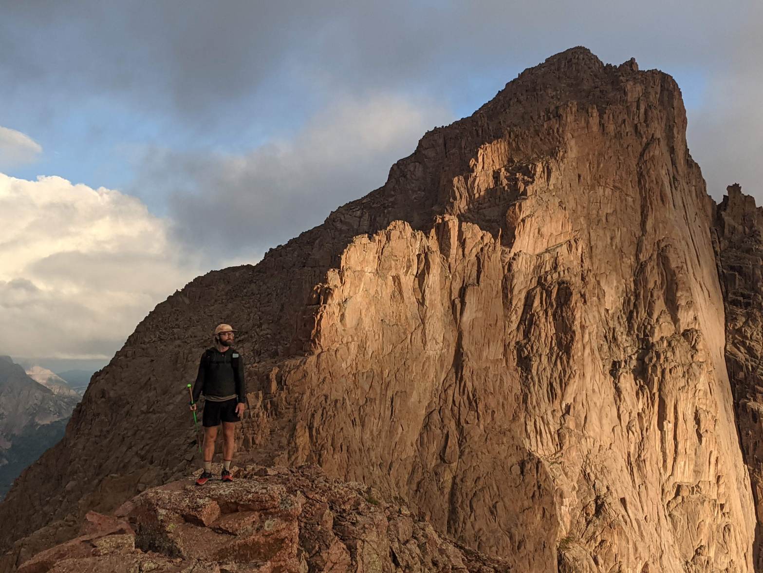
Another early morning. I was packed and ready at 6am. We started the day with a good vertical climb around some big cliffy slabs and up to a pass all off trail. There was excellent lighting and clouds on the way up. What big, cool mountains. We ended up higher than expected at a pass that led to a drainage north of ours and we wanted to go east. We took the opportunity to tag a bonus peak, Peak 12, which sits lower than many surrounding peaks (only a tad above 13,000ft!) but offers an eagle’s nest perch looking into many drainages. The clouds danced around the peaks off in the distance and above us. We followed goat tracks up. Peak 12’s north ridge connected to our pass and we descended some gullies and scurried around cliffs to get to our pass. We saw goats in the valley below. From the pass on we did a descending traverse below some high cliffs of Glacier Point’s north faces before reaching the base of Twin Thumbs Pass to get into the Chicago Basin. We arrived at the base, scurried through a talus field, and found ourselves on loose scree losing one foot of progress for every two gained. Eventually the scree ended and we had 30ft of easy cliffy ledges to the top of Twin Thumbs Pass. Upon topping out,l we ate some food, took some photos, then descended to the popular Chicago Basin. We didn’t see anyone until we were down below Twin Lakes. Weather was cloudy up high, okay down low. We turned left and headed for Jupiter Mountain, a centennial peak (one of 100 highest in the state). We took the trail up, passing two mining shafts and one old cabin then took our exit to the top. We ascended very steep grassy slopes to a rocky ridge. That took us into the clouds and eventually a false summit. The true summit was another 200 feet away and we scrambled up to it. It was a cool blocky, airy summit with no view at all. We rapidly descended, eventually getting out of the clouds (and rain!) and found ourselves back on trail. From there on it was just a simple walk out on good trail! We stopped for a long lunch and coffee. While eating, rain moved in and then passed. We continued hiking what seemed like a long forested trail. My feet got pretty banged up in my shoes and I found a big ol’ blister when I got to camp. We camped at the Animas River which has picnic tables! What a treat to cook and eat dinner sitting down. We have an easy hike out tomorrow.
Day 5 Thursday August 18, 2022
Samsam and I slept in and had a casual morning. We only had a handful of miles to hike out so we took our time getting ready in the morning and used it to dry and organize gear, pack our stuff up, drink hot coffee, and eat the remainder of our food. Once we were ready to go around 11 we tossed our packs on and started trudging up and out. My heel blister HURT! We arrived at the cars a bit after 1pm. We drove into Durango and ate a ton of food at the Durango Diner then spent time at the library before swimming in the Animas River. What a cool place to have spent a handful of days.