Cactus to Clouds route

- Nearly 11,000 ft of vertical gain roundtrip across ~30 miles.
- Hike from the desert of palm springs to the summit of the tallest mountain in the lower 48 (tallest, not highest)
- Expect sand, cactus, snow, pine forests, and the humbling effects of altitude.
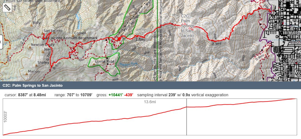
A map of the route:
Interested in your own hike of C2C? Here are some great resources I used while planning my own hike:
- Halfway Anywhere has a great site and write-up from his own hike
- San Jac Jon regularly posts conditions updates for PCT thruhikers and others
- San Jacinto Message board is a great resource for conditions as well.
- Many other folks have done this hike. Use your search engine of choice to find more info.
My Hike:
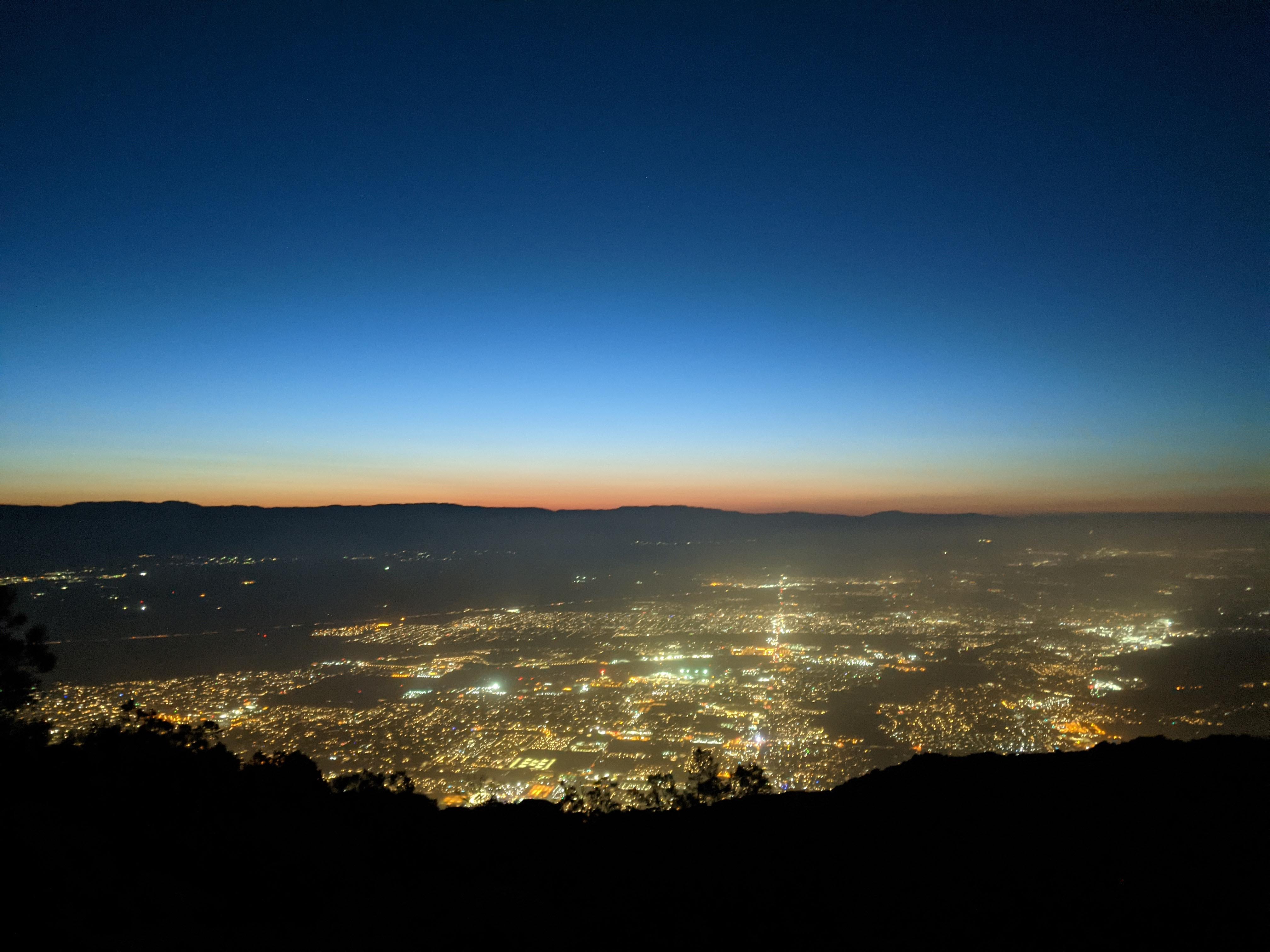
At midnight Wednesday morning my alarm went off. 30 minutes later I’m in the car hurtling down the highway towards Palm Springs, coffee in hand listening to the radio. 2 hours later I’m parking on an empty street next to the Palm Springs Art Museum. A few minutes later I’m on my feet starting the hike to the summit of Mt. San Jacinto.
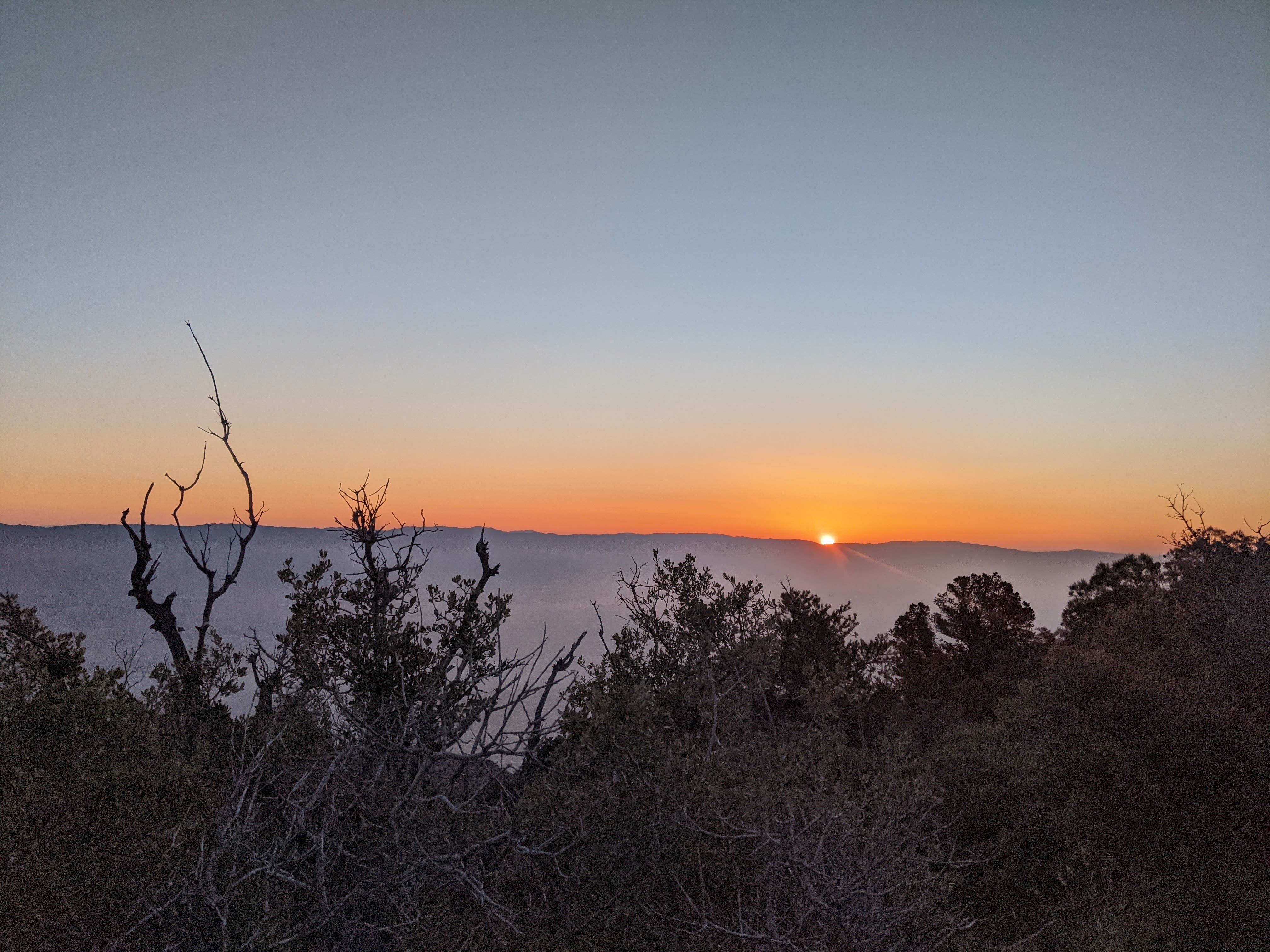
Starting at my car, I climbed the eastern facing slopes of San Jacinto, overlooking the city of Palm Springs. Preceding sunrise I caught a faint easterly glow of light. When sunrise hit I was already a few thousand feet up and well into my day.
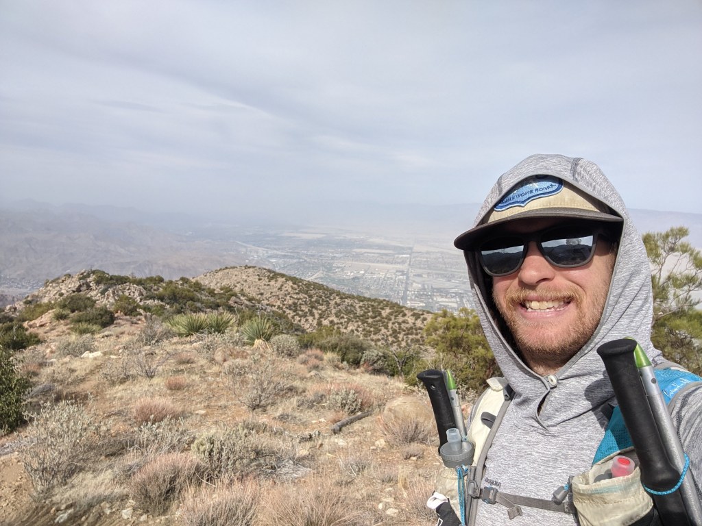
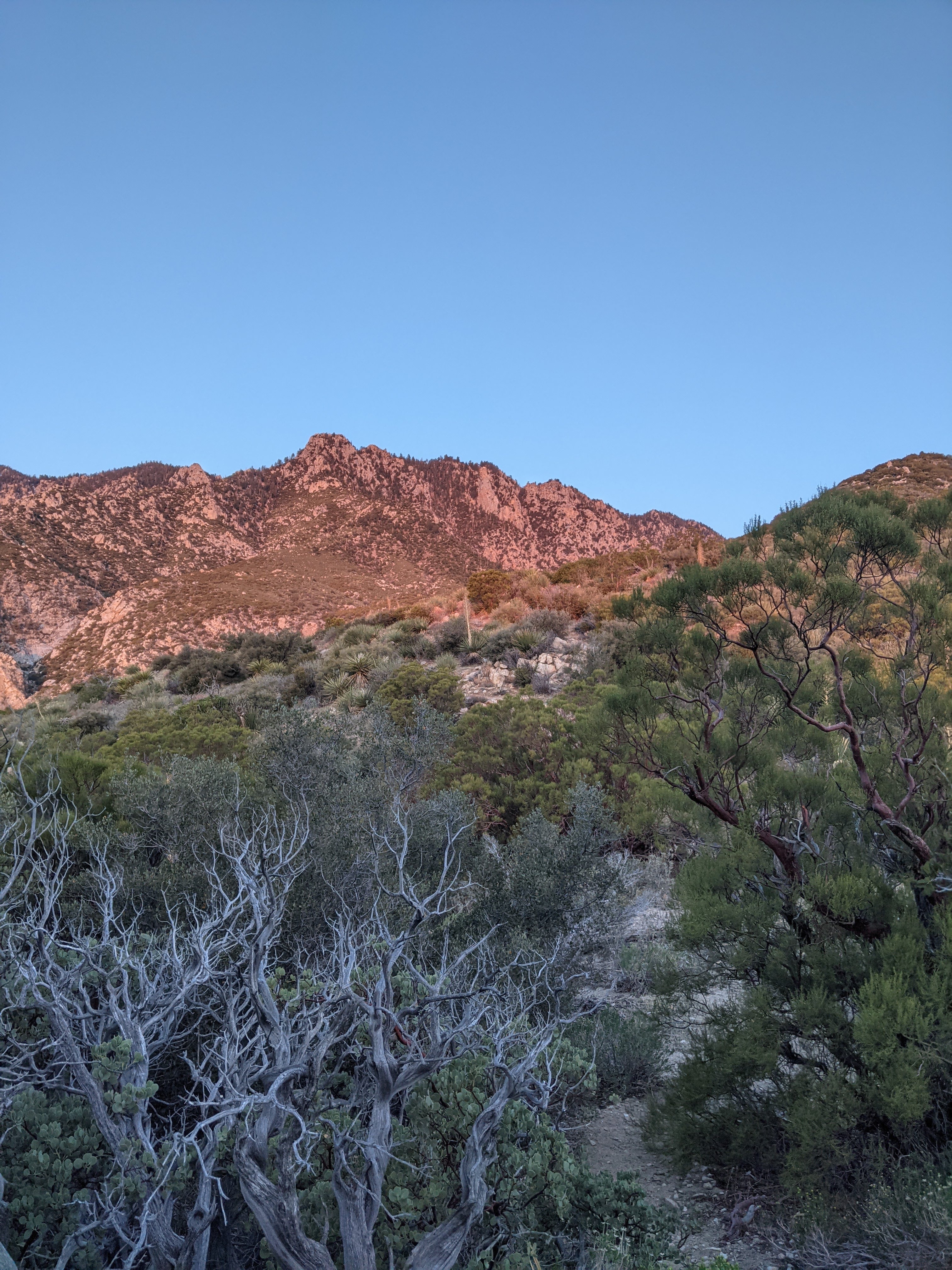
While climbing out of Palm Springs I noticed that the trail starts with the typical low elevation desert ecosystem: agaves, prickly pear, and the occasional spiky shrub. As I followed the trail higher, new species started to appear including taller shrubs such as manzanita and juniper. Around 7,000ft ponderosa pine made an appearance, solemnly standing on either side of the trail. I struggled with the next 1,000ft as the trail steepened before reaching Long Valley, a sort of hanging valley high above the desert. Upon cresting the trail into the valley, I felt transported to a new ecosystem. I was surrounded by monstrous ponderosa pines with forest meadows spreading out beyond the trail. The hot and sandy desert the trail began in felt a world away. Here I heard forest birds call out to each other. The prickly defense desert plants adapted to prevent herbivory had been dropped. I saw small brooks, rushing with crystal clear water, draining the seasonal wetlands. I felt forest duff under my shoes. So far I had not seen a single person since I got out of my car 5 hours prior, yet suddenly I was back in a world where humans frequented. I used the bathroom at the ranger station and refilled my water, yet still no actual human was to be seen.
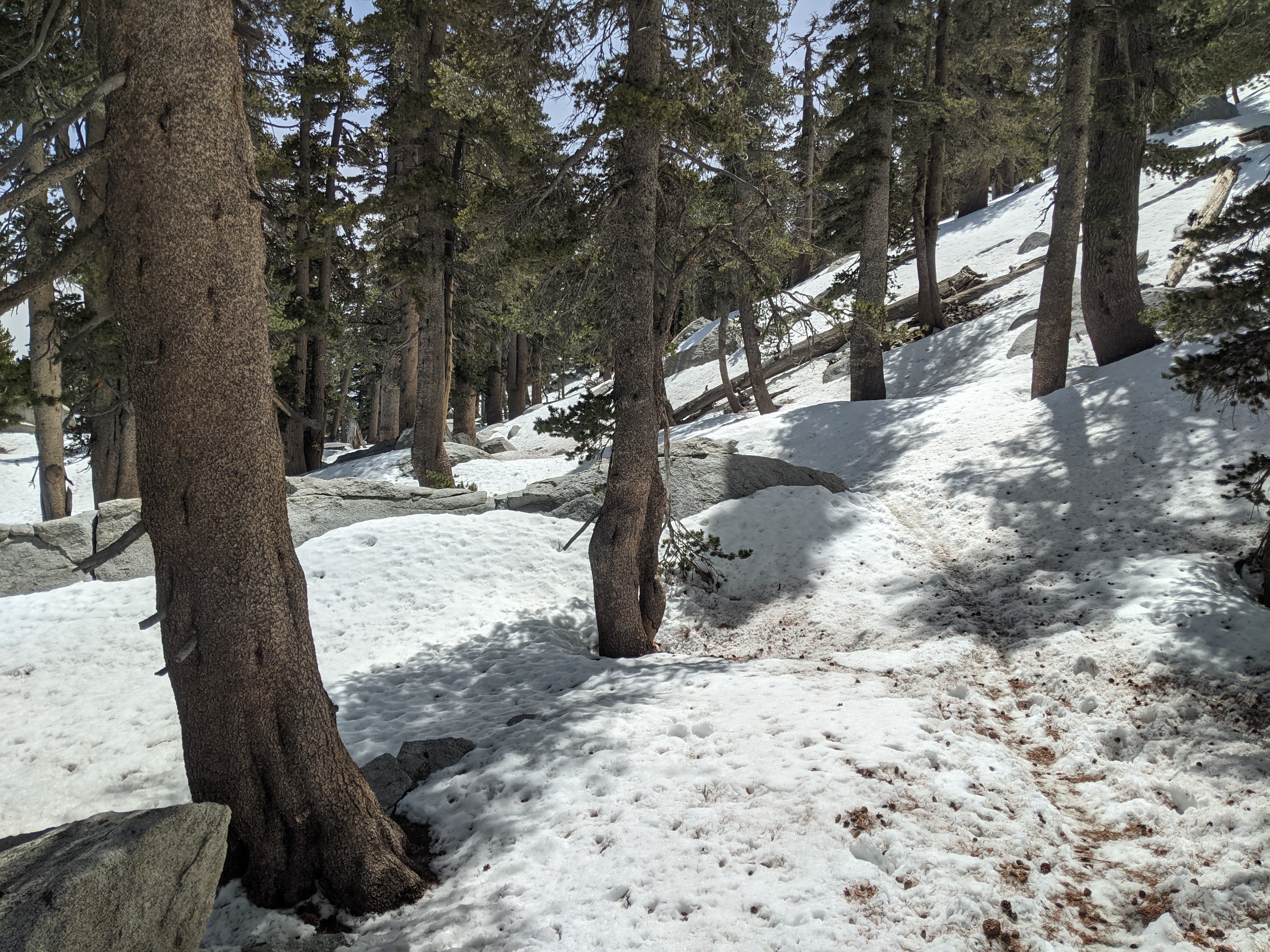

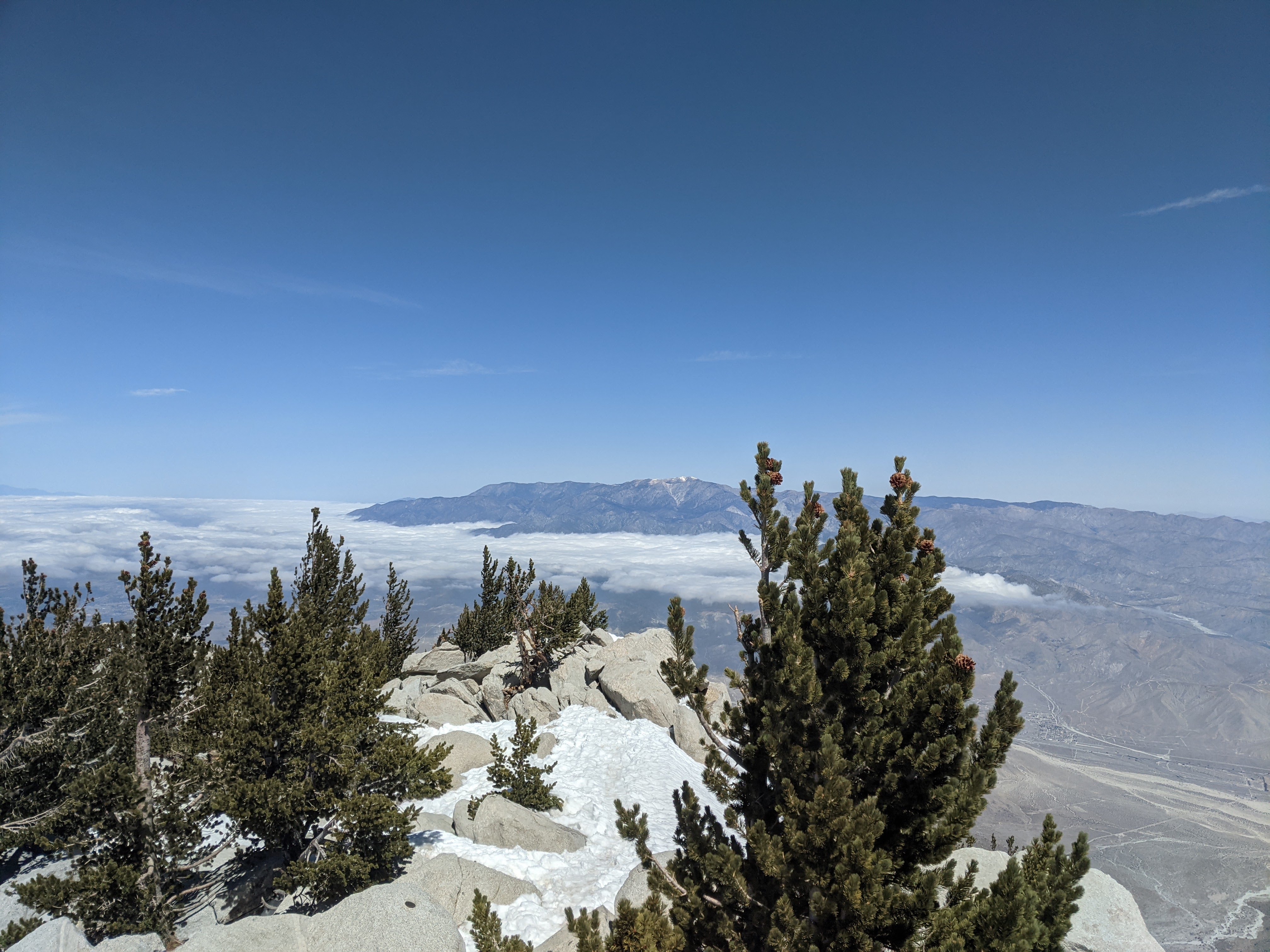
A mile or so later I crossed a pleasant brook and started climbing the north facing slope up to Wellman’s divide. Finally, snow. I made quick work of the climb to Wellman’s divide, my spirit having improved while being on snow. At Wellman’s divide I saw the trail continue north up to the summit. A pleasant hour or so later I found myself in the upper snowfields below the bouldery peak. At this point I was really starting to feel the 10,000ft of vertical gain and the humbling effects of altitude. Being so close I was happy to push on. Having been kicked to the curb with altitude sickness before, I knew that my symptoms were mild. No HAPE or HACE yet, just a mild headache and a bit out of breath, though I did keep checking in with myself. Upon summiting I was nearly blown away, both figuratively and literally! The wind was fierce up there but the views were incredible spreading down into the LA basin and across the 10,000ft chasm of the Cabazon/I-10 corridor, to San Gorgonio and on to Mt. Baldy. I bundled up in most of the clothes I carried from the desert to sit down for a few minutes.
15 minutes later I was back on my feet heading down, knowing that I was only at the half-way point. I finally saw the first people of the day just below the summit and a PCT thruhiker not far after. When I was back in Long Valley, where the aerial tram lets passengers off, I found no one. I stopped into the office and found that they aren’t running Tuesday and Wednesday for now while working on some remodelling of the summit station. I only saw one additional hiker between the aerial tram and the last mile-or-so of the trailhead where I saw numerous folks.
The descent was long. I ran sections when I could and had to take sitting breaks at times as well.
This hike challenged me. The massive amount of gain, the early start, and the bit of snow I experienced near the top, sufficiently wore me out by the time I got back to my car 16 hours after setting out. Upon reaching home I ate some pizza and fell asleep.
Gear and food
Some folks may be interested in what I chose to take so below are photos of what I had on my back. I wore Patagonia Baggies and a Patagonia Tropic Comfort 2 sun hoody. My shoes were Hoka Speedgoats and regular ol’ sunnies and a trucker hat. I packed everything in a UD running vest roughly ~15L in size. I carried a 500mL and 600mL soft body bottles and a ~750mL foldable platypus-style bottle for the hike to Long Valley. It wasn’t used beyond the first 10mi.
I made the gametime decision to not take any snow specific gear beyond folding z-style hiking poles and I did not wish I had microspikes or an axe for any section. A few weeks prior I may have needed them.
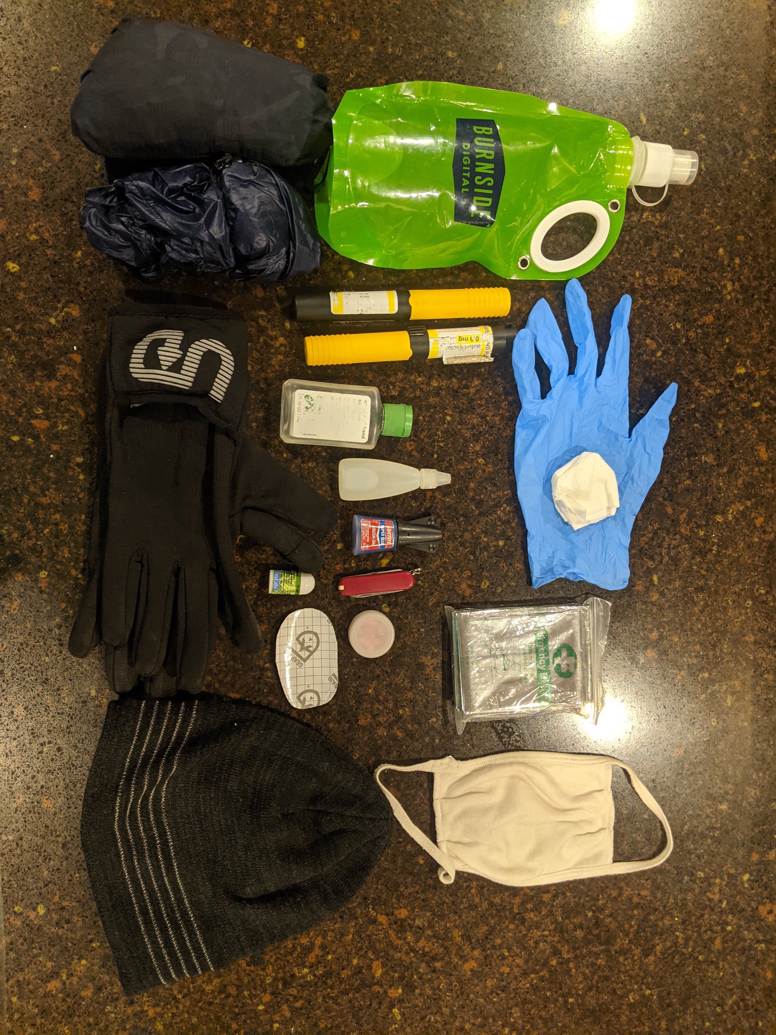
For warmth I brought and wore a Patagonia Houdini and liner gloves. I also had a beanie and wind pants, neither were worn. Of course I carried a mask though I rarely used it until the last mile when I saw a dozen people.
For small items I brought a variant of my typical first aid/safety kit: ibuprofen, superglue, gear tape, small knife, bleach for water purification, headlamp, space blanket, benadryl, epipens (for bee allergy), nitrile glove with TP for emergency bathroom usage, and some hand sanitizer.
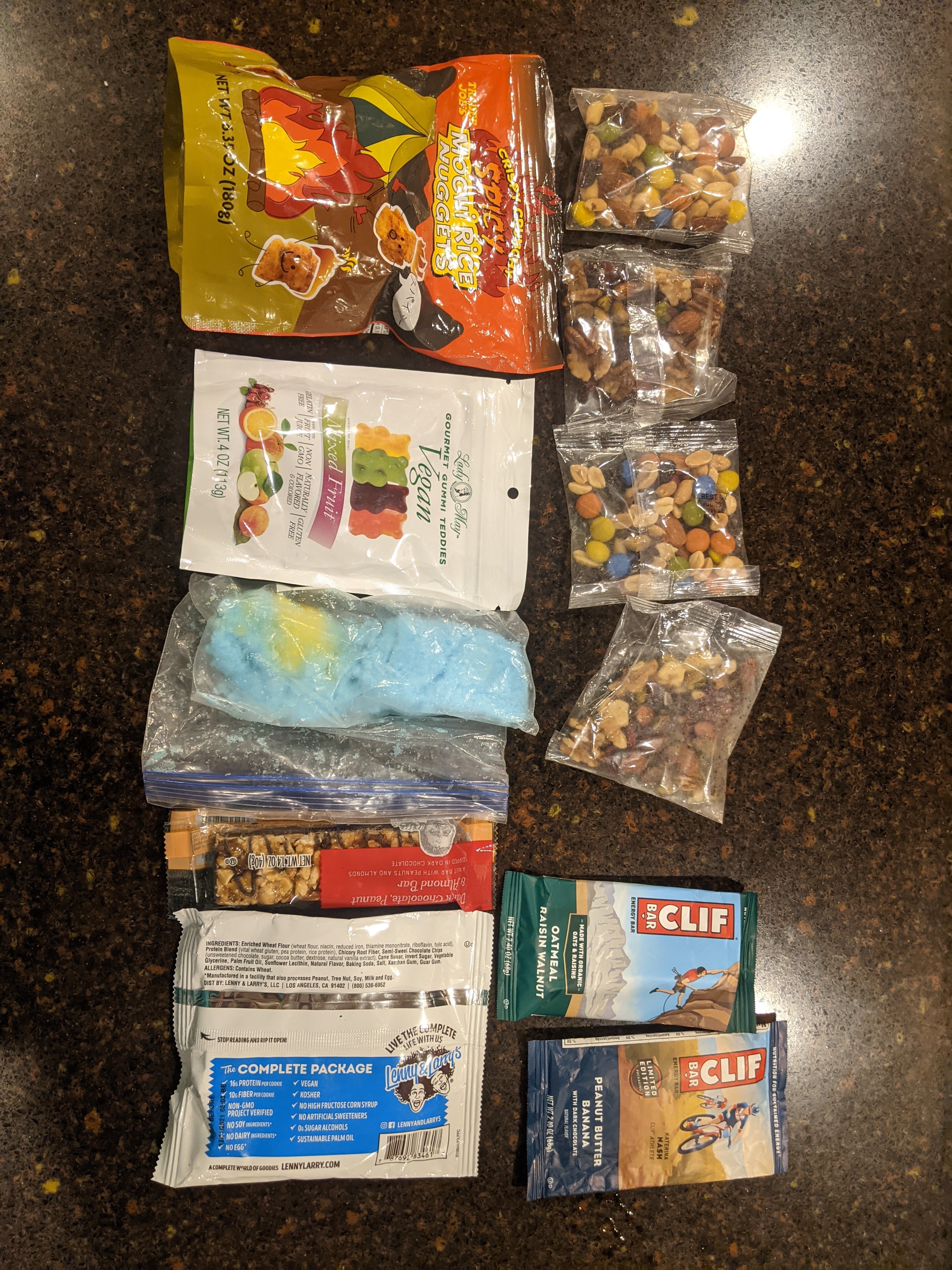
I brought a ton of food and didn’t eat it all. Not pictured are two homemade burritos (sweet potato and black bean). I tried to prioritize food I will eat, items easy to eat, and a diversity of sugary goods and savory/salty items in that order.
